The European Commission’s Joint Research Center (JRC) is doing some phenomenal work on Geo-Spatial Information Analysis for Global Security and Stability. I’ve had several meetings with JRC colleagues over the years and have always been very impressed with their projects.
The group is not very well known outside Europe so the purpose of this blog post is to highlight some of the Center’s projects.
- Enumeration of Refugee Camps: The project developed an operational methodology to estimate refugee populations using very high resolution (VHR) satellite imagery. “The methodology relies on a combination of machine-assisted procedures, photo-interpretation and statistical sampling.”
- Monitoring and Mapping Evolving Crisis using Open-Source Databases and Statistics: This project analyzes quantitative data on security-related events extracted from databases and unstructured information in open-source text documents using statistical methods. The data is then visualized using GIS to determine impact of events on humanitarian assistance.
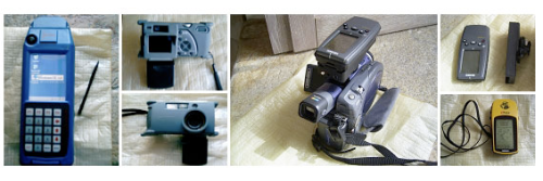
- Benchmarking Hand Held Equipment for Field Data Collection: This project tested new devices for the collection for geo-referenced information. “The assessment of the instruments considered their technical characteristics, like the availability of necessary instruments or functionalities, technical features, hardware specifics, software compatibility and interfaces.”
- GEOCREW – Study on Geodata and Crisis Early Warning: This project analyzed the use of geo-spatial technology in the decision-making process of institutions dealing with international crises. The project also aimed to show best practice in the use of geo-spatial technologies in the decision-making process.
- Support to Peacekeeping Operations in the Sudan: Maps are generally not available or often are out of date for most of the conflict areas in which peacekeping personnel is deployed, This UNDPKO Darfur mapping initiative aimed to create an alliance of partners that addressed this gap and shared the results.
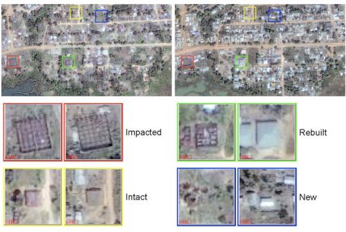
- Automatic Recognition of Post-Conflict Damage using Satellite Imagery: This project developed and tested several methodologies to automatically detect various degrees of infrastructural damage in post-conflict settings.
- Temporary Settlement Analysis by Remote Sensing: The project analyzes different types of refugee and IDP settlements to identify single structures inside refugee settlements. “The objective of the project is to establish the first comprehensive catalog of image interpretation keys, based on last-generation satellite data and related to the analysis of transitional settlements.”
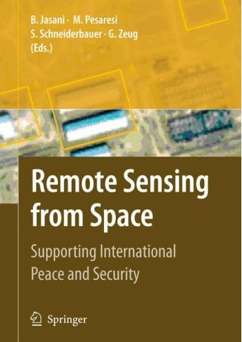
JRC colleagues often publish papers on their work and I highly recommend having a look at this book when it comes out in June 2009:


Hello
a really good report in your Blog. Now I can say, thanks.
Greeting
Zille
Pingback: Literature Review: GIS for Conflict Analysis « iRevolution
Pingback: Crisis Mapping Uganda: Combining Narratives and GIS to Study Genocide « iRevolution
Pingback: Syria: Crowdsourcing Satellite Imagery Analysis to Identify Mass Human Rights Violations | iRevolution
Pingback: Combining Crowdsourced Satellite Imagery Analysis with Crisis Reporting: An Update on Syria | iRevolution
Pingback: Crowd-sourcing in Syria? Satellite crisis-mapping Imagery Analysis? « Adonis Diaries
Pingback: Combining Crowdsourced Satellite Imagery Analysis with Crisis Reporting: An Update on Syria