
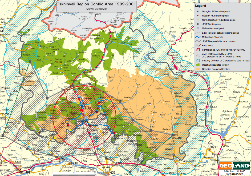
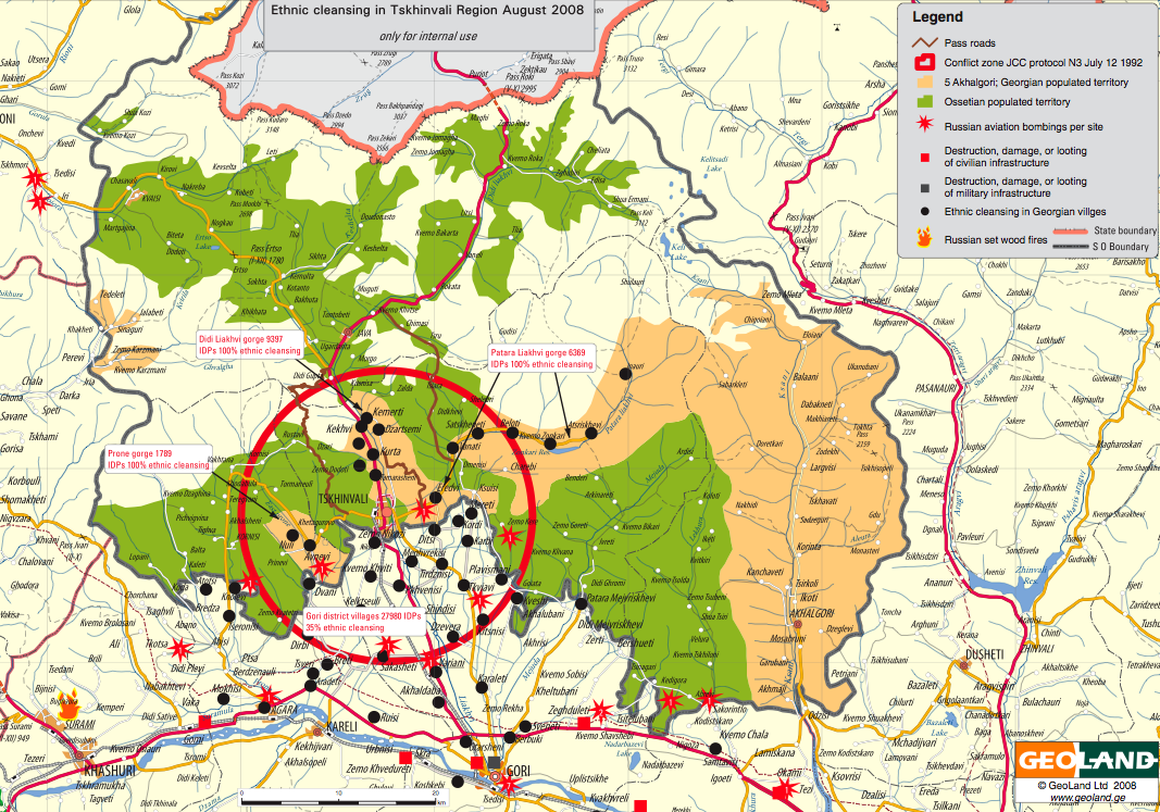
New highly detailed maps of South Ossetia provided by the Georgian Ministry of Internal Affairs. The titles associated with each map also comes from the Georgian government. I imagine these maps will eventually be available as KML files on Google Earth.
(1) Tskhinvali Region Conflict Area (1999-2001) [PDF]
(2) Ethnic Cleansing in Tskhinvali Region August 2008 [PDF]
(3) South Ossetia Ethnic Landscape Before Ethnic Cleansing [PDF]

(4) South Ossetia Ethnic Landscape After Ethnic Cleansing [PDF]

(5) Russian Invasion and Occupation of Georgia [PDF]

All maps (with the exception of 2 and 3) are accompanied by the explanatory legends and are otherwise self-explanatory.
