
A 6.1 magnitude earthquake struck Ludian County in Yunnan, China earlier this month. Some 600 people lost their lives; over 2,400 were injured and another 200,000 were forced to relocate. In terms of infrastructure damage, about 30,000 buildings were damaged and more than 12,000 homes collapsed. To rapidly search for survivors and assess this damage, responders in China turned to DJI’s office in Hong Kong. DJI is one of leading manufacturers of commercial UAVs in the world.

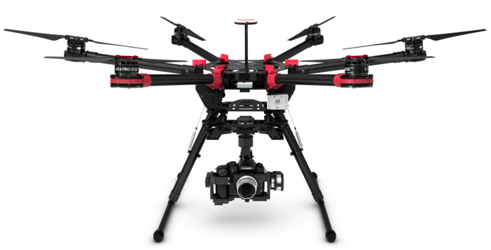
DJI’s team of pilots worked directly with the China Association for Disaster and Emergency Response Medicine (CADERM). According to DJI, “This was the first time [the country] used [UAVs] in its relief efforts and as a result many of the cooperating agencies and bodies working on site have approached us for training / using UAS technology in the future […].” DJI flew two types of quadcopters, the DJI S900 and DJI Phantom 2 Vision+ pictured below (respectively):
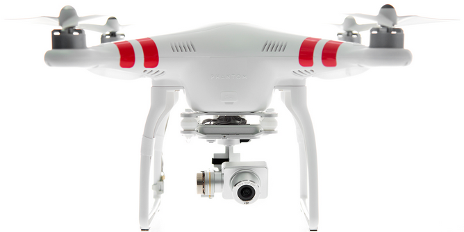
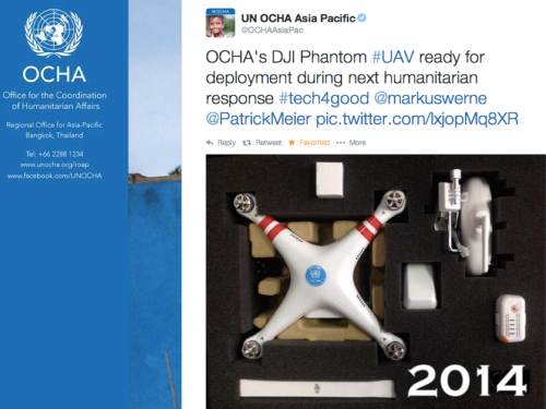
As mentioned here, The DJI Phantom 2 is the same one that the UN Office for the Coordination of Humanitarian Affairs (OCHA) is experimenting with:
Given the dense rubble and vegetation in the disaster affected region of Ludian County in China, ground surveys were particularly challenging to carry out. So UAVs provided disaster responders with an unimpeded bird’s eye view of the damage, helping them prioritize their search and rescue efforts. DJI reports that the UAVs “were able to relay images back to rescue workers, who used them to determine which roads needed to be cleared first and which areas of the rubble to search for possible survivors. […].”
The video above shows some striking aerial footage of the disaster damage. This is the not first time that UAVs have been used for search and rescue or road clearance operations. Transporting urgent supplies to disaster areas requires that roads be cleared as quickly as possible, which is why UAVs were used for this and other purposes after Typhoon Haiyan in the Philippines. In Ludian, “Aerial images captured by the team were [also] used by workers in the epicenter area […] where most of the traditional buildings in the area collapsed.”
DJI was not the only group to fly UAVs in response to the quake in Yunnan. The Chinese government itself deployed UAVs (days before DJI). As the Associated Press reported several weeks ago already, “A novel part of the Yunnan response was the use of drones to map and monitor a quake-formed lake that threatened to flood areas downstream. China has rapidly developed drone use in recent years, and they helped save time and money while providing highly reliable data, said Xu Xiaokun, an engineer with the army reserves.”
Working with UAV manufacturers directly may prove to be the preferred route for humanitarian organizations requiring access to aerial imagery following major disasters. At the same time, having the capacity and skills in-house to rapidly deploy these UAVs affords several advantages over the partnership model. So combining in-house capacity with a partnership model may ultimately be the way to go but this will depend heavily on the individual mandates and needs of humanitarian organizations.

See Also:
- Humanitarians in the Sky: Using UAVs for Disaster Response [link]
- Live Crisis Map of UAV Videos for Disaster Response [link]
- Humanitarian UAV Missions During Balkan Floods [link]
- UAVs, Community Mapping & Disaster Risk Reduction in Haiti [link]
- “TripAdvisor” for International UAV/Drone Travel [link]

Pingback: Google Already Developing UAV’s for Disaster Response | iRevolution
Pingback: Reflections on the Use of UAVs in Humanitarian Interventions | iRevolution
Pingback: Drones: Putting China’s economy on autopilot - Age Times
Pingback: Drones: Putting China’s economy on autopilotDrones: Putting China’s economy on autopilot - Desi Players
Pingback: 救命活動から環境汚染のモニタリングまで、ドローンが支える中国経済 | TechCrunch Japan