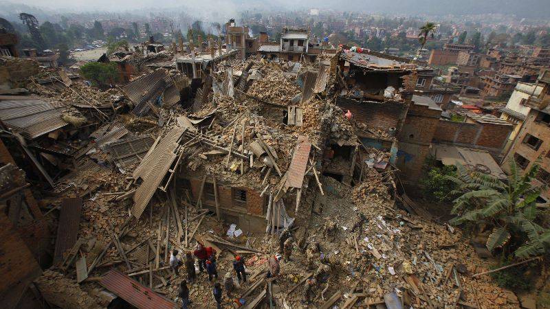
An expedition in 1858 revealed that Lake Victoria was the source of the Nile. We found ourselves on the shores of Africa’s majestic lake this October, a month after a 5.9 magnitude earthquake struck Tanzania’s Kagera Region. Hundreds were injured and dozens killed. This was the biggest tragedy in decades for the peaceful lakeside town of Bukoba. The Ministry of Home Affairs invited WeRobotics to support the recovery and reconstruction efforts by carrying out aerial surveys of the affected areas.

The mission of WeRobotics is to build local capacity for the safe and effective use of appropriate robotics solutions. We do this by co-creating local robotics labs that we call Flying Labs. We use these Labs to transfer the professional skills and relevant robotics solutions to outstanding local partners. Our explicit focus on capacity building explains why we took the opportunity whilst in Kagera to train two Tanzanian colleagues. Khadija and Yussuf joined us from the State University of Zanzibar (SUZA). They were both wonderful to work with and quick learners too. We look forward to working with them and other partners to co-create our Flying Labs in Tanzania. More on this in a future post.
Aerial Surveys of Kagera Region After The Earthquake
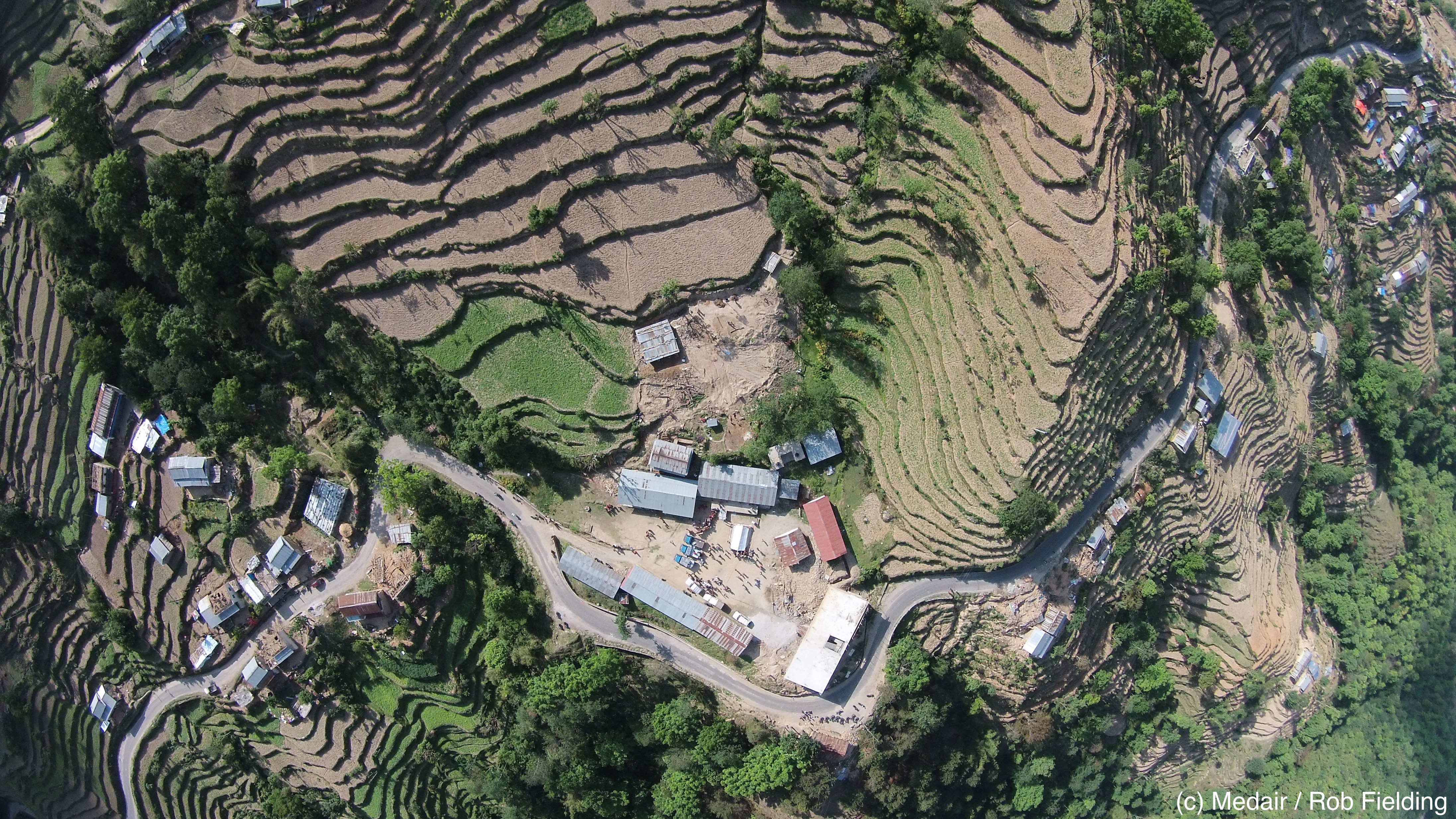
We surveyed multiple areas in the region based on the priorities of our local partners as well as reports provided by local villagers. We used the Cumulus One UAV from our technology partner DanOffice to carry out the flights. The Cumulus has a stated 2.5 hour flight time and 50 kilometer radio range. We’re using software from our partner Pix4D to process the 3,000+ very high resolution images captured during our 2 days around Bukoba.

Above, Khadija and Yussuf on the left with a local engineer and a local member of the community on the right, respectfully. The video below shows how the Cumulus takes off and lands. The landing is automatic and simply involves the UAV stalling and gently gliding to the ground.
We engaged directly with local communities before our flights to explain our project and get their permissions to fly. Learn more about our Code of Conduct.

Aerial mapping with fixed-wing UAVs can identify large-scale damage over large areas and serve as a good base map for reconstruction. A lot of the damage, however, can be limited to large cracks in walls, which cannot be seen with nadir (vertical) imagery. We thus flew over some areas using a Parrot Bebop2 to capture oblique imagery and to get closer to the damage. We then took dozens of geo-tagged images from ground-level with our phones in order to ground-truth the aerial imagery.

We’re still processing the resulting imagery so the results below are simply the low resolution previews of one (out of three) surveys we carried out.

Both Khadija and Yussuf were very quick learners and a real delight to work with. Below are more pictures documenting our recent work in Kagera. You can follow all our trainings and projects live via our Twitter feed (@werobotics) and our Facebook page. Sincerest thanks to both Linx Global Intelligence and UR Group for making our work in Kagera possible. Linx provided the introduction to the Ministry of Home Affairs while the UR Group provided invaluable support on the logistics and permissions.

Yussuf programming the flight plan of the Cumulus

Khadija is setting up the Cumulus for a full day of flying around Bukoba area

Khadija wants to use aerial robots to map Zanzibar, which is where she’s from

Community engagement is absolutely imperative

Local community members inspecting the Parrot’s Bebop2
From the shores of Lake Victoria to the coastlines of Zanzibar
Together with the outstanding drone team from the State University of Zanzibar, we mapped Jozani Forest and part of the island’s eastern coastline. This allowed us to further field-test our long-range platform and to continue our local capacity building efforts following our surveys near the Ugandan border. Here’s a picture-based summary of our joint efforts.

Flying Labs Coordinator Yussuf sets up the Cumulus UAV for flight

Turns out selfie sticks are popular in Zanzibar and kids love robots.

Khairat from Team SUZA is operating the mobile air traffic control tower. Team SUZA uses senseFly eBees for other projects on the island.

Another successful takeoff, courtesy of Flying Labs Coordinator Yussuf.

We flew the Cumulus at a speed of 65km/h and at an altitude of 265m.

The Cumulus flew for 2 hours, making this our longest UAV flight in Zanzibar so far.

Khadija from Team SUZA explains to local villagers how and why she maps Zanzibar using flying robots.

Tide starts rushing back in. It’s important to take the moon into account when mapping coastlines, as the tide can change drastically during a single flight and thus affect the stitching process.
The content above is cross-posted from WeRobotics.