
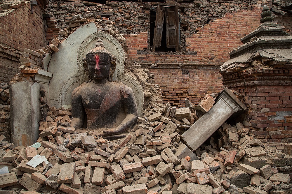
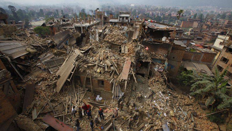
Digital Humanitarians are responding in full force to the devastating earthquake that struck Nepal. Information sharing and coordination is taking place online via CrisisMappers and on multiple dedicated Skype chats. The Standby Task Force (SBTF), Humanitarian OpenStreetMap (HOT) and others from the Digital Humanitarian Network (DHN) have also deployed in response to the tragedy. This blog post provides a quick summary of some of these digital humanitarian efforts along with what’s coming in terms of new deployments.
Update: A list of Crisis Maps for Nepal is available below.
At the request of the UN Office for the Coordination of Humanitarian Affairs (OCHA), the SBTF is using QCRI’s MicroMappers platform to crowdsource the analysis of tweets and mainstream media (the latter via GDELT) to rapidly 1) assess disaster damage & needs; and 2) Identify where humanitarian groups are deploying (3W’s). The MicroMappers CrisisMaps are already live and publicly available below (simply click on the maps to open live version). Both Crisis Maps are being updated hourly (at times every 15 minutes). Note that MicroMappers also uses both crowdsourcing and Artificial Intelligence (AIDR).
Update: More than 1,200 Digital Jedis have used MicroMappers to sift through a staggering 35,000 images and 7,000 tweets! This has so far resulted in 300+ relevant pictures of disaster damage displayed on the Image Crisis Map and over 100 relevant disaster tweets on the Tweet Crisis Map.
Live CrisisMap of pictures from both Twitter and Mainstream Media showing disaster damage:

Live CrisisMap of Urgent Needs, Damage and Response Efforts posted on Twitter:

Note: the outstanding Kathmandu Living Labs (KLL) team have also launched an Ushahidi Crisis Map in collaboration with the Nepal Red Cross. We’ve already invited invited KLL to take all of the MicroMappers data and add it to their crisis map. Supporting local efforts is absolutely key.
The Humanitarian UAV Network (UAViators) has also been activated to identify, mobilize and coordinate UAV assets & teams. Several professional UAV teams are already on their way to Kathmandu. The UAV pilots will be producing high resolution nadir imagery, oblique imagery and 3D point clouds. UAViators will be pushing this imagery to both HOT and MicroMappers for rapid crowdsourced analysis (just like was done with the aerial imagery from Vanuatu post Cyclone Pam, more on that here). A leading UAV manufacturer is also donating several UAVs to UAViators for use in Nepal. These UAVs will be sent to KLL to support their efforts. In the meantime, DigitalGlobe, Planet Labs and SkyBox are each sharing their satellite imagery with CrisisMappers, HOT and others in the Digital Humanitarian Network.
There are several other efforts going on, so the above is certainly not a complete list but simply reflect those digital humanitarian efforts that I am involved in or most familiar with. If you know of other major efforts, then please feel free to post them in the comments section. Thank you. More on the state of the art in digital humanitarian action in my new book, Digital Humanitarians.
List of Nepal Crisis Maps
Please add to the list below by posting new links in this Google Spreadsheet. Also, someone should really create 1 map that pulls from each of the listed maps.
Code for Nepal Casualty Crisis Map:
http://bit.ly/1IpUi1f
DigitalGlobe Crowdsourced Damage Assessment Map:
http://goo.gl/bGyHTC
Disaster OpenRouteService Map for Nepal:
http://www.openrouteservice.org/disaster-nepal
ESRI Damage Assessment Map:
http://arcg.is/1HVNNEm
Harvard WorldMap Tweets of Nepal:
http://worldmap.harvard.edu/maps/nepalquake
Humanitarian OpenStreetMap Nepal:
http://www.openstreetmap.org/relation/184633
Kathmandu Living Labs Crowdsourced Crisis Map: http://www.kathmandulivinglabs.org/earthquake
MicroMappers Disaster Image Map of Damage:
http://maps.micromappers.org/2015/nepal/images/#close
MicroMappers Disaster Damage Tweet Map of Needs:
http://maps.micromappers.org/2015/nepal/tweets
NepalQuake Status Map:
http://www.nepalquake.org/status-map
UAViators Crisis Map of Damage from Aerial Pics/Vids:
http://uaviators.org/map (takes a while to load)
Visions SDSU Tweet Crisis Map of Nepal:
http://vision.sdsu.edu/ec2/geoviewer/nepal-kathmandu#

Reblogged this on GeoBuiz Channel and commented:
Continuing to our Blog on Satellite Images for Nepal Earthquake Disaster, here are another interesting blog with more update from on the ground in Nepal!
Pingback: Nepal, Google Person Finder.MicroMappers y varios HT tras el terremoto | iRescate
Pingback: Nepal Earthquake – How to Help « Casus Calamitas
Thanks Patrick – great article – don’t forget Humanity Road 🙂
Thanks Cat, can you post links to your deployment here? (Sorry can’t keep track of everything, so fast moving).
Humanity Road is providing social media situation report information with updates on communities in need, communications, medical impacts, aid coordination and more for the live report visit http://humanityroad.org/apr25nepalquake/ PDF reports are at the top of the page.
i was just going into to add Humanity Road and Cat beat me to it 🙂
It’s great to see how many people and groups are helping the rescue efforts — the support is overwhelming. Times of need bring out the best in people. So glad they are being helped. Sending prayers, and hoping for more survivors.
Pingback: Link List: Social Media, ICT and the Nepal Earthquake | Social Media for Good
Pingback: Comment les “Digital Jedi” réagissent au tremblement de terre au Nepal | BLOG | DigitaleBox
Pingback: Nepal earthquake emergency: why digital humanitarian response matters and how you can help | Beatrice Martini – blog
Also http://nepal.amnesty.org.in/
Pingback: משלוח אורגני: קישורים וחדשות ברשת, אפריל 2015 | אינטרנט להשפעה ושינוי חברתי
Pingback: Supporting Nepal | I World New
I created a map of emergency facility in Kathmandu based on OpenStreetMap data. http://cdb.io/1FBH9RG
Thanks for sharing, Ian
Very informative article.
Thanks for reading and for your kind comment.