Tag Archives: Nepal

Back to the Future: Drones in Humanitarian Action

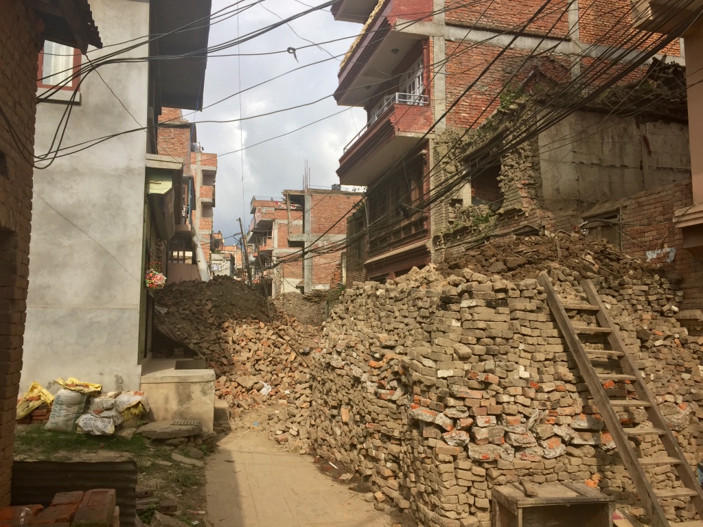
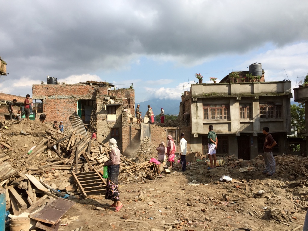
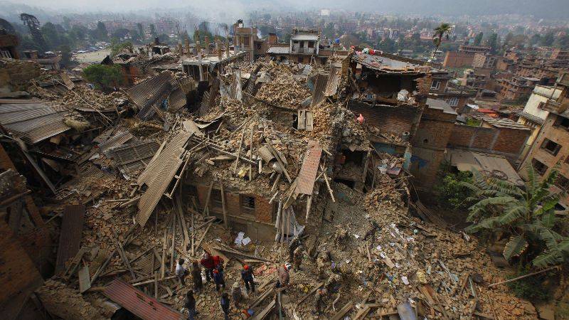
A devastating earthquake struck Nepal on April 25th, 2015. The humanitarian drone response to the earthquake was almost entirely foreign-led, top-down and techno-centric. International drone teams self-deployed and largely ignored the humanitarian drone code of conduct. Many had never heard of humanitarian principles and most had no prior experience in disaster response. Some were arrested by local authorities. At best, these foreign drone teams had little to no impact. At worse, they violated the principle of Do No Harm. Nepal Flying Labs was co-created five months after the earthquake, on September 25th, 2015, to localize the responsible and effective use of drones for positive social impact. Today, Flying Labs are operational in 25 countries across Asia, Africa and Latin America.

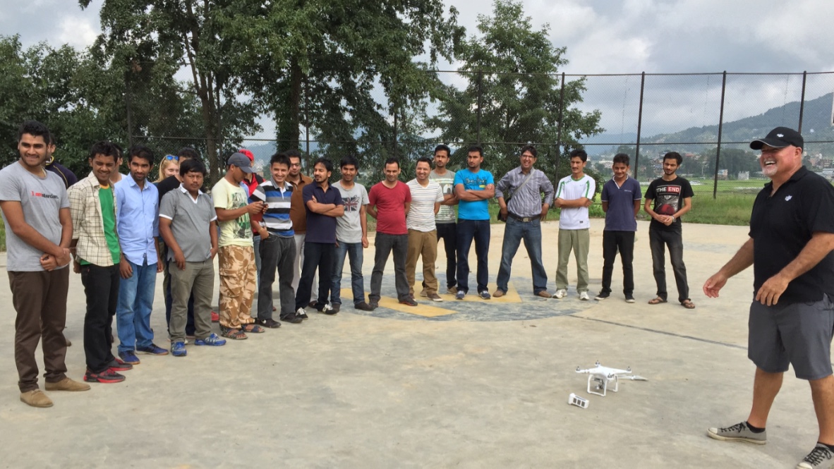
This month, on behalf of the World Food Program (WFP), WeRobotics teamed up with Nepal Flying Labs and WFP Nepal to run a 5-day hands-on training and disaster simulation to improve the rapid deployment and coordination of drones in humanitarian action. WeRobotics previously designed and ran similar humanitarian drone trainings and simulations on behalf of WFP (and others) in the Dominican Republic, Peru, Myanmar, Malawi and Mozambique, for example. In fact, WeRobotics has been running humanitarian drone trainings since 2015 both in-person and online.

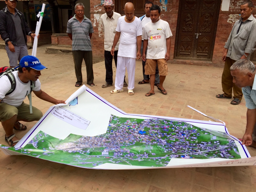
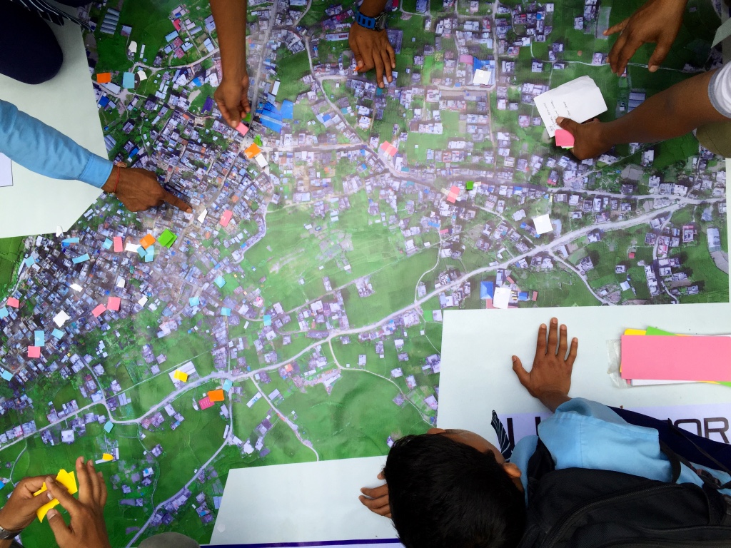
All 25 Flying Labs typically run their trainings in local languages. As such, the 5-day training in Nepal was largely led by Nepal Flying Labs and run in Nepali. Over 40 participants from 16 Nepali organizations took the training, which included an introduction to drone technologies,  drone photogrammetry, imagery processing, lessons learned and best practices from past humanitarian drone missions, and overviews of codes of conduct, data protection protocols and coordination mechanisms, all drawn from direct operational experience. The training also comprised a series of excellent talks given by Nepali experts who are already engaged in the use of drones in disaster management and other sectors in Nepal. This featured important talks by several officials from the Civil Aviation Authority of Nepal (CAAN). In addition, the training included a co-creation session using design thinking methods during which local experts identified the most promising humanitarian applications of drone technology in Nepal.

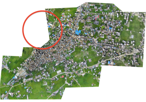
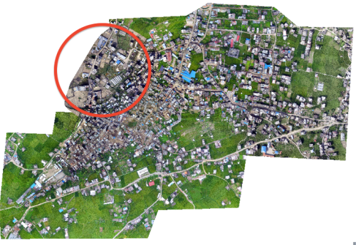
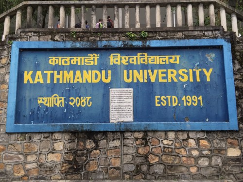
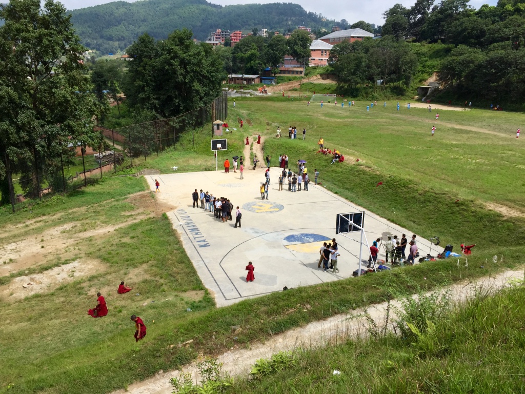
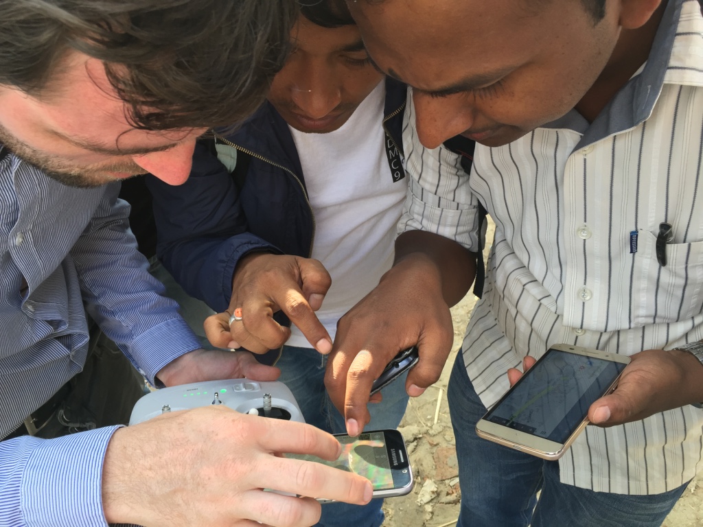
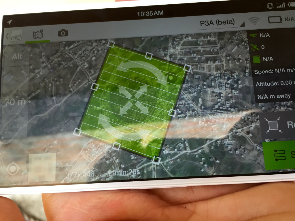
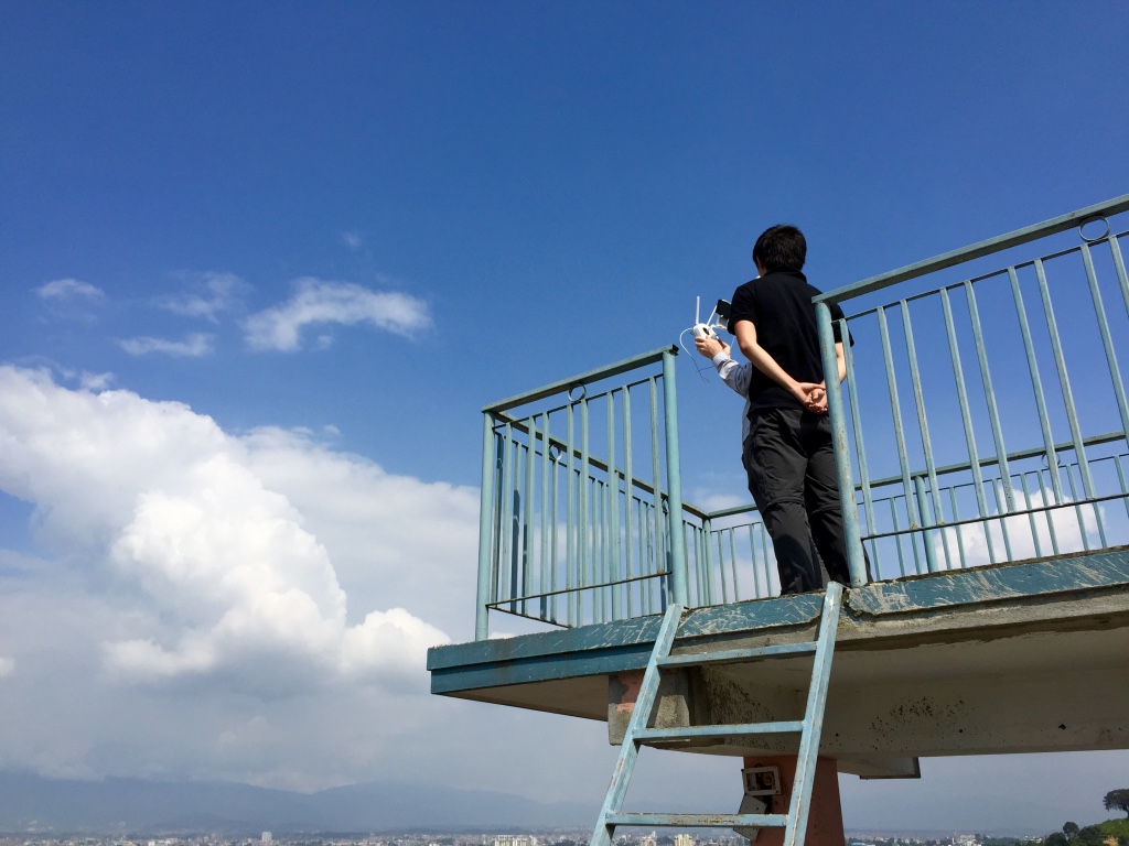
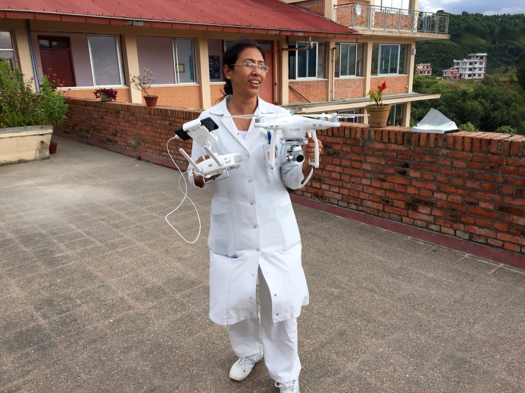
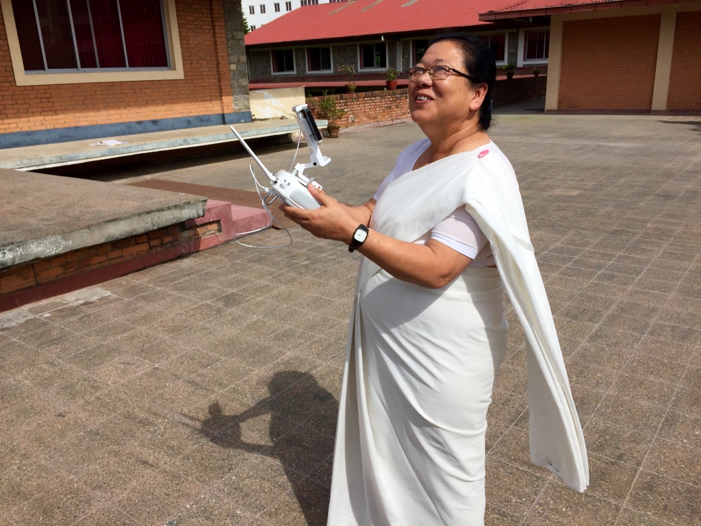
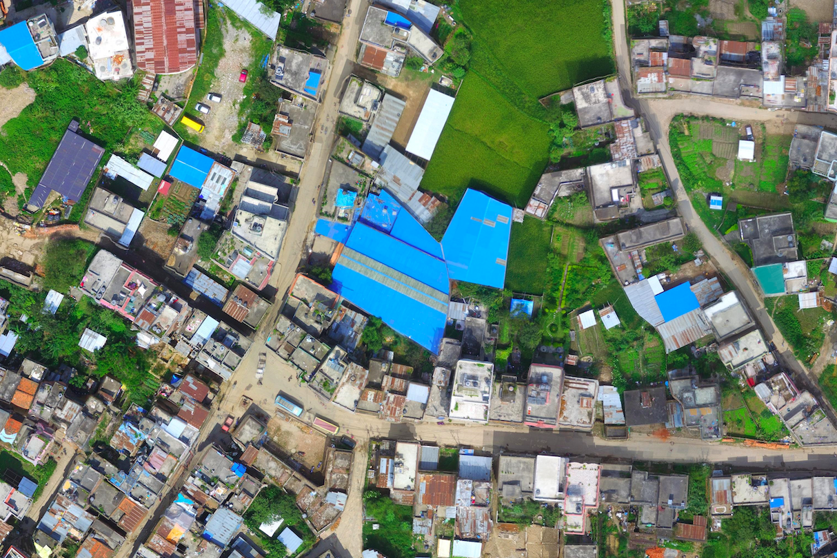
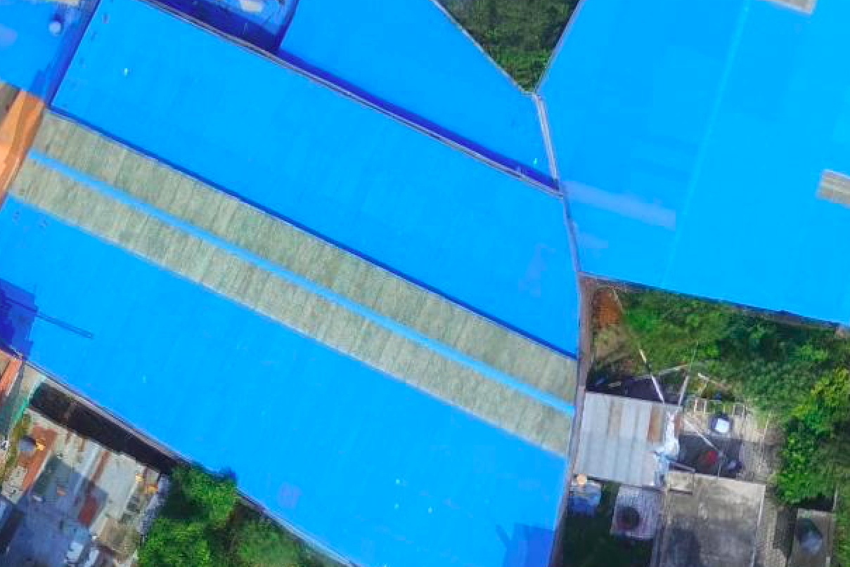
Nepal Flying Labs also trained participants on how to fly drones and program drone flights. The drones were rented locally from the Flying Labs and their partners. This hands-on session, kindly hosted by Kathmandu University, was followed by another hands-on session on how to process and analyze aerial imagery. In this session, Nepal Flying Labs introduced participants to Pix4Dreact and Picterra. Pix4Dreact provides an ultra-rapid solution to data processing, allowing humanitarian drone teams to process 1,000 high-resolution aerial images in literally minutes, which is invaluable as this used to take hours. Picterra enables drone teams to quickly analyze aerial imagery by automatically identifying features of interest to disaster responders such as damaged buildings, for example. While Picterra uses deep learning and transfer learning to automate feature detection, users don’t need any background or prior experience in artificial intelligence to make full use of the platform. During the hands on-session, trainers used Picterra to automatically detect buildings in aerial (orthophoto) map of an earthquake-affected area.

After completing a full day of hands-on training, Nepal Flying Labs gave a briefing on the disaster simulation scheduled for the following day. The simulation is the centerpiece of the humanitarian drone trainings run by WeRobotics and Flying Labs. It requires participants to put into practice everything they’ve learned in the training. The simulation consolidates their learning and provides them with important insights on how to streamline their coordination efforts. It is often said that disaster responders train the way they respond and respond they way they train. This is why simulations are absolutely essential.

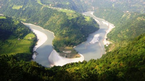
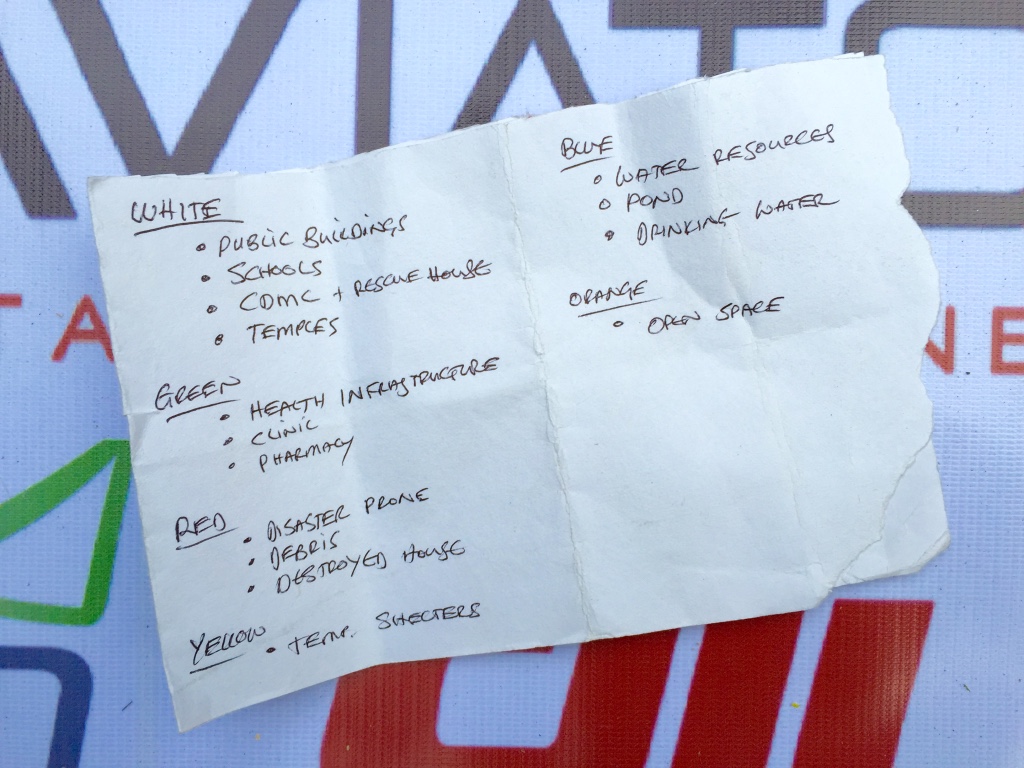
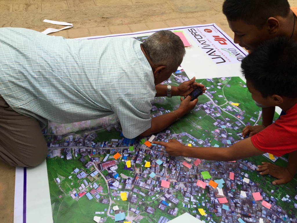
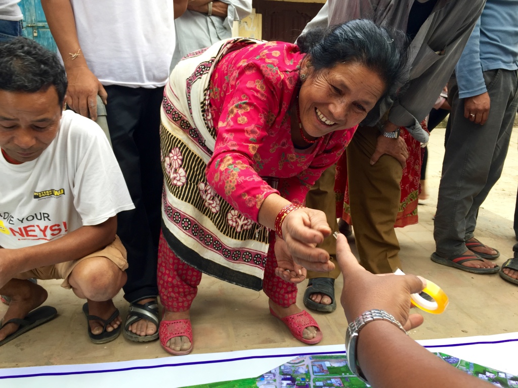
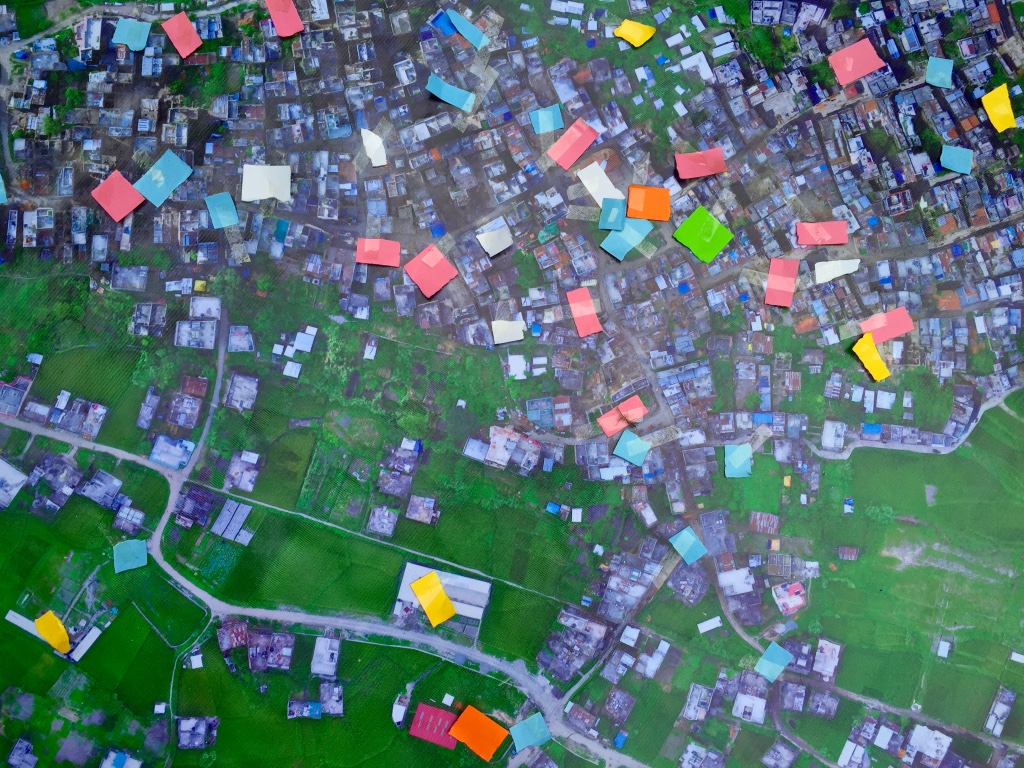
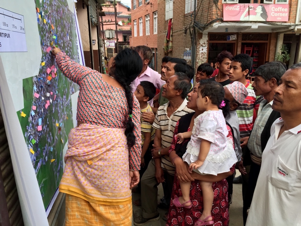
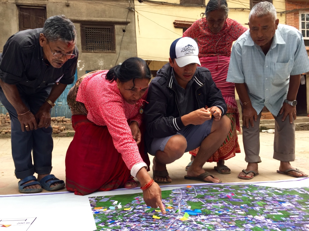
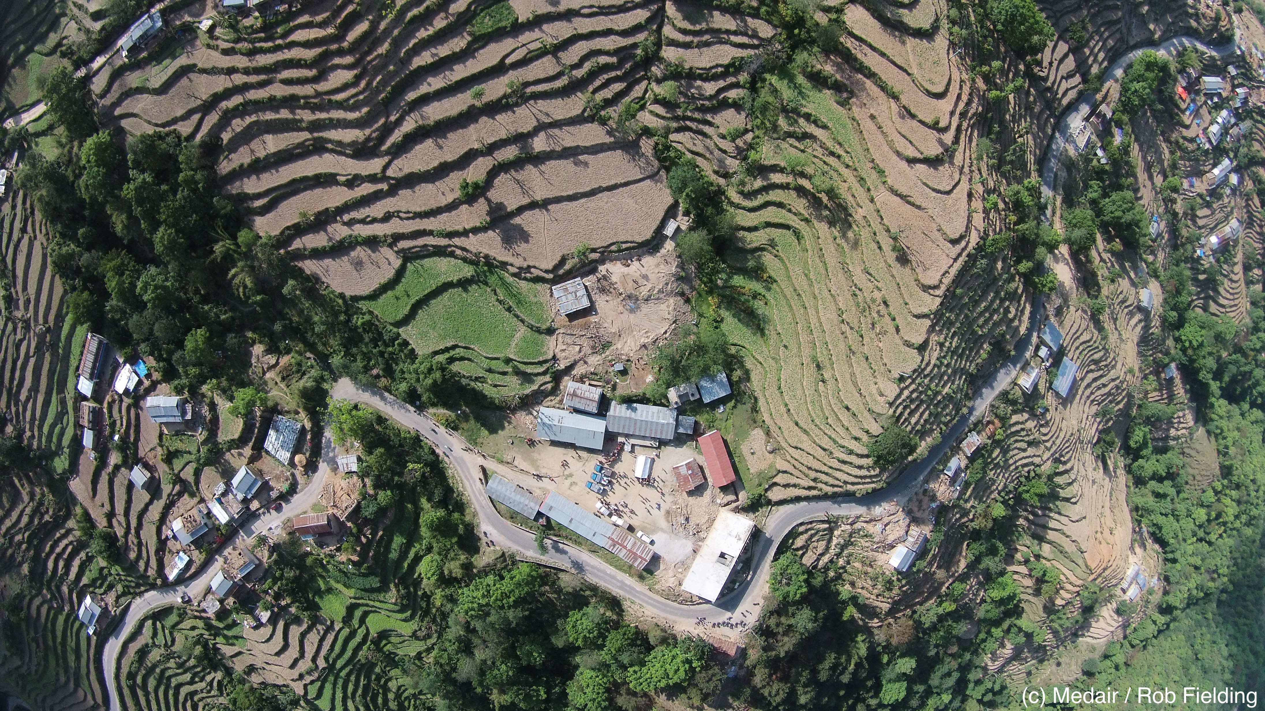
The simulation was held at Bhumlu Rural Municipality, a 3+ hour drive from Kathmandu. Bhumlu is highly prone to flooding and landslides, which is why it was selected for the simulation and why the Government of Nepal was particularly keen to get high-resolution maps of the area. The disaster simulation was run by Nepal Flying Labs in Nepali. The simulation, first designed by WeRobotics in 2015, consists of three teams (Authorities, Pilots and Analysts) who must work together to identify and physically retrieve colored markers as quickly and safely as possible. The markers, which were placed across Bhumlu prior to participants’ arrival, are typically 1 meter by 1 meter in size, and each color represents an indicator of interest to humanitarians, e.g., Yellow = survivor; Blue = landslide; and Red = disaster damage. Both the colors and the number of different markers are customized based on the local priorities. Below, Nepal Flying Labs Coordinator Uttam Pudasaini hides a yellow marker under a tree prior to the arrival of participants.

Myanmar has held the record for the fastest completion of the simulation since 2017. As such, they’ve held the number one spot and been the gold standard for two years now. The teams in Myanmar, who were trained by WeRobotics, retrieved all markers in just over 4 hours. As such, WeRobotics challenged the teams in Nepal to beat that record and take over the number one spot. They duly obliged and retrieved all markers in a very impressive time of 3 hours and 4 minutes, clenching the number one spot from Myanmar.

On the following and final day of the workshop, Nepal Flying Labs and WeRobotics facilitated an all-hands session to debrief on the simulation, inviting each team and trainee to reflect on lessons learned and share their insights. For example, a feedback loop between the Pilots and Analysis Teams is important so pilots can plan further flights based on the maps produced by the analysts. Like a number of previous simulations run by WeRobotics, the Analysis Team noted that having a portal printer on hand would be ideal. The Pilots Team also suggested that having different colored visibility vests would’ve enabled more rapid field coordination between and within teams by enabling individuals to more quickly identify who is who.

When asked which individuals or group had the most challenging job in the simulation, the consensus was the retrieval group who are part of the Authorities Team and responsible for retrieving the markers after they’ve been geo-located by the Analysis Team. This was particularly interesting given that in all previous simulations run by WeRobotics, the consensus had always been that the Analysis Team had the hardest task. In coming weeks, these insights together with the many others gained from the simulation in Nepal will be added to this document on best practices in humanitarian drone missions.

After the full simulation debrief, Nepal Flying Labs facilitated the final session of the training: a panel discussion on the development of drone regulations to save lives and reduce suffering in Nepal. The panelists included senior officials from Civil Aviation, Home Ministry and Nepal Police. The session was run in Nepali and presented participants with an excellent opportunity to engage with and inform key policymakers. In preparation for this session, Nepal Flying Labs and partners prepared this 3-page policy document (PDF) with priority questions and recommendations, which served as the basis for the Q&A with the panel. This discussion and policy document created a roadmap for next steps which Nepal Flying Labs and partners have pledged to take forward with all stakeholders.


Acknowledgements: WeRobotics and Nepal Flying Labs would like to sincerely thank WFP HQ and WPF Nepal for the kind invitation to run this training and for providing the superb coordination and logistics that made this training so fruitful. WeRobotics and Nepal Flying Labs would also like to express sincere thanks to DroNepal for co-leading the training with Nepal Flying Labs. Sincere thanks to the local communities we worked with during the simulation and to the CAA and local police for granting flight permissions. To all 40+ participants, sincerest thanks for all the energy you brought to the training and for your high levels of engagement throughout each of the 5 days, which significantly enriched the training. Last but certainly not least, sincere thanks to the Belgium Government for funding this training.

Using Swimming Robots to Warn Villages of Himalayan Tsunamis

Cross-posted from National Geographic 

Climate change is having a devastating impact on the Himalaya. On the Ngozumpa glacier, one of the largest and longest in the region, hundreds of supraglacial lakes dot the glacier surface. One lake in particular is known for its continuous volume purges on an annual basis. Near the start of the monsoon this summer, in less than 48 hours, it loses enough water to fill over 40 Olympic-sized swimming pools. To make matters worse, these glacial lakes act like cancers: they consume Himalayan glaciers from the inside out, making some of them melt twice as fast. As a result, villages down-valley from these glacial lakes are becoming increasingly prone to violent flash floods, which locals call Himalayan Tsunamis.

To provide early warnings of these flash floods requires that we collect a lot more geophysical and hydrologic information on these glacial lakes. So scientists like Ulyana (co-author) are racing to understand exactly how these glacial lakes form and grow, and how they’re connected to each other through seemingly secret subterranean channels. We need to know how deep and steep these lakes are, what the lake floors look like and of what materials they are composed (e.g., mud, rock, bare ice).

Ulyana, her colleagues and a small local team of Sherpa have recently started using autonomous swimming robots to automatically map lake floors and look for cracks that may trigger mountain tsunamis. Using robotics to do this is both faster and more accurate than having humans take the measurements. What’s more, robots are significantly safer. Indeed, even getting near these lakes (let alone in them!) is dangerous enough due to unpredictable collapses of ice called calving and large boulders rolling off of surrounding ice cliffs and into the lakes below. Just imagine being on a small inflatable boat floating on ice-cold water when one of those icefalls happen.

We (Ulyana and Patrick) are actively looking to utilize diving robots as well—specifically the one in the video footage below. This OpenROV Trident robot will enable us to get to the bottom of these glacial lakes to identify deepening ‘hotspots’ before they’re visible from the lake’s surface or from the air. Our plan next year is to pool our efforts, bringing diving, swimming and flying robots to Nepal so we can train our partners—Sherpas and local engineers—on how to use these robotic solutions to essentially take the ‘pulse’ of the changing Himalaya. This way they’ll be able to educate as well as warn nearby villages before the next mountain floods hit.

We plan to integrate these efforts with WeRobotics (co-founded by co-author Patrick) and in particular with the local robotics lab that WeRobotics is already setting up in Kathmandu. This lab has a number of flying robots and trained Nepali engineers. To learn more about how these flying robots are being used in Nepal, check out the pictures here.

We’ll soon be adding diving robots to the robotic lab’s portfolio in Nepal thanks to WeRobotics’s partnership with OpenROV. What’s more, all WeRobotics labs have an expressed goal of spinning off  local businesses that offer robotics as services. Thus, the robotics start-up that spins off from our lab in Nepal will offer a range of mapping services using both flying and diving robots. As such, we want to create local jobs that use robotics (jobs that local partners want!) so that our Nepali friends can make a career out of saving their beautiful mountains.  

Please do get in touch if you’d like to get involved or support in other ways! Email us ulyana@scienceinthewild.com and patrick@werobotics.org

This is What Happens When You Send Flying Robots to Nepal

In September 2015, we were invited by our partner Kathmandu University to provide them and other key stakeholders with professional hands-on training to help them scale the positive impact of their humanitarian efforts following the devastating earthquakes. More specifically, our partners were looking to get trained on how to use aerial robotics solutions (drones) safely and effectively to support their disaster risk reduction and early recovery efforts. So we co-created Kathmandu Flying Labs to ensure the long-term sustainability of our capacity building efforts. Kathmandu Flying Labs is kindly hosted by our lead partner, Kathmandu University (KU). This is already well known. What is hardly known, however, is what happened after we left the country.

Screen Shot 2015-11-02 at 5.17.58 PM

Our Flying Labs are local innovation labs used to transfer both relevant skills and appropriate robotics solutions sustainably to outstanding local partners who need these the most. The co-creation of these Flying Labs include both joint training and applied projects customized to meet the specific needs & priorities of our local partners. In Nepal, we provided both KU and Kathmandu Living Labs (KLL) with the professional hands-on training they requested. What’s more, thanks to our Technology Partner DJI, we were able to transfer 10 DJI Phantoms (aerial robotics solutions) to our Nepali partners (6 to KU and 4 to KLL). In addition, thanks to another Technology Partner, Pix4D, we provided both KU and KLL with free licenses of the Pix4D software and relevant training so they could easily process and analyze the imagery they captured using their DJI platforms. Finally, we carried out joint aerial surveys of Panga, one of the towns hardest-hit by the 2015 Earthquake. Joint projects are an integral element of our capacity building efforts. These projects serve to reinforce the training and enable our local partners to create immediate added value using aerial robotics. This important phase of Kathmandu Flying Labs is already well documented.

WP15

What is less known, however, is what KU did with the technology and software after we left Nepal. Indeed, the results of this next phase of the Flying Labs process (during which we provide remote support as needed) has not been shared widely, until now. KU’s first order of business was to actually finish the joint project we had started with them in Panga. It turns out that our original aerial surveys there were actually incomplete, as denoted by the red circle below.

Map_Before

But because we had taken the time to train our partners and transfer both our skills and the robotics technologies, the outstanding team at KU’s School of Engineering returned to Panga to get the job done without needing any further assistance from us at WeRobotics. They filled the gap:

Map_After

The KU team didn’t stop there. They carried out a detailed aerial survey of a nearby hospital to create the 3D model below (at the hospital’s request). They also created detailed 3D models of the university and a nearby temple that had been partially damaged by the 2015 earthquakes. Furthermore, they carried out additional disaster damage assessments in Manekharka and Sindhupalchowk, again entirely on their own.

Yesterday, KU kindly told us about their collaboration with the World Wildlife Fund (WWF). Together, they are conducting a study to determine the ecological flow of Kaligandaki river, one of the largest rivers in Nepal. According to KU, the river’s ecosystem is particularly “complex as it includes aquatic invertebrates, flora, vertebrates, hydrology, geo-morphology, hydraulics, sociology-cultural and livelihood aspects.” The Associate Dean at KU’s School of Engineering wrote “We are deploying both traditional and modern technology to get the information from ground including UAVs. In this case we are using the DJI Phantoms,” which “reduced largely our field investigation time. The results are interesting and promising.” I look forward to sharing these results in a future blog post.

kali-gandaki-river

Lastly, KU’s Engineering Department has integrated the use of the robotics platforms directly into their courses, enabling Geomatics Engineering students to use the robots as part of their end-of-semester projects. In sum, KU has done truly outstanding work following our capacity building efforts and deserve extensive praise. (Alas, it seems that KLL has made little to no use of the aerial technologies or the software since our training 10 months ago).

Several months after the training in Nepal, we were approached by a British company that needed aerial surveys of specific areas for a project that the Nepal Government had contracted them to carry out. So they wanted to hire us for this project. We proposed instead that they hire our partners at Kathmandu Flying Labs since the latter are more than capable to carry out the surveys themselves. In other words, we actively drive business opportunities to Flying Labs partners. Helping to create local jobs and local businesses around robotics as a service is one of our key goals and the final phase of the Flying Labs framework.

So when we heard last week that USAID’s Global Development Lab was looking to hire a foreign company to carry out aerial surveys for a food security project in Nepal, we jumped on a call with USAID to let them know about the good work carried out by Kathmandu Flying Labs. We clearly communicated to our USAID colleagues that there are perfectly qualified Nepali pilots who can carry out the same aerial surveys. USAID’s Development Lab will be meeting with Kathmandu Flying Labs during their next visit in September.

thumb_IMG_4591_1024

On a related note, one of the participants who we trained in September was hired soon after by Build Change to support the organization’s shelter programs by producing Digital Surface Models (DSMs) from aerial images captured using DJI platforms. More recently, we heard from another student who emailed us with the following: “I had an opportunity to participate in the Humanitarian UAV Training mission in Nepal. It’s because of this training I was able learn how to fly drones and now I can conduct aerial Survey on my own with any hardware.  I would like to thank you and your team for the knowledge transfer sessions.”

This same student (who graduated from KU) added: “The workshop that your team did last time gave us the opportunity to learn how to fly and now we are handling some professional works along with major research. My question to you is ‘How can young graduates from developing countries like ours strengthen their capacity and keep up with their passion on working with technology like UAVs […]? The immediate concern for a graduate in Nepal is a simple job where he can make some money for him and prove to his family that he has done something in return for all the investments they have been doing upon him […]’.

KU campus sign

This is one of several reasons why our approach at WeRobotics is not limited to scaling the positive impact of local humanitarian, development, environmental and public health projects. Our demand-driven Flying Labs model goes the extra (aeronautical) mile to deliberately create local jobs and businesses. Our Flying Labs partners want to make money off the skills and technologies they gain from WeRobotics. They want to take advantage of the new career opportunities afforded by these new AI-powered robotics solutions. And they want their efforts to be sustainable.

In Nepal, we are now interviewing the KU graduate who posed the question above because we’re looking to hire an outstanding and passionate Coordinator for Kathmandu Flying Labs. Indeed, there is much work to be done as we are returning to Nepal in coming months for three reasons: 1) Our local partners have asked us to provide them with the technology and training they need to carry out large scale mapping efforts using long-distance fixed-wing platforms; 2) A new local partner needs to create very high-resolution topographical maps of large priority areas for disaster risk reduction and planning efforts, which requires the use of a fixed-wing platform; 3) We need to meet with KU’s Business Incubation Center to explore partnership opportunities since we are keen to help incubate local businesses that offer robotics as a service in Nepal.

Video: Crisis Mapping Nepal with Aerial Robotics

CrisisMappingNepalVideo

I had the honor of spearheading this disaster recovery UAV mission in Nepal a few weeks ago as part of Kathmandu Flying Labs. I’ve been working on this new initiative (in my own time) with Kathmandu Living Labs (KLL), Kathmandu University (KU), DJI and Pix4D. This Flying Lab is the first of several local UAV innovation labs that I am setting up (in my personal capacity and during my holiday time) with friends and colleagues in disaster-prone countries around the world. The short film documentary above was launched just minutes ago by DJI and describes how we teamed up with local partners in Kathmandu to make use of aerial robotics (UAVs) to map Nepal’s recovery efforts.

Here are some of the 3D results, courtesy of Pix4D (click to enlarge):

3D_1

Screen Shot 2015-11-02 at 5.17.58 PM

Why work in 3D? Because disaster damage is a 3D phenomenon. This newfound ability to work in 3D has important implications for Digital Humanitarians. To be sure, the analysis of these 3D models could potentially be crowdsourced and eventually analyzed entirely within a Virtual Reality environment.

Since most of our local partners in Nepal don’t have easy access to computers or VR headsets, I found another way to unlock and liberate this digital data by printing our high-resolution maps on large, rollable banners.

temp

WP13

We brought these banner maps back to the local community and invited them to hack the map. How? Directly, by physically adding their local knowledge to the map; knowledge about the location of debris, temporary shelters, drinking water and lots more. We brought tape and color-coded paper with us to code this knowledge so that the community could annotate the map themselves.

WP16

In other words, we crowdsourced a crisis map of Panga, which was highly participatory. The result was a rich, contextual social layer on top of the base map, which further inform community discussions on strategies and priorities guiding their recovery efforts. For the first time ever, the community of Panga was working off the one and same dataset to inform their rebuilding. In short, our humanitarian mission combined aerial robotics, computer vision, water-proof banners, local knowledge, tape, paper and crowdsourcing to engage local communities on the reconstruction process.

WP19

I’m now spending my evenings & weekends working with friends and colleagues to plan a follow-up mission in early 2016. We’ll be returning to Kathmandu Flying Labs with new technology partners to train our local partners on how to use fixed-wing UAVs for large scale mapping efforts. In the meantime, we’re also exploring the possibility of co-creating Jakarta Flying Labs, Monrovia Flying Labs and Santiago Flying Labs in 2016.

I’m quitting my day job next week to devote myself full time to these efforts. Fact is, I’ve been using all of my free time (meaning evenings, weekends and many, many weeks of holiday time) to pursue my passion in aid robotics and to carry out volunteer-based UAV missions like the one in Nepal. I’ve also used holiday time (and my own savings) to travel across the globe to present this volunteer-work at high-profile events, such as the 2015 Web Summit here in Dublin where the DJI film documentary was just publicly launched.

bookcover

My Nepali friends & I need your help to make sure that Kathmandu Flying Labs take-off and become a thriving and sustainable center of social entrepreneur-ship. To this end, we’re actively looking for both partners and sponsors to make all this happen, so please do get in touch if you share our vision. And if you’d like to learn more about how UAVs other emerging technologies are changing the face of humanitarian action, then check out my new book Digital Humanitarians.

In the meantime, big, big thanks to our Nepali partners and technology partners for making our good work in Kathmandu possible!

Aerial Robotics in the Land of Buddha

Buddhist Temples adorn Nepal’s blessed land. Their stupas, like Everest, stretch to the heavens, yearning to democratize the sky. We felt the same yearning after landing in Kathmandu with our UAVs. While some prefer the word “drone” over “UAVs”, the reason our Nepali partners use the latter dates back some 3,000 years to the spiritual epic Mahabharata (Great Story of Bharatas). The ancient story features Drona, a master of advanced military arts who slayed hundreds of thousands with his bow & arrows. This strong military connotation explains why our Nepali partners use “UAV” instead, which is the term we also used for our Humanitarian UAV Mission in the land of Buddha. Our purpose: to democratize the sky.

Screen Shot 2015-09-28 at 12.05.09 AM

Unmanned Aerial Vehicles (UAVs) are aerial robots. They are the first wave of robotics to impact the humanitarian space. The mission of the Humanitarian UAV Network (UAViators) is to enable the safe, responsible and effective use of UAVs in a wide range of humanitarian and development settings. We thus spearheaded a unique and weeklong UAV Mission in Nepal in close collaboration with Kathmandu University (KU), Kathmandu Living Labs (KLL), DJI and Pix4D. This mission represents the first major milestone for Kathmandu Flying Labs (please see end of this post for background on KFL).

WP1

Our joint UAV mission combined both hands-on training and operational deployments. The full program is available here. The first day comprised a series of presentations on Humanitarian UAV Applications, Missions, Best Practices, Guidelines, Technologies, Software and Regulations. These talks were given by myself, KU, DJI, KLL and the Civil Aviation Authority (CAA) of Nepal. The second day  focused on direct hands-on training. DJI took the lead by training 30+ participants on how to use the Phantom 3 UAVs safely, responsibly. Pix4D, also on site, followed up by introducing their imagery-analysis software.

WP2

WP3

WP4

The second-half of the day was dedicated to operations. We had already received written permission from the CAA to carry out all UAV flights thanks to KU’s outstanding leadership. KU also selected the deployment sites and enabled us to team up with the very pro-active Community Disaster Management Committee (CDMC-9) of Kirtipur to survey the town of Panga, which had been severely affected by the earthquake just months earlier. The CDMC was particularly keen to gain access to very high-resolution aerial imagery of the area to build back faster and better, so we spent half-a-day flying half-a-dozen Phantom 3’s over parts of Panga as requested by our local partners.

WP5

WP6

WP7

WP8

The best part of this operation came at the end of the day when we had finished the mission and were packing up: Our Nepali partners politely noted that we had not in fact finished the job; we still had a lot more area to cover. They wanted us back in Panga the following day to complete our mapping mission. We thus changed our plans and returned the next day during which—thanks to DJI & Pix4D—we flew several dozen additional UAV flights from four different locations across Panga (without taking a single break; no lunch was had). Our local partners were of course absolutely invaluable throughout since they were the ones informing the flight plans. They also made it possible for us to launch and land all our flights from the highest rooftops across town. (Click images to enlarge).

WP8b

WP8bb

WP8c

WP8cc

WP8d

Meanwhile, back at KU, our Pix4D partners provided hands-on training on how to use their software to analyze the aerial imagery we had collected the day before. KLL also provided training on how to use the Humanitarian Open Street Map Tasking Manager to trace this aerial imagery. Incidentally, we flew well over 60 UAV flights all in all over the course of our UAV mission, which includes all our training flights on campus as well as our aerial survey of a teaching hospital. Not a single incident or accident occurred; everyone followed safety guidelines and the technology worked flawlessly.

WP8e

WP8f

WP8g

With more than 800 aerial photographs in hand, the Pix4D team worked through the night to produce a very high-resolution orthorectified mosaic of Panga. Here are some of the results.

WP9

WP10

WP11

WP12

Compare these results with the resolution and colors of the satellite imagery for the same area (maximum zoom).

Screen Shot 2015-09-28 at 12.32.36 AM

WP10

We can now use MicroMappers to crowdsource the analysis & digital annotation of oblique aerial pictures and videos collected throughout the mission. This is an important step in the development of automated feature-detection algorithms using techniques from computer vision and machine learning. The reason we want automated solutions is because aerial imagery already presents a Big Data challenge for humanitarian and development organizations. Indeed, a single 20- minute UAV flight can generate some 800 images. A trained analyst needs at least one minute to analyze a single image, which means that more than 13 hours of human time is needed to analyze imagery captured from just one 20-minute UAV flight. More on this Big Data challenge here.

Incidentally, since Pix4D also used their software to produce a number of stunning 3D models, I’m keen to explore ways to crowdsource 3D models via MicroMappers and to explore possible Virtual Reality solutions to the Big Data challenge. In any event, we generated all the aerial data requested by our local partners by the end of the day.

While this technically meant that we had successfully completed our mission, it didn’t feel finished to me. I really wanted to “liberate” the data completely and place it directly into the hands of the CDCM and local community in Panga. What’s the point of “open data” if most of Panga’s residents are not able to view or interact with the resulting maps? So I canceled my return flight and stayed an extra day to print out our aerial maps on very large roll-able and waterproof banners (which are more durable than paper-based maps).

WP13

WP14

WP15

We thus used these banner-maps and participatory mapping methods to engage the local community directly. We invited community members to annotate the very-high resolution aerial maps themselves by using tape and color-coded paper we had brought along. In other words, we used the aerial imagery as a base map to catalyze a community-wide discussion; to crowdsource and to visualize the community’s local knowledge. Participatory mapping and GIS (PPGIS) can play an impactful role in humanitarian and development projects, hence the initiative with our local partners (more here on community mapping).

In short, our humanitarian mission combined aerial robotics, computer vision, waterproof banners, tape, paper and crowdsourcing to inform the rebuilding process at the community level.

WP16

WP20

WP19

WP18

WP17

WP16b

WP24

WP23

WP22

WP21

WP25

The engagement from the community was absolutely phenomenal and definitely for me the highlight of the mission. Our CDMC partners were equally thrilled and excited with the community engagement that the maps elicited. There were smiles all around. When we left Panga some four hours later, dozens of community members were still discussing the map, which our partners had hung up near a popular local teashop.

There’s so much more to share from this UAV mission; so many angles, side-stories and insights. The above is really just a brief and incomplete teaser. So stay tuned, there’s a lot more coming up from DJI and Pix4D. Also, the outstanding film crew that DJI invited along is already reviewing the vast volume of footage captured during the week. We’re excited to see the professionally edited video in coming weeks, not to mention the professional photographs that both DJI and Pix4D took throughout the mission. We’re especially keen to see what our trainees at KU and KLL do next with the technology and software that are now in their hands. Indeed, the entire point of our mission was to help build local capacity for UAV missions in Nepal by transferring knowledge, skills and technology. It is now their turn to democratize the skies of Nepal.

WP26

WP27

Acknowledgements: Some serious acknowledgements are in order. First, huge thanks to Lecturer Uma Shankar Panday from KU for co-sponsoring this mission, for hosting us and for making our joint efforts a resounding success. The warm welcome and kind hospitality we received from him, KU’s faculty and executive leadership was truly very touching. Second, special thanks to the CAA of Nepal for participating in our training and for giving us permission to fly. Third, big, big thanks to the entire DJI and Pix4D Teams for joining this UAViators mission and for all their very, very hard work throughout the week. Many thanks also to DJI for kindly donating 10 Smartisan phones and 10 Phantom 3’s to KU and KLL; and kind thanks to Pix4D for generously donating licenses of their software to both KU and KLL. Fourth, many thanks to KLL for contributing to the training and for sharing our vision behind Kathmandu Flying Labs. Fifth, I’d like to express my sincere gratitude to Smartisan for co-sponsoring this mission. Sixth, deepest thanks to CDMC and Dhulikhel Hospital for partnering with us on the ops side of the mission. Their commitment and life-saving work are truly inspiring. Seventh, special thanks to the film and photography crew for being so engaged throughout the mission; they were absolutely part of the team. In closing, I want to specifically thank my colleagues Andrew Schroeder from UAViators and Paul & William from DJI for all the heavy lifting they did to make this entire mission possible. On a final and personal note, I’ve made new friends for life as a result of this UAV mission, and for that I am infinitely grateful.


Kathmandu Flying Labs: My colleague Dr. Nama Budhathoki and I began discussing the potential role that small UAVs could play in his country in early 2014, well over a year-and-half before Nepal’s tragic earthquakes. Nama is the Director of Kathmandu Living Labs, a crack team of Digital Humanitarians whose hard work has been featured in The New York Times and the BBC. Nama and team create open-data maps for disaster risk reduction and response. They use Humanitarian OpenStreetMap’s Tasking Server to trace buildings and roads visible from orbiting satellites in order to produce these invaluable maps. Their primary source of satellite imagery for this is Bing. Alas, said imagery is both low-resolution and out-of-date. And they’re not sure they’ll have free access to said imagery indefinitely either.

KFL logo draft

So Nama and I decided to launch a UAV Innovation Lab in Nepal, which I’ve been referring to as Kathmandu Flying Labs. A year-and-a-half later, the tragic earthquake struck. So I reached out to DJI in my capacity as founder of the Humanitarian UAV Network (UAViators). The mission of UAViators is to enable the safe, responsible and effective use of UAVs in a wide range of humanitarian and development settings. DJI, who are on the Advisory Board of UAViators, had deployed a UAV team in response to the 6.1 earthquake in China the year before. Alas, they weren’t able to deploy to Nepal. But they very kindly donated two Phantom 2’s to KLL.

A few months later, my colleague Andrew Schroeder from UAViators and Direct Relief reconnected with DJI to explore the possibility of a post-disaster UAV Mission focused on recovery and rebuilding. Both DJI and Pix4D were game to make this mission happen, so I reached out to KLL and KU to discuss logistics. Professor Uma at KU worked tirelessly to set everything up. The rest, as they say, is history. There is of course a lot more to be done, which is why Nama, Uma and I are already planning the next important milestones for Kathmandu Flying Labs. Do please get in touch if you’d like to be involved and contribute to this truly unique initiative. We’re also exploring payload delivery options via UAVs and gearing up for new humanitarian UAV missions in other parts of the planet.

Humanitarian UAV Missions in Nepal: Early Observations (Updated)

Public request from the United Nations (UN) Office for the Coordination of Humanitarian Affairs (OCHA) posted on April 28, 2015:

“OCHA would prefer that all the UAV operators coordinate their efforts. With UAViators (Humanitarian UAV Network) in place, OCHA suggest that they all connect to UAViators and share their activities so everyone knows what is being worked on. Please make sure all UAV teams register at the RDC (Reception and Departure Center) at the airport.” 

Note: UAViators does not self-deploy but rather responds to requests from established humanitarian organizations.


There are at the very least 15 humanitarian UAV teams operating in Nepal. We know this since these teams voluntarily chose to liaise with the Humanitarian UAV Network (UAViators). In this respect, the current humanitarian UAV response is far better coordinated than the one I witnessed in the Philippines right after Typhoon Haiyan in 2013. In fact, there was little to no coordination at the time amongst the multiple civilian UAV teams; let alone between these teams and humanitarian organizations, or the Filipino government for that matter. This lack of coordination coupled with the fact that I could not find any existing “Code of Conduct” for the use of UAVs in humanitarian settings is actually what prompted me to launch UAViators just months after leaving the Philippines.

DCIM100MEDIA

The past few days have made it clear that we still have a long way to go in the humanitarian UAV space. Below are some early observations (not to be taken as criticisms but early reflections only). UAV technology is highly disruptive and is only now starting to have visible impact (both good and bad) in humanitarian contexts. We don’t have all the answers; the institutions are not keeping up with the rapid pace of innovation, nor are the regulators. The challenges below cut across technical, organizational, regulatory challenges that are only growing more complex. So I welcome your constructive input on how to improve these efforts moving forward.

  • Yes, we now have a Code of Conduct which was drafted by several humanitarian professionals, UAV pilots & experts and academics. However, this doesn’t mean that every civilian UAV pilot in Nepal has taken the time to read this document let alone knows that this document exists. As such, most UAV pilots may not even realize that they require legal permission from the government in order to operate or that they should carry some form of insurance. Even professional pilots may not think to inform the local police that they have formal authorization to operate; or know how to communicate with Air Traffic Control or with the military for flight permissions. UAViators can’t force anyone in Nepal to comply with national regulations or the Code. The Network can only encourage UAV pilots to follow best practices. The majority of the problems vis-a-vis the use of UAVs in Nepal would have been avoided had the majority of UAV users followed the Humanitarian UAV Code of Conduct.
  • Yes, more countries have instituted UAV regulations. Some of these tend to be highly restrictive, equating 700-gram micro-UAVs with 50-kilo UAVs. Some apply the same sets of laws for the use of UAVs for amateur movie productions as for the professional use of UAVs for Search & Rescue. In any event, there are no (clear) regulations in Nepal as per research and phone calls made by the Humanitarian UAV Network (see also the UAViators Laws/Travel Wiki). To this end, UAViators has provided contact info to Nepal’s Civil Aviation Authority and Chief of Police. Update: All humanitarian UAV Teams are now required to obtain permission from the Ministry of Home Affairs to operate UAVs in Nepal. Once permission is granted, individual flight plants must be approved by the Nepal Army (via UNDAC). More info here (see May 8 Update). It has taken almost two weeks to get the above process in place. Clearly, without a strong backing or leadership from an established humanitarian group that is able and willing to mediate with appropriate Ministries and Civil Aviation authorities, there is only so much that UAViators can do to support the above process.
  • Yes, we now have all 15 UAV teams on one single dedicated email thread. And yes, UAViators has been able to vet many teams while keeping amateur UAV pilots on standby if the latter have less than 50 hours of flight experience. Incidentally, requests for imagery can be made here. That said, what about all the other civilian UAV pilots operating independently? These other pilots, some of them reporters and disaster junkies, have already undermined the use of UAVs for humanitarian efforts. Indeed, it was reported that “The Nepali Government became very irritated with reporters collecting disaster adventure footage using drones.” This has prompted the government to ban UAV flights with the exception of flights carried out for humanitarian purposes. The latter still require permission from the Ministry of Home Affairs. The problem with so-called “drone journalists” is not simply a safety issue, which is obviously the number one priority of a humanitarian UAV mission. Fact is, there are far more requests for aerial imagery than can be met with just 10 UAV teams on site. So coordination and data sharing is key—even with drone journalists if the latter are prepared to be a part of the solution by liaising with UAViators and following the Code of Conduct. Furthermore, local communities have already expressed anger at the fact that drone & humanitarian journalists have “have visited the same sites with no plans to share data, make the imagery publicly available, or to make an effort to communicate to villages why the flights are important and how the information will be used to assist in relief efforts.”
  • Yes, we have workflows in place for the UAV teams to share their imagery, and some already have. Alas, limited Internet bandwidth is significantly slowing down the pace of data sharing. Some UAV teams have not (yet) expressed an interest in sharing their imagery. Some have not provided information about where they’re flying. Of course, they are incredibly busy. And besides, they are not required to share any data or information. The best UAViators can do is simply to outline the added value of sharing this imagery & their flight plans. And without strong public backing from established humanitarian groups, there is little else the Network can do. Update: several UAV teams are now only sharing imagery with local and national authorities. If the UN and others want this imagery, they need to go through Nepali authorities.
  • Yes, UAViators is indeed in touch with a number of humanitarian organizations who would like aerial imagery for specific areas, however these groups are unable (or not yet willing) to make these requests public or formal until they better understand the risks (legal, political and operational), the extent of the value-added (they want to see the imagery first), the experience and reliability of the UAV teams, etc. They are also weary of having UAV teams take requests for imagery as carte blanche to say they are operating on their behalf. At the same time, these humanitarian organizations do not have the resources (or time) to provide any coordination support between the Humanitarian UAV Network, appropriate government ministries and Nepal’s Civil Aviation Authority.
  • Yes, we have a dedicated UAViators site for Nepal updated multiple times a day. Unfortunately, most UAV Teams are having difficulty accessing this site from Nepal due to continuing Internet connectivity issues. This is also true of the dedicated UAViators Google Spreadsheet being used to facilitate the coordination of UAV operations. This online resource includes each team’s contact info, UAV assets, requests for aerial imagery, data needs, etc. We’re now sharing this information via basic text within the body of emails; but this also contributes to email overload. Incidentally, the UAVs being used by the 7 Teams in Nepal are small UAVs such as DJI’s Phantom and Inspire and Aeryon SkyRangers and eBees for example.
  • Yes, we have set up a UAV-Flights-Twitter map for Nepal (big thanks to colleagues at LinkedIn) to increase the transparency of where and when UAVs are being flown across the country. Alas, none of the UAV teams have made use of this solution yet even though most are tweeting from the field. This service allows UAV teams to send a simple tweet about their next UAV flight which then gets mapped automatically. If not used in Nepal, perhaps this service will be used in the future & combined with SMS/WhatsApp.
  • Yes, UAViators is connected with the Digital Humanitarian Network (DHN); specifically Humanitarian OpenStreetMap (HOT) and the Standby Task Force (SBTF), with the latter ready to deploy QCRI’s MicroMappers platform for the analysis of oblique imagery. Yet we’re still not sure how best to combine the results of nadir imagery and oblique imagery analysis to add value. Every point on a nadir (vertical) image has a GPS coordinate; but this is not true of obliques (photos taken at an angle). The GPS data for oblique photographs is simply the GPS coordinates for the position of the camera at the time the oblique image was taken. (Specialist gimbal mounted cameras can provide GPS info for objects in oblique photographs, but these are not in use in Nepal).
  • Yes, UAViators has access to a local physical office in Kathmandu. Thanks to the kind offer from Kathmandu Living Labs (KLL), UAV pilots can meet and co-work at KLL. However, even finding a time for all the UAV teams to meet at this office has proven impossible. And yet this is so crucial; there are good reasons why humanitarians have Cluster meetings.
  • Yes, 3D models (Point Clouds) of disaster areas can add insights to disaster damage assessments. That said, these are often huge files and thus particularly challenging to upload. And when these do get posted on-line, what is the best way to have them analyzed? GIS experts and other professionals tend to be completely swamped during disasters. But even if a team were available, what methods & software should they be using to assess and indeed quantify the level of damage in each 3D model? Can this assessment be crowdsourced? And how can the results of 3D analysis be added to other datasets and official humanitarian information products?
  • Yes, the majority of UAV teams that have chosen to liaise with the Humanitarian UAV Network are now in Nepal, yet it took a while for some teams to get on site and there were delays with their UAV assets getting into the country. This points to the need for building local capacity within Nepal and other disaster-prone countries so that local organizations can rapidly deploy UAVs and analyze the resulting imagery themselves after major disasters. This explains why my colleague Nama Budhathoki (at KLL) and I have been looking to set up Kathmandu Flying Labs (basically a Humanitarian UAV Innovation Lab) for literally a year now. In any event, thanks to LinkedIn for Good, we were able to identify some local UAV pilots and students right after the earthquake; some of whom have since been paired with the international UAV teams. Building the capacity of local teams is also important because of the local knowledge and local contacts (and potentially the legal permissions) that these teams will already have.

https://vimeo.com/126676918

So where do we go from here? Despite the above challenges, there is a lot more coordination and structure to the UAV response in Nepal than there was following Typhoon Haiyan in 2013. Then again, the challenges that come with UAV operations in disaster situations are only going to increase as more UAV teams deploy in future crises alongside members of the public, drone journalists, military UAVs, etc. At some point, hopefully sooner (before accidents and major mistakes happen) rather than later, an established humanitarian organization will take on the responsibility of mediating between UAV teams, UAViators, the government, civil aviation officials, military and other aid groups.

What we may need is something along the lines of what GSMA’s Disaster Response Program has done for Mobile Network Operators (MNOs) and the humanitarian community. GSMA has done a lot since the 2010 Haiti Earthquake to bridge MNOs and humanitarians, acting as convener, developing standard operating procedures, ethical guidelines, a global model agreement, etc. Another suggestion floated by a humanitarian colleague is the INSARAG Secretariat, which classifies and also categorizes Search and Rescue teams. Each teams has to “sign onto agreed guidelines (behavior, coordination, markings, etc). So, when the first one arrives, they know to setup a reception space; they all know that there will be coordination meetings, etc.” Perhaps INSARAG could serve as a model for UAViators 2.0. Update: UNDAC is now serving as liaison for UAV flights, which will likely set a precedence for future humanitarian UAV missions.

Coordination is never easy. And leveraging a new, disruptive technology for disaster response is also a major challenge. I, for one, am ready and want to take on these new challenges, but do I need a willing and able partner in the humanitarian community to take on these challenges with me and others. The added value of timely, very high-resolution aerial data during disaster is significant for disaster response, not to mention the use of UAVs for payload transportation and the provision of communication services via UAV. The World Humanitarian Summit (WHS) is coming up next year. Will we unveil a solution to the above challenges at this pivotal Summit or will we continue dragging our feet and forgo the humanitarian innovation opportunities that are right on front of our eyes in Nepal?

In the meantime, I want to thank and acknowledge the following UAV Teams for liaising with the Humanitarian UAV Network: Team RubiconSkyCatch, Halo Drop, GlobalMedic, Medair, Deploy Media and Paul Borrud. Almost all teams have already been able to share aerial imagery. If other responders on the ground are able to support these efforts in any way, e.g., CISCO providing better Internet connectivity, or if you know of other UAV groups that are moving faster and able to provide guidance, for example, then please do get in touch.

A Force for Good: How Digital Jedis are Responding to the Nepal Earthquake (Updated)

Digital Humanitarians are responding in full force to the devastating earthquake that struck Nepal. Information sharing and coordination is taking place online via CrisisMappers and on multiple dedicated Skype chats. The Standby Task Force (SBTF), Humanitarian OpenStreetMap (HOT) and others from the Digital Humanitarian Network (DHN) have also deployed in response to the tragedy. This blog post provides a quick summary of some of these digital humanitarian efforts along with what’s coming in terms of new deployments.

Update: A list of Crisis Maps for Nepal is available below.

Credit: http://www.thestar.com/content/dam/thestar/uploads/2015/4/26/nepal2.jpg

At the request of the UN Office for the Coordination of Humanitarian Affairs (OCHA), the SBTF is using QCRI’s MicroMappers platform to crowdsource the analysis of tweets and mainstream media (the latter via GDELT) to rapidly 1) assess disaster damage & needs; and 2) Identify where humanitarian groups are deploying (3W’s). The MicroMappers CrisisMaps are already live and publicly available below (simply click on the maps to open live version). Both Crisis Maps are being updated hourly (at times every 15 minutes). Note that MicroMappers also uses both crowdsourcing and Artificial Intelligence (AIDR).

Update: More than 1,200 Digital Jedis have used MicroMappers to sift through a staggering 35,000 images and 7,000 tweets! This has so far resulted in 300+ relevant pictures of disaster damage displayed on the Image Crisis Map and over 100 relevant disaster tweets on the Tweet Crisis Map.

Live CrisisMap of pictures from both Twitter and Mainstream Media showing disaster damage:

MM Nepal Earthquake ImageMap

Live CrisisMap of Urgent Needs, Damage and Response Efforts posted on Twitter:

MM Nepal Earthquake TweetMap

Note: the outstanding Kathmandu Living Labs (KLL) team have also launched an Ushahidi Crisis Map in collaboration with the Nepal Red Cross. We’ve already invited invited KLL to take all of the MicroMappers data and add it to their crisis map. Supporting local efforts is absolutely key.

WP_aerial_image_nepal

The Humanitarian UAV Network (UAViators) has also been activated to identify, mobilize and coordinate UAV assets & teams. Several professional UAV teams are already on their way to Kathmandu. The UAV pilots will be producing high resolution nadir imagery, oblique imagery and 3D point clouds. UAViators will be pushing this imagery to both HOT and MicroMappers for rapid crowdsourced analysis (just like was done with the aerial imagery from Vanuatu post Cyclone Pam, more on that here). A leading UAV manufacturer is also donating several UAVs to UAViators for use in Nepal. These UAVs will be sent to KLL to support their efforts. In the meantime, DigitalGlobePlanet Labs and SkyBox are each sharing their satellite imagery with CrisisMappers, HOT and others in the Digital Humanitarian Network.

There are several other efforts going on, so the above is certainly not a complete list but simply reflect those digital humanitarian efforts that I am involved in or most familiar with. If you know of other major efforts, then please feel free to post them in the comments section. Thank you. More on the state of the art in digital humanitarian action in my new book, Digital Humanitarians.


List of Nepal Crisis Maps

Please add to the list below by posting new links in this Google Spreadsheet. Also, someone should really create 1 map that pulls from each of the listed maps.

Code for Nepal Casualty Crisis Map:
http://bit.ly/1IpUi1f 

DigitalGlobe Crowdsourced Damage Assessment Map:
http://goo.gl/bGyHTC

Disaster OpenRouteService Map for Nepal:
http://www.openrouteservice.org/disaster-nepal

ESRI Damage Assessment Map:
http://arcg.is/1HVNNEm

Harvard WorldMap Tweets of Nepal:
http://worldmap.harvard.edu/maps/nepalquake 

Humanitarian OpenStreetMap Nepal:
http://www.openstreetmap.org/relation/184633

Kathmandu Living Labs Crowdsourced Crisis Map: http://www.kathmandulivinglabs.org/earthquake

MicroMappers Disaster Image Map of Damage:
http://maps.micromappers.org/2015/nepal/images/#close

MicroMappers Disaster Damage Tweet Map of Needs:
http://maps.micromappers.org/2015/nepal/tweets

NepalQuake Status Map:
http://www.nepalquake.org/status-map

UAViators Crisis Map of Damage from Aerial Pics/Vids:
http://uaviators.org/map (takes a while to load)

Visions SDSU Tweet Crisis Map of Nepal:
http://vision.sdsu.edu/ec2/geoviewer/nepal-kathmandu#