Tag Archives: Satellite Imagery

GIS Technology for Genocide Prevention

Matthew Levinger at USIP kindly shared a copy of his forthcoming publication on “Geographic Information Systems Technology as a Tool for Genocide Prevention.” The article will be published as part of the special issue of Space and Polity on “Geography and Genocide.”

The article considers the uses of virtual globes such as Google Earth for “stimulating more effective responses to emerging threats of genocide and mass atrocities.”

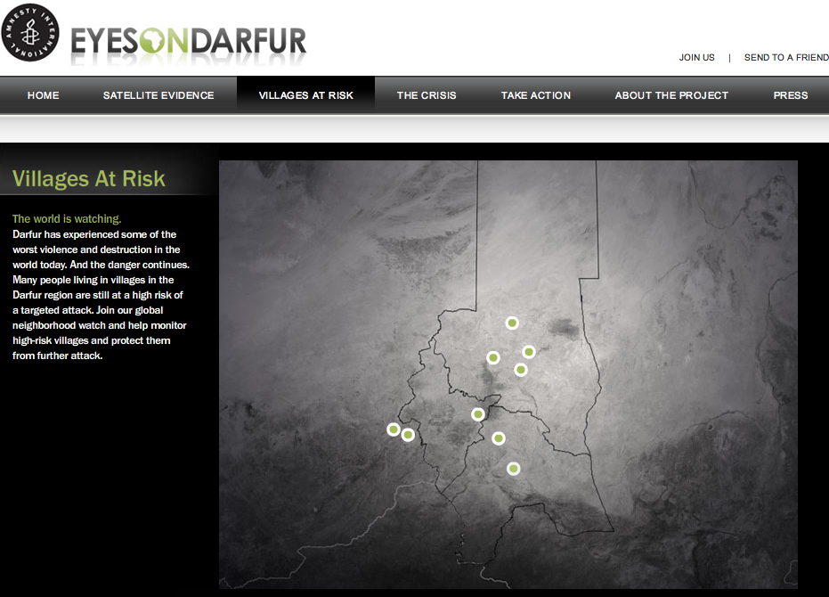
Matt draws on two case studies that utilize commercial satellite imagery to document the genocide in Darfur: the U.S. Holocaust Memorial Museum’s (USHMM) Crisis in Darfur project and  and Amnesty International  (AI) USA’s Eyes on Darfur initiative. (See also my previous post USHMM’s and AI’s initiative here and here).

Matt concludes that “GIS-based early warning systems may have the greatest value not for public advocacy movements but rather for policy practitioners charged with designing and implementing responses to emerging threats.  Such technology also has the potential to help endangered populations in conflict zones to organize timely and effective defensive action against threats of atrocities.”

John Prendergast, a senior African analyst at the International Crisis Group (ICG), predicted that the USHMM‘s project with Google Earth  would “bring a spotlight to a very dark corner of the earth, a torch that will indirectly help protect the victims.  It is David versus Goliath, and Google Earth just gave David a stone for his slingshot.”

I’m far from convinced. First of all, the USHMM‘s Google Earth layer is not updated so the information depicted is of no operational value.  Second, the Museum has only produced a Google Earth layer for every corner of the Earth. Third of all, drawing a correlation between virtual globes and the supposed “Global Panopticon” effect is difficult to prove.

In Discipline and Punish: The Birth of the Prison, Michel Foucault reflects on the role of surveillance as an instrument of power.  He cites the example of Jeremy Bentham’s “Panopticon,” an architectural model for a prison enabling a single guard, located in a central tower, to watch all of the inmates in their cells.  The “major effect of the Panopticon,” writes Foucault, is “to induce in the inmate a state of conscious and permanent visibility that assures the automatic functioning of power.”

According to Foucault, the Panopticon renders power both “visible and unverifiable”:

Visible: the inmate will constantly have before his eyes the tall outline of the central tower from which he is being spied upon.

Unverifiable: the inmate must never know whether he is being looked at at any one moment; but he must be sure that he may always be so.

Does high-resolution satellite imagery coupled with virtual globes lead to a reversal of Bentham’s Panopticon effect? That is, does this new medium enable the many to watch (and control) the few?

As Matt correctly notes vis-a-vis Jeremy Bentham’s Panopticon, “the use of surveillance was always coupled to the threat of punishment for deviant acts.” So while AI‘s advocacy efforts and those of the Museum‘s are important for keeping the issues in the public discourse, they are hardly acts of punishment.

Google Earth may very well have given David a stone for his slingshot; problem is, David doesn’t have a slingshot and his hands are most likely tied.

Patrick Philippe Meier

Job: Satellite Imagery & Conflict Specialist

The European Union’s Information Support for Effective and Rapid External Action (ISFEREA) is looking for a conflict specialist post-doc researcher. I haven’t posted job openings before but this one from my colleagues at the Joint Research Center (JRC) is especially relevant to iRevolution’s focus.

Background: ISFEREA develops techniques for automatic image processing of digital images acquired via satellite platforms as well as methodologies to explore the links between conflict risk and the exploitation (and degradation) of natural resources such as minerals. In particular, very high resolution (VHR) sensors with meter and sub-meter spatial resolution are being tested for multi-spectral and multi-temporal analysis.

Applications fields are related to human security, conflict resource monitoring, post-disaster damage assessment, and analysis of human settlements, including temporary settlements and refugee camps

The candidate will conduct research on conflict risk modelling and links between natural resources and conflicts. She/he would contribute to:

  1. Collecting, organizing and analyzing all available data sources on conflicts, political tensions/crises, and some types of natural resources;
  2. Developing modelling scenarios and applying them to study the relationships between natural resources and armed conflicts as well as political instability.

The position presumes the will and the interest of the candidate to publish the results of his/her work in peer reviewed publications.

Requirements: University degree in political or social sciences; PhD degree in similar discipline or 5 years of relevant work experience, especially in conflict studies; good knowledge of at least one of the following three regions: African Great Lakes, Horn of Africa and Central Asia; good oral and written communication skills in English; team player and collaborative, proactive in research, capacity to learn and adaptability to stress.

Duration: 36 months

Applications Due: before 11 Jan, 2009 – 23:59:59 CET

Please follow this link for further information.

Patrick Philippe Meier

Top 5 iRevolution Posts of 2008

Here are the five most popular posts of 2008 on iRevolution:

  1. The Past and Future of Crisis Mapping
  2. Crisis Mapping Kenya’s Election Violence
  3. SMS and Web 2.0 for Mumbai Early Warning
  4. Intellipedia for Humanitarian Warning/Response
  5. Tracking Genocide by Remote Sensing

Happy Holidays!

Patrick Philippe Meier

Satellite Imagery, Mobile Phones and Radios

Earth Observation System Launches in Africa: the SERVIR system integrates satellite resources into a web-based Earth information system, putting previously inaccessible information into action locally.

“A satellite birds-eye view can provide an overall picture of a natural disaster and its consequences,” said Dr. Tesfaye Korme, director of remote sensing and geographic information systems at RCMRD. “The new SERVIR-Africa platform comes just in time to provide us with the satellite data to develop maps of last week’s flooding in western Kenya and eastern Uganda, and estimate the number of displaced people.  We will provide this information to the authorities responsible for disaster response.”

For early warning in advance of events, SERVIR-Africa is developing tools to predict floods in high-risk areas and vector-borne diseases such as Rift Valley Fever. It will also provide visualization capability to map the location of climate change projections so people can see, for example, the potential impact climate change may have on the land resources where they live.  In addition, SERVIR-Africa’s information technology team will use the Internet to serve up satellite and ground-based earth observations, map data, and geospatial analyzes that target issues such as urbanization, biodiversity threats, and management of natural resources.  Mobile phones and radio, too, will be explored as a means to deliver useful information to people.
I’m particularly pleased to read that mobile phones and radios will be explored (and hopefully used) to deliver information at the community level.

e-CORCE to render Google Earth Obsolete?

I was watching TV Afrique during my stay in Jo’burg for MobileActive ’08 and caught an interesting piece of news that could have far-reaching implications for crisis mapping: a new project called “e-Continuous Observing System Relayed by Cellular processing Environment” or e-CORCE.

The driving question behind this bold initiative led by le Centre Francais d’Etudes Spatiales (CNES) is: “can we provide a massive and automated representation of the whole Earth with 1-m resolution and on a daily basis?”

The project would make use of 13 satellites and 50 relay stations for image processing. CNES hopes to have the e-CORCE operational by 2014.

Patrick Philippe Meier

Satellite Images Cast Doubt on Success of Iraq Surge

From the current issue of New Scientist:

US military officials may have taken credit where none is due for decreasing violence in Baghdad with their troop surge of February 2007, data from satellite imaging suggests. By comparing the amount of light produced at night in different areas of the capital before, during and after the 30,000 extra troops had been deployed, researchers from UCLA were able to track the movements of the warring Sunni and Shiite factions.

The amount of light was assumed to reflect the number of lights switched on in an area. Combining that with a map of neighborhood boundaries showed that the lights had dimmed much more in the Sunni dominated west and south-western regions of Baghdad. But this change began before the influx of extra troops. The light levels in four other major cities untouched by the surge remained constant or increased during the period.

The team at UCLA used four images taken on clear nights between 16 November 2003, well before the surge began, and 16 Dec 2007, after it had started, to draw their conclusions.

According to the project’s team leader, “it seems that it was sectarian cleansing that has led to the decrease in violence as the Sunnis were ‘cleared out.” It is particularly ironic that the satellite images used in the analysis came from a US Department of Defence weather satellite.

Patrick Philippe Meier

Using Satellites for Human Rights Monitoring

The journal Disasters just published an interesting piece entitled “Images of War: Using satellite images for human rights monitoring in Turkish Kurdistan.” The authors conclude that satellite images are “useful to validate witness reports of forest fires [and while] the use of this technology for human rights groups will depend on some feasibility factors such as prices, access and expertise, the images proved to be key for analysis of spatial aspects of conflict and valuable for reconstructing a more trustworthy picture.”

Other points from the publication worth noting:

Our study has proven that even with limited resources it is possible to combine remote sensing with local witness reports, when they include information about time and place. Depending on the kind of human rights violations being monitored, costs may vary significantly. As we focussed here on burned forests we could use the cheaper Landsat images. Our method of a remotely-sensed analysis (in our case by means of satellite images) is based on the availability of information about the area under study. Even without high resolution satellite images we were able to show the structural nature of village destruction.

See my other related blog entries on “Tracking Genocide by Remote Sensing” here and on “Human Rights 2.0” here.

Patrick Philippe Meier

Tracking Genocide by Remote Sensing

The Remote Sensing Project at Yale University’s Genocide Studies Program has just released a 50-page Working Paper entitled “Tracking the Genocide in Darfur: Population Displacement as Recorded by Remote Sensing.” The Project also has studies on Timor-Leste and Rwanda. The Darfur report uses satellite imagery of vegetation from 1998 through 2007 in the regions of Darfur most impacted by the genocide. The analysis shows that natural vegetation coverage is steadily recovering albeit not as a result of increased rainfall but of,

the abrupt change in land use directly related to the systematic violence committed by Sudanese government and militia forces against the peoples of Darfur. In an agriculture-based society, this vegetation rebound resulted from the loss of livestock and the inability to farm, caused by human displacement and the destruction of subsistence resources from 2003 to 2007.

The Working Paper demonstrates that a direct correlation exists between the displacement of local populations and the looting of livestock, as depicted in the rebound of vegetation coverage and vigor. To be sure, the returning vegetation is not a result of intensified agrarian activities but of depopulation.

The research also shows that,

it is possible to study the influences of climate and land use on a fragile environment using remote sensing applications. For future research into the prevention of genocide, these types of applications can be useful in understanding and quantifying the factors contributing to environmental strains that can cause violence associated with competition for diminishing resources. If preventive measures can be implemented and enforced based on an understanding of these factors, it might be possible to avoid acts of genocide.

This was in fact the underlying motivation behind my work on the Horn of Africa’s Conflict Early Warning and Response Network (CEWARN), which monitors cross-border pastoral conflict. Recognizing that tracking political, economic and social factors was insufficient for conflict early warning, I turned to the regional organization’s Climate Prediction and Applications Center (ICPAC) for GIS data on vegetation, forage and rainfall; the assumption being that environmental factors influence pastoral conflict and therefore could potentially serve as early warning indicators.

Preliminary statistical analyses of the data suggest that aggravating behavior, along with a reduction in peace initiatives and reciprocal exchanges, is associated with an escalation in pastoral conflict, particularly when coupled with an increase in vegetation that may provide cover for organized raids. We therefore recommend that conflict early warning systems integrate both response options and salient environmental indicators into their analyses to better deal with the complexity of the relationships between pastoral conflict and the environment in an era of climate change.

The results of my study were recently published in the Journal of Political Geography:

P. Meier et al. (2007). “Environmental Influences on Pastoral Conflict in the Horn of Africa,” Journal of Political Geography, 26:716-735.

One lesson to be drawn from the Yale study in terms of crisis mapping and prevention of mass atrocities is that we should redouble our efforts to pursue a more systematic and rigorous research agenda that focuses explicitly on multi-modal pattern analysis of proxy indicators.

Patrick Philippe Meier

Eyes on Darfur: 2 Villages Missing from Site

An update on Amnesty International’s (AI) “Eyes on Darfur” project based on my previous blog.

At least two of the protected villages monitored by AI using very-high resolution imagery provided by AAAS have been removed from the site after reported attacks in the area, with updated imagery still being processed. The attacks in question were summarized by this UNHCR Report.

This raises some important questions as noted by a colleague in a recent discussion: the bigger issue here is vital, all this geo-mapping is virtual, and while it may impact the real world that’s not a foregone conclusion; Would other NGOs, or perhaps a consortium, do better at the protective concept? And how? Namely, who can protect these villages and others like them?

I will write another blog this week on precisely these questions, i.e., civilian protection.

Patrick Philippe Meier

Human Rights 2.0: Eyes on Darfur

Amnesty International (AI) is taking human rights monitoring to a whole new level, metaphorically and literally speaking. The organization’s “Eyes on Darfur” project leverages the power of high-resolution satellite imagery to provide unimpeachable evidence of the atrocities being committed in Darfur – enabling action by private citizens, policy makers and international courts. Eyes On Darfur also breaks new ground in protecting human rights by allowing people around the world to literally “watch over” and protect twelve intact, but highly vulnerable, villages using commercially available satellite imagery.

I met with AI today to learn more. The human rights organization sends government officials these images on a regular basis to remind them that the world is watching. The impact? The villages monitored by AI have not been attacked while neighboring ones have. According to AI, there have also been notable changes in decisions made by the Bashir government since “Eyes on Darfur” went live a year ago. Equally interesting is that AI has been able to track the movement of the Janjaweed thanks to commercially available satellite imagery. In addition, the government of Chad cited the AI project as one of the reasons they accepted UN peacekeepers.

The American Association for the Advancement of Science (AAAS) is also leading a Human Rights and Geospatial Technologies project. So I also sat with them to learn more (September 2007). NGOs in Burma provided AAAS with information concerning attacks on civilians carried out by government forces in late 2006 and early 2007. AAAS staff reviewed these reports and compared them with high-resolution satellite images to identify destruction of housing and infrastructure and construction of new military occupation camps. The result is available in these Google Earth Layers. AAAS has provided comparable layers for Sudan, Chad, Lebanon and Zimbabwe. And this is just the tip of the iceberg.

AI is venturing on a 3-year project to provide satellite imagery to monitor forced displacement for early detection and advocacy. AAAS is developing a user-friendly web-based interface to let the NGO community know in real time where commercial satellites are positioned and what geographical areas they are taking pictures of. The interface includes direct links to the private companies operating these satellites along with contact and pricing information. AAAS believes this tool will enable the NGO community to make far more effective use of satellite imagery and to serve as a deterrent against repressive regimes choosing to commit mass atrocities.

The European Commission’s Joint Research Center (JRC) out of Ispra, Italy is also engaged in phenomenal work using satellite imagery. I first met with the JRC in 2004 and more recently in October 2007. The Center has developed automated models for change detection that are far more reliable than previously thought possible. Using pattern detection algorithms, the JRC can detect whether infrastructure has been destroyed, damaged, built or remained unchanged. They are now applying these models to monitor changes in refugee camps worldwide. The advantage of the JRC’s models is that they don’t necessarily require high resolution satellite imagery.

The same team at the JRC has also developed models to approximate population density in urban areas such as the Kibera slums out of Nairobi. Using satellite pictures taken at different angles, the team is able to construct 3D models of infrastructure such as individual buildings and houses. Thanks to these models they are able to approximate the size of these structures and thus estimate the number of inhabitants.

While AI and AAAS have been collaborating on some of these projects, the JRC has not been connected to this work. I therefore organized a working lunch during the OCHA +5 Symposium in Geneva last Fall to connect AAAS, the JRC, the Feinstein Center and the USHMM. My intention is to catalyze greater collaboration between these organizations and projects so we can upgrade to Human Rights 2.0.

Patrick Philippe Meier