
I enjoy thinking about the different analogies one can use to describe crisis mapping. I’ve likened crisis mapping to the Nascza Lines here and to cymatics here, for example. In a recent interview with Reuters/Alertnet (published here), I used the following analogy:
“Crisis mapping is to the humanitarian space what x-rays are to emergency rooms.”
I wanted to find an analogy that would steer clear of technical jargon and capture the public’s imagination. I thought through several analogies before the interview. For example, I debated using Magnetic Resonance Imaging (MRI) as analogy instead of x-rays since, well, it’s a more accurate comparison.
Why?
Have a look at the first minute of this rather amusing video, which first shows some x-ray pictures and then MRI scans.
MRI scans provide “quantitative, real-time, thermal images of the treated area” (1). All x-rays do is display static, albeit still useful, information. It’s a bit like comparing today’s high-speed digital video cameras with the cameras of bygone days that produced black and white photographs.
I thought about these analogies again this evening while walking home from MIT’s conference on data visualization. That’s when something very obvious dawned on me. The biggest problem with crisis maps is the word “maps”. The majority of the world’s population including myself associate maps with printed maps—no thanks to pirates.
The term “animated map” almost seems like an oxymoron, much like the word “airbus” must have come across when the company was founded 40 years ago. For you fellow Harry Potter fans, perhaps the best way to describe what I’m trying to convey is by referring to The Daily Prophet, the magical newspaper whose articles include moving pictures. Or perhaps the magical Marauder’s map which tracks the movement of students and teachers at Hogwarts in real-time.

Source: newlaunches.com
Fictional protagonists aside, Albert Einstein was spot on when he wrote:
“Imagination is more important than knowledge. For knowledge is limited to all we now know and understand, while imagination embraces the entire world, and all there ever will be to know and understand.”
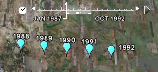
We know a lot about maps but if we were to play the word association game we’d likely come up with static descriptions rather than words associated with moving pictures. The time slider feature on Google Earth is perhaps starting to shift people’s conception of maps. Hans Rosling‘s work with Gapminder is also stirring our imagination since he talks about time series data much like a sports commentator describes a horse race (see his really neat TED talk here).
source: google earth
But we’re even more trapped by our archaic conception of maps than we realize. Playing the word association game with the word “map” may conjure Google Earth’s time slider for a few neogeographers, but I doubt that anyone would blurt out “3D!” for example. And yet, that’s what some of us crisis mappers are increasingly thinking about.
Google invited me to participate in a full-day workshop at their DC office last week and sure enough they told us to expect that all structures (e.g., buildings, mountains) on Google Earth would be rendered in 3D within about 2 years. The team is looking to integrate Mapmaker, My Maps, and Sketch-Up with Google Earth. And we already know they have a great flight simulator.

Source: gizmodo
Now compare the above screenshot of Google Earth with a screenshot of Simcity 4 below. And then, of course, there’s also Second Life, and more recently live video integrated into Google Earth.

In the meantime, the most accurate 3D map of any city on Earth has just been created using very high resolution lasers—some 7 million individual points of light to be exact. You could call this the best MRI of a terrestrial city yet!
I’ve already blogged about crisis maps evolving into 3D virtual worlds with live data feeds and agent-based models for scenario development, simulation and forecasting:
- 3D Crisis Mapping for Disaster Simulation Training (link)
- GeoTime: Visual Crisis Mapping in 3D (link)
All these systems are part of the evolving info webs I recently blogged about. But the italicized attributes above hardly come to mind when we hear the word map. And I think this is biggest problem with the term “crisis maps.” Perhaps we should come up with an entirely new term. But coming back to my interview with Reuters/Alertnet, a new more accurate term would simply add more technical jargon and definitely lose the public’s imagination (and mine with it).
So I’ve got an alternative “solution” … maybe. We keep the word map, or rather M.A.P.S. Yes, that’s right “Crisis MAPS.” All we need now is to be as creative as InSTEDD and find a way to fit this acronym with something sensible.
So how’s this?
Crisis MAPS = Crisis Movies and Platform Simulations

The issue of appropriate terms to describe making visual complex processes—-has been a challenge for years. When I discuss the need for accurate means to visually represent the complexity of human “reality” I use the term, “multi-dimensional visualizations”. This allows for the time and space dimensions to be included under that label and allows for dynamic and complex interplay of variables to be understood.
The issue now is to use the visual technologies that are now available in a way that allows for the “multi-dimensional” aspects to be accurately portrayed.
In any case, your “x-ray” ideas was cool—ultimately the goal of “mapping” or as I say, “multi-dimensional visual representations” is to make visible, the “invisible”…..
best, Jerri
“Multi-dimensional” means that time and space–which are constantly “moving” automatically
Thanks for your thoughts on the issue, Patrick. I think MRIs, as opposed to x-rays, better reflect the layering aspect of maps, as you indicate here. However, I suggest moving away from the medical/diagnostic link because it implies a degree of clarity in decision-making that does not (yet) exist. For instance, an MRI might show a mass and an x-ray might show a fractured bone — diagnosis in many cases is straightforward. Mapping can help to “diagnose” problems, but “treatment plans” are less clear because the mapping diagnosis may be incomplete.
Maybe visualization, more generally, is a term that captures what you are trying to represent with “Crisis Movies and Platform Simulations”? Visualization and analysis?
Thanks for your feedback, Eric! Indeed, all analogies have their limits : )
Yes, we are talking about crisis visualizations and representations, not just old school maps.
🙂
Pingback: Crisis Mapping Conference 2009 « Eric P. Green
Patrick,
I very much enjoyed your enlightening presentation at the recent AfP conference.
To the topic. I wouldn’t sweat the terminology too much as the idea of mapping something that is in constant motion is as old as maps themselves. Luckily for the job prospects of cartographers.
Some years ago I read about members of the Long Range Desert Patrol Group (became the SAS) mapping sand dunes during WW2. I don’t know enough about it to comment on the efficacy of imagining shifting sands but I have no problem getting my head around the possibilities. Such is your project.
Keep up the good work.
Steve
Thanks for your note Steve. I realize that in our field, peacebuilding, conflict prevention, crisis mapping, we don’t get phased with the idea of dynamic space-time maps. But my post is more geared towards people outside our community, who have never heard of crisis mapping. Does that make sense?
Would love to learn more about SAS mapping of sand dunes in WW2! Sounds fascinating! Let me know if you do find a reference.
Thanks again for your n note.
Patrick,
I do think that the words “crisis mapping” are sufficient to the task for those who can add a small sprinkling of imagination (ok, I’m an optimist!!) and for those who can’t, a brief presentation such as the one I attended is enough to get the juices flowing.
The WW2 story s one I read in a Daily Telegraph obituary of the man who was mainly responsible. I’ll see if I can hunt something down.
Apart from the concept, what has always stuck in my mind about the obit was that after describing his hair-raisng adventures in the desert, the writer then went on to explain that after the war he became president of the Tea Council……. But of course.
MAPS=Mediated Action Placement Strategies
Patrick,
In reading your article I know exactly where you’re coming from. While I was reading I kept feeling that the term map is broad enough to still capture the breadth of CrisisMappers activities. I looked up map on dictionary.com http://dictionary.reference.com/browse/map. Look at the idioms – to “put on the map” means “to bring into the public eye, to make known…” In my mind as a new CrisisMapper that’s what it’s about.
I also work in the GIS community and was an Army Imagery Analyst and I’ve had this challenge for 17 years of explaining what we do to non-technical folks. Ultimately, I find I only get my point across when showing people what’s possible. Maps exist because it’s insufficient to verbalize the landscape (whether it’s terrain, the universe, DNA, the brain, etc.) to reach the understanding we need. It’s follows then that you have to also show what’s possible in mapping with different dimensions (like you’ve done in your previous post: Beyond the Dot). I worked with temporal GIS and putting a practical, functioning tool in people’s hands was really the only way to get that understanding.
What’s really interesting to me is what people can do with the data once they get their hands on it – either through an API call or a download. I’m a big fan of being able to get the live feed and see what’s possible with the data.
Scott
Thanks for sharing, Scott!