
Update: Crisis Map now includes features to post photos in addition to videos!
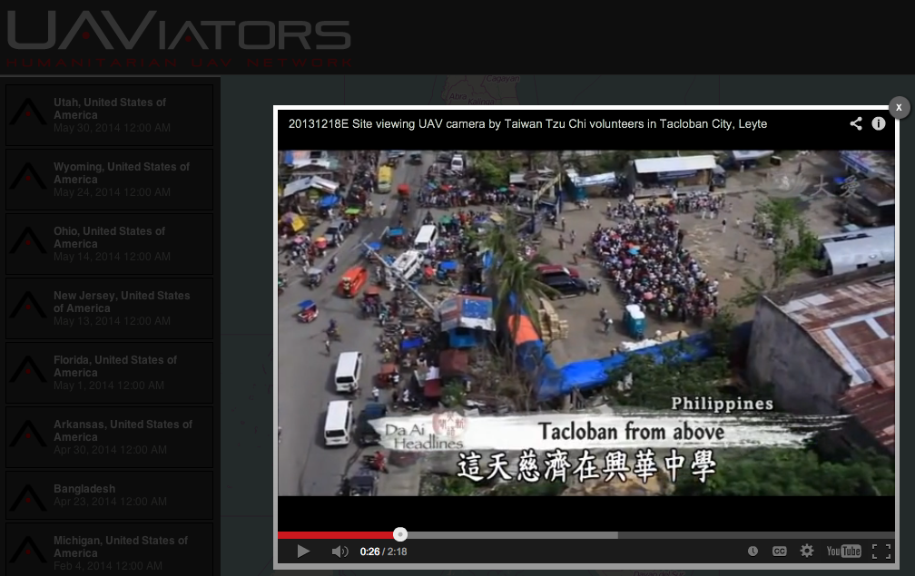
The latest version of the Humanitarian UAV Network’s Crisis Map of UAV/aerial photos & videos is now live on the Network’s website. The crowdsourced map already features dozens of aerial videos of recent disasters. Now, users can also post aerial photographs areas. Like the use of social media for emergency management, this new medium—user-generated (aerial) content—can be used by humanitarian organizations to complement their damage assessments and thus improve situational awareness.
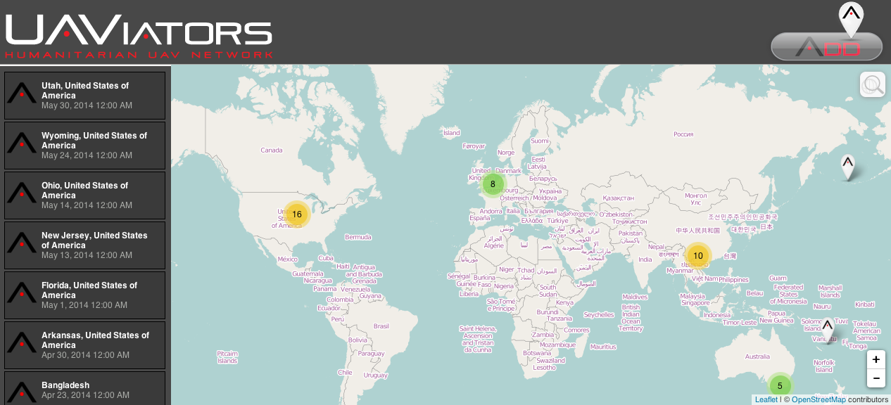
The purpose of this Humanitarian UAV Network (UAViators) map is not only to provide humanitarian organizations and disaster-affected communities with an online repository of aerial information on disaster damage to augment their situational awareness; this crisis map also serves to raise awareness on how to safely & responsibly use small UAVs for rapid damage assessments. This explains why users who upload new content to the map must confirm that they have read the UAViator‘s Code of Conduct. They also have to confirm that the photos & videos conform to the Network’s mission and that they do not violate privacy or copyrights. In sum, the map seeks to crowdsource both aerial footage and critical thinking for the responsible use of UAVs in humanitarian settings.
As noted above, this is the first version of the map, which means several other features are currently in the works. These new features will be rolled out incrementally over the next weeks and months. In the meantime, feel free to suggest any features you’d like to see in the comments section below. Thank you.

- Humanitarian UAV Network: Strategy for 2014-2015 [link]
- Humanitarians in the Sky: Using UAVs for Disaster Response [link]
- Humanitarian UAV Missions During Balkan Floods [link]
- Using UAVs for Disaster Risk Reduction in Haiti [link]
- Using MicroMappers to Make Sense of UAV/Aerial Imagery During Disasters [link]

Pingback: Common Misconceptions About Humanitarian UAVs | iRevolution
Pingback: Results: Evaluation of Humanitarian UAVs | iRevolution
Pingback: Live: “TripAdvisor” for UAV/Drone Travel | iRevolution
Pingback: Humanitarian UAVs Fly in China After Earthquake | iRevolution
Pingback: Official UN Policy Brief on Humanitarian UAVs | iRevolution
Pingback: WHO Using UAVs to Transport Medical Supplies | iRevolution
Pingback: Google Already Developing UAV’s for Disaster Response | iRevolution
Pingback: UAV/Aerial Video of Gaza Destruction | iRevolution
Pingback: Reflections on the Use of UAVs in Humanitarian Interventions | iRevolution
Pingback: Disaster Tweets Coupled With UAV Imagery Give Responders Valuable Data on Infrastructure Damage | iRevolution