Tag Archives: Clicker

Piloting MicroMappers: Crowdsourcing the Analysis of UAV Imagery for Disaster Response

New update here!

UAVs are increasingly used in humanitarian response. We have thus added a new Clicker to our MicroMappers collection. The purpose of the “Aerial Clicker” is to crowdsource the tagging of aerial imagery captured by UAVs in humanitarian settings. Trying out new technologies during major disasters can pose several challenges, however. So we’re teaming up with Drone Adventures, Kuzikus Wildlife Reserve, Polytechnic of Namibia, and l’École Polytechnique Fédérale de Lausanne (EPFL) to try out our new Clicker using high-resolution aerial photographs of wild animals in Namibia.

Kuzikus1
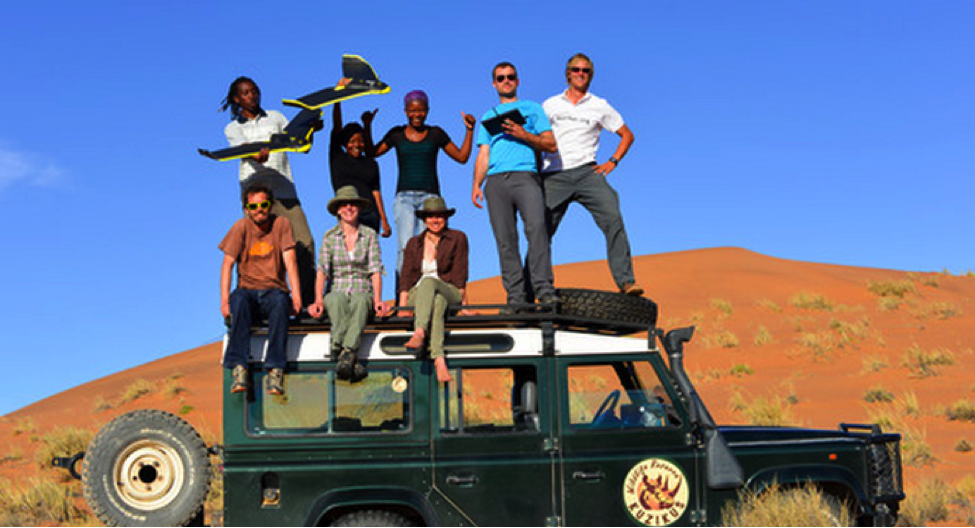
As part of their wildlife protection efforts, rangers at Kuzikus want to know how many animals (and what kinds) are roaming about their wildlife reserve. So Kuzikus partnered with Drone Adventures and EPFL’s Cooperation and Development Center (CODEV) and the Laboratory of Geographic Information Systems (LASIG) to launch the SAVMAP project, which stands for “Near real-time ultrahigh-resolution imaging from unmanned aerial vehicles for sustainable land management and biodiversity conservation in semi-arid savanna under regional and global change.” SAVMAP was co-funded by CODEV through LASIG. You can learn more about their UAV flights here.

Our partners are interested in experimenting with crowdsourcing to make sense of this aerial imagery and raise awareness about wildlife in Namibia. As colleagues at Kuzikus recently told us, “Rhino poaching continues to be a growing problem that threatens to extinguish some rhino species within a decade or two. Rhino monitoring is thus important for their protection. One problematic is to detect rhinos in large areas and/or dense bush areas. Using digital maps in combination with MicroMappers to trace aerial images of rhinos could greatly improve rhino monitoring efforts.” 

So our pilot project serves two goals: 1) Trying out the new Aerial Clicker for future humanitarian deployments; 2) Assessing whether crowdsourcing can be used to correctly identify wild animals.

MM Aerial Clicker

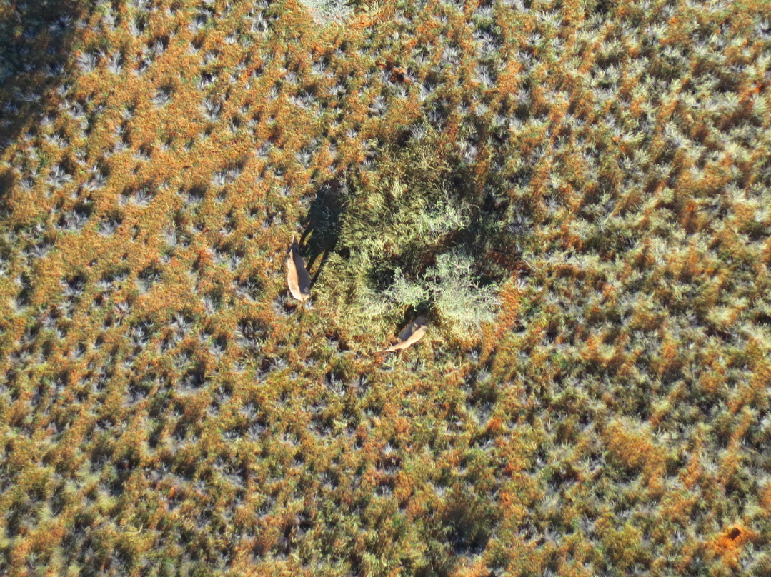
Can you spot the zebras in the aerial imagery above? If so, you’re already a digital ranger! No worries, you won’t need to know that those are actually zebras, you’ll simply outline any animals you find (using your mouse) and click on “Add my drawings.” Yes, it’s that easy : )

We’ll be running our Wildlife Challenge from September 26th-28th. To sign up for this digital expedition to Namibia, simply join the MicroMappers list-serve here. We’ll be sure to share the results of the Challenge with all volunteers who participate and with our partners in Namibia. We’ll also be creating a wildlife map based on the results so our friends know where the animals have been spotted (by you!).

MM_Rhino

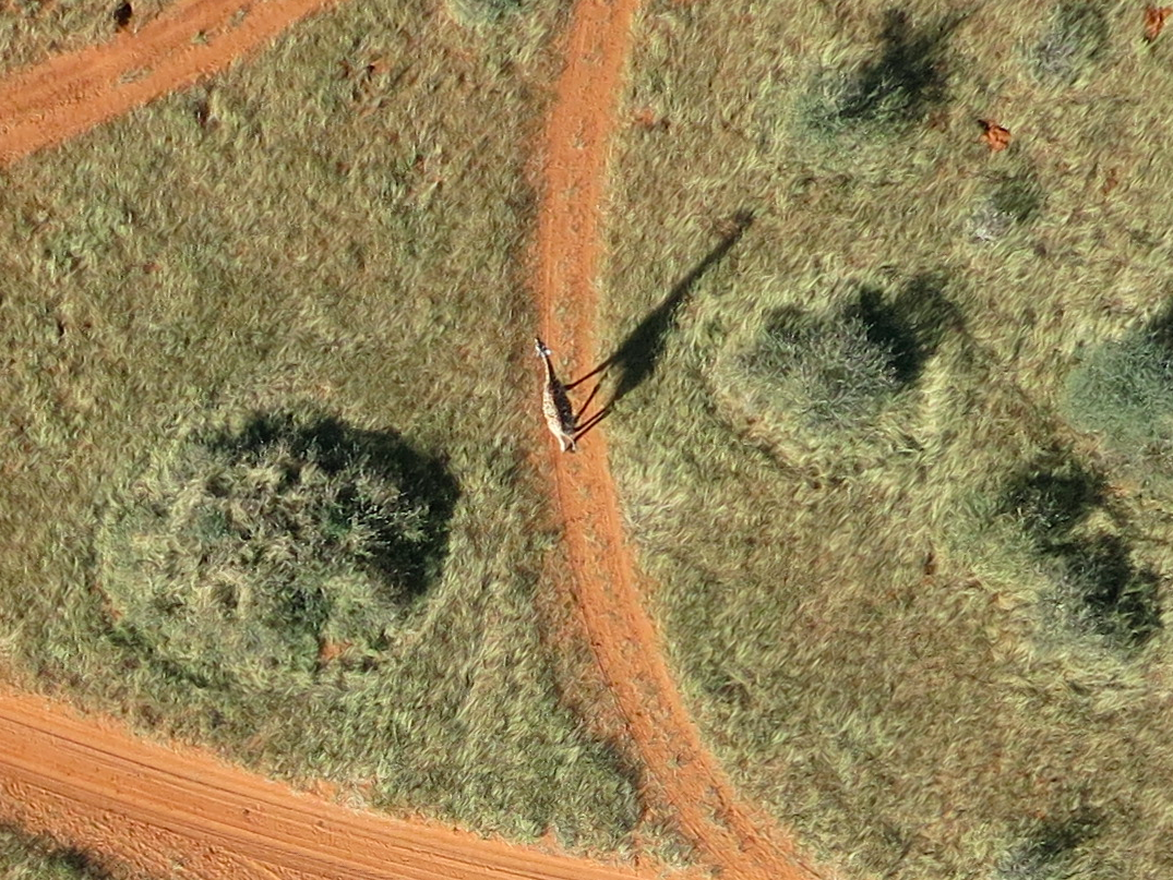
Given that rhino poaching continues to be a growing problem in Namibia (and elsewhere), we will obviously not include the location of rhinos in our wildlife map. You’ll still be able to look for and trace rhinos (like those above) as well as other animals like ostriches, oryxes & giraffes, for example. Hint: shadows often reveal the presence of wild animals!

MM_Giraffe

Drone Adventures hopes to carry out a second mission in Namibia early next year. So if we’re successful in finding all the animals this time around, then we’ll have the opportunity to support the Kuzikus Reserve again in their future protection efforts. Either way, we’ll be better prepared for the next humanitarian disaster thanks to this pilot. MicroMappers is developed by QCRI and is a joint project with the United Nations Office for the Coordination of Humanitarian Affairs (OCHA).

Any questions or suggestions? Feel free to email me at patrick@iRevolution.net or add them in the comments section below. Thank you!

MicroMappers: Microtasking for Disaster Response

My team and I at QCRI are about to launch MicroMappers: the first ever set of microtasking apps specifically customized for digital humanitarian response. If you’re new to microtasking in the context of disaster response, then I recommend reading this, this and this. The purpose of our web-based microtasking apps (we call them Clickers) is to quickly make sense of all the user-generated, multi-media content posted on social media during disasters. How? By using microtasking and making it as easy as a single click of the mouse to become a digital humanitarian volunteer. This is how volunteers with Zooniverse were able to click-and-thus-tag well over 2,000,000 images in under 48-hours.

We have already developed and customized four Clickers using the free and open source microtasking platform CrowdCrafting: TweetClicker, TweetGeoClicker, ImageClicker and ImageGeoClicker. Each Clicker includes a mini-tutorial to guide volunteers. While we’re planning to launch them live next month, these Clickers (described below) can be used right now if need be. When a disaster strikes, we can automatically upload tweets to the TweetClicker, for example. These tweets are pre-filtered for keywords and hashtags relevant to the disaster in question. We can also automatically identify multimedia content posted to Twitter and upload this to the ImageClicker to tag pictures that show damage, for example.

TweetClicker

TweetClicker:  This Clicker invites volunteers to tag tweets based on categories specified by an organization like the UN, Red Cross or FEMA. These categories could include those from the UN Cluster System or other information needs.

TweetClicker_screenshot2

ImageClicker

ImageClicker: The purpose of this Clicker is to tag pictures posted on social media (and elsewhere) based on categories specified by a humanitarian organization. Images are auto-matically scraped from Twitter and uploaded to this Clicker.

ImageClicker_screenshot4

TweetGeoClickerTweetGeoClicker: This Clicker invites volunteers to geo-tag tweets (that are not already automatically geo-tagged). The Clicker’s mini-tutorial provides a list of tips on how to find the GPS locations of places mentioned in a given tweet.

TweetGeoClicker_screenshot

ImageGeoClickerImageGeoClicker: The purpose of this Clicker is to geo-tag images posted on social media (that are not geo-tagged auto-matically). Like the Clicker above, a mini-tutorial provides a list of tips on how to find out where a given image was taken.

ImageGeoClicker_screenshot2

We are working on developing several more Clickers such as a VideoClicker and welcome suggestions for other Clickers. We are also developing “Connectors” for the Clickers we’ve developed. That is, once a tweet has been tagged using the TweetClicker, it can be automatically pushed to the TweetGeoClicker for geo-tagging purposes. Note that all our Clickers include built-in quality control mechanisms. For example, only if 3 volunteers tag an image as showing disaster damage does that image get tagged as such. This voting system ensures a high level of data quality.

Finally, we’re developing a Crisis Mapping feature to display geo-tagged tweets and images that are processed using our Clickers. For example, as soon as an image is geo-tagged by 3 volunteers using the ImageGeoClicker, it automatically appears on the live Crisis Map in real-time. Other data visualization features are also possible, such as an interface that provides trends and statistical analysis of the microtasked data. This too is on our to-do list. We’re also looking into making these Clickers useable on smartphones and tablets.

While MicroMappers is a joint collaboration with the United Nations Office for the Coordination of Humanitarian Affairs (OCHA), the Clickers are open for use by other humanitarian organizations such as FEMA and the Red Cross. Simply get in touch with me if you’d like to use these Clickers. In the meantime, many thanks to the Standby Volunteer Task Force (SBTF), a founding member of the Digital Humanitarian Network (DHN), for their invaluable feedback on earlier versions of the Clickers.

Want to be a MicroMapper? Simply join us here! We’ll provide you with updates and let you know when humanitarian organizations need your support to make sense of social media reports following a disaster.

bio

See also: 

  • Results of MicroMappers Response to Pakistan Earthquake (Link)
  • MicroMappers featured on UK Guardian and Wired