Tag Archives: Riots

Global Heat Map of Protests in 2013

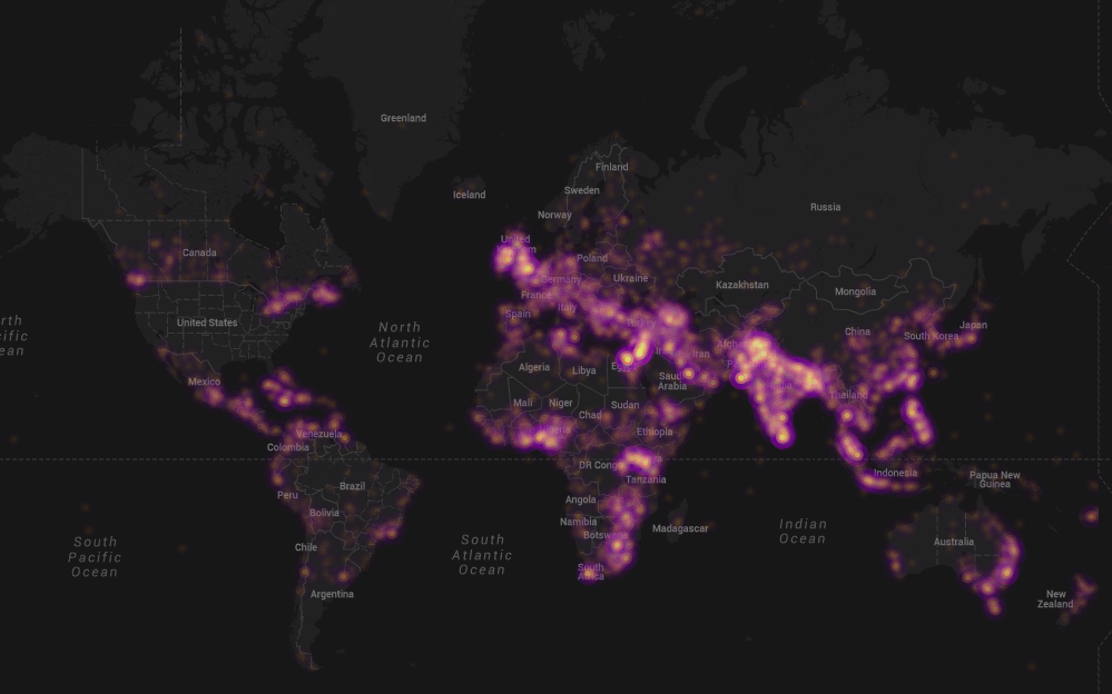
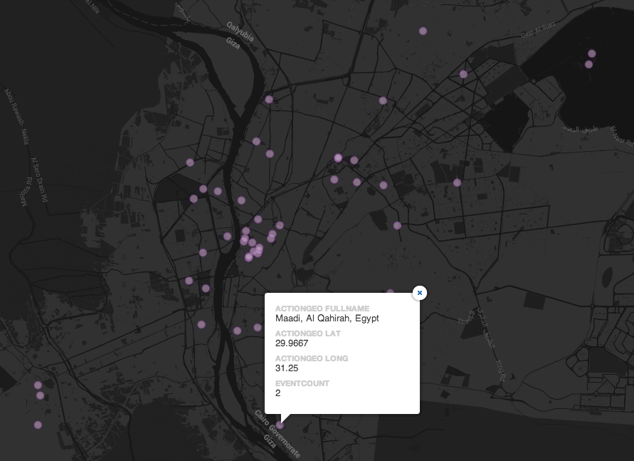
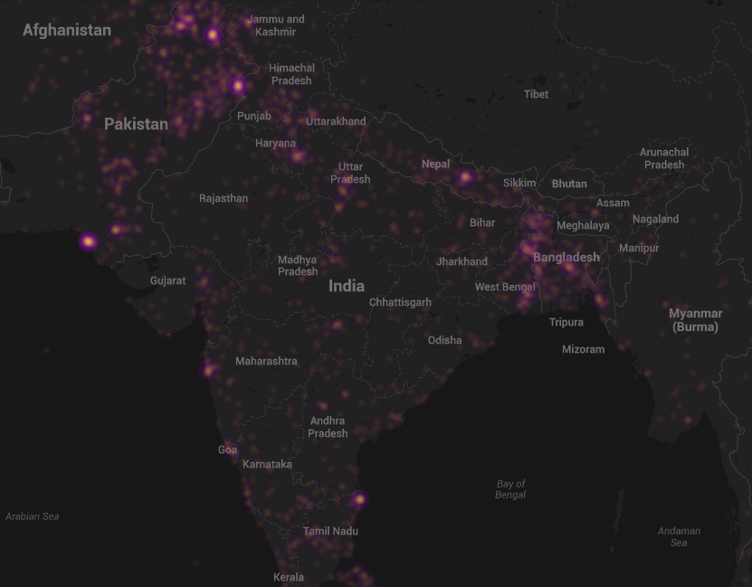
My colleague Kalev Leetaru recently launched GDELT (Global Data on Events, Location and Tone), which includes over 250 million events ranging from riots and protests to diplomatic exchanges and peace appeals. The data is based on dozens of news sources such as AFP, AP, BBC, UPI, Washington Post, New York Times and all national & international news from Google News. Given the recent wave of protests in Cairo and Istanbul, a collaborator of Kalev’s, John Beieler, just produced this digital dynamic map of protests events thus far in 2013. John left out the US because “it was a shining beacon of protest activity that distracted from the other parts of the map.” Click on the maps below to enlarge & zoom in.

World

Heat Map Protests

Egypt

Egypt Protests

India

GDELT India

As Kalev notes, “Right now its just a [temporally] static map, it was done as a pilot just to see what it would look like in the first place, but the ultimate goal would be to do realtime updates, we just need to find someone with the interest and time to do this.” Any readers want to take up the challenge? Having a live map of protests (including US data) with “slow motion replay” functionality could be quite insightful given current upheavals. In the meantime, other stunning visualizations of the GDELT data are available here.

And to think that the quantitative analysis section of my doctoral dissertation was an econometric analysis of protest data coded at the country-year level based on just one news source, Reuters. I wonder if/how my findings would change with GDELT’s data. Anyone looking for a dissertation topic?

bio

Crisis Mapping Analysis of London Riots 2011

My colleague Adam White from GroupShot just shared an interesting location analysis study of the recent London riots. The study was carried out by the group Space Syntax and is available here (PDF). The purpose of the study was to test whether the overly complex spatial layout of large post-war housing estates has “an effect on social patterns, often leading to social malaise and anti-social behavior.” While the study’s methods are interesting, I’m concerned about some of the underlying socio-economic assumptions that buttress the analysis.

According to the study, 84% of verified incidents in north London and 96% in south London took place within a five minute walk—400 meters—of both: 1) An established town centre, and 2) a large post-war housing estate. Meanwhile, local centres without large post-war estates nearby were unaffected.

The study makes some interesting assumptions, e.g., “most post-war housing estates have been designed in such a way that they create over-complex, and as a result, under-used spaces. These spaces are populated by large groups of unsupervised children and teenagers, where peer socialisation can occur between them without the influence of adults. This pattern of activity, and the segregation of user groups, is not found in non-estate street networks. Our analysis of court records shows that the majority of convicted rioters in the study areas live on large post-war housing estates.”

The reason I’m uncomfortable with the above has to do with the implied solution, i.e., simplify the complex spaces and bring more social traffic to under-utilized areas. This will ensure that children and teenagers are more supervised and prevent peer socialization from taking place without the influence of adults. In other words, simply replace the “hardware” so the “social software” won’t have any more bugs. Snap, if only Mubarak could have hacked Tahrir Square before the revolution. Sarcasm aside, there were some real and legitimate grievances that motivated some of the protestors in England (and Egypt), which this study doesn’t address.

The next version of the analysis is supposed to include socio-economic data to understand the relationship between deprivation and rioting, which in my mind should have come first. But better late than never. In the meantime, here is a post on the tactical use of technology for nonviolent protests with a reference to London: “Maps, Activism and Technology: Check-In’s with a Purpose.”