Tag Archives: Transportation

Testing Agile Cargo Drone Delivery to Improve Healthcare

Hard-to-reach communities need more than paved roads to access healthcare. They need both affordable and convenient transportation to and from local healthcare providers. If it costs too much to get to the clinic, then they’ll never get to the clinic. If it takes too much time to get to the clinic, then they’ll never get to the clinic. Why? Because their choices are limited. They may be too sick to spend hours traveling back and forth to a clinic. They may not have the option of taking time off work or cannot afford to forgo the income. Or they may have family responsibilities that limit how long they can be away from home.

Hard-to-reach communities need more than paved roads to access healthcare. They need affordable and convenient transportation to and from local healthcare providers.

Discussions around the last mile typically focus on the challenge of delivering medicines to local healthcare facilities rather than caring for the patient directly. So what would totally agile, peer-to-peer cargo drone delivery look like?

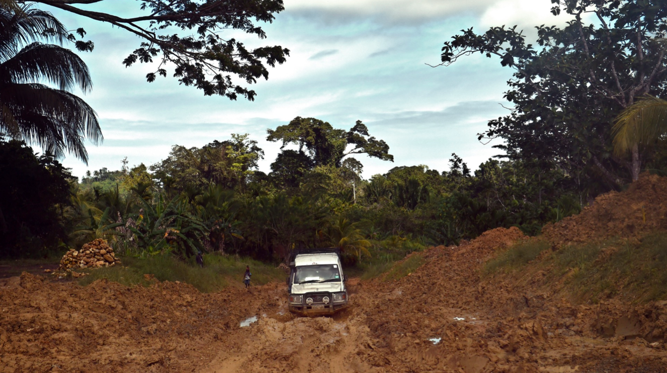
Cargo drones that deliver medical supplies always follow predetermined routes. They transport medicines from one fixed point to another—regional hospitals to remote clinics, for example. But what if Community Health Workers (CHWs) need additional medicines while visiting remote communities? They may not know exactly what they need ahead of time or they’re unable to carry a wide range of medicines with them across rough terrain. Worse, what if CHWs aren’t available and patients have difficulty getting to the clinic or to the pharmacy?

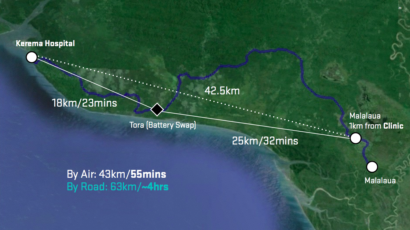
While discussions around the use of cargo drones for medical deliveries typically focus on “long range” deliveries (100km+), smaller cargo drones can also play an important role in literal last-mile deliveries, the last 1,600 meters.

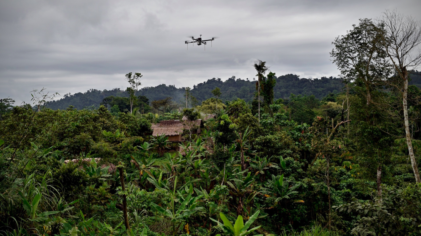
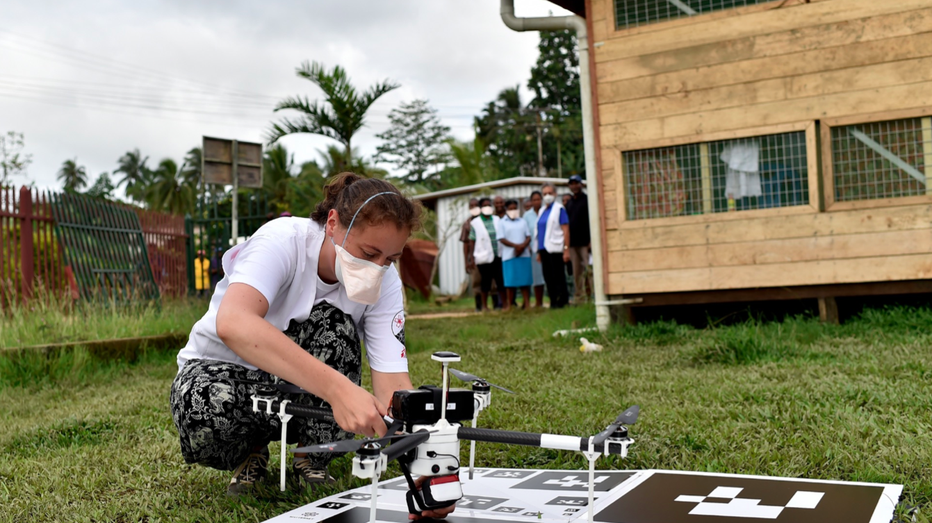
To explore this further, we invited our new technology partner, Dronistics, to join us and Dominican Republic Flying Labs in the remote mountains of Montasitos. Using large, long-range drones to make one-mile deliveries isn’t a good use of resources. These drones typically need more space to land and require pre-approved fixed-routes. In contrast, because Dronistics is more of a flying ball than a traditional drone, therefore can be safely operated and can deliver directly to individuals within a one-mile radius. This approach could help Flying Labs democratize cargo drone deliveries, enabling remote communities to both send and receive deliveries.

This exploration in the Dominican Republic was the first time that Dronistics field tested their solution outside of Switzerland. They learned a lot from the experience and were very good about carefully documenting all of our feedback. Equally important, they were a great team player; very respectful of local partners and communities, humble, thoughtful and keen to learn. These human qualities are more important to us than any startup’s drone technology. As such, we’re already exploring further collaboration between Dronistics and several other Flying Labs around the world.

In the meantime, we sincerely thank the Municipality of Montasitos along with local communities for their time and their kind welcome. We also thank the Centro de Innovacion De Drones, Parque Cibernatico, Dronistics and Pfizer for their generous partnership and support on this project. We would also like to thank NCCR Robotics that supports Dronistics through an NCCR Robotics Spin Fund Grant.


To learn more about the use of cargo drones in public health, please see our dedicated online course on the topic. And explore previous cargo drone projects run by WeRobotics and Flying Labs. Note that the Dronistics flights in the DR were for demo and exploratory purposes only, no official deliveries were made.

What to Know When Using Humanitarian UAVs for Transportation

UAVs can support humanitarian action in a variety of ways. Perhaps the most common and well-documented use-case is data collection. There are several other use-cases, however, such as payload transportation, which I have blogged about herehere and here. I had the opportunity to learn more about the logistics and operations of payload UAVs while advising a well-known public health NGO in Liberia as well as an international organization in Tanzania. This advising led to conversations with some of the leading experts in the UAV-for-transportation space like Google Project WingMatternet and Vayu for example.

UAV payload unit

Below are just some of the questions you’ll want to ask when you’re considering the use of UAVs for the transportation of small payloads. Of course, the UAV may not be the most appropriate technology for the problem you’re looking to solve. So naturally, the very first step is to carry out a comparative cost-benefit analysis with multiple technologies. The map below, kindly shared by Matternet, is from a project they’re working on with Médecins Sans Frontières (MSF) in Papua New Guinea.

Credit: Matternet

Why does it take some 4 hours to drive 60km (40 miles) compared to 55 minutes by UAV? The pictures below (also shared by Matternet) speak for themselves.

Credit: Matternet

Credit: Matternet

Credit: Matternet

Any use of UAVs in humanitarian contexts should follow the Code of Conduct proposed by the Humanitarian UAV Network (UAViators), which was recently endorsed by the UN. Some of the (somewhat obvious) questions you’ll want to bear in mind as you carry out your cost-benefit analysis thus include:

  • What is maximum, minimum and the average distance that the UAV needs to fly?
  • How frequently do the UAVs need to make the deliveries?
  • How much mass needs to be moved per given amount of time?
  • What is the mass of individual packages (and can these be split into smaller parcels if need be)?
  • Do the packages contain a mechanism for cold transport or would the UAV need to provide refrigeration (assuming this is needed)?
  • What do the take-off and landing spaces look like? How much area, type of ground, size of trees or other obstacles nearby?
  • What does the typology between the take-off and landing sites look like? Tall trees, mountains, or other obstructions?
  • Regarding batteries, is there easy access to electricity in the areas where the UAVs will be landing?
  • Is there any form of cell phone coverage in the landing areas?
  • What is the overall fixed and variable cost of operating the payload UAVs compared to other solutions?
  • What impact (both positive and negative) will the introduction of the payload UAV have on the local economy?

While the payload weight is relatively small (1kg-2kg) for low-cost UAVs, keep in mind that UAV flights can continue around the clock. As one of my colleagues at the Syria Airlift Project recently noted, “If  one crew could launch a plane every 5 minutes, that would add up to almost 200kg in an eight-hour time period.”

IMG_1893

Naturally, Google and Matternet are not the only group out there developing UAVs for payload transportation. Amazon, DHL and others are prototyping the same technology. In addition, many of the teams I met at the recent Drones for Good Challenge in Dubai demo’ed payload solutions. One of the competition’s top 5 finalists was Drone Life from Spain. They flew their quadcopter (pictured above) fully autonomously. What’s special about this particular prototype is not just it’s range (40-50km with 2-3kg payload) but the fact that it also includes a fridge (for vaccines, organs, etc.,) that can be remotely monitored in real-time to ensure the temperature remains within required parameters.

At some point in your planning process, you’ll want to map the landing and take-off sites. The map below (click to enlarge) is the one we recently produced for the Tanzania UAV project (which is still being explored). Naturally, all these payload UAV flights would be pre-programmed and autonomous. If you’d like to learn more about how one programs such flights, check out my short video here.

Screen Shot 2015-02-11 at 2.06.45 PM

One other point worth keeping in mind is that UAVs need not be independent from existing transportation infrastructure. One team at the recent Drones for Good Challenge in Dubai suggested using public buses as take-off and landing points for UAVs. A university in the US is actually exploring this same use case, extending the reach of delivery trucks by using UAVs.

Of course, there are a host of issues that one needs to consider when operating any kind of UAV for humanitarian purposes. These include regulations, permits, risk assessments and mitigation strategies, fail safe mechanisms, community engagement, data privacy/security, etc. The above is simply meant to highlight some of the basic questions that need to be posed at the outset of the project. Needless to say, the very first question should always be whether the UAV is indeed the most appropriate tool (cost/benefit analysis) for the task at hand. In any case, the above is obviously not an exhaustive list. So I’d very much welcome feedback on what’s missing. Thank you!