
My Internews colleagues have just released this important report on the role of communications in the 2011 Japan Earthquake. Independent reports like this one are absolutely key to building the much-needed evidence base of humanitarian technology. Internews should thus be applauded for investing in this important study. The purpose of my blog post is to highlight findings that I found most interesting and to fill some of the gaps in the report’s coverage.

I’ll start with the gaps since there are far fewer of these. While the report does reference the Sinsai Crisis Map, it over looks a number of key points that were quickly identified in an email reply just 61 minutes after Internews posted the study on the CrisisMappers list-serve. These points were made by my Fletcher colleague Jeffrey Reynolds who spearheaded some of the digital response efforts from The Fletcher School in Boston:
“As one of the members who initiated crisis mapping effort in the aftermath of the Great East Japan Earthquake, I’d like to set the record straight on 4 points:
- The crisis mapping effort started at the Fletcher School with students from Tufts, Harvard, MIT, and BU within a couple hours of the earthquake. We took initial feeds from the SAVE JAPAN! website and put them into the existing OpenStreetMap (OSM) for Japan. This point is not to take credit, but to underscore that small efforts, distant from a catastrophe, can generate momentum – especially when the infrastructure in area/country in question is compromised.
- Anecdotally, crisis mappers in Boston who have since returned to Japan told me that at least 3 people were saved because of the map.
- Although crisis mapping efforts may not have been well known by victims of the quake and tsunami, the embassy community in Tokyo leveraged the crisis map to identify their citizens in the Tohuku region. As the proliferation of crisis map-like platforms continues, e.g., Waze, victims in future crises will probably gravitate to social media faster than they did in Japan. Social media, specifically crisis mapping, has revolutionized the role of victim in disasters–from consumer of services, to consumer of relief AND supplier of information.
- The crisis mapping community would be wise to work with Twitter and other suppliers of information to develop algorithms that minimise noise and duplication of information.
Thank you for telling this important story about the March 11 earthquake. May it lead to the reduction of suffering in current crises and those to come.” Someone else on CrisisMappers noted that “the first OSM mappers of satellite imagery from Japan were the mappers from Haiti who we trained after their own string of catastrophes.” I believe Jeffrey is spot on and would only add the following point: According to Hal, the crisis map received over one million unique views in the weeks and months that followed the Tsunami. The vast majority of these were apparently from inside Japan. So lets assume that 700,000 users accessed the crisis map but that only 1% of them found the map useful for their purposes. This means that 7,000 unique users found the map informative and of consequence. Unless a random sample of these 7,000 users were surveyed, then I find it rather myopic to claim so confidently that the map had no impact. Just because impact is difficult to measure doesn’t imply there was none to measure in the first place.
In any event, Internews’s reply to this feedback was exemplary and far more con-structive than the brouhaha that occurred over the Disaster 2.0 Report. So I applaud the team for how positive, pro-active and engaging they have been to our feedback. Thank you very much.
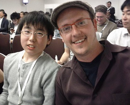
In any event, the gaps should not distract from what is an excellent and important report on the use of technology in response to the Japan Earthquake. As my colleague Hal Seki (who spearheaded the Sinsai Crisis Map) noted on Crisis-Mappers, “the report was accurate and covered important on-going issues in Japan.” So I want to thank him again, and his entire team (including Sora, pictured above, the youngest volunteer behind the the crisis mapping efforts) and Jeffrey & team at Fletcher for all their efforts during those difficult weeks and months following the devastating disaster.
Below are multiple short excerpts from the 56-page Internews report that I found most interesting. So if you don’t have time to read the entire report, then simply glance through the list below.
- Average tweets-per-minute in Japan before earthquake = 3,000
- Average tweets-per-minute in Japan after earthquake = 11,000
- DM’s per minute from Japan to world before earthquake = 200
- DM’s per minute from Japan to world after earthquake = 1,000
- Twitter’s global network facilitated search & rescue missions for survivors stranded by the tsunami. Within 3 days the Government of Japan had also set up its first disaster-related Twitter account.
- Safecast, a volunteer-led project to collect and share radiation measurements, was created within a week of the disaster and generated over 3.5 million readings by December 2012.
- If there is no information after a disaster, people become even more stressed and anxious. Old media works best in emergencies.
- Community radio, local newspapers, newsletters–in some instances, hand written newsletters–and word of mouth played a key role in providing lifesaving information for communities. Radio was consistently ranked the most useful source of information by disaster-affected communities, from the day of the disaster right through until the end of the first week.
- The second challenge involved humanitarian responders’ lack of awareness about the valuable information resources being generated by one very significant, albeit volunteer, community: the volunteer technical and crisis mapping communities.
- The OpenStreet Map volunteer community, for instance, created a map of over 500,000 roads in disaster-affected areas while volunteers working with another crisis map, Sinsai.info, verified, categorised and mapped 12,000 tweets and emails from the affected regions for over three months. These platforms had the potential to close information gaps hampering the response and recovery operation, but it is unclear to what degree they were used by professional responders.
- The “last mile” needs to be connected in even the most technologically advanced societies.
- Still, due to the problems at the Fukushima nuclear plant and the scale of the devastation, there was still the issue of “mismatching” – where mainstream media coverage focused on the nuclear crisis and didn’t provide the information that people in evacuation centres needed most.
- The JMA use a Short Message Service Cell Broadcast (SMS-CB) system to send mass alerts to mobile phone users in specific geographic locations. Earthquakes affect areas in different ways, so alerting phone users based on location enables region-specific alerts to be sent. The system does not need to know specific phone numbers so privacy is protected and the risk of counterfeit emergency alerts is reduced.
- A smartphone application such as Yurekuru Call, meaning “Earthquake Coming”, can also be downloaded and it will send warnings before an earthquake, details of potential magnitude and arrival times depending on the location.
- This started with a 14-year-old junior high school student who made a brave but risky decision to live stream NHK on Ustream using his iPhone camera [which is illegal]. This was done within 17 minutes of the earthquake happening on March 11.
- So for most disaster- affected communities, local initiatives such as community radios, community (or hyper-local) newspapers and word of mouth provided information evacuees wanted the most, including information on the safety of friends and family and other essential information.
- It is worth noting that it was not only professional reporters who committed themselves to providing information, but also community volunteers and other actors – and that is despite the fact that they too were often victims of the disaster.
- And after the disaster, while the general level of public trust in media and in social media increased, radio gained the most trust from locals. It was also cited as being a more personable source of information – and it may even have been the most suitable after events as traumatic as these because distressing images couldn’t be seen.
- Newspapers were also information lifelines in Ishinomaki, 90km from the epicentre of the earthquake. The local radio station was temporarily unable to broadcast due to a gasoline shortage so for a short period of time, the only information source in the city was a handwritten local newspaper, the Hibi Shimbun. This basic, low-cost, community initiative delivered essential information to people there.
- Newsletters also proved to be a cost-efficient and effective way to inform communities living in evacuation centres, temporary shelters and in their homes.
- Social networks such as Twitter, Mixi and Facebook provided a way for survivors to locate friends and family and let people know that they had survived.
- Audio-visual content sharing platforms like YouTube and Ustream were used not only by established organisations and broadcasters, but also by survivors in the disaster-affected areas to share their experiences. There were also a number of volunteer initiatives, such as the crowdsourced disaster map, Sinsai.info, established to support the affected communities.
- With approx 35 million account holders in Japan, Twitter is the most popular social networking site in that country. This makes Japan the third largest Twitter user in the world behind the USA and Brazil.
- The most popular hash tags included: #anpi (for finding people) and #hinan (for evacuation centre information) as well as #jishin (earthquake information).
- The Japanese site, Mixi, was cited as the most used social media in the affected Tohoku region and that should not be underestimated. In areas where there was limited network connectivity, Mixi users could easily check the last time fellow users had logged in by viewing their profile page; this was a way to confirm whether that user was safe. On March 16, 2011, Mixi released a new application that enabled users to view friends’ login history.
- Geiger counter radiation readings were streamed by dozens, if not hundreds, of individuals based in the area.
- Ustream also allowed live chats between viewers using their Twitter, Facebook and Instant Messenger accounts; this service was called “Social Stream”.
- Local officials and NGOs commented that the content of the tweets or Facebook messages requesting assistance were often not relevant because many of the messages were based on secondary information or were simply being re-tweeted.
- The JRC received some direct messages requesting help, but after checking the situation on the ground, it became clear that many of these messages were, for instance, re-tweets of aid requests or were no longer relevant, some being over a week old.
- “Ultimately the opportunities (of social media) outweigh the risks. Social media is here to stay and non-engagement is simply not an option.”
- The JRC also had direct experience of false information going viral; the organisation became the subject of a rumour falsely accusing it of deducting administration fees from cash donations. The rumour originated online and quickly spread across social networks, causing the JRC to invest in a nationwide advertising campaign confirming that 100 percent of the donations went to the affected people.
- In February 2012 Facebook tested their Disaster Message Board, where users mark themselves and friends as “safe” after a major disaster. The service will only be activated after major emergencies.
- Most page views [of Sinsai.info] came from the disaster-affected city of Sendai where internet penetration is higher than in surrounding rural areas. […] None of the survivors interviewed during field research in Miyagi and Iwate were aware of this crisis map.
- The major mobile phone providers in Japan created emergency messaging services known as “disaster message boards” for people to type, or record messages, on their phones for relatives and friends to access. This involved two types of message boards. One was text based, where people could input a message on the provider’s website that would be stored online or automatically forwarded to pre-registered email addresses. The other was a voice recording that could be emailed to a recipient just like an answer phone message.
- The various disaster message boards were used 14 million times after the earthquake and they significantly reduced congestion on the network – especially if the same number of people had to make a direct call.
- Information & communication are a form of aid – although unfor-tunately, historically, the aid sector has not always recognised this. Getting information to people on the side of the digital divide, where there is no internet, may help them survive in times of crisis and help communities rebuild after immediate danger has passed.
- Timely and accurate information for disaster- affected people as well as effective communication between local populations and those who provide aid also improve humanitarian responses to disasters. Using local media – such as community radio or print media – is one way to achieve this and it is an approach that should be embraced by humanitarian organisations.
- With plans for a US$50 smartphone in the pipeline, the interna-tional humanitarian community needs to prepare for a transforma-tion in the way that information flows in disaster zones.
- This report’s clear message is that the more channels of communication available during a disaster the better. In times of emergency it is simply not possible to rely on only one, or even three or four kinds, of communication. Both low tech and high tech methods of communication have proven themselves equally important in a crisis.


Pingback: Humanitarian OpenStreetMap Team: Saving Lives Through Maps | Mollweide