
We have completed our digital humanitarian operation in the Philippines after five continuous days with MicroMappers. Many, many thanks to all volunteers from all around the world who donated their time by clicking on tweets and images coming from the Philippines. Our UN OCHA colleagues have confirmed that the results are being shared widely with their teams in the field and with other humanitarian organizations on the ground. More here.
In terms of preliminary figures (to be confirmed):
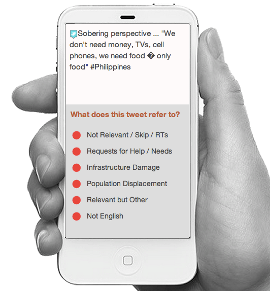
- Tweets collected during first 48 hours of landfall = ~230,000
- Tweets automatically filtered for relevancy/uniqueness = ~55,000
- Tweets clicked using the TweetClicker = ~ 30,000
- Relevant tweets triangulated using TweetClicker = ~3,800
- Triangulated tweets published on live Crisis Map = ~600
- Total clicks on TweetClicker = ~ 90,000
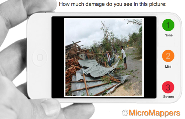
- Images clicked using the ImageClicker = ~ 5,000
- Relevant images triangulated using TweetClicker = ~1,200
- Triangulated images published on live Crisis Map = ~180
- Total clicks on ImageClicker = ~15,000
- Total clicks on MicroMappers (Image + Tweet Clickers) = ~105,000
Since each single tweet and image uploaded to the Clickers was clicked on by (at least) three individual volunteers for quality control purposes, the number of clicks is three times the total number of tweets and images uploaded to the respective clickers. In sum, digital humanitarian volunteers have clocked a grand total of ~105,000 clicks to support humanitarian operations in the Philippines.
While the media has largely focused on the technology angle of our digital humanitarian operation, the human story is for me the more powerful message. This operation succeeded because people cared. Those ~105,000 clicks did not magically happen. Each and every single one of them was clocked by humans, not machines. At one point, we had over 300 digital volunteers from the world over clicking away at the same time on the TweetClicker and more than 200 on the ImageClicker. This kind of active engagement by total strangers—good “digital Samaritans”—explains why I find the human angle of this story to be the most inspiring outcome of MicroMappers. “Crowdsourcing” is just a new term for the old saying “it takes a village,” and sometimes it takes a digital village to support humanitarian efforts on the ground.
Until recently, when disasters struck in faraway lands, we would watch the news on television wishing we could somehow help. That private wish—that innate human emotion—would perhaps translate into a donation. Today, not only can you donate cash to support those affected by disasters, you can also donate a few minutes of your time to support the operational humanitarian response on the ground by simply clicking on MicroMappers. In other words, you can translate your private wish into direct, online public action, which in turn translates into supporting offline collective action in the disaster-affected areas.
Clicking is so simple that anyone with Internet access can help. We had high schoolers in Qatar clicking away, fire officers in Belgium, graduate students in Boston, a retired couple in Kenya and young Filipinos clicking away. They all cared and took the time to try and help others, often from thousands of miles away. That is the kind of world I want to live in. So if you share this vision, then feel free to join the MicroMapper list-serve.
Considering that MicroMappers is still very much under development, we are all pleased with the results. There were of course many challenges; the most serious was the CrowdCrafting server which hosts our Clickers. Unfortunately, that server was not able to handle the load and traffic generated by digital volunteers. So their server crashed twice and also slowed our Clickers to a complete stop at least a dozen times during the past five days. At times, it would take 10-15 seconds for a new tweet or image to load, which was frustrating. We were also limited by the number of tweets and images we could upload at any given time, usually ~1,500 at most. Any larger load would seriously slow down the Clickers. So it is rather remarkable that digital volunteers managed to clock more than 100,000 clicks given the repeated interruptions.

Besides the server issue, the other main bottleneck was the geo-location of the ~30,000 tweets and ~5,000 images tagged using the Clickers. We do have a Tweet and Image GeoClicker but these were not slated to launch until next week at CrisisMappers 2013, which meant they weren’t ready for prime time. We’ll be sure to launch them soon. Once they are operational, we’ll be able to automatically push triangulated tweets and images from the Tweet and Image Clickers directly to the corresponding GeoClickers so volunteers can also aid humanitarian organizations by mapping important tweets and images directly.

There’s a lot more that we’ve learned throughout the past 5 days and much room for improvement. We have a long list of excellent suggestions and feedback from volunteers and partners that we’ll be going through starting tomorrow. The most important next step is to get a more powerful server that can handle a lot more load and traffic. We’re already taking action on that. I have no doubt that our clicks would have doubled without the server constraints.
For now, though, BIG thanks to the SBTF Team and in particular Jus McKinnon, the QCRI et al team, in particular Ji Lucas, Hemant Purohit and Andrew Ilyas for putting in very, very long hours, day in and day out on top of their full-time jobs and studies. And finally, BIG thanks to the World Wide Crowd, to all you who cared enough to click and support the relief operations in the Philippines. You are the heroes of this story.


Pingback: Live Crisis Map of Disaster Damage Reported on Social Media | iRevolution
Pingback: Typhoon Yolanda: UN Needs Your Help Tagging Crisis Tweets for Disaster Response (Updated) | iRevolution
Pingback: Tag Tweets to Support Typhoon Relief Efforts in Philippines! « MicroMappers
Pingback: Early Results of MicroMappers Response to Yolanda Typhoon | Decision2.0
Awesome effort here, thanks for sharing the story. I have to wonder if there’s some way that you could leverage the data that’s being pulled into the Echosec.net social map (See @echosec_search) service as well or leverage POI information from a foursquare DB to perhaps identify places or locations where there could be supplies or other valuable resources to be found… just a thought
Many thanks for the suggestion, do you have a contact at EchoSec that you could please put me in touch with?
Thanks, I know that you have helped in multiple ways!
Pingback: Typhoon Haiyan: Social media improves situational awareness | Social Media for Good
Where can we see these maps? Of the Philiipines
They are linked to on my previous post:
http://iRevolution.net/2013/11/11/live-crisis-map-of-disaster-damage-reported-on-social-media
Thank you, very fast! I collaborate with http://www.swissfreshwater.com which develops a purification machine powered by solar panels, originally designed for brackhish water, and we plan to do something for the Phillipines. Thats why the maps! it is designed for remote rural communities
Best, Francois
My pleasure! Thanks for sharing your work, Francois. I’m Swiss (although born & raised in Africa) and my parents live close to Lausanne. Perhaps next time I’m in country, we could meet. Please let me know if you do deploy to Philippines in any event. Thanks again
The world is small”Will keep you informed, thanks, f
Pingback: Weekly: Typhoon Yolanda Relief, Hackathons and Software releases – Blog | Ushahidi
Pingback: Opening Keynote Address of CrisisMappers 2013 | iRevolution
Pingback: Some others for a change | Speed Evidence Project
Pingback: Krisenhilfe übers Netz: Wie sie funktioniert und wie du mitmachen kannst
Hi Patrick – I’m very interested by this – and included it in this article in Forced Migration Review. http://www.fmreview.org/en/25th-anniversary/hastie.pdf Looking forward to the book.
Many thanks for sharing, Rachel
Hi Rachel, this may be of interest:
http://iRevolution.net/2014/02/06/inferring-migration-patterns-from-twitter
Pingback: Using UAVs for Search & Rescue | iRevolution
Pingback: Using Crowd Computing to Analyze UAV Imagery for Search & Rescue Operations | iRevolution
Pingback: Crowdsourcing the Search for Malaysia Flight 370 | iRevolution
Pingback: Results of the Crowdsourced Search for Malaysia Flight 370 | iRevolution
Pingback: Launching a Search and Rescue Challenge for Drone / UAV Pilots | iRevolution
Pingback: Revealing VGI-induced bias in the Philippines by
Pingback: Revealing VGI-induced bias in the Philippines by Sankia Shakty
Pingback: Revealing VGI-induced bias in the Philippines by Sankya Shakty
Pingback: 急募:Crisismappers コミュニティはデータ作成者を必要としています | オープンデータとオープンガバメントを推進する Open Knowledge Foundation Japan
Pingback: Zoomanitarians: Using Citizen Science and Next Generation Satellites to Accelerate Disaster Damage Assessments | iRevolution
Pingback: Launching a Search and Rescue Challenge for Drone | Drone NOW | Pagonal_UAV
Pingback: Disaster Tweets Coupled With UAV Imagery Give Responders Valuable Data on Infrastructure Damage | iRevolution
Pingback: MicroMappers Philippines (Coconut) Deployment Now Live! « MicroMappers
Pingback: MicroMappers Philippines (Coconut) Deployment Now Complete! « MicroMappers
Pingback: UN Activates MicroMappers for Philippines Typhoon Ruby! « MicroMappers
Pingback: Why Asia needs digital Jedis: Patrick Meier