Tag Archives: Typhoon

Digital Jedis Complete Response to Typhoon Ruby

Thank you, Digital Jedis!

Every Click you made on MicroMappers was a gift. Typhoon Ruby (Hagupit) disrupted the lives of many and caused damage in regions already affected by previous disasters. As MicroMappers, you gave your time, clicks and skills to make a difference. Catherine, the Head of the UN’s Information Management Unit in the Philippines had this to say: “I would like to thank all the volunteers […] for their invaluable contribution over the past few days. We are lucky that Hagupit [Ruby] made less damages than expected and that the emergency quickly scaled down.”

MM Ruby Tweet Map

MicroMappers and our partners at the Standby Task Force (SBTF) were activated by the United Nations Office for the Coordination of Humanitarian Affairs (OCHA). The Mission?

To augment the situational awareness of humanitarian actors on the ground by making sense of social media generated following the Typhoon.

Over the course of 72 hours, these Digital Jedis united to MicroMap one Click at a time. By reviewing tweets and image, each MicroMapper built collective intelligence and insights that were used to build a comprehensive situational awareness reports and maps for the UN. Many hands, and in this case, Clicks, make light work.

As Catherine rightly notes, there was thankfully less damage than many feared. This explains why our MicroMaps (above and below) are thankfully not riddled with hundreds of markers. In addition, we prioritize quality over quantity at MicroMappers. Our UN partners had specifically asked for tweets related to:

(1) Requests for Help / Needs
(2) Infrastructure Damage
(3) Humanitarian Aid Provided

Together, these tweets—which are mapped above—represented less than 5% of the Ruby-related tweets that were collected during the first 72 hours of the Typhoon making landfall. This doesn’t mean that only 5% of the information on Twitter was relevant for emergency response, however. Indeed, we also tagged tweets that were not related to the above 3 categories but that were still informative. These constituted more than 20% of all tweets collected (which are not included in the map above). In the analysis provided to UN partners, we did include a review of those other relevant tweets.

MM Ruby Tweet Clicker

Some 700 Digital Jedis joined the response online, a new record for MicroMappers! An astounding 50,394 Clicks were made using the Text Clicker pictured above (each tweet was reviewed by at least 3 digital volunteers for quality assurance purposes). And a further 3,555 Clicks were carefully made by the SBTF to geo-locate (map) relevant tweets. In other words, close to 55,000 Clicks went into making the high quality map displayed above! That’s over 12 Clicks per minute non-stop for more than 4,300 consecutive minutes!

MM Ruby Image Map

The United Nations also asked Digital Jedis to identify pictures posted on Twitter that showed disaster damage. Over 30,000 Clicks went into this operation with a further 7,413 Clicks made by the SBTF to map images that showed severe and mild damage. In sum, over 40,000 Clicks went into the MicroMap above. Overall, the entire MicroMappers response was powered by close to 100,000 Clicks!

Screen Shot 2014-12-10 at 8.36.04 AMMM Infographic 2MM Infographic 3

Digital Jedis have yet again shown that together, we can help people get positively involved in their world, even when half-a-globe and many timezones away. Yes, we can and should donate $$ to support relief efforts and good causes around the world but we can also get directly involved by donating our time, or what we call M&M’s, Minutes and Mouse clicks. This year MicroMappers have mobilized to support wildlife protection in Namibia, food security efforts in the Philippines and of course this most recent response to Typhoon Ruby. On that note, thanks again to all volunteers who supported the MicroMappers response to the Typhoon in partnership with the United Nations. You truly are Digital Jedis! And the UK Guardian certainly agrees, check out their article on our digital response.

So what’s next? We will continue to solicit your feedback on how to improve the Clickers and will get started right away. (Add your MicroMappers feedback here). In the meantime, we will leave the Clickers online for newcomers who wish to practice. We are also in touch with the UN and UAV partners in the Philippines as they may soon fly their small, remote-control planes to take aerial photographs over disaster affected areas. If they do, they will send us the photographs for analysis via MicroMappers, so stay tuned.

In closing, MicroMappers was developed by QCRI in partnership SBTF/OCHA. So a million thanks to the QCRI team and SBTF for deploying MicroMappers in support of these digital humanitarian efforts. Special thanks go to Ji Lucas, Jus Mackinnon, ChaTo Castillo, Muhammad Imran, Heather Leson, Sarah Vieweg and last but certainly not least Peter Mosur.

(Ed. note: Blog post was cross-posted from MicroMappers.org. Infrographic uses Infogr.am software)

Calling All Digital Jedis: Support UN Response to Super Typhoon Ruby!

The United Nations has officially activated the Digital Humanitarian Network (DHN) in response to Typhoon Ruby. The DHN serves as the official interface between formal humanitarian organizations and digital volunteer groups from all around the world. These digital volunteers—also known as Digital Jedis— provide humanitarian organizations like the UN and the Red Cross with the “surge” capacity they need to make sense of the “Big Data” that gets generated during disasters. This “Big Data” includes large volumes of social media reports and satellite imagery, for example. And there is a lot of this data being generated right now as a result of Super Typhoon Ruby.

Typhoon Ruby

To make sense of this flash flood of information, Digital Jedis use crowdsourcing platforms like MicroMappers, which was developed in partnership with the UN Office for the Coordination of Humanitarian Affairs (OCHA). In their activation of the Digital Humanitarian Network, the UN has requested that Digital Jedis look for Ruby-related tweets that refer to needs, damage & response efforts. They have also asked digital volunteers to identify pictures of damage caused by the Typhoon. These tweets and pictures will then to be added to a live crisis map to augment the UN’s own disaster damage and needs assessment efforts.

You too can be a Digital Jedi. Trust me, MicroMappers is far easier to use than a lightsaber. All it takes is a single Click of the mouse. Yes, it really is that simple. So, if a Digital Jedi you want to be, let your first Click be this one! Following that click will set you on the path to help the United Nation’s important relief efforts in the Philippines. So if you’ve got a bit of time on your hands—even 2 minutes goes a long way—then help us make a meaningful difference in the world, join the Force! And may the Crowd be with Us!

bio

See also: Digital Humanitarians – The Path of the Digtal Jedis

Humanitarians in the Sky: Using UAVs for Disaster Response

The following is a presentation that I recently gave at the 2014 Remotely Piloted Aircraft Systems Conference (RPAS 2014) held in Brussels, Belgium. The case studies on the Philippines and Haiti are also featured in my upcoming book on “Digital Humanitarians: How Big Data is Changing the Face of Humanitarian Response.” The book is slated to be published in January/February 2015.

Screen Shot 2014-06-24 at 2.20.54 PM

Good afternoon and many thanks to Peter van Blyenburgh for the kind invitation to speak on the role of UAVs in humanitarian contexts beyond the European region. I’m speaking today on behalf of the Humanitarian UAV Network, which brings together seasoned humanitarian professionals with UAV experts to facilitate the use of UAVs in humanitarian settings. I’ll be saying more about the Humanitarian UAV Network (UAViators, pronounced “way-viators”) at the end of my talk.
Screen Shot 2014-06-24 at 2.21.19 PM

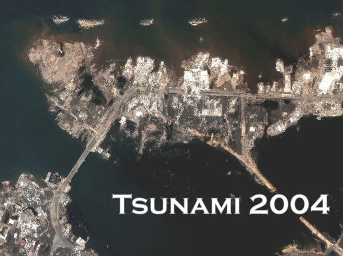
The view from above is key for humanitarian response. Indeed, satellite imagery has played an important role in relief operations since Hurricane Mitch in 1998. And the Indian Ocean Tsunami was the first to be captured from space as the way was still propagating. Some 650 images were produced using data from 15 different sensors. During the immediate aftermath of the Tsunami, satellite images were used at headquarters to assess the extent of the emergency. Later, satellite images were used in the field directly, distributed by the Humanitarian Information Center (HIC) and others to support and coordinate relief efforts. 
Screen Shot 2014-06-24 at 2.21.30 PM

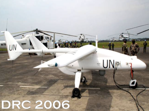
Satellites do present certain limitations, of course. These include cost, the time needed to acquire images, cloud cover, licensing issues and so on. In any event, two years after the Tsunami, an earlier iteration of the UN’s DRC Mission (MONUC) was supported by a European force (EUFOR), which used 4 Belgian UAVs. But I won’t be speaking about this type of UAV. For a variety of reasons, particularly affordability, ease of transport, regulatory concerns, and community engagement, UAVs used in humanitarian response are smaller systems or micro-UAVs that weigh just a few kilograms, such as one fixed-wing displayed below.
Screen Shot 2014-06-24 at 2.21.47 PM

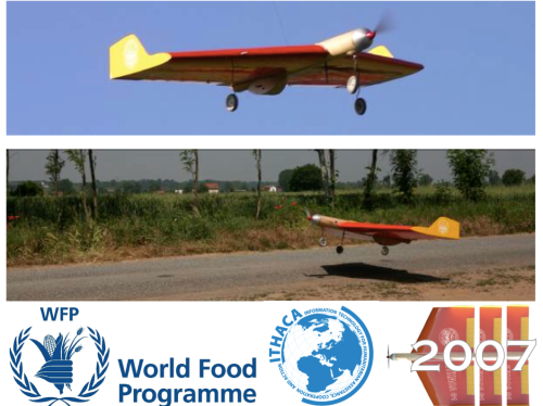
The World Food Program’s UAVs were designed and built at the University of Torino “way back” in 2007. But they’ve been grounded until this year due to lack of legislation in Italy.
Screen Shot 2014-06-24 at 2.22.05 PM

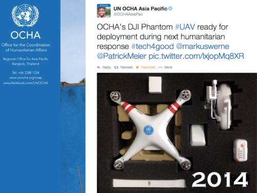
In June 2014, the UN’s Office for the Coordination of Humanitarian Affairs (OCHA) purchased a small quadcopter for use in humanitarian response and advocacy. Incidentally, OCHA is on the Advisory Board of the Humanitarian UAV Network, or UAViators. 
Screen Shot 2014-06-24 at 2.22.41 PM

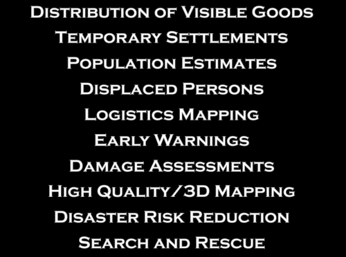
Now, there are many uses cases for the operation of UAVs in humanitarian settings (those listed above are only a subset). All of you here at RPAS 2014 are already very familiar with these applications. So let me jump directly to real world case studies from the Philippines and Haiti.
Screen Shot 2014-06-24 at 2.23.08 PM

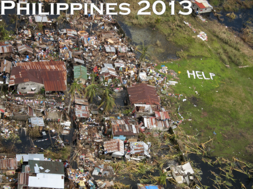
Typhoon Haiyan, or Yolanda as it was known locally, was the most powerful Typhoon in recorded human history to make landfall. The impact was absolutely devastated. I joined UN/OCHA in the Philippines following the Typhoon and was struck by how many UAV projects were being launched. What follows is just a few of said projects.
Screen Shot 2014-06-24 at 2.26.45 PM

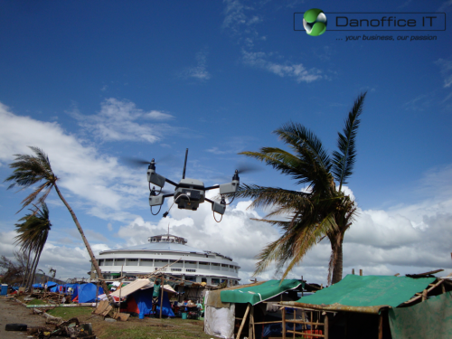
Danoffice IT, a company based in Lausanne, Switzerland, used the Sky-Watch Huginn X1 Quadcopter to support the humanitarian response in Tacloban. The rotary-wing UAV was used to identify where NGOs could set up camp. Later on, the UAV was used to support a range of additional tasks such as identifying which roads were passable for transportation/logistics. The quadcopter was also flown up the coast to assess the damage from the storm surge and flooding and to determine which villages had been most affected. This served to speed up the relief efforts and made the response more targeted vis-a-vis the provision of resources and assistance. Danoffice IT is also on the Board of the Humanitarian UAV Network (UAViators).
Screen Shot 2014-06-24 at 2.27.06 PM

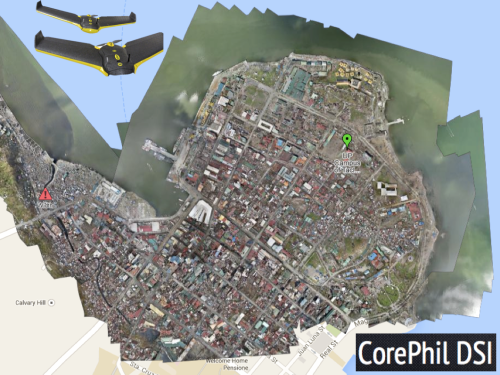
A second UAV project was carried out by local UAV start-up called CorePhil DSI. The team used an eBee to capture aerial imagery of downtown Tacloban, one of the areas hardest-hit by Typhoon Yolanda. They captured 22 Gigabytes of imagery and shared this with the Humanitarian OpenStreetMap Team (HOT) who are also on the Board of UAViators. HOT subsequently crowdsourced the tracing of this imagery (and satellite imagery) to create the most detailed and up-to-date maps of the area. These maps were shared with and used by multiple humanitarian organizations as well as the Filipino Government.
Screen Shot 2014-06-24 at 2.27.28 PM

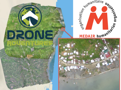
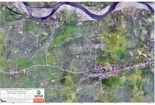
In a third project, the Swiss humanitarian organization Medair partnered with Drone Adventures to create a detailed set of 2D maps and 3D terrain models of the disaster-affected areas in which Medair works. These images were used to inform the humanitarian organization’s recovery and reconstruction programs. To be sure, Medair used the maps and models of Tacloban and Leyte to assist in assessing where the greatest need was and what level of assistance should be given to affected families as they continued to recover. Having these accurate aerial images of the affected areas allowed the Swiss organization to address the needs of individual households and—equally importantly—to advocate on their behalf when necessary.
Screen Shot 2014-06-24 at 3.20.08 PM

Drone Adventures also flew their fixed-wing UAVs (eBee’s) over Dulag, just north of Leyte, where more than 80% of homes and croplands were destroyed during the Typhoon. Medair is providing both materials and expertise to help build new shelters in Dulag. So the aerial imagery is proving invaluable to identify just how much material is needed and where. The captured imagery is also enabling community members themselves to better understand both where the greatest needs are an also what the potential solutions might be.
Screen Shot 2014-06-24 at 2.27.55 PM

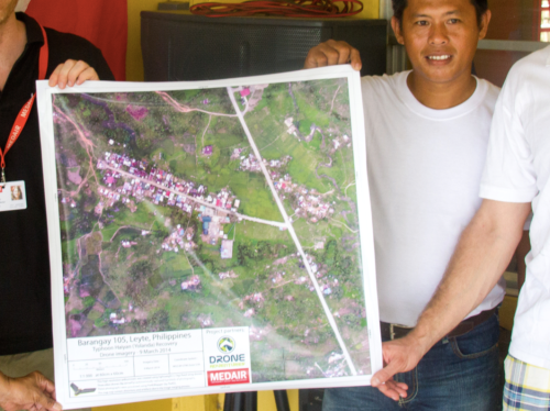
The partners are also committed to Open Data. The imagery captured was made available online and for free, enabling community leaders and humanitarian organizations to use the information to coordinate other reconstruction efforts. In addition, Drone Adventures and Medair presented locally-printed maps to community leaders within 24 hours of flying the UAVs. Some of these maps were printed on rollable, water proof banners, which make them more durable when used in the field.
Screen Shot 2014-06-24 at 2.28.11 PM

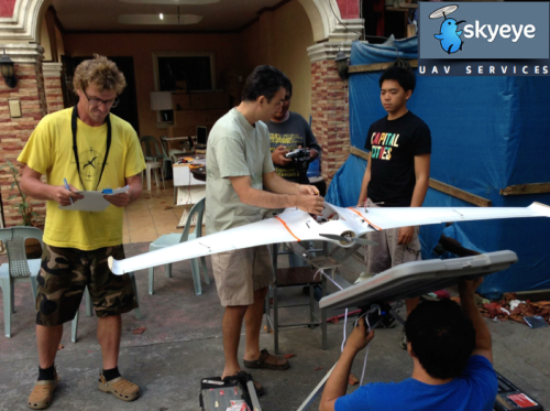
In yet another UAV project, the local Filipino start-up SkyEye Inc partnered with the University of the Philippines in Manila to develop expendable UAVs or xUAVs. The purpose of this initiative is to empower grassroots communities to deploy their own low-cost xUAVs and thus support locally-deployed response efforts. The team has trained 4 out of 5 teams across the Philippines to locally deploy UAVs in preparation for the next Typhoon season. In so doing, they are also transferring math, science and engineering skills to local communities. It is worth noting that community perceptions of UAVs in the Philippines and elsewhere has always been very positive. Indeed, local communities perceive small UAVs as toys more than anything else.
Screen Shot 2014-06-24 at 2.28.37 PM

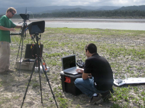
SkyEye worked with this group from the University of Hawaii to create disaster risk reduction models of flood-prone areas.
Screen Shot 2014-06-24 at 2.29.22 PM

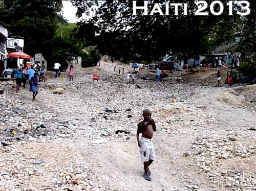
Moving to Haiti, the International Organization for Migration (IOM) has partnered with Drone Adventures and other to produce accurate topographical and 3D maps of disaster prone areas in the Philippines. These aerial images have been used to inform disaster risk reduction and community resilience programs. The UAVs have also enabled IOM to assess destroyed houses and other types of damage caused by floods and droughts. In addition, UAVs have been used to monitor IDP camps, helping aid workers identify when shelters are empty and thus ready to be closed. Furthermore, the high resolution aerial imagery has been used to support a census survey of public building, shelters, hospitals as well as schools.
Screen Shot 2014-06-24 at 2.29.46 PM

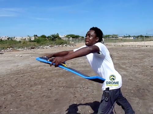
After Hurricane Sandy, for example, aerial imagery enabled IOM to very rapidly assess how many houses had collapsed near Rivière Grise and how many people were affected by the flooding. The aerial imagery was also used to identify areas of standing water where mosquitos and epidemics could easily thrive. Throughout their work with UAVs, IOM has stressed that regular community engagement has been critical for the successful use of UAVs. Indeed, informing local communities of the aerial mapping projects and explaining how the collected information is to be used is imperative. Local capacity building is also paramount, which is why Drone Adventures has trained a local team of Haitians to locally deploy and maintain their own eBee UAV.
Screen Shot 2014-06-24 at 2.30.27 PM

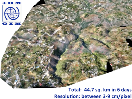
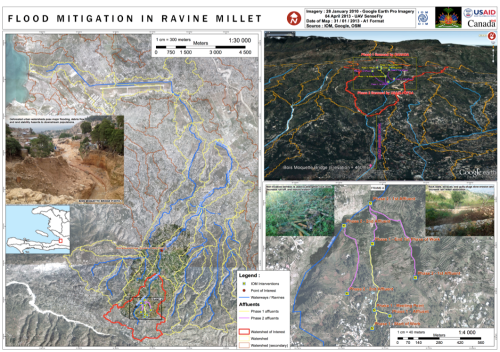
The pictures above and below are some of the information products produced by IOM and Drone Adventures. The 3D model above was used to model flood risk in the area and to inform subsequent disaster risk reduction projects.
Screen Shot 2014-06-24 at 2.30.47 PM

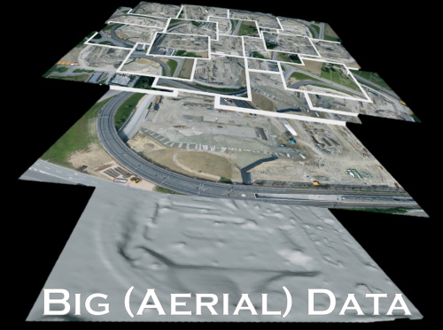
Several colleagues of mine have already noted that aerial imagery presents a Big Data challenge. This means that humanitarian organizations and others will need to use advanced computing (human computing and machine computing) to make sense of Big (Aerial) Data.
Screen Shot 2014-06-24 at 2.31.54 PM

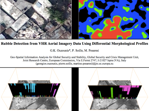
My colleagues at the European Commission’s Joint Research Center (JRC) are already beginning to apply advanced computing to automatically analyze aerial imagery. In the example from Haiti below, the JRC deployed a machine learning classifier to automatically identify rubble left over from the massive earthquake that struck Port-au-Prince in 2010. Their classifier had an impressive accuracy of 92%, “suggesting that the method in its simplest form is sufficiently reliable for rapid damage assessment.”
Screen Shot 2014-06-24 at 2.32.06 PM

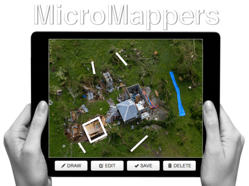
Human computing (or crowdsourcing) can also be used to make sense of Big Data. My team and I at QCRI have partnered with the UN (OCHA) to create the MicroMappers platform, which is a free and open-source tool to make sense of large datasets created during disasters, like aerial data. We have access to thousands of digital volunteers who can rapidly tag and trace aerial imagery; the resulting analysis of this tagging/tracing can be used to increase the situational awareness  of humanitarian organizations in the field.
Screen Shot 2014-06-24 at 2.32.43 PM


Digital volunteers can trace features of interest such as shelters without roofs. Our plan is to subsequently use these traced features as training data to develop machine learning classifiers that can automatically identify these features in future aerial images. We’re also exploring the second use-case depicted below, ie, the rapid transcription of imagery, which can then be automatically geo-tagged and added to a crisis map.
Screen Shot 2014-06-24 at 2.32.55 PM


The increasing use of UAVs during humanitarian disasters is why UAViators, the Humanitarian UAV Network, was launched. Recall the relief operations in response to Typhoon Yolanda; an unprecedented number of UAV projects were in operation. But most operators didn’t know about each other, so they were not coordinating flights let alone sharing imagery with local communities. Since the launch of UAViators, we’ve developed the first ever Code of Conduct for the use of UAVs in humanitarian settings, which includes guidelines on data protection and privacy. We have also drafted an Operational Check-List to educate those who are new to humanitarian UAVs. We are now in the process of carrying out a comprehensive evaluation of UAV models along with cameras, sensors, payload mechanism and image processing software. The purpose of this evaluation is to identify which are the best fit for use by humanitarians in the field. Since the UN and others are looking for training and certification programs, we are actively seeking partners to provide these services.
Screen Shot 2014-06-24 at 2.34.04 PM

The above goals are all for the medium to long term. More immediately, UAViators is working to educate humanitarian organizations on both the opportunities and challenges of using UAVs in humanitarian settings. UAViators is also working to facilitate the coordinate UAV flights during major disasters, enabling operators to share their flight plans and contact details with each other via the UAViators website. We are also planning to set up an SMS service to enable direct communication between operators and others in the field during UAV flights. Lastly, we are developing an online map for operators to easily share the imagery/videos they are collecting during relief efforts.
Screen Shot 2014-06-24 at 2.34.36 PM

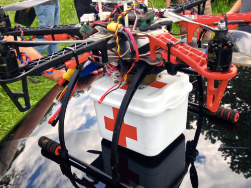
Data collection (imagery capture) is certainly not the only use case for UAVs in humanitarian contexts. The transportation of payloads may play an increasingly important role in the future. To be sure, my colleagues at UNICEF are actively exploring this with a number of partners in Africa.
Screen Shot 2014-06-24 at 2.34.47 PM

Other sensors also present additional opportunities for the use of UAVs in relief efforts. Sensors can be used to assess the impact of disasters on communication infrastructure, such as cell phone towers, for example. Groups are also looking into the use of UAVs to provide temporary communication infrastructure (“aerial cell phone towers”) following major disasters.
Screen Shot 2014-06-24 at 2.34.59 PM

The need for Sense and Avoid systems (a.k.a. Detection & Avoid solutions) has been highlighted in almost every other presentation given at RPAS 2014. We really need this new technology earlier rather than later (and that’s a major  understatement). At the same time, it is important to emphasize that the main added value of UAVs in humanitarian settings is to capture imagery of areas that are overlooked or ignored by mainstream humanitarian relief operations; that is, of areas that are partially or completely disconnected logistically. By definition, disaster-affected communities in these areas are likely to be more vulnerable than others in urban areas. In addition, the airspaces in these disconnected regions are not complex airspaces and thus present fewer challenges around safety and coordination, for example.
Screen Shot 2014-06-24 at 2.35.19 PM

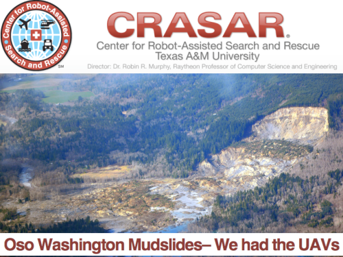
UAVs were ready to go following the mudslides in Oso, Washington back in March of this year. The UAVs were going to be used to look for survivors but the birds were not allowed to fly. The decision to ground UAVs and bar them from supporting relief and rescue efforts will become increasingly untenable when lives are at stake. I genuinely applaud the principle of proportionality applied by the EU and respective RPAS Associations vis-a-vis risks and regulations, but there is one very important variable missing in the proportionality equation: social benefit. Indeed, the cost benefit calculus of UAV risk & regulation in the context of humanitarian use must include the expected benefit of lives saved and suffering alleviated. Let me repeat this to make sure I’m crystal clear: risks must be weighed against potential lives saved.
Screen Shot 2014-06-24 at 2.35.39 PM

At the end of the day, the humanitarian context is different from precision agriculture or other commercial applications of UAVs such as film making. The latter have no relation to the Humanitarian Imperative. Having over-regulation stand in the way of humanitarian principles will simply become untenable. At the same time, the principle of Do No Harm must absolutely be upheld, which is why it features prominently in the Humanitarian UAV Network’s Code of Conduct. In sum, like the Do No Harm principle, the cost benefit analysis of proportionality must include potential or expected benefits as part of the calculus.
Screen Shot 2014-06-24 at 2.35.56 PM

To conclude, a new (forthcoming) policy brief by the UN (OCHA) publicly calls on humanitarian organizations to support initiatives like the Humanitarian UAV Network. This is an important, public endorsement of our work thus far. But we also need support from non-humanitarian organizations like those you represent in this room. For example, we need clarity on existing legislation. Our partners like the UN need to have access to the latest laws by country to inform their use of UAVs following major disasters. We really need your help on this; and we also need your help in identifying which UAVs and related technologies are likely to be a good fit for humanitarians in the field. So if you have some ideas, then please find me during the break, I’d really like to speak with you, thank you!

bio

See Also:

  • Crisis Map of UAV/Aerial Videos for Disaster Response [link]
  • How UAVs are Making a Difference in Disaster Response [link]
  • Humanitarians Using UAVs for Post Disaster Recovery [link]
  • Grassroots UAVs for Disaster Response [link]
  • Using UAVs for Search & Rescue [link]
  • Debrief: UAV/Drone Search & Rescue Challenge [link]
  • Crowdsourcing Analysis of UAV Imagery for Search/Rescue [link]
  • Check-List for Flying UAVs in Humanitarian Settings [link]

Picture Credits:

  • Danoffice IT; Drone Adventures, SkyEye, JRC


The Use of Expendable UAVs After Typhoon Haiyan

My colleague Dr. Imes Chiu recently co-authored this report (PDF) on his team’s use of expendable UAVs following Typhoon Haiyan (known as Typhoon Yolanda in the Philippines). Imes is Chief of Applied Research at the Center for Excellence in Disaster Management and Humanitarian Assistance (COE-DMHA) based in Honolulu, Hawaii.

Screen Shot 2014-06-09 at 8.46.51 AM

Highlights of the report:

  • “The interdisciplinary […] team concluded that during the rapid response phase of disaster management, aerial imagery of damaged areas proved more useful than a detailed needs-assessment.”
  • “Imagery provided by civil drones enabled local government units to immediately and accurately assess the extent of the damage in their jurisdictions, even when operating with a significantly reduced staff.”
  • “What they [relief workers] actually need at this point is to get an accurate understanding and a very detailed picture at the village level, at the camp level, as to what exactly is going on.”
  • “During Haiyan recovery operations, civil drones were quickly adopted as routine operating procedures for many humanitarian groups. Overcoming the logistical challenges posed by massive debris in Tacloban, civil drones provided many NGOs much needed situational awareness at a time when needs-assessment teams did not have access to the disaster area.”
  • “Initially used to pinpoint potential base camp locations for aid workers, many NGOs began adapted the use of civil drones to inform their relief, rescue and recovery operations from aerial views of infrastructure devastation, road and power line damages, emergency areas and relief distribution networks. Civil drones also helped ensure the safety of aid workers through regular information feeds of their movements in the affected areas.”
  • “The biggest challenge […] was determining a launch & recovery site sufficient for a fixed-wing xUAV, so the team used a multi-rotor helicopter drone that is vertically launched and recovered. Imagery from both video and still photography informed the acquisition team where to launch and recover the larger fixed-wing unit.”
  • “Even though this UAV subclass is termed ‘expendable,’ it does not mean the team intentionally or willingly ‘expends’ them, rather it means that the cost is so low and accessibility so high that the drones can be readily replace in case of loss—therefore users are not inhibited by the cost & loss factors.”
  • “A significant benefit of the xUAV is as an asset that could be locally employed and managed. They do not require a centralized command system; they are ‘locally modifiable’ so changes to the system can easily be done to meet community needs. These expendable systems by nature are small, inexpensive and not transportation limited. Unlike larger systems, xUAV could easily be hand carried to remote locations. The components are derived from everyday consumer technology backed by a large network of web-based support systems, often set-up by the academic community.”
  • “The team’s first effort started from a fixed-wing xUAV that covered an area of approximately 1.5 square kilometers at an altitude of 150 meters. The total flight time was approximately 30 minutes. The imagery acquired rendered a final mosaic at eight centimeter per pixel. The current xUAV configuration can fly and capture imagery for approximately an hour.”
  • “The xUAV platform used to generate the Tacloban mosaic imagery consisted of widely available parts that can be purchased for approximately $1,000. This is significantly cheaper than the more expensive commercial ‘turnkey’ systems.”


Bio

See Also:

  • Welcome to the Humanitarian UAV Network [link]
  • How UAVs are Making a Difference in Disaster Response [link]
  • Humanitarians Using UAVs for Post Disaster Recovery [link]
  • Grassroots UAVs for Disaster Response [link]
  • Using UAVs for Search & Rescue [link]
  • Debrief: UAV/Drone Search & Rescue Challenge [link]
  • Crowdsourcing Analysis of UAV Imagery for Search/Rescue [link]
  • Check-List for Flying UAVs in Humanitarian Settings [link]

Combining Radio, SMS and Advanced Computing for Disaster Response

I’m headed to the Philippines this week to collaborate with the UN Office for the Coordination of Humanitarian Affairs (OCHA) on humanitarian crowdsourcing and technology projects. I’ll be based in the OCHA Offices in Manila, working directly with colleagues Andrej Verity and Luis Hernando to support their efforts in response to Typhoon Yolanda. One project I’m exploring in this respect is a novel radio-SMS-computing initiative that my colleague Anahi Ayala (Internews) and I began drafting during ICCM 2013 in Nairobi last week. I’m sharing the approach here to solicit feedback before I land in Manila.

Screen Shot 2013-11-25 at 6.21.33 AM

The “Radio + SMS + Computing” project is firmly grounded in GSMA’s official Code of Conduct for the use of SMS in Disaster Response. I have also drawn on the Bellagio Big Data Principles when writing up the in’s and out’s of this initiative with Anahi. The project is first and foremost a radio-based initiative that seeks to answer the information needs of disaster-affected communities.

The project: Local radio stations in the Philippines would create and broadcast radio programs inviting local communities to serve as “community journalists” to describe how the Typhoon has impacted their communities. The radio stations would provide a free SMS short-code and invite said communities to text in their observations. Each radio station would include in their broadcast a unique 2-letter identifier and would ask those texting in to start their SMS with that identifier. They would also emphasize that text messages should not include any Personal Identifying Information (PII) and no location information either. Those messages that do include PII would be deleted.

Text messages sent to the SMS short code would be automatically triaged by radio station (using the 2-letter identifier) and forwarded to the respective radio stations via SMS. (At this point, few local radio stations have web access in the disaster-affected areas). These radio stations would be funded to create radio programs based on the SMS’s received. These programs would conclude by asking local communities to text in their information needs—again using the unique radio identifier as a prefix in the text messages. Radio stations would create follow-up programs to address the information needs texted in by local communities (“news you can use”). This could be replicated on a weekly basis and extended to the post-disaster reconstruction phase.

Yolanda destruction

In parallel, the text messages documenting the impact of the Typhoon at the community level would be categorized by Cluster—such as shelter, health, education, etc. Each classified SMS would then be forwarded to the appropriate Cluster Leads. This is where advanced computing comes in: the application of microtasking and machine learning. Trusted Filipino volunteers would be invited to tag each SMS by Cluster-category (and also translate relevant text messages into English). Once enough text messages have been tagged per category, the use of machine learning classifiers would enable the automatic classification of incoming SMS’s. As explained above, these classified SMS’s would then be automatically forwarded to a designated point of contact at each Cluster Agency.

This process would be repeated for SMS’s documenting the information needs of local communities. In other words, information needs would be classified by Cluster category and forwarded to Cluster Leads. The latter would share their responses to stated information needs with the radio stations who in turn would complement their broadcasts with the information provided by the humanitarian community, thus closing the feedback loop.

The radio-SMS project would be strictly opt-in. Radio programs would clearly state that the data sent in via SMS would be fully owned by local communities who could call in or text in at any time to have their SMS deleted. Phone numbers would only be shared with humanitarian organization if the individuals texting to radio stations consented (via SMS) to their numbers being shared. Inviting communities to act as “citizen journalists” rather than asking them to report their needs may help manage expectations. Radio stations can further manage these expectations during their programs by taking questions from listeners calling in. In addition, the project seeks to limit the number of SMS’s that communities have to send. The greater the amount of information solicited from disaster-affected communities, the more challenging managing expectations may be. The project also makes a point of focusing on local information needs as the primary entry point. Finally, the data collection limits the geographical resolution to the village level for the purposes of data privacy and protection.

AIDR logo

It remains to be seen whether this project gets funded, but I’d welcome any feedback iRevolution readers may have in any event since this approach could also be used in future disasters. In the meantime, my QCRI colleagues and I are looking to modify AIDR to automatically classify SMS’s (in addition to tweets). My UNICEF colleagues already expressed to me their need to automatically classify millions of text messages for their U-Report project, so I believe that many other humanitarian and development organizations will benefit from a free and open source platform for automatic SMS classification. At the technical level, this means adding “batch-processing” to AIDR’s current “streaming” feature. We hope to have an update on this in coming weeks. Note that a batch-processing feature will also allow users to upload their own datasets of tweets for automatic classification. 

Bio

Early Results of MicroMappers Response to Typhoon Yolanda (Updated)

We have completed our digital humanitarian operation in the Philippines after five continuous days with MicroMappers. Many, many thanks to all volunteers from all around the world who donated their time by clicking on tweets and images coming from the Philippines. Our UN OCHA colleagues have confirmed that the results are being shared widely with their teams in the field and with other humanitarian organizations on the ground. More here.

ImageClicker

In terms of preliminary figures (to be confirmed):

  • Tweets collected during first 48 hours of landfall = ~230,000
  • Tweets automatically filtered for relevancy/uniqueness = ~55,000
  • Tweets clicked using the TweetClicker = ~ 30,000
  • Relevant tweets triangulated using TweetClicker = ~3,800
  • Triangulated tweets published on live Crisis Map = ~600
  • Total clicks on TweetClicker = ~ 90,000
  • Images clicked using the ImageClicker = ~ 5,000
  • Relevant images triangulated using TweetClicker = ~1,200
  • Triangulated images published on live Crisis Map = ~180
  • Total clicks on ImageClicker = ~15,000
  • Total clicks on MicroMappers (Image + Tweet Clickers) = ~105,000

Since each single tweet and image uploaded to the Clickers was clicked on by (at least) three individual volunteers for quality control purposes, the number of clicks is three times the total number of tweets and images uploaded to the respective clickers. In sum, digital humanitarian volunteers have clocked a grand total of ~105,000 clicks to support humanitarian operations in the Philippines.

While the media has largely focused on the technology angle of our digital humanitarian operation, the human story is for me the more powerful message. This operation succeeded because people cared. Those ~105,000 clicks did not magically happen. Each and every single one of them was clocked by humans, not machines. At one point, we had over 300 digital volunteers from the world over clicking away at the same time on the TweetClicker and more than 200 on the ImageClicker. This kind of active engagement by total strangers—good “digital Samaritans”—explains why I find the human angle of this story to be the most inspiring outcome of MicroMappers. “Crowdsourcing” is just a new term for the old saying “it takes a village,” and sometimes it takes a digital village to support humanitarian efforts on the ground.

Until recently, when disasters struck in faraway lands, we would watch the news on television wishing we could somehow help. That private wish—that innate human emotion—would perhaps translate into a donation. Today, not only can you donate cash to support those affected by disasters, you can also donate a few minutes of your time to support the operational humanitarian response on the ground by simply clicking on MicroMappers. In other words, you can translate your private wish into direct, online public action, which in turn translates into supporting offline collective action in the disaster-affected areas.

Clicking is so simple that anyone with Internet access can help. We had high schoolers in Qatar clicking away, fire officers in Belgium, graduate students in Boston, a retired couple in Kenya and young Filipinos clicking away. They all cared and took the time to try and help others, often from thousands of miles away. That is the kind of world I want to live in. So if you share this vision, then feel free to join the MicroMapper list-serve.

Yolanda TweetClicker4

Considering that MicroMappers is still very much under development, we are all pleased with the results. There were of course many challenges; the most serious was the CrowdCrafting server which hosts our Clickers. Unfortunately, that server was not able to handle the load and traffic generated by digital volunteers. So their server crashed twice and also slowed our Clickers to a complete stop at least a dozen times during the past five days. At times, it would take 10-15 seconds for a new tweet or image to load, which was frustrating. We were also limited by the number of tweets and images we could upload at any given time, usually ~1,500 at most. Any larger load would seriously slow down the Clickers. So it is rather remarkable that digital volunteers managed to clock more than 100,000 clicks given the repeated interruptions. 

Besides the server issue, the other main bottleneck was the geo-location of the ~30,000 tweets and ~5,000 images tagged using the Clickers. We do have a Tweet and Image GeoClicker but these were not slated to launch until next week at CrisisMappers 2013, which meant they weren’t ready for prime time. We’ll be sure to launch them soon. Once they are operational, we’ll be able to automatically push triangulated tweets and images from the Tweet and Image Clickers directly to the corresponding GeoClickers so volunteers can also aid humanitarian organizations by mapping important tweets and images directly.

There’s a lot more that we’ve learned throughout the past 5 days and much room for improvement. We have a long list of excellent suggestions and feedback from volunteers and partners that we’ll be going through starting tomorrow. The most important next step is to get a more powerful server that can handle a lot more load and traffic. We’re already taking action on that. I have no doubt that our clicks would have doubled without the server constraints.

For now, though, BIG thanks to the SBTF Team and in particular Jus McKinnon, the QCRI et al team, in particular Ji Lucas, Hemant Purohit and Andrew Ilyas for putting in very, very long hours, day in and day out on top of their full-time jobs and studies. And finally, BIG thanks to the World Wide Crowd, to all you who cared enough to click and support the relief operations in the Philippines. You are the heroes of this story.

bio

Live Crisis Map of Disaster Damage Reported on Social Media

Update: See early results of MicroMappers deployment here

Digital humanitarian volunteers have been busing tagging images posted to social media in the aftermath of Typhoon Yolanda. More specifically, they’ve been using the new MicroMappers ImageClicker to rate the level of damage they see in each image. Thus far, they have clicked over 7,000 images. Those that are tagged as “Mild” and “Severe” damage are then geolocated by members of the Standby Volunteer Task Force (SBTF) who have partnered with GISCorps and ESRI to create this live Crisis Map of the disaster damage tagged using the ImageClicker. The map takes a few second to load, so please be patient.

YolandaPH Crisis Map 1

The more pictures are clicked using the ImageClicker, the more populated this crisis map will become. So please help out if you have a few seconds to spare—that’s really all it takes to click an image. If there are no picture left to click or the system is temporarily offline, then please come back a while later as we’re uploading images around the clock. And feel free to join our list-serve in the meantime if you wish to be notified when humanitarian organizations need your help in the future. No prior experience or training necessary. Anyone who knows how to use a computer mouse can become a digital humanitarian.

The SBTF, GISCorps and ESRI are members of the Digital Humanitarian Network (DHN), which my colleague Andrej Verity and I co-founded last year. The DHN serves as the official interface for direct collaboration between traditional “brick-and-mortar” humanitarian organizations and highly skilled digital volunteer networks. The SBTF Yolanda Team, spearheaded by my colleague Justine Mackinnon, for example, has also produced this map based on the triangulated results of the TweetClicker:

YolandaPH Crisis Map 2
There’s a lot of hype around the use of new technologies and social media for disaster response. So I want to be clear that our digital humanitarian operations in the Philippines have not been perfect. This means  that we’re learning (a lot) by doing (a lot). Such is the nature of innovation. We don’t have the luxury of locking ourselves up in a lab for a year to build the ultimate humanitarian technology platform. This means we have to work extra, extra hard when deploying new platforms during major disasters—because not only do we do our very best to carry out Plan A, but we often have to carry out  Plans B and C in parallel just in case Plan A doesn’t pan out. Perhaps Samuel Beckett summed it up best: “Ever tried. Ever failed. No matter. Try Again. Fail again. Fail better.”

bio

Digital Humanitarians: From Haiti Earthquake to Typhoon Yolanda

We’ve been able to process and make sense of a quarter of a million tweets in the aftermath of Typhoon Yolanda. Using both AIDR (still under development) and Twitris, we were able to collect these tweets in real-time and use automated algorithms to filter for both relevancy and uniqueness. The resulting ~55,000 tweets were then uploaded to MicroMappers (still under development). Digital volunteers from the world over used this humanitarian technology platform to tag tweets and now images from the disaster (click image below to enlarge). At one point, volunteers tagged some 1,500 tweets in just 10 minutes. In parallel, we used machine learning classifiers to automatically identify tweets referring to both urgent needs and offers of help. In sum, the response to Typhoon Yolanda is the first to make full use of advanced computing, i.e., both human computing and machine computing to make sense of Big (Crisis) Data.

ImageClicker YolandaPH

We’ve come a long way since the tragic Haiti Earthquake. There was no way we would’ve been able to pull off the above with the Ushahidi platform. We weren’t able to keep up with even a few thousand tweets a day back then, not to mention images. (Incidentally, MicroMappers can also be used to tag SMS). Furthermore, we had no trained volunteers on standby back when the quake struck. Today, not only do we have a highly experienced network of volunteers from the Standby Volunteer Task Force (SBTF) who serve as first (digital) responders, we also have an ecosystem of volunteers from the Digital Humanitarian Network (DHN). In the case of Typhoon Yolanda, we also had a formal partner, the UN Office for the Coordination of Humanitarian Affairs (OCHA), that officially requested digital humanitarian support. In other words, our efforts are directly in response to clearly articulated information needs. In contrast, the response to Haiti was “supply based” in that we simply pushed out all information that we figured might be of use to humanitarian responders. We did not have a formal partner from the humanitarian sector going into the Haiti operation.

Yolanda Prezi

What this new digital humanitarian operation makes clear is that preparedness, partnerships & appropriate humanitarian technology go a long way to ensuring that our efforts as digital humanitarians add value to the field-based operations in disaster zones. The above Prezi by SBTF co-founder Anahi (click on the image to launch the presentation) gives an excellent overview of how these digital humanitarian efforts are being coordinated in response to Yolanda. SBTF Core Team member Justine Mackinnon is spearheading the bulk of these efforts.

While there are many differences between the digital response to Haiti and Yolanda, several key similarities have also emerged. First, neither was perfect, meaning that we learned a lot in both deployments; taking a few steps forward, then a few steps back. Such is the path of innovation, learning by doing. Second, like our use of Skype in Haiti, there’s no way we could do this digital response work without Skype. Third, our operations were affected by telecommunications going offline in the hardest hit areas. We saw an 18.7% drop in relevant tweets on Saturday compared to the day before, for example. Fourth, while the (very) new technologies we are deploying are promising, they are still under development and have a long way to go. Fifth, the biggest heroes in response to Haiti were the volunteers—both from the Haitian Diaspora and beyond. The same is true of Yolanda, with hundreds of volunteers from the world over (including the Philippines and the Diaspora) mobilizing online to offer assistance.

A Filipino humanitarian worker in Quezon City, Philippines, for example, is volunteering her time on MicroMappers. As is customer care advisor from Eurostar in the UK and a fire officer from Belgium who recruited his uniformed colleagues to join the clicking. We have other volunteer Clickers from Makati (Philippines), Cape Town (South Africa), Canberra & Gold Coast (Australia), Berkeley, Brooklyn, Citrus Heights & Hinesburg (US), Kamloops (Canada), Paris & Marcoussis (France), Geneva (Switzerland), Sevilla (Spain), Den Haag (Holland), Munich (Germany) and Stokkermarke (Denmark) to name just a few! So this is as much a human story is it is one about technology. This is why online communities like MicroMappers are important. So please join our list-serve if you want to be notified when humanitarian organizations need your help.

Bio

Using CrowdFlower to Microtask Disaster Response

Cross-posted from CrowdFlower blog

A devastating earthquake struck Port-au-Prince on January 12, 2010. Two weeks later, on January 27th, a CrowdFlower was used to translate text messages from Haitian Creole to English. Tens of thousands of messages were sent by affected Haitians over the course of several months. All of these were heroically translated by hundreds of dedicated Creole-speaking volunteers based in dozens of countries across the globe. While Ushahidi took the lead by developing the initial translation platform used just days after the earthquake, the translation efforts were eventually rerouted to CrowdFlower. Why? Three simple reasons:

  1. CrowdFlower is one of the leading and most highly robust micro-tasking platforms there is;
  2. CrowdFlower’s leadership is highly committed to supporting digital humanitarian response efforts;
  3. Haitians in Haiti could now be paid for their translation work.

While the CrowdFlower project was launched 15 days after the earthquake, i.e., following the completion of search and rescue operations, every single digital humanitarian effort in Haiti was reactive. The key takeaway here was the proof of concept–namely that large-scale micro-tasking could play an important role in humanitarian information management. This was confirmed months later when devastating floods inundated much of Pakistan. CrowdFlower was once again used to translate incoming messages from the disaster affected population. While still reactive, this second use of CrowdFlower demonstrated replicability.

The most recent and perhaps most powerful use of CrowdFlower for disaster response occurred right after Typhoon Pablo devastated the Philippines in early December 2012. The UN Office for the Coordination of Humanitarian Affairs (OCHA) activated the Digital Humanitarian Network (DHN) to rapidly deliver a detailed dataset of geo-tagged pictures and video footage (posted on Twitter) depicting the damage caused by the Typhoon. The UN needed this dataset within 12 hours, which required that 20,000 tweets to be analyzed as quickly as possible. The Standby Volunteer Task Force (SBTF), a member of Digital Huma-nitarians, immediately used CrowdFlower to identify all tweets with links to pictures & video footage. SBTF volunteers subsequently analyzed those pictures and videos for damage and geographic information using other means.

This was the most rapid use of CrowdFlower following a disaster. In fact, this use of CrowdFlower was pioneering in many respects. This was the first time that a member of the Digital Humanitarian Network made use of CrowdFlower (and thus micro-tasking) for disaster response. It was also the first time that Crowd-Flower’s existing workforce was used for disaster response. In addition, this was the first time that data processed by CrowdFlower contributed to an official crisis map produced by the UN for disaster response (see above).

These three use-cases, Haiti, Pakistan and the Philippines, clearly demonstrate the added value of micro-tasking (and hence CrowdFlower) for disaster response. If CrowdFlower had not been available in Haiti, the alternative would have been to pay a handful of professional translators. The total price could have come to some $10,000 for 50,000 text messages (at 0.20 cents per word). Thanks to CrowdFlower, Haitians in Haiti were given the chance to make some of that money by translating the text messages themselves. Income generation programs are absolutely critical to rapid recovery following major disasters. In Pakistan, the use of CrowdFlower enabled Pakistani students and the Diaspora to volunteer their time and thus accelerate the translation work for free. Following Typhoon Pablo, paid CrowdFlower workers from the Philippines, India and Australia categorized several thousand tweets in just a couple hours while the volunteers from the Standby Volunteer Task Force geo-tagged the results. Had CrowdFlower not been available then, it is highly, highly unlikely that the mission would have succeeded given the very short turn-around required by the UN.

While impressive, the above use-cases were also reactive. We need to be a lot more pro-active, which is why I’m excited to be collaborating with CrowdFlower colleagues to customize a standby platform for use by the Digital Humanitarian Network. Having a platform ready-to-go within minutes is key. And while digital volunteers will be able to use this standby platform, I strongly believe that paid CrowdFlower workers also have a key role to play in the digital huma-nitarian ecosystem. Indeed, CrowdFlower’s large, multinational and multi-lingual global workforce is simply unparalleled and has the distinct advantage of being very well versed in the CrowdFlower platform.

In sum, it is high time that the digital humanitarian space move from crowd-sourcing to micro-tasking. It has been three years since the tragic earthquake in Haiti but we have yet to adopt micro-tasking more widely. CrowdFlower should thus play a key role in promoting and enabling this important shift. Their con-tinued important leadership in digital humanitarian response should also serve as a model for other private sector companies in the US and across the globe.

bio

How the UN Used Social Media in Response to Typhoon Pablo (Updated)

Our mission as digital humanitarians was to deliver a detailed dataset of pictures and videos (posted on Twitter) which depict damage and flooding following the Typhoon. An overview of this digital response is available here. The task of our United Nations colleagues at the Office of the Coordination of Humanitarian Affairs (OCHA), was to rapidly consolidate and analyze our data to compile a customized Situation Report for OCHA’s team in the Philippines. The maps, charts and figures below are taken from this official report (click to enlarge).

Typhon PABLO_Social_Media_Mapping-OCHA_A4_Portrait_6Dec2012

This map is the first ever official UN crisis map entirely based on data collected from social media. Note the “Map data sources” at the bottom left of the map: “The Digital Humanitarian Network’s Solution Team: Standby Volunteer Task Force (SBTF) and Humanity Road (HR).” In addition to several UN agencies, the government of the Philippines has also made use of this information.

Screen Shot 2012-12-08 at 7.26.19 AM

Screen Shot 2012-12-08 at 7.29.24 AM

The cleaned data was subsequently added to this Google Map and also made public on the official Google Crisis Map of the Philippines.

Screen Shot 2012-12-08 at 7.32.17 AM

One of my main priorities now is to make sure we do a far better job at leveraging advanced computing and microtasking platforms so that we are better prepared the next time we’re asked to repeat this kind of deployment. On the advanced computing side, it should be perfectly feasible to develop an automated way to crawl twitter and identify links to images  and videos. My colleagues at QCRI are already looking into this. As for microtasking, I am collaborating with PyBossa and Crowdflower to ensure that we have highly customizable platforms on stand-by so we can immediately upload the results of QCRI’s algorithms. In sum, we have got to move beyond simple crowdsourcing and adopt more agile micro-tasking and social computing platforms as both are far more scalable.

In the meantime, a big big thanks once again to all our digital volunteers who made this entire effort possible and highly insightful.