Tag Archives: Philippines

From Aerial to Maritime Robotics for Payload Delivery?

WeRobotics is co-creating a global network of social innovation labs to accelerate the transfer of appropriate robotics solutions to local partners who need them the most. Launched last week at the prestigious 2016 International Drones & Robotics for Good Awards in Dubai, WeRobotics seeks to democratize the Fourth Industrial Revolution. One of several new labs under consideration is Cuyo Flying Labs in the Cuyo Archipelago of the Philippines.

CuyoPic

Our local partners in this district are outstanding public health professionals who have made a clear and data-driven case for exploring robotics solutions to improve the delivery of essential medicines across the islands of the Archipelago. WeRobotics has reached out to it’s network of Technology Partners to identify a cross-section of aerial robotics solutions. We plan to pilot and evaluate these solutions together with our local partners this year; just waiting to hear back on a number of grant proposals.

CuyoMap

Aerial robots are not the only robotics solutions out there, however. Indeed, a number of contestants at the International Drones & Robotics Awards presented maritime robotics platforms. One team from NYU Abu Dhabi presented their Reef Rover solution, which I gave high marks to (I served on the panel of judges for the finals of the championship and also had the honor of giving the opening Keynote). Fellow keynote speaker David Lang from OpenROV also presented his group’s maritime robotics solution.

So I caught up with David and told him about the possible Cuyo project. I asked him about possible autonomous maritime robotics solutions that could carry a 1- 2kg payload across a 20-mile stretch. Given that GPS signals and radio waves do not travel well underwater, the solution would need to be a surface-water robot. That said, Team NYU did come up with a neat solution to this issue as shown in the above video. But said solution may be problematic for long distances. In any event, I was surprised to learn from David that existing surface-water robotics solutions would likely range in the hundreds of thousands of dollars. So I asked David about possibility hacking a remote control boat since these toys cost a couple hundred dollars at most.

RCboat

This could totally be done, according to David. He encouraged me to blog about the humanitarian applications of small autonomous boats and to share my post with the DIY community for feedback. So here we are. I also did some research on autonomous boats and came across this high school project—aptly titled DIY boat—along with the short video below. These kinds of boats can travel between 10-25 miles per hour. Battery power won’t be an issue but salt water and robotics are not the best of friends. So developing a persistent & robust solution with sense and avoid technology will need more thought.

I also found this more recent article (February 2, 2016) on swarming robot boats that apparently demonstrate learning. More on this applied research project in the video below.

As for operating this in Cuyo, we could test out the autonomous boat late at night when no commercial boats or fishermen are likely to be out and about. The water routes would be automatically programmed so the maritime robot would simply do several runs back and forth. In other words, even if the boat can “only” carry 1kg-2kg at a time, the frequency of the trips could make up for the low payload weight—just like aerial robotics. Of course, we’d have to look up the Philippine’s maritime regulations to figure out what kinda of permits might be necessary, but I assume these regulations may not be as demanding as aviation regulations.

Screen Shot 2016-02-06 at 12.21.36 PM

In any event, WeRobotics seeks to work across multiple robotics platforms, from aerial robotics to terrestrial robotics to maritime robotics. For now, though, most of the world’s attention is focused on the hype surrounding small autonomous aerial robots. But aerial robotics won’t be the one and only wave of robotics to impact the social good space. So f you know of existing maritime solutions that we could pilot this year as part of Cuyo Flying Labs, then I’d be most grateful if you could either get in touch or leave a comment below. Many thanks!

Low-Cost UAV Applications for Post-Disaster Assessments: A Streamlined Workflow

Colleagues Matthew Cua, Charles Devaney and others recently co-authored this excellent study on their latest use of low-cost UAVs/drones for post-disaster assessments, environmental development and infrastructure development. They describe the “streamlined workflow—flight planning and data acquisition, post-processing, data delivery and collaborative sharing,” that they created “to deliver acquired images and orthorectified maps to various stakeholders within [their] consortium” of partners in the Philippines. They conclude from direct hands-on experience that “the combination of aerial surveys, ground observations and collaborative sharing with domain experts results in richer information content and a more effective decision support system.”

Screen Shot 2014-10-03 at 11.26.12 AM

UAVs have become “an effective tool for targeted remote sensing operations in areas that are inaccessible to conventional manned aerial platforms due to logistic and human constraints.” As such, “The rapid development of unmanned aerial vehicle (UAV) technology has enabled greater use of UAVs as remote sensing platforms to complement satellite and manned aerial remote sensing systems.” The figure above (click to enlarge) depicts the aerial imaging workflow developed by the co-authors to generate and disseminate post-processed images. This workflow, the main components of which are “Flight Planning & Data Acquisition,” “Data Post-Processing” and “Data Delivery,” will “continuously be updated, with the goal of automating more activities in order to increase processing speed, reduce cost and minimize human error.”

Screen Shot 2014-10-03 at 11.27.02 AM

Flight Planning simply means developing a flight plan based on clearly defined data needs. The screenshot above (click to enlarge) is a “UAV flight plan of the coastal section of Tacloban city, Leyte generated using APM Mission Planner. The [flight] plan involved flying a small UAV 200 meters above ground level. The raster scan pattern indicated by the yellow line was designed to take images with 80% overlap & 75% side overlap. The waypoints indicating a change in direction of the UAV are shown as green markers.” The purpose of the overlapping is to stitch and accurately geo-referenced the images during post-processing. A video on how to program UAV flight is available here.  This video specifically focuses on post-disaster assessments in the Philippines.

“Once in the field, the team verifies the flight plans before the UAV is flown by performing a pre-flight survey [which] may be done through ground observations of the area, use of local knowledge or short range aerial observations with a rotary UAV to identify launch/recovery sites and terrain characteristics. This may lead to adjustment in the flight plans. After the flight plans have been verified, the UAV is deployed for data acquisition.”

Screen Shot 2014-10-03 at 11.27.33 AM

Matthew, Charles and team initially used a Micropilot MP-Vision UAV for data acquisition. “However, due to increased cost of maintenance and significant skill requirements of setting up the MP-Vision,” they developed their own custom UAV instead, which “uses semi-professional and hobby- grade components combined with open-source software” as depicted in the above figure (click to enlarge). “The UAV’s airframe is the Super SkySurfer fixed-wing EPO foam frame.” The team used the “ArduPilot Mega (APM) autopilot system consisting of an Arduino-based microprocessor board, airspeed sensor, pressure and tem-perature sensor, GPS module, triple-axis gyro and other sensors. The firmware for navigation and control is open-source.”

The custom UAV, which costs approximately $2,000, has “an endurance of about 30-50 minutes, depending on payload weight and wind conditions, and is able to survey an area of up to 4 square kilometers.” The custom platform was “easier to assemble, repair, maintain, modify & use. This allowed faster deploy-ability of the UAV. In addition, since the autopilot firmware is open-source, with a large community of developers supporting it, it became easier to identify and address issues and obtain software updates.” That said, the custom UAV was “more prone to hardware and software errors, either due to assembly of parts, wiring of electronics or bugs in the software code.” Despite these drawbacks, “use of the custom UAV turned out to be more feasible and cost effective than use of a commercial-grade UAV.”

In terms of payloads (cameras), three different kinds were used: Panasonic Lumix LX3, Canon S100, and GoPro Hero 3. These cameras come with both advantages and disadvantages for aerial mapping. The LX3 has better image quality but the servo triggering the shutter would often fail. The S100 is GPS-enabled and does not require mechanical triggering. The Hero-3 was used for video reconnaissance specifically.

Screen Shot 2014-10-04 at 5.31.47 AM

“The workflow at [the Data-Processing] stage focuses on the creation of an orthomosaic—an orthorectified, georeferenced and stitched map derived from aerial images and GPS and IMU (inertial measurement unit values, particularly yaw, pitch and roll) information.” In other words, “orthorectification is the process of stretching the image to match the spatial accuracy of a map by considering location, elevation, and sensor information.”

Transforming aerial images into orthomosaics involves: (1) manually removing take-off/landing, burry & oblique images; (2) applying contrast enhancement to images that are either over- or under-exposed using commercial image-editing software; (3) geo-referencing the resulting images; (4) creating an orthomosaic from the geo-tagged images. The geo-referencing step is not needed if the images are already geo-referenced (i.e., have GPS coordinates, like those taken with the Cannon S100. “For non-georeferenced images, georeferencing is done by a custom Python script that generates a CSV file containing the mapping between images and GPS/IMU information. In this case, the images are not embedded with GPS coordinates.” The sample orthomosaic above uses 785 images taken during two UAV flights (click to enlarge).

Matthew, Charles and team used the “Pix4Dmapper photomapping software developed by Pix4D to render their orthomosaics. “The program can use either geotagged or non-geotagged images. For non-geotagged images, the software accepts other inputs such as the CSV file generated by the custom Python script to georeference each image and generate the photomosaic. Pix4D also outputs a report containing information about the output, such as total area covered and ground resolution. Quantum GIS, an open-source GIS software, was used for annotating and viewing the photomosaics, which can sometimes be too large to be viewed using common photo viewing software.”

Screen Shot 2014-10-03 at 11.28.20 AM

Data Delivery involves uploading the orthomosaics to a common, web-based platform that stakeholders can access. Orthomosaics “generally have large file sizes (e.g around 300MB for a 2 sq. km. render),” so the team created a web-based geographic information systems (GIS) to facilitate sharing of aerial maps. “The platform, named VEDA, allows viewing of rendered maps and adding metadata. The key advantage of using this platform is that the aerial imagery data is located in one place & can be accessed from any computer with a modern Internet browser. Before orthomosaics can be uploaded to the VEDA platform, they need to be converted into an approprate format supported by the platform. The current format used is MBTiles developed by Mapbox. The MBTiles format specifies how to partition a map image into smaller image tiles for web access. Once uploaded, the orthomosaic map can then be annotated with additional information, such as markers for points of interest.” The screenshot above (click to enlarge) shows the layout of a rendered orthomosaic in VEDA.

Matthew, Charles and team have applied the above workflow in various mission-critical UAV projects in the Philippines including damage assessment work after Typhoon Haiyan in 2013. This also included assessing the impact of the Typhoon on agriculture, which was an ongoing concern for local government during the recovery efforts. “The coconut industry, in particular, which plays a vital role in the Philippine economy, was severely impacted due to millions of coconut trees being damaged or flattened after the storm hit. In order to get an accurate assessment of the damage wrought by the typhoon, and to make a decision on the scale of recovery assistance from national government, aerial imagery coupled with a ground survey is a potentially promising approach.”

So the team received permission from local government to fly several missions over areas in Eastern Visayas that [were] devoted to coconut stands prior to Typhoon Haiyan.” (As such, “The UAV field team operated mostly in rural areas and wilderness, which reduced the human risk factor in case of aircraft failure. Also, as a safety guideline, the UAV was not flown within 3 miles from an active airport”). The partners in the Philippines are developing image processing techniques to distinguish “coconut trees from wild forest and vegetation for land use assessment and carbon source and sink estimates. One technique involved use of superpixel classification, wherein the image pixels are divided into homogeneous regions (i.e. collection of similar pixels) called superpixels which serve as the basic unit for classification.”

Screen Shot 2014-10-03 at 11.29.07 AM

The image below shows the “results of the initial test run where areas containing coconut trees [above] have been segmented.”

Screen Shot 2014-10-03 at 11.29.23 AM

“Similar techniques could also be used for crop damage assessment after a disaster such as Typhoon Haiyan, where for example standing coconut trees could be distinguished from fallen ones in order to determine capacity to produce coconut-based products.” This is an area that my team and I at QCRI are exploring in partnership with Matthew, Charles and company. In particular, we’re interested in assessing whether crowdsourcing can be used to facilitate the development of machine learning classifiers for image feature detection. More on this herehere and on CNN here. In addition, since “aerial imagery augmented with ground observations would provide a richer source of informa-tion than either one could provide alone,” we are also exploring the integration of social media data with aerial imagery (as described here).

In conclusion, Matthew, Charles and team are looking to further develop the above framework by automating more processes, “such as image filtering and image contrast enhancement. Autonomous take-off & landing will be configured for the custom UAV in order to reduce the need for a skilled pilot. A catapult system will be created for the UAV to launch in areas with a small clearing and a parachute system will be added in order to reduce the risk of damage due to belly landings.” I very much look forward to following the team’s progress and to collaborating with them on imagery analysis for disaster response.

bio

See Also:

  • Official UN Policy Brief on Humanitarian UAVs [link]
  • Common Misconceptions About Humanitarian UAVs [link]
  • Humanitarians in the Sky: Using UAVs for Disaster Response [link]
  • Humanitarian UAVs Fly in China After Earthquake [link]
  • Humanitarian UAV Missions During Balkan Floods [link]
  • Humanitarian UAVs in the Solomon Islands [link]
  • UAVs, Community Mapping & Disaster Risk Reduction in Haiti [link]

The Filipino Government’s Official Strategy on Crisis Hashtags

As noted here, the Filipino Government has had an official strategy on promoting the use of crisis hashtags since 2012. Recently, the Presidential Communications Development and Strategic Planning Office (PCDSPO) and the Office of the Presidential Spokesperson (PCDSPO-OPS) have kindly shared their their 7-page strategy (PDF), which I’ve summarized below.

Gov Twitter

The Filipino government first endorsed the use of the #rescuePH and #reliefPH in August 2012, when the country was experiencing storm-enhanced monsoon rains. These were initiatives from the private sector. Enough people were using the hashtags to make them trend for days. Eventually, we adopted the hashtags in our tweets for disseminating government advisories, and for collecting reports from the ground. We also ventured into creating new hashtags, and into convincing media outlets to use unified hashtags.” For new hashtags, “The convention is the local name of the storm + PH (e.g., #PabloPH, #YolandaPH). In the case of the heavy monsoon, the local name of the monsoon was used, plus the year (i.e., #Habagat2013).” After agreeing on the hashtags, ” the OPS issued an official statement to the media and the public to carry these hashtags when tweeting about weather-related reports.”

The Office of the Presidential Spokesperson (OPS) would then monitor the hashtags and “made databases and lists which would be used in aid of deployed government frontline personnel, or published as public information.” For example, the OPS  “created databases from reports from #rescuePH, containing the details of those in need of rescue, which we endorsed to the National Disaster Risk Reduction & Management Council, the Coast Guard, and the Department of Transportation and Communications. Needless to say, we assumed that the databases we created using these hashtags would be contaminated by invalid reports, such as spam & other inappropriate messages. We try to filter out these erroneous or malicious reports, before we make our official endorsements to the concerned agencies. In coordination with officers from the Department of Social Welfare and Development, we also monitored the hashtag #reliefPH in order to identify disaster survivors who need food and non-food supplies.”

During Typhoon Haiyan (Yolanda), “the unified hashtag #RescuePH was used to convey lists of people needing help.” This information was then sent to to the National Disaster Risk Reduction & Management Council so that these names could be “included in their lists of people/communities to attend to.” This rescue hashtag was also “useful in solving surplus and deficits of goods between relief operations centers.” So the government encouraged social media users to coordinate their #ReliefPH efforts with the Department of Social Welfare and Development’s on-the-ground relief-coordination efforts. The Government also “created an infographic explaining how to use the hashtag #RescuePH.”

Screen Shot 2014-06-30 at 10.10.51 AM

Earlier, during the 2012 monsoon rains, the government “retweeted various updates on the rescue and relief operations using the hashtag #SafeNow. The hashtag is used when the user has been rescued or knows someone who has been rescued. This helps those working on rescue to check the list of pending affected persons or families, and update it.”

The government’s strategy document also includes an assessment on their use of unified hashtags during disasters. On the positive side, “These hashtags were successful at the user level in Metro Manila, where Internet use penetration is high. For disasters in the regions, where internet penetration is lower, Twitter was nevertheless useful for inter-sector (media – government – NGOs) coordination and information dissemination.” Another positive was the use of a unified hashtag following the heavy monsoon rains of 2012, “which had damaged national roads, inconvenienced motorists, and posing difficulty for rescue operations. After the floods subsided, the government called on the public to identify and report potholes and cracks on the national highways of Metro Manila by tweeting pictures and details of these to the official Twitter account […] , and by using the hashtag #lubak2normal. The information submitted was entered into a database maintained by the Department of Public Works and Highways for immediate action.”

Screen Shot 2014-06-30 at 10.32.57 AM

The hashtag was used “1,007 times within 2 hours after it was launched. The reports were published and locations mapped out, viewable through a page hosted on the PCDSPO website. Considering the feedback, we considered the hashtag a success. We attribute this to two things: one, we used a platform that was convenient for the public to report directly to the government; and two, the hashtag appealed to humor (lubak means potholes or rubble in the vernacular). Furthermore, due to the novelty of it, the media had no qualms helping us spread the word. All the reports we gathered were immediately endorsed […] for roadwork and repair.” This example points to the potential expanded use of social media and crowdsourcing for rapid damage assessments.

On the negative side, the use of #SafeNow resulted mostly in “tweets promoting #safenow, and very few actually indicating that they have been successfully rescued and/or are safe.” The most pressing challenge, however, was filtering. “In succeeding typhoons/instances of flooding, we began to have a filtering problem, especially when high-profile Twitter users (i.e., pop-culture celebrities) began to promote the hashtags through Twitter. The actual tweets that were calls for rescue were being drowned by retweets from fans, resulting in many nonrescue-related tweets […].” This explains the need for Twitter monitoring platforms like AIDR, which is free and open source.

Bio

Humanitarians in the Sky: Using UAVs for Disaster Response

The following is a presentation that I recently gave at the 2014 Remotely Piloted Aircraft Systems Conference (RPAS 2014) held in Brussels, Belgium. The case studies on the Philippines and Haiti are also featured in my upcoming book on “Digital Humanitarians: How Big Data is Changing the Face of Humanitarian Response.” The book is slated to be published in January/February 2015.

Screen Shot 2014-06-24 at 2.20.54 PM

Good afternoon and many thanks to Peter van Blyenburgh for the kind invitation to speak on the role of UAVs in humanitarian contexts beyond the European region. I’m speaking today on behalf of the Humanitarian UAV Network, which brings together seasoned humanitarian professionals with UAV experts to facilitate the use of UAVs in humanitarian settings. I’ll be saying more about the Humanitarian UAV Network (UAViators, pronounced “way-viators”) at the end of my talk.
Screen Shot 2014-06-24 at 2.21.19 PM

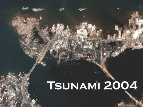
The view from above is key for humanitarian response. Indeed, satellite imagery has played an important role in relief operations since Hurricane Mitch in 1998. And the Indian Ocean Tsunami was the first to be captured from space as the way was still propagating. Some 650 images were produced using data from 15 different sensors. During the immediate aftermath of the Tsunami, satellite images were used at headquarters to assess the extent of the emergency. Later, satellite images were used in the field directly, distributed by the Humanitarian Information Center (HIC) and others to support and coordinate relief efforts. 
Screen Shot 2014-06-24 at 2.21.30 PM

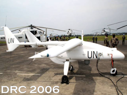
Satellites do present certain limitations, of course. These include cost, the time needed to acquire images, cloud cover, licensing issues and so on. In any event, two years after the Tsunami, an earlier iteration of the UN’s DRC Mission (MONUC) was supported by a European force (EUFOR), which used 4 Belgian UAVs. But I won’t be speaking about this type of UAV. For a variety of reasons, particularly affordability, ease of transport, regulatory concerns, and community engagement, UAVs used in humanitarian response are smaller systems or micro-UAVs that weigh just a few kilograms, such as one fixed-wing displayed below.
Screen Shot 2014-06-24 at 2.21.47 PM

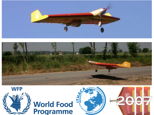
The World Food Program’s UAVs were designed and built at the University of Torino “way back” in 2007. But they’ve been grounded until this year due to lack of legislation in Italy.
Screen Shot 2014-06-24 at 2.22.05 PM

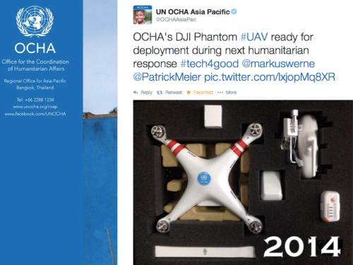
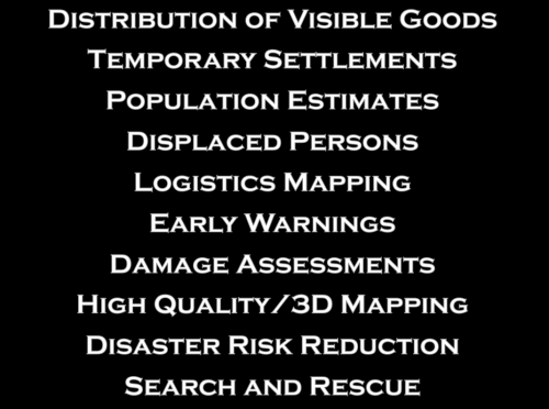
In June 2014, the UN’s Office for the Coordination of Humanitarian Affairs (OCHA) purchased a small quadcopter for use in humanitarian response and advocacy. Incidentally, OCHA is on the Advisory Board of the Humanitarian UAV Network, or UAViators. 
Screen Shot 2014-06-24 at 2.22.41 PM

Now, there are many uses cases for the operation of UAVs in humanitarian settings (those listed above are only a subset). All of you here at RPAS 2014 are already very familiar with these applications. So let me jump directly to real world case studies from the Philippines and Haiti.
Screen Shot 2014-06-24 at 2.23.08 PM

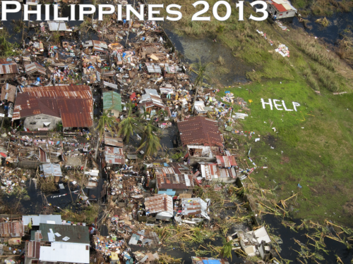
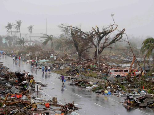
Typhoon Haiyan, or Yolanda as it was known locally, was the most powerful Typhoon in recorded human history to make landfall. The impact was absolutely devastated. I joined UN/OCHA in the Philippines following the Typhoon and was struck by how many UAV projects were being launched. What follows is just a few of said projects.
Screen Shot 2014-06-24 at 2.26.45 PM

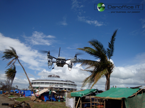
Danoffice IT, a company based in Lausanne, Switzerland, used the Sky-Watch Huginn X1 Quadcopter to support the humanitarian response in Tacloban. The rotary-wing UAV was used to identify where NGOs could set up camp. Later on, the UAV was used to support a range of additional tasks such as identifying which roads were passable for transportation/logistics. The quadcopter was also flown up the coast to assess the damage from the storm surge and flooding and to determine which villages had been most affected. This served to speed up the relief efforts and made the response more targeted vis-a-vis the provision of resources and assistance. Danoffice IT is also on the Board of the Humanitarian UAV Network (UAViators).
Screen Shot 2014-06-24 at 2.27.06 PM

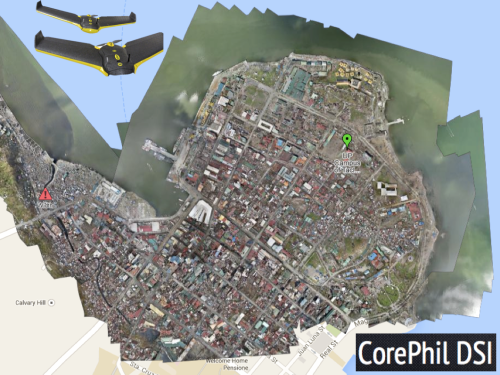
A second UAV project was carried out by local UAV start-up called CorePhil DSI. The team used an eBee to capture aerial imagery of downtown Tacloban, one of the areas hardest-hit by Typhoon Yolanda. They captured 22 Gigabytes of imagery and shared this with the Humanitarian OpenStreetMap Team (HOT) who are also on the Board of UAViators. HOT subsequently crowdsourced the tracing of this imagery (and satellite imagery) to create the most detailed and up-to-date maps of the area. These maps were shared with and used by multiple humanitarian organizations as well as the Filipino Government.
Screen Shot 2014-06-24 at 2.27.28 PM

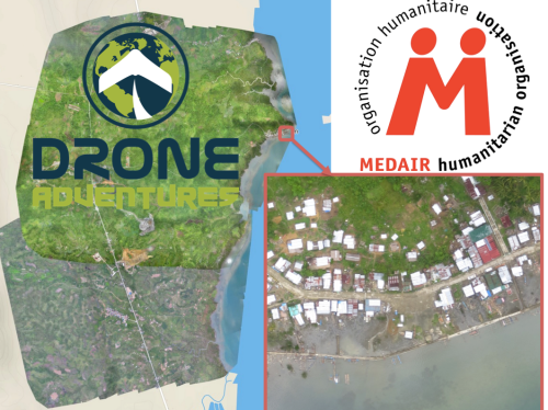
In a third project, the Swiss humanitarian organization Medair partnered with Drone Adventures to create a detailed set of 2D maps and 3D terrain models of the disaster-affected areas in which Medair works. These images were used to inform the humanitarian organization’s recovery and reconstruction programs. To be sure, Medair used the maps and models of Tacloban and Leyte to assist in assessing where the greatest need was and what level of assistance should be given to affected families as they continued to recover. Having these accurate aerial images of the affected areas allowed the Swiss organization to address the needs of individual households and—equally importantly—to advocate on their behalf when necessary.
Screen Shot 2014-06-24 at 3.20.08 PM

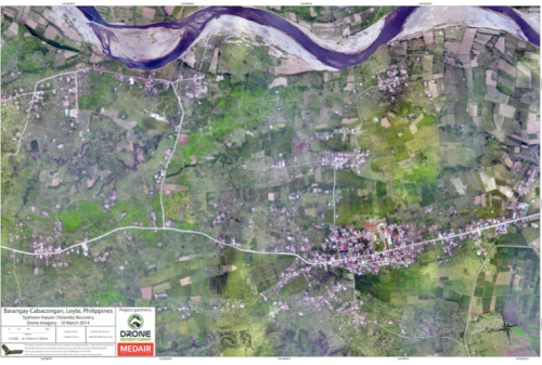
Drone Adventures also flew their fixed-wing UAVs (eBee’s) over Dulag, just north of Leyte, where more than 80% of homes and croplands were destroyed during the Typhoon. Medair is providing both materials and expertise to help build new shelters in Dulag. So the aerial imagery is proving invaluable to identify just how much material is needed and where. The captured imagery is also enabling community members themselves to better understand both where the greatest needs are an also what the potential solutions might be.
Screen Shot 2014-06-24 at 2.27.55 PM

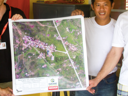
The partners are also committed to Open Data. The imagery captured was made available online and for free, enabling community leaders and humanitarian organizations to use the information to coordinate other reconstruction efforts. In addition, Drone Adventures and Medair presented locally-printed maps to community leaders within 24 hours of flying the UAVs. Some of these maps were printed on rollable, water proof banners, which make them more durable when used in the field.
Screen Shot 2014-06-24 at 2.28.11 PM

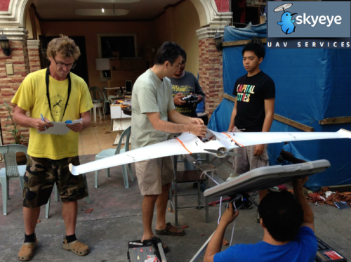
In yet another UAV project, the local Filipino start-up SkyEye Inc partnered with the University of the Philippines in Manila to develop expendable UAVs or xUAVs. The purpose of this initiative is to empower grassroots communities to deploy their own low-cost xUAVs and thus support locally-deployed response efforts. The team has trained 4 out of 5 teams across the Philippines to locally deploy UAVs in preparation for the next Typhoon season. In so doing, they are also transferring math, science and engineering skills to local communities. It is worth noting that community perceptions of UAVs in the Philippines and elsewhere has always been very positive. Indeed, local communities perceive small UAVs as toys more than anything else.
Screen Shot 2014-06-24 at 2.28.37 PM

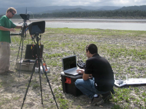
SkyEye worked with this group from the University of Hawaii to create disaster risk reduction models of flood-prone areas.
Screen Shot 2014-06-24 at 2.29.22 PM

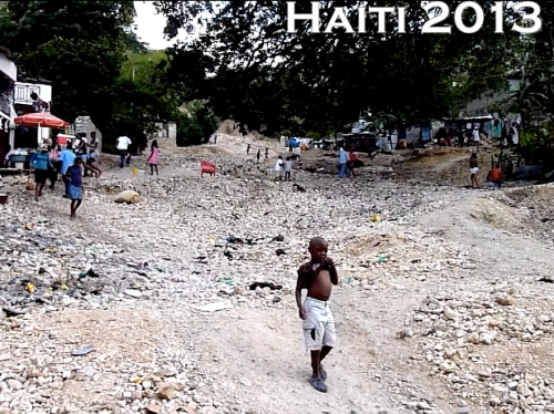
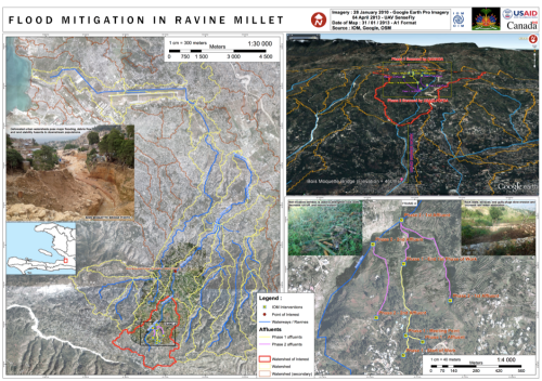
Moving to Haiti, the International Organization for Migration (IOM) has partnered with Drone Adventures and other to produce accurate topographical and 3D maps of disaster prone areas in the Philippines. These aerial images have been used to inform disaster risk reduction and community resilience programs. The UAVs have also enabled IOM to assess destroyed houses and other types of damage caused by floods and droughts. In addition, UAVs have been used to monitor IDP camps, helping aid workers identify when shelters are empty and thus ready to be closed. Furthermore, the high resolution aerial imagery has been used to support a census survey of public building, shelters, hospitals as well as schools.
Screen Shot 2014-06-24 at 2.29.46 PM

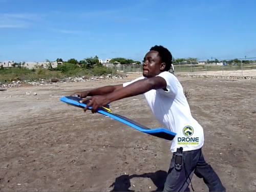
After Hurricane Sandy, for example, aerial imagery enabled IOM to very rapidly assess how many houses had collapsed near Rivière Grise and how many people were affected by the flooding. The aerial imagery was also used to identify areas of standing water where mosquitos and epidemics could easily thrive. Throughout their work with UAVs, IOM has stressed that regular community engagement has been critical for the successful use of UAVs. Indeed, informing local communities of the aerial mapping projects and explaining how the collected information is to be used is imperative. Local capacity building is also paramount, which is why Drone Adventures has trained a local team of Haitians to locally deploy and maintain their own eBee UAV.
Screen Shot 2014-06-24 at 2.30.27 PM

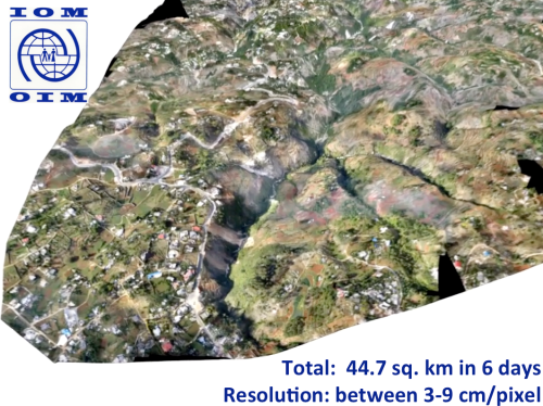
The pictures above and below are some of the information products produced by IOM and Drone Adventures. The 3D model above was used to model flood risk in the area and to inform subsequent disaster risk reduction projects.
Screen Shot 2014-06-24 at 2.30.47 PM

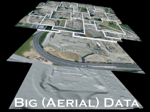
Several colleagues of mine have already noted that aerial imagery presents a Big Data challenge. This means that humanitarian organizations and others will need to use advanced computing (human computing and machine computing) to make sense of Big (Aerial) Data.
Screen Shot 2014-06-24 at 2.31.54 PM

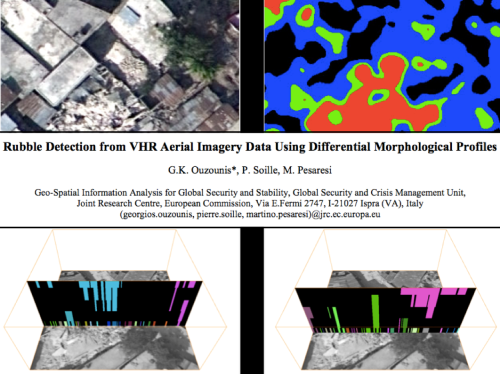
My colleagues at the European Commission’s Joint Research Center (JRC) are already beginning to apply advanced computing to automatically analyze aerial imagery. In the example from Haiti below, the JRC deployed a machine learning classifier to automatically identify rubble left over from the massive earthquake that struck Port-au-Prince in 2010. Their classifier had an impressive accuracy of 92%, “suggesting that the method in its simplest form is sufficiently reliable for rapid damage assessment.”
Screen Shot 2014-06-24 at 2.32.06 PM

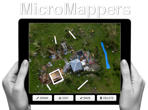
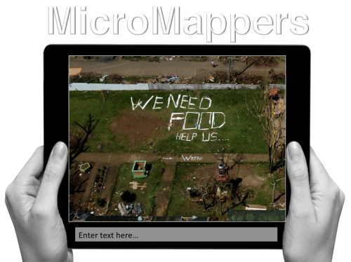
Human computing (or crowdsourcing) can also be used to make sense of Big Data. My team and I at QCRI have partnered with the UN (OCHA) to create the MicroMappers platform, which is a free and open-source tool to make sense of large datasets created during disasters, like aerial data. We have access to thousands of digital volunteers who can rapidly tag and trace aerial imagery; the resulting analysis of this tagging/tracing can be used to increase the situational awareness  of humanitarian organizations in the field.
Screen Shot 2014-06-24 at 2.32.43 PM


Digital volunteers can trace features of interest such as shelters without roofs. Our plan is to subsequently use these traced features as training data to develop machine learning classifiers that can automatically identify these features in future aerial images. We’re also exploring the second use-case depicted below, ie, the rapid transcription of imagery, which can then be automatically geo-tagged and added to a crisis map.
Screen Shot 2014-06-24 at 2.32.55 PM


The increasing use of UAVs during humanitarian disasters is why UAViators, the Humanitarian UAV Network, was launched. Recall the relief operations in response to Typhoon Yolanda; an unprecedented number of UAV projects were in operation. But most operators didn’t know about each other, so they were not coordinating flights let alone sharing imagery with local communities. Since the launch of UAViators, we’ve developed the first ever Code of Conduct for the use of UAVs in humanitarian settings, which includes guidelines on data protection and privacy. We have also drafted an Operational Check-List to educate those who are new to humanitarian UAVs. We are now in the process of carrying out a comprehensive evaluation of UAV models along with cameras, sensors, payload mechanism and image processing software. The purpose of this evaluation is to identify which are the best fit for use by humanitarians in the field. Since the UN and others are looking for training and certification programs, we are actively seeking partners to provide these services.
Screen Shot 2014-06-24 at 2.34.04 PM

The above goals are all for the medium to long term. More immediately, UAViators is working to educate humanitarian organizations on both the opportunities and challenges of using UAVs in humanitarian settings. UAViators is also working to facilitate the coordinate UAV flights during major disasters, enabling operators to share their flight plans and contact details with each other via the UAViators website. We are also planning to set up an SMS service to enable direct communication between operators and others in the field during UAV flights. Lastly, we are developing an online map for operators to easily share the imagery/videos they are collecting during relief efforts.
Screen Shot 2014-06-24 at 2.34.36 PM

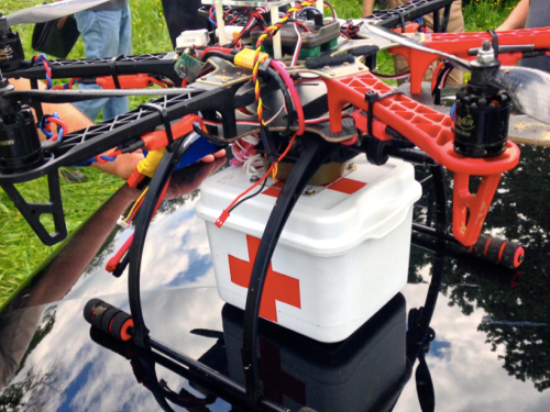
Data collection (imagery capture) is certainly not the only use case for UAVs in humanitarian contexts. The transportation of payloads may play an increasingly important role in the future. To be sure, my colleagues at UNICEF are actively exploring this with a number of partners in Africa.
Screen Shot 2014-06-24 at 2.34.47 PM

Other sensors also present additional opportunities for the use of UAVs in relief efforts. Sensors can be used to assess the impact of disasters on communication infrastructure, such as cell phone towers, for example. Groups are also looking into the use of UAVs to provide temporary communication infrastructure (“aerial cell phone towers”) following major disasters.
Screen Shot 2014-06-24 at 2.34.59 PM

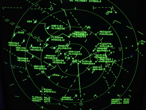
The need for Sense and Avoid systems (a.k.a. Detection & Avoid solutions) has been highlighted in almost every other presentation given at RPAS 2014. We really need this new technology earlier rather than later (and that’s a major  understatement). At the same time, it is important to emphasize that the main added value of UAVs in humanitarian settings is to capture imagery of areas that are overlooked or ignored by mainstream humanitarian relief operations; that is, of areas that are partially or completely disconnected logistically. By definition, disaster-affected communities in these areas are likely to be more vulnerable than others in urban areas. In addition, the airspaces in these disconnected regions are not complex airspaces and thus present fewer challenges around safety and coordination, for example.
Screen Shot 2014-06-24 at 2.35.19 PM

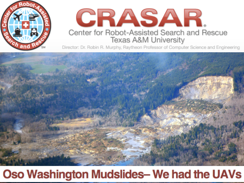
UAVs were ready to go following the mudslides in Oso, Washington back in March of this year. The UAVs were going to be used to look for survivors but the birds were not allowed to fly. The decision to ground UAVs and bar them from supporting relief and rescue efforts will become increasingly untenable when lives are at stake. I genuinely applaud the principle of proportionality applied by the EU and respective RPAS Associations vis-a-vis risks and regulations, but there is one very important variable missing in the proportionality equation: social benefit. Indeed, the cost benefit calculus of UAV risk & regulation in the context of humanitarian use must include the expected benefit of lives saved and suffering alleviated. Let me repeat this to make sure I’m crystal clear: risks must be weighed against potential lives saved.
Screen Shot 2014-06-24 at 2.35.39 PM

At the end of the day, the humanitarian context is different from precision agriculture or other commercial applications of UAVs such as film making. The latter have no relation to the Humanitarian Imperative. Having over-regulation stand in the way of humanitarian principles will simply become untenable. At the same time, the principle of Do No Harm must absolutely be upheld, which is why it features prominently in the Humanitarian UAV Network’s Code of Conduct. In sum, like the Do No Harm principle, the cost benefit analysis of proportionality must include potential or expected benefits as part of the calculus.

Screen Shot 2014-06-24 at 2.35.56 PM

To conclude, a new (forthcoming) policy brief by the UN (OCHA) publicly calls on humanitarian organizations to support initiatives like the Humanitarian UAV Network. This is an important, public endorsement of our work thus far. But we also need support from non-humanitarian organizations like those you represent in this room. For example, we need clarity on existing legislation. Our partners like the UN need to have access to the latest laws by country to inform their use of UAVs following major disasters. We really need your help on this; and we also need your help in identifying which UAVs and related technologies are likely to be a good fit for humanitarians in the field. So if you have some ideas, then please find me during the break, I’d really like to speak with you, thank you!

bio

See Also:

  • Crisis Map of UAV/Aerial Videos for Disaster Response [link]
  • How UAVs are Making a Difference in Disaster Response [link]
  • Humanitarians Using UAVs for Post Disaster Recovery [link]
  • Grassroots UAVs for Disaster Response [link]
  • Using UAVs for Search & Rescue [link]
  • Debrief: UAV/Drone Search & Rescue Challenge [link]
  • Crowdsourcing Analysis of UAV Imagery for Search/Rescue [link]
  • Check-List for Flying UAVs in Humanitarian Settings [link]

Picture Credits:

  • Danoffice IT; Drone Adventures, SkyEye, JRC


The Use of Expendable UAVs After Typhoon Haiyan

My colleague Dr. Imes Chiu recently co-authored this report (PDF) on his team’s use of expendable UAVs following Typhoon Haiyan (known as Typhoon Yolanda in the Philippines). Imes is Chief of Applied Research at the Center for Excellence in Disaster Management and Humanitarian Assistance (COE-DMHA) based in Honolulu, Hawaii.

Screen Shot 2014-06-09 at 8.46.51 AM

Highlights of the report:

  • “The interdisciplinary […] team concluded that during the rapid response phase of disaster management, aerial imagery of damaged areas proved more useful than a detailed needs-assessment.”
  • “Imagery provided by civil drones enabled local government units to immediately and accurately assess the extent of the damage in their jurisdictions, even when operating with a significantly reduced staff.”
  • “What they [relief workers] actually need at this point is to get an accurate understanding and a very detailed picture at the village level, at the camp level, as to what exactly is going on.”
  • “During Haiyan recovery operations, civil drones were quickly adopted as routine operating procedures for many humanitarian groups. Overcoming the logistical challenges posed by massive debris in Tacloban, civil drones provided many NGOs much needed situational awareness at a time when needs-assessment teams did not have access to the disaster area.”
  • “Initially used to pinpoint potential base camp locations for aid workers, many NGOs began adapted the use of civil drones to inform their relief, rescue and recovery operations from aerial views of infrastructure devastation, road and power line damages, emergency areas and relief distribution networks. Civil drones also helped ensure the safety of aid workers through regular information feeds of their movements in the affected areas.”
  • “The biggest challenge […] was determining a launch & recovery site sufficient for a fixed-wing xUAV, so the team used a multi-rotor helicopter drone that is vertically launched and recovered. Imagery from both video and still photography informed the acquisition team where to launch and recover the larger fixed-wing unit.”
  • “Even though this UAV subclass is termed ‘expendable,’ it does not mean the team intentionally or willingly ‘expends’ them, rather it means that the cost is so low and accessibility so high that the drones can be readily replace in case of loss—therefore users are not inhibited by the cost & loss factors.”
  • “A significant benefit of the xUAV is as an asset that could be locally employed and managed. They do not require a centralized command system; they are ‘locally modifiable’ so changes to the system can easily be done to meet community needs. These expendable systems by nature are small, inexpensive and not transportation limited. Unlike larger systems, xUAV could easily be hand carried to remote locations. The components are derived from everyday consumer technology backed by a large network of web-based support systems, often set-up by the academic community.”
  • “The team’s first effort started from a fixed-wing xUAV that covered an area of approximately 1.5 square kilometers at an altitude of 150 meters. The total flight time was approximately 30 minutes. The imagery acquired rendered a final mosaic at eight centimeter per pixel. The current xUAV configuration can fly and capture imagery for approximately an hour.”
  • “The xUAV platform used to generate the Tacloban mosaic imagery consisted of widely available parts that can be purchased for approximately $1,000. This is significantly cheaper than the more expensive commercial ‘turnkey’ systems.”


Bio

See Also:

  • Welcome to the Humanitarian UAV Network [link]
  • How UAVs are Making a Difference in Disaster Response [link]
  • Humanitarians Using UAVs for Post Disaster Recovery [link]
  • Grassroots UAVs for Disaster Response [link]
  • Using UAVs for Search & Rescue [link]
  • Debrief: UAV/Drone Search & Rescue Challenge [link]
  • Crowdsourcing Analysis of UAV Imagery for Search/Rescue [link]
  • Check-List for Flying UAVs in Humanitarian Settings [link]

Humanitarians Using UAVs for Post Disaster Recovery

I recently connected with senseFly’s Adam Klaptocz who founded the non-profit group DroneAdventures to promote humanitarian uses of UAVs. I first came across Adam’s efforts last year when reading about his good work in Haiti, which demonstrated the unique role that UAV technology & imagery can play in post-disaster contexts. DroneAdventures has also been active in Japan and Peru. In the coming months, the team will also be working on “aerial archeology” projects in Turkey and Egypt. When Adam emailed me last week, he and his team had just returned from yet another flying mission, this time in the Philippines. I’ll be meeting up with Adam in a couple weeks to learn more about their recent adventures. In the meantime, here’s a quick recap of what they were up to in the Philippines this month.

MedAir

Adam and team snapped hundreds of aerial images using their “eBee drones” to create a detailed set of 2D maps and 3D terrain models of the disaster-affected areas where partner Medair works. This is the first time that the Swiss humanitarian organization Medair is using UAVs to inform their recovery and rehabilitation programs. They plan to use the UAV maps & models of Tacloban and hard-hit areas in Leyte to assist in assessing “where the greatest need is” and what level of “assistance should be given to affected families as they continue to recover” (1). To this end, having accurate aerial images of these affected areas will allow the Swiss organization to “address the needs of individual households and advocate on their behalf when necessary” (2). 

ebee

An eBee Drone also flew over Dulag, north of Leyte, where more than 80% of the homes and croplands were destroyed following Typhoon Yolanda. Medair is providing both materials and expertise to build new shelters in Dulag. As one Medair representative noted during the UAV flights, “Recovery from a disaster of this magnitude can be complex. The maps produced from the images taken by the drones will give everyone, including community members themselves, an opportunity to better understand not only where the greatest needs are, but also their potential solutions” (3). The partners are also committed to Open Data: “The images will be made public for free online, enabling community leaders and humanitarian organizations to use the information to coordinate reconstruction efforts” (4). The pictures of the Philippines mission below were very kindly shared by Adam who asked that they be credited to DroneAdventures.

Credit: DroneAdventures

At the request of the local Mayor, DroneAdventures and MedAir also took aerial images of a relatively undamaged area some 15 kilometers north of Tacloban, which is where the city government is looking to relocate families displaced by Typhoon Yolanda. During the deployment, Adam noted that “Lightweight drones such as the eBee are safe and easy to operate and can provide crucial imagery at a precision and speed unattainable by satellite imagery. Their relatively low cost of deployment make the technology attainable even by small communities throughout the developing world. Not only can drones be deployed immediately following a disaster in order to assess damage and provide detailed information to first-responders like Medair, but they can also assist community leaders in planning recovery efforts” (5). As the Medair rep added, “You can just push a button or launch them by hand to see them fly, and you don’t need a remote anymore—they are guided by GPS and are inherently safe” (6).

Credit: DroneAdventures

I really look forward to meeting up with Adam and the DroneAdventures team at the senseFly office in Lausanne next month to learn more about their recent work and future plans. I will also be asking the team for their feedback and guidance on the Humanitarian UAV Network (UAViators) that I am launching. So stay tuned for updates!

Bio

See also:

  • Calling All UAV Pilots: Want to Support Humanitarian Efforts? [link]
  • How UAVs are Making a Difference in Disaster Response [link]
  • Grassroots UAVs for Disaster Response (in the Philippines) [link]


Grassroots UAVs for Disaster Response

I was recently introduced to a new initiative that seeks to empower grassroots communities to deploy their own low-cost xUAVs. The purpose of this initiative? To support locally-led disaster response efforts and in so doing transfer math, science and engineering skills to local communities. The “x” in xUAV refers to expendable. The initiative is a partnership between California State University (Long Beach), University of Hawaii, Embry Riddle, The Philippine Council for Industry, Energy & Emerging Technology Research & Development, Skyeye, Aklan State University and Ateneo de Manila University in the Philippines. The team is heading back to the Philippines next week for their second field mission. This blog post provides a short overview of the project’s approach and the results from their first mission, which took place during December 2013-February 2014.

xUAV1

The xUAV team is specifically interested in a new category of UAVs, those that are locally available, locally deployable, low-cost, expendable and extremely easy to use. Their first field mission to the Philippines focused on exploring the possibilities. The pictures above/below (click to enlarge) were kindly shared by the Filipinos engaged in the project—I am very grateful to them for allowing me to share these publicly. Please do not reproduce these pictures without their written permission, thank you.

xUAV2

I spoke at length with one of the xUAV team leads, Ted Ralston, who is heading back to the Philippines the second field mission. The purpose of this follow up visit is to shift the xUAV concept from experimental to deployable. One area that his students will be focusing on with the University of Manila is the development of a very user-friendly interface (using a low-cost tablet) to pilot the xUAVs so that local communities can simply tag way-points on a map that the xUAV will then automatically fly to. Indeed, this is where civilian UAVs are headed, full automation. A good example of this trend towards full automation is the new DroidPlanner 2.0 App just released by 3DRobotics. This free app provides powerful features to very easily plan autonomous flights. You can even create new flight plans on the fly and edit them onsite.

DroidPlanner.png

So the xUAV team will focus on developing software for automated take-off and landing as well as automated adjustments for wind conditions when the xUAV is airborne, etc. The software will also automatically adjust the xUAV’s flight parameters for any added payloads. Any captured imagery would then be made easily viewable via touch-screen directly from the low-cost tablet.

xUAV3

One of the team’s top priorities throughout this project is to transfer their skills to young Filipinos, given them hands on training in science, math and engineering. An equally important, related priority, is their focus on developing local partnerships with multiple partners. We’re familiar with ideas behind Public Participatory GIS (PPGIS) vis-a-vis the participatory use of geospatial information systems and technologies. The xUAV team seeks to extend this grassroots approach to Public Participatory UAVs.

xUAV4

I’m supporting this xUAV initiative in a number of ways and will be uploading the team’s UAV imagery (videos & still photos) from their upcoming field mission to MicroMappers for some internal testing. I’m particularly interested in user-generated (aerial) content that is raw and not pre-processed or stitched together, however. Why? Because I expect this type of imagery to grow in volume given the very rapid growth of the personal micro-UAV market. For more professionally produced and stitched-together aerial content, an ideal platform is Humanitarian OpenStreetMap’s Tasking Server, which is tried and tested for satellite imagery and which was recently used to trace processed UAV imagery of Tacloban.

Screen Shot 2014-03-12 at 1.03.20 PM

I look forward to following the xUAV team’s efforts and hope to report on the outcome of their second field mission. The xUAV initiative fits very nicely with the goals of the Humanitarian UAV Network (UAViators). We’ll be learning a lot in the coming weeks and months from our colleagues in the Philippines.

bio

Combining Radio, SMS and Advanced Computing for Disaster Response

I’m headed to the Philippines this week to collaborate with the UN Office for the Coordination of Humanitarian Affairs (OCHA) on humanitarian crowdsourcing and technology projects. I’ll be based in the OCHA Offices in Manila, working directly with colleagues Andrej Verity and Luis Hernando to support their efforts in response to Typhoon Yolanda. One project I’m exploring in this respect is a novel radio-SMS-computing initiative that my colleague Anahi Ayala (Internews) and I began drafting during ICCM 2013 in Nairobi last week. I’m sharing the approach here to solicit feedback before I land in Manila.

Screen Shot 2013-11-25 at 6.21.33 AM

The “Radio + SMS + Computing” project is firmly grounded in GSMA’s official Code of Conduct for the use of SMS in Disaster Response. I have also drawn on the Bellagio Big Data Principles when writing up the in’s and out’s of this initiative with Anahi. The project is first and foremost a radio-based initiative that seeks to answer the information needs of disaster-affected communities.

The project: Local radio stations in the Philippines would create and broadcast radio programs inviting local communities to serve as “community journalists” to describe how the Typhoon has impacted their communities. The radio stations would provide a free SMS short-code and invite said communities to text in their observations. Each radio station would include in their broadcast a unique 2-letter identifier and would ask those texting in to start their SMS with that identifier. They would also emphasize that text messages should not include any Personal Identifying Information (PII) and no location information either. Those messages that do include PII would be deleted.

Text messages sent to the SMS short code would be automatically triaged by radio station (using the 2-letter identifier) and forwarded to the respective radio stations via SMS. (At this point, few local radio stations have web access in the disaster-affected areas). These radio stations would be funded to create radio programs based on the SMS’s received. These programs would conclude by asking local communities to text in their information needs—again using the unique radio identifier as a prefix in the text messages. Radio stations would create follow-up programs to address the information needs texted in by local communities (“news you can use”). This could be replicated on a weekly basis and extended to the post-disaster reconstruction phase.

Yolanda destruction

In parallel, the text messages documenting the impact of the Typhoon at the community level would be categorized by Cluster—such as shelter, health, education, etc. Each classified SMS would then be forwarded to the appropriate Cluster Leads. This is where advanced computing comes in: the application of microtasking and machine learning. Trusted Filipino volunteers would be invited to tag each SMS by Cluster-category (and also translate relevant text messages into English). Once enough text messages have been tagged per category, the use of machine learning classifiers would enable the automatic classification of incoming SMS’s. As explained above, these classified SMS’s would then be automatically forwarded to a designated point of contact at each Cluster Agency.

This process would be repeated for SMS’s documenting the information needs of local communities. In other words, information needs would be classified by Cluster category and forwarded to Cluster Leads. The latter would share their responses to stated information needs with the radio stations who in turn would complement their broadcasts with the information provided by the humanitarian community, thus closing the feedback loop.

The radio-SMS project would be strictly opt-in. Radio programs would clearly state that the data sent in via SMS would be fully owned by local communities who could call in or text in at any time to have their SMS deleted. Phone numbers would only be shared with humanitarian organization if the individuals texting to radio stations consented (via SMS) to their numbers being shared. Inviting communities to act as “citizen journalists” rather than asking them to report their needs may help manage expectations. Radio stations can further manage these expectations during their programs by taking questions from listeners calling in. In addition, the project seeks to limit the number of SMS’s that communities have to send. The greater the amount of information solicited from disaster-affected communities, the more challenging managing expectations may be. The project also makes a point of focusing on local information needs as the primary entry point. Finally, the data collection limits the geographical resolution to the village level for the purposes of data privacy and protection.

AIDR logo

It remains to be seen whether this project gets funded, but I’d welcome any feedback iRevolution readers may have in any event since this approach could also be used in future disasters. In the meantime, my QCRI colleagues and I are looking to modify AIDR to automatically classify SMS’s (in addition to tweets). My UNICEF colleagues already expressed to me their need to automatically classify millions of text messages for their U-Report project, so I believe that many other humanitarian and development organizations will benefit from a free and open source platform for automatic SMS classification. At the technical level, this means adding “batch-processing” to AIDR’s current “streaming” feature. We hope to have an update on this in coming weeks. Note that a batch-processing feature will also allow users to upload their own datasets of tweets for automatic classification. 

Bio

Early Results of MicroMappers Response to Typhoon Yolanda (Updated)

We have completed our digital humanitarian operation in the Philippines after five continuous days with MicroMappers. Many, many thanks to all volunteers from all around the world who donated their time by clicking on tweets and images coming from the Philippines. Our UN OCHA colleagues have confirmed that the results are being shared widely with their teams in the field and with other humanitarian organizations on the ground. More here.

ImageClicker

In terms of preliminary figures (to be confirmed):

  • Tweets collected during first 48 hours of landfall = ~230,000
  • Tweets automatically filtered for relevancy/uniqueness = ~55,000
  • Tweets clicked using the TweetClicker = ~ 30,000
  • Relevant tweets triangulated using TweetClicker = ~3,800
  • Triangulated tweets published on live Crisis Map = ~600
  • Total clicks on TweetClicker = ~ 90,000
  • Images clicked using the ImageClicker = ~ 5,000
  • Relevant images triangulated using TweetClicker = ~1,200
  • Triangulated images published on live Crisis Map = ~180
  • Total clicks on ImageClicker = ~15,000
  • Total clicks on MicroMappers (Image + Tweet Clickers) = ~105,000

Since each single tweet and image uploaded to the Clickers was clicked on by (at least) three individual volunteers for quality control purposes, the number of clicks is three times the total number of tweets and images uploaded to the respective clickers. In sum, digital humanitarian volunteers have clocked a grand total of ~105,000 clicks to support humanitarian operations in the Philippines.

While the media has largely focused on the technology angle of our digital humanitarian operation, the human story is for me the more powerful message. This operation succeeded because people cared. Those ~105,000 clicks did not magically happen. Each and every single one of them was clocked by humans, not machines. At one point, we had over 300 digital volunteers from the world over clicking away at the same time on the TweetClicker and more than 200 on the ImageClicker. This kind of active engagement by total strangers—good “digital Samaritans”—explains why I find the human angle of this story to be the most inspiring outcome of MicroMappers. “Crowdsourcing” is just a new term for the old saying “it takes a village,” and sometimes it takes a digital village to support humanitarian efforts on the ground.

Until recently, when disasters struck in faraway lands, we would watch the news on television wishing we could somehow help. That private wish—that innate human emotion—would perhaps translate into a donation. Today, not only can you donate cash to support those affected by disasters, you can also donate a few minutes of your time to support the operational humanitarian response on the ground by simply clicking on MicroMappers. In other words, you can translate your private wish into direct, online public action, which in turn translates into supporting offline collective action in the disaster-affected areas.

Clicking is so simple that anyone with Internet access can help. We had high schoolers in Qatar clicking away, fire officers in Belgium, graduate students in Boston, a retired couple in Kenya and young Filipinos clicking away. They all cared and took the time to try and help others, often from thousands of miles away. That is the kind of world I want to live in. So if you share this vision, then feel free to join the MicroMapper list-serve.

Yolanda TweetClicker4

Considering that MicroMappers is still very much under development, we are all pleased with the results. There were of course many challenges; the most serious was the CrowdCrafting server which hosts our Clickers. Unfortunately, that server was not able to handle the load and traffic generated by digital volunteers. So their server crashed twice and also slowed our Clickers to a complete stop at least a dozen times during the past five days. At times, it would take 10-15 seconds for a new tweet or image to load, which was frustrating. We were also limited by the number of tweets and images we could upload at any given time, usually ~1,500 at most. Any larger load would seriously slow down the Clickers. So it is rather remarkable that digital volunteers managed to clock more than 100,000 clicks given the repeated interruptions. 

Besides the server issue, the other main bottleneck was the geo-location of the ~30,000 tweets and ~5,000 images tagged using the Clickers. We do have a Tweet and Image GeoClicker but these were not slated to launch until next week at CrisisMappers 2013, which meant they weren’t ready for prime time. We’ll be sure to launch them soon. Once they are operational, we’ll be able to automatically push triangulated tweets and images from the Tweet and Image Clickers directly to the corresponding GeoClickers so volunteers can also aid humanitarian organizations by mapping important tweets and images directly.

There’s a lot more that we’ve learned throughout the past 5 days and much room for improvement. We have a long list of excellent suggestions and feedback from volunteers and partners that we’ll be going through starting tomorrow. The most important next step is to get a more powerful server that can handle a lot more load and traffic. We’re already taking action on that. I have no doubt that our clicks would have doubled without the server constraints.

For now, though, BIG thanks to the SBTF Team and in particular Jus McKinnon, the QCRI et al team, in particular Ji Lucas, Hemant Purohit and Andrew Ilyas for putting in very, very long hours, day in and day out on top of their full-time jobs and studies. And finally, BIG thanks to the World Wide Crowd, to all you who cared enough to click and support the relief operations in the Philippines. You are the heroes of this story.

bio

Live Crisis Map of Disaster Damage Reported on Social Media

Update: See early results of MicroMappers deployment here

Digital humanitarian volunteers have been busing tagging images posted to social media in the aftermath of Typhoon Yolanda. More specifically, they’ve been using the new MicroMappers ImageClicker to rate the level of damage they see in each image. Thus far, they have clicked over 7,000 images. Those that are tagged as “Mild” and “Severe” damage are then geolocated by members of the Standby Volunteer Task Force (SBTF) who have partnered with GISCorps and ESRI to create this live Crisis Map of the disaster damage tagged using the ImageClicker. The map takes a few second to load, so please be patient.

YolandaPH Crisis Map 1

The more pictures are clicked using the ImageClicker, the more populated this crisis map will become. So please help out if you have a few seconds to spare—that’s really all it takes to click an image. If there are no picture left to click or the system is temporarily offline, then please come back a while later as we’re uploading images around the clock. And feel free to join our list-serve in the meantime if you wish to be notified when humanitarian organizations need your help in the future. No prior experience or training necessary. Anyone who knows how to use a computer mouse can become a digital humanitarian.

The SBTF, GISCorps and ESRI are members of the Digital Humanitarian Network (DHN), which my colleague Andrej Verity and I co-founded last year. The DHN serves as the official interface for direct collaboration between traditional “brick-and-mortar” humanitarian organizations and highly skilled digital volunteer networks. The SBTF Yolanda Team, spearheaded by my colleague Justine Mackinnon, for example, has also produced this map based on the triangulated results of the TweetClicker:

YolandaPH Crisis Map 2
There’s a lot of hype around the use of new technologies and social media for disaster response. So I want to be clear that our digital humanitarian operations in the Philippines have not been perfect. This means  that we’re learning (a lot) by doing (a lot). Such is the nature of innovation. We don’t have the luxury of locking ourselves up in a lab for a year to build the ultimate humanitarian technology platform. This means we have to work extra, extra hard when deploying new platforms during major disasters—because not only do we do our very best to carry out Plan A, but we often have to carry out  Plans B and C in parallel just in case Plan A doesn’t pan out. Perhaps Samuel Beckett summed it up best: “Ever tried. Ever failed. No matter. Try Again. Fail again. Fail better.”

bio