Tag Archives: Tanzania

How Zanzibaris are Hacking Flying Robots

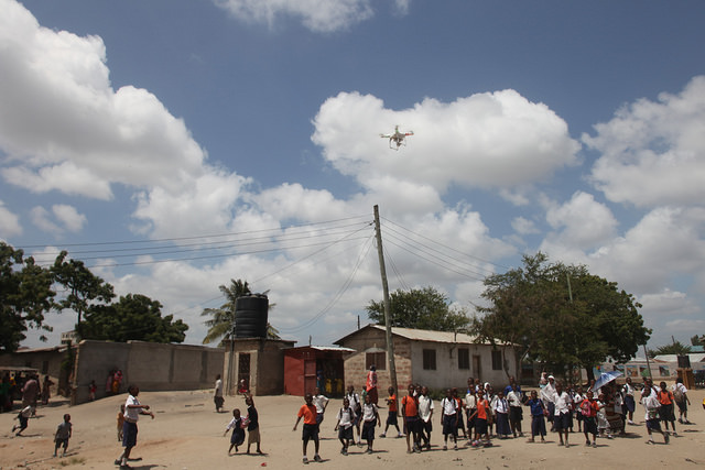
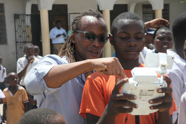
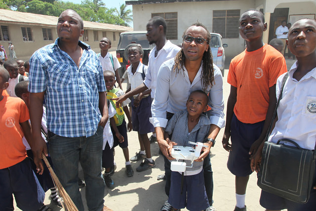
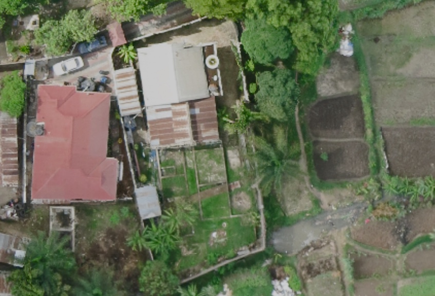
Island life can be rough for flying robots. They have to contend with sandy beaches, sea salt, overbearing heat, humidity, high winds and rapidly changing weather patterns featuring sudden downpours. Birds of prey can also be a major menace for flying robots. While these aren’t exactly the types of problems one typically comes across at humanitarian innovation labs in New York, Geneva or Singapore, they’re part of everyday life for our Tanzania Flying Labs and partners like the State University of Zanzibar (SUZA). When team and I at WeRobotics were in Tanzania last month to continue building the local capacity of our Flying Labs, I had the opportunity to learn first hand from our Tanzanian friends about how they hack robotics solutions to survive island life.

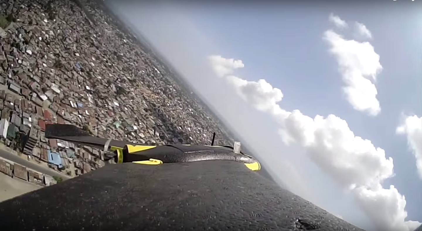
Birds of prey are no joke when their airspace is invaded. I’ve experienced this several times while flying robots (UAVs/drones) over the past four years. The aerial photograph above, for example, was taken about 2 years ago in South Africa. I raced to land my UAV as soon as I spotted the eagle but the bird came in for attack nonetheless. I was seriously worried that the eagle would be injured but luckily it swerved away at the last second.

Turns out birds of prey are a problem for many UAV pilots around the world. According to senseFly, a leading UAV manufacturer, bird strikes against UAVs are “surprisingly common and occur in many parts of the world; not only in Australia but also parts of Africa, select US states, parts of Europe and in Latin America.” Our Tanzanian team and partners face similar challenges when flying in Zanzibar, with some of their UAVs no longer operational after encounters with birds of prey. So they’ve tried a number of different tactics and the one that seems to work the best for now is deceivingly simple.

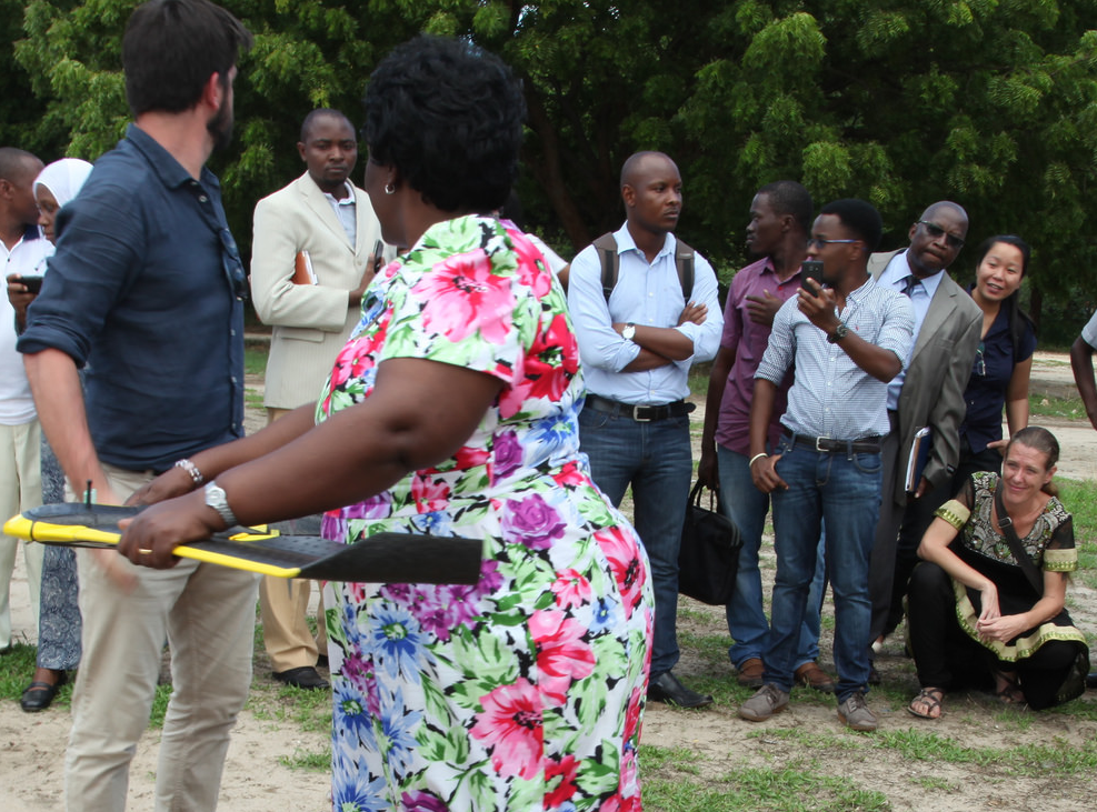
I found about this while looking over the shoulder of my colleague Khadija as she was prepared a third UAV for flight. I hadn’t seen aluminum foil on a flying robot before and couldn’t figure out what it was for. So I asked Khadija, who explained: “This is to keep the birds away; they don’t like it when we invade their airspace, they were there first, after all. So we simply tape some foil to a wing, which shines and keeps the birds away.” Perhaps the eagles realize that birds aren’t supposed to shine, so they keep their distance. Now, this isn’t exactly a sexy solution by any means, and it barely costs 25 cents, but it works.

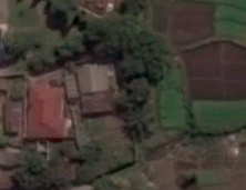
Humanitarian technology doesn’t have to be shiny or expensive, it just has to work. Another simple way that our Zanzibari friends are hacking UAV flights to help robots cope with island life has to do with the orange tarp below.

When aerial robots land on sand, the grains can wreck havoc on the motors, cameras and sensors. This is especially true if you’re flying (and landing) several times a day for many weeks on end. It’s also worth noting that non-sandy landing sites can be quite few and far between in some parts of the island. So our local colleagues have been experimenting with fishing nets and most recently tarps in order to catch the robots as they come in for landing. They’re still working on refining this technique as this video shows:

Have you come across other examples of local adaptations of robotics/UAV technology in Africa, Asia or Latin America? If so, I’d really like to hear from you so I can share them with our growing network of Flying Labs. Thank you!

Why Robots Are Flying Over Zanzibar and the Source of the Nile

An expedition in 1858 revealed that Lake Victoria was the source of the Nile. We found ourselves on the shores of Africa’s majestic lake this October, a month after a 5.9 magnitude earthquake struck Tanzania’s Kagera Region. Hundreds were injured and dozens killed. This was the biggest tragedy in decades for the peaceful lakeside town of Bukoba. The Ministry of Home Affairs invited WeRobotics to support the recovery and reconstruction efforts by carrying out aerial surveys of the affected areas. 

2016-10-10-08-14-57-hdr

The mission of WeRobotics is to build local capacity for the safe and effective use of appropriate robotics solutions. We do this by co-creating local robotics labs that we call Flying Labs. We use these Labs to transfer the professional skills and relevant robotics solutions to outstanding local partners. Our explicit focus on capacity building explains why we took the opportunity whilst in Kagera to train two Tanzanian colleagues. Khadija and Yussuf joined us from the State University of Zanzibar (SUZA). They were both wonderful to work with and quick learners too. We look forward to working with them and other partners to co-create our Flying Labs in Tanzania. More on this in a future post.

Aerial Surveys of Kagera Region After The Earthquake

We surveyed multiple areas in the region based on the priorities of our local partners as well as reports provided by local villagers. We used the Cumulus One UAV from our technology partner DanOffice to carry out the flights. The Cumulus has a stated 2.5 hour flight time and 50 kilometer radio range. We’re using software from our partner Pix4D to process the 3,000+ very high resolution images captured during our 2 days around Bukoba.

img_6753

Above, Khadija and Yussuf on the left with a local engineer and a local member of the community on the right, respectfully. The video below shows how the Cumulus takes off and lands. The landing is automatic and simply involves the UAV stalling and gently gliding to the ground. 

We engaged directly with local communities before our flights to explain our project and get their permissions to fly. Learn more about our Code of Conduct.

img_6807

Aerial mapping with fixed-wing UAVs can identify large-scale damage over large areas and serve as a good base map for reconstruction. A lot of the damage, however, can be limited to large cracks in walls, which cannot be seen with nadir (vertical) imagery. We thus flew over some areas using a Parrot Bebop2 to capture oblique imagery and to get closer to the damage. We then took dozens of geo-tagged images from ground-level with our phones in order to ground-truth the aerial imagery.

img_6964

We’re still processing the resulting imagery so the results below are simply the low resolution previews of one (out of three) surveys we carried out.

ortho1_bukoba

Both Khadija and Yussuf were very quick learners and a real delight to work with. Below are more pictures documenting our recent work in Kagera. You can follow all our trainings and projects live via our Twitter feed (@werobotics) and our Facebook page. Sincerest thanks to both Linx Global Intelligence and UR Group for making our work in Kagera possible. Linx provided the introduction to the Ministry of Home Affairs while the UR Group provided invaluable support on the logistics and permissions.

img_6827

Yussuf programming the flight plan of the Cumulus

img_6875

Khadija is setting up the Cumulus for a full day of flying around Bukoba area

img_6756

Khadija wants to use aerial robots to map Zanzibar, which is where she’s from

img_6787

Community engagement is absolutely imperative

img_6791

Local community members inspecting the Parrot’s Bebop2

From the shores of Lake Victoria to the coastlines of Zanzibar

Together with the outstanding drone team from the State University of Zanzibar, we mapped Jozani Forest and part of the island’s eastern coastline. This allowed us to further field-test our long-range platform and to continue our local capacity building efforts following our surveys near the Ugandan border. Here’s a picture-based summary of our joint efforts.

2016-10-14-09-09-48

Flying Labs Coordinator Yussuf sets up the Cumulus UAV for flight

2016-10-13-14-44-27-hdr

Turns out selfie sticks are popular in Zanzibar and kids love robots.

2016-10-14-10-01-25

Khairat from Team SUZA is operating the mobile air traffic control tower. Team SUZA uses senseFly eBees for other projects on the island.

2016-10-15-09-03-10

Another successful takeoff, courtesy of Flying Labs Coordinator Yussuf.

2016-10-15-11-11-20

We flew the Cumulus at a speed of 65km/h and at an altitude of 265m.

2016-10-15-13-11-13

The Cumulus flew for 2 hours, making this our longest UAV flight in Zanzibar so far.

2016-10-15-10-38-51-hdr

Khadija from Team SUZA explains to local villagers how and why she maps Zanzibar using flying robots.

2016-10-15-17-26-23

Tide starts rushing back in. It’s important to take the moon into account when mapping coastlines, as the tide can change drastically during a single flight and thus affect the stitching process.

The content above is cross-posted from WeRobotics.

World Bank Using UAVs for Disaster Risk Reduction in Tanzania

An innovative World Bank team in Tanzania is exploring the use of UAVs for disaster risk reduction efforts. Spearheaded by colleague Edward Anderson, the team recently partnered with friends at Drone Adventures to capture very high-resolution images of flood-prone areas in the country’s capital. This imagery is now being used to generate Digital Terrain Models to develop more reliable flood-inundation models at an unparalleled level of resolution. This project is a joint effort with the Commission for Science and Technology (COSTECH) and kindly supported by the Swedish International Development Agency and the Global Facility for Disaster Risk Reduction (GFDRR), working in partnership with the Tanzania Red Cross.

Drone Adventures flew dozens of flights over the course of 10 days, covering close to 90km² at a resolution of 4cm-8cm. They used eBees, which weigh about 700 grams and are 95% foam-based with a small properly facing the back, which makes the UAV extra safe. Here are some pictures (click to enlarge) from the recent mission in Dar es Salam, courtesy of Mark Iliffe from the Bank.

16544751406_dd5feb3ae3_z

15948142154_81b0b854bf_z

Screen Shot 2015-08-14 at 1.17.32 PM

Screen Shot 2015-08-14 at 1.28.41 PM

16569015351_b1d0907f7f_z

Screen Shot 2015-08-16 at 4.18.40 PM

The World Bank Team also used a DJI Phantom 2 UAV pictured below. Like Drone Adventures, they also took the time to engage local communities. This approach to community engagement in UAV projects is an important component of the UAViators Code of Conduct and Guidelines. The team is using the DJI Phantom to inform urban planning and transportation conversations, and to quickly assess flood impact, as this video explains.

16569539912_0c7a5ca5b2_z

16384737537_773757f8fc_z

16384734007_e1b739b1f0_z
16570687475_0846dcaf87_z
Screen Shot 2015-08-16 at 4.18.16 PM

Screen Shot 2015-08-16 at 4.17.53 PM

Most of the resulting imagery has already been added to OpenAerialMap here. The imagery is also being used here as part of the Missing Maps project. This has already improved the level of detail of Dar es Salam maps. For example, compare the level of detail in this map before the aerial imagery was made available:

Screen Shot 2015-08-14 at 1.55.26 PM

With these more detailed maps enabled by the availability of aerial imagery:

Screen Shot 2015-08-14 at 1.57.22 PM

Screen Shot 2015-08-14 at 2.01.40 PM

Screen Shot 2015-08-14 at 2.02.12 PM

And here’s a comparison of a satellite image (taken from Google Earth) of a neighborhood in Dar es Salam with an areal image (from an eBee) at around the same spatial resolution.

Screen Shot 2015-08-16 at 5.34.08 PM

thumb_Screen Shot 2015-08-16 at 5.37.02 PM_1024

As Mark from the World Bank noted during a recent conversation, making this aerial imagery open and making the data derived from this imagery open “gives agencies and municipalities data that they’ve not had access to previously. But there are still outstanding questions such as authoritativeness that need to be resolved. There is a lot of institutional work with statistics and mapping agencies that is ongoing to validate the data and ensure they’re happy with it, prior to it augmenting traditional mapping practices. That’s where we’re at currently.”

Acknowledgements: Many thanks to Edward & Mark for sharing their efforts.