Tag Archives: WeRobotics

WeRobotics for Humans in a Hurry

We need to be better at communicating what WeRobotics is (and isn’t) to fellow humans. We can’t expect everyone to have the time to read through most of these blog posts and somehow immediately understand the big picture. We are keen to share more about our community, culture, and methodology. The FAQ below is a way to share more about our work. We are learning as we build. Feel free to share this post with anyone who might benefit from more clarity. It’s a quick 3 minute read. 

Is WeRobotics a for-profit company?

WeRobotics is a registered not-for-profit in the US and a tax-exempt organization in Switzerland.

Are Flying Labs for-profit companies?

Flying Labs are coordinated by local not-for-profit organizations and/or local companies. 

What is the difference between Flying Labs and WeRobotics Labs?

There are no such things as WeRobotics Labs.

Flying Labs are independently organized centers of expertise that are coordinated by local experts pin the Global South. Calling them WeRobotics Labs instead of Flying Labs might suggest they are staffed and managed by WeRobotics and belong to WeRobotics. Flying Labs are not staffed or managed by WeRobotics and are not owned by WeRobotics. Furthermore, calling them WeRobotics Labs would be disrespectful as doing so would take attention away from local experts who run their Flying Labs. Calling them WeRobotics Labs would directly undermine everyone’s efforts. 

Is FlyingLabs.org its own legal entity?

We’re using WeRobotics to co-create an independent international organization deeply rooted in the Global South and run entirely by leaders from the Global South. This has been our goal from the very start. As a first step, we are co-creating a network of country-level Flying Labs across Africa, Asia and Latin America. The second step is to secure systems change funding to co-create FlyingLabs.org as its own legal entity with its own leadership selected from and by country-level Flying Labs. We have already developed a concrete, 5-year plan and budget to launch FlyingLabs.org as its own independent entity.

What happens to WeRobotics after FlyingLabs.org becomes its own organization?

FlyingLabs.org may want to hire WeRobotics for certain projects or roles as needed. In addition, WeRobotics will offer new consulting services such as enabling other organizations to adopt the “Flying Labs Formula” at scale. Consulting projects represent around 30% of our revenue today. We will continue to grow this revenue stream to 80% of total revenue by the time FlyingLabs.org becomes its own legal entity. The remaining 20% will be grant funding to cover core.

What do you mean by “decolonizing technology for good”?

In this recent blog post, we talk about “the colonization of the public sphere through the use of instrumental technical rationality. In this sphere, complex social problems are reduced to technical questions, effectively removing the plurality of contending perspectives.” By advocating for the “decolonization of technology for good” we advocate against the reduction of complex social problems into technical problems. Equally importantly, we advocate for restoring the plurality of contending perspectives. In our case, this means strongly advocating for the Power of Local.

Decolonization is a rather loaded word.

Is that question or comment? Just kidding. Yes, decolonization is a loaded term. We discussed this at length with Flying Labs during last year’s retreat. We use the word decolonization selectively to call more attention to power dynamics, especially (but not exclusively) in the “Technology for Good” space. This may come as a surprise to some since WeRobotics co-founders are from the Global North. Thing is, we feel strongly that those with privilege have a particular responsibility to listen and call out these power dynamics where they can. This is about solidarity, which is one of our core values along with inclusion, diversity, autonomy, humanity, humility and sharing. 

Are Flying Labs independent?

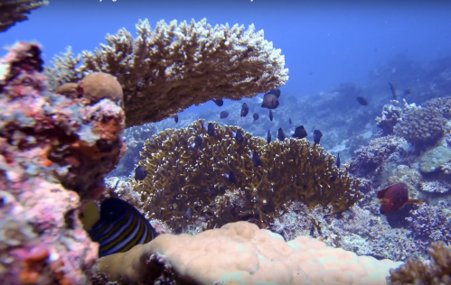
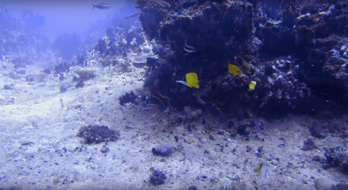
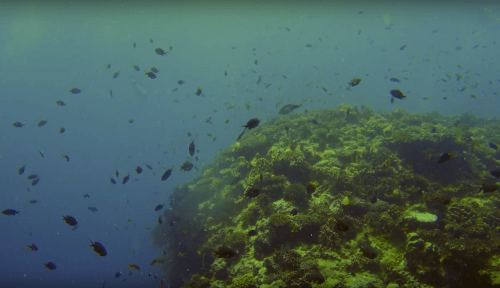
Yes: We are an open network with a federated model. Hierarchy is not part of our formal culture. We co-create in an open way. As such, Flying Labs conduct their own affairs and make their own decisions. They select their own projects and partners. They run their own meetings and their own finances. They develop their own value propositions, governance models, business models and services. They write their own blog posts and many are also engaged on multiple social media platforms. WeRobotics does not have password access to any of these platforms. It should be noted that 90% of blog posts hosted on the Flying Labs blog and WeRobotics blog are about Flying Labs and published by Flying Labs. In addition, 95% of all photos and videos in these blog posts are of Flying Labs, not WeRobotics. We work hard to amplify the voices of local experts across the Flying Labs network. Furthermore, Labs do their own media interviews and also decide which conferences and workshops they want to organize or speak at.*

No: Flying Labs must follow local, national and international laws. This includes relevant aviation regulations and our Child Protection Policy, for example. In addition, Flying Labs must follow this Code of Conduct and these Flying Labs Guidelines (PDF). 

*When WeRobotics receives an invitation to speak at a conference, we transfer the invitation to Flying Labs whenever possible. This has given Flying Labs the opportunity to give presentations and keynotes in Malaysia, Japan, Dubai, Australia, Jamaica and Kenya, for example. We do the same when receiving requests for media interviews. Helping to amplify the voices of local experts is important to us.

Does WeRobotics own the data (and metadata) collected by Flying Labs?

No, Flying Labs and/or their clients own the data and metadata collected by Flying Labs. WeRobotics does not own or monetize the data or metadata collected by Flying Labs. 

Do Flying Labs pay fees to WeRobotics?

Yes, Flying Labs make annual contributions to the Flying Labs Fund. These mandatory contributions range from USD 250 to $750 depending on the type of organization that coordinates any given Flying Labs. Note that 100% of the annual contributions go directly to the Flying Labs Fund and that 100% of the Flying Labs Fund goes right back to the Flying Labs in the form of micro-grants, subsidized travel, free software, free training, retreats and more. WeRobotics does not take commissions.

Is the Flying Labs model based on a franchise model?

We frequently describe the Affiliate Flying Labs Program as being based on a franchise model. But this is simply a means to express affiliation. There’s no ownership in our case, so we ought to use a different word to describe the Affiliate Program. “Cooperative model” may be more accurate.

Is WeRobotics perfect?

LOL.

Back to the Future: Drones in Humanitarian Action

A devastating earthquake struck Nepal on April 25th, 2015. The humanitarian drone response to the earthquake was almost entirely foreign-led, top-down and techno-centric. International drone teams self-deployed and largely ignored the humanitarian drone code of conduct. Many had never heard of humanitarian principles and most had no prior experience in disaster response. Some were arrested by local authorities. At best, these foreign drone teams had little to no impact. At worse, they violated the principle of Do No Harm. Nepal Flying Labs was co-created five months after the earthquake, on September 25th, 2015, to localize the responsible and effective use of drones for positive social impact. Today, Flying Labs are operational in 25 countries across Asia, Africa and Latin America.

This month, on behalf of the World Food Program (WFP), WeRobotics teamed up with Nepal Flying Labs and WFP Nepal to run a 5-day hands-on training and disaster simulation to improve the rapid deployment and coordination of drones in humanitarian action. WeRobotics previously designed and ran similar humanitarian drone trainings and simulations on behalf of WFP (and others) in the Dominican Republic, Peru, Myanmar, Malawi and Mozambique, for example. In fact, WeRobotics has been running humanitarian drone trainings since 2015 both in-person and online.

All 25 Flying Labs typically run their trainings in local languages. As such, the 5-day training in Nepal was largely led by Nepal Flying Labs and run in Nepali. Over 40 participants from 16 Nepali organizations took the training, which included an introduction to drone technologies,  drone photogrammetry, imagery processing, lessons learned and best practices from past humanitarian drone missions, and overviews of codes of conduct, data protection protocols and coordination mechanisms, all drawn from direct operational experience. The training also comprised a series of excellent talks given by Nepali experts who are already engaged in the use of drones in disaster management and other sectors in Nepal. This featured important talks by several officials from the Civil Aviation Authority of Nepal (CAAN). In addition, the training included a co-creation session using design thinking methods during which local experts identified the most promising humanitarian applications of drone technology in Nepal.

Nepal Flying Labs also trained participants on how to fly drones and program drone flights. The drones were rented locally from the Flying Labs and their partners. This hands-on session, kindly hosted by Kathmandu University, was followed by another hands-on session on how to process and analyze aerial imagery. In this session, Nepal Flying Labs introduced participants to Pix4Dreact and Picterra. Pix4Dreact provides an ultra-rapid solution to data processing, allowing humanitarian drone teams to process 1,000 high-resolution aerial images in literally minutes, which is invaluable as this used to take hours. Picterra enables drone teams to quickly analyze aerial imagery by automatically identifying features of interest to disaster responders such as damaged buildings, for example. While Picterra uses deep learning and transfer learning to automate feature detection, users don’t need any background or prior experience in artificial intelligence to make full use of the platform. During the hands on-session, trainers used Picterra to automatically detect buildings in aerial (orthophoto) map of an earthquake-affected area.

After completing a full day of hands-on training, Nepal Flying Labs gave a briefing on the disaster simulation scheduled for the following day. The simulation is the centerpiece of the humanitarian drone trainings run by WeRobotics and Flying Labs. It requires participants to put into practice everything they’ve learned in the training. The simulation consolidates their learning and provides them with important insights on how to streamline their coordination efforts. It is often said that disaster responders train the way they respond and respond they way they train. This is why simulations are absolutely essential.

The simulation was held at Bhumlu Rural Municipality, a 3+ hour drive from Kathmandu. Bhumlu is highly prone to flooding and landslides, which is why it was selected for the simulation and why the Government of Nepal was particularly keen to get high-resolution maps of the area. The disaster simulation was run by Nepal Flying Labs in Nepali. The simulation, first designed by WeRobotics in 2015, consists of three teams (Authorities, Pilots and Analysts) who must work together to identify and physically retrieve colored markers as quickly and safely as possible. The markers, which were placed across Bhumlu prior to participants’ arrival, are typically 1 meter by 1 meter in size, and each color represents an indicator of interest to humanitarians, e.g., Yellow = survivor; Blue = landslide; and Red = disaster damage. Both the colors and the number of different markers are customized based on the local priorities. Below, Nepal Flying Labs Coordinator Uttam Pudasaini hides a yellow marker under a tree prior to the arrival of participants.

Myanmar has held the record for the fastest completion of the simulation since 2017. As such, they’ve held the number one spot and been the gold standard for two years now. The teams in Myanmar, who were trained by WeRobotics, retrieved all markers in just over 4 hours. As such, WeRobotics challenged the teams in Nepal to beat that record and take over the number one spot. They duly obliged and retrieved all markers in a very impressive time of 3 hours and 4 minutes, clenching the number one spot from Myanmar.

On the following and final day of the workshop, Nepal Flying Labs and WeRobotics facilitated an all-hands session to debrief on the simulation, inviting each team and trainee to reflect on lessons learned and share their insights. For example, a feedback loop between the Pilots and Analysis Teams is important so pilots can plan further flights based on the maps produced by the analysts. Like a number of previous simulations run by WeRobotics, the Analysis Team noted that having a portal printer on hand would be ideal. The Pilots Team also suggested that having different colored visibility vests would’ve enabled more rapid field coordination between and within teams by enabling individuals to more quickly identify who is who.

When asked which individuals or group had the most challenging job in the simulation, the consensus was the retrieval group who are part of the Authorities Team and responsible for retrieving the markers after they’ve been geo-located by the Analysis Team. This was particularly interesting given that in all previous simulations run by WeRobotics, the consensus had always been that the Analysis Team had the hardest task. In coming weeks, these insights together with the many others gained from the simulation in Nepal will be added to this document on best practices in humanitarian drone missions.

After the full simulation debrief, Nepal Flying Labs facilitated the final session of the training: a panel discussion on the development of drone regulations to save lives and reduce suffering in Nepal. The panelists included senior officials from Civil Aviation, Home Ministry and Nepal Police. The session was run in Nepali and presented participants with an excellent opportunity to engage with and inform key policymakers. In preparation for this session, Nepal Flying Labs and partners prepared this 3-page policy document (PDF) with priority questions and recommendations, which served as the basis for the Q&A with the panel. This discussion and policy document created a roadmap for next steps which Nepal Flying Labs and partners have pledged to take forward with all stakeholders.


Acknowledgements: WeRobotics and Nepal Flying Labs would like to sincerely thank WFP HQ and WPF Nepal for the kind invitation to run this training and for providing the superb coordination and logistics that made this training so fruitful. WeRobotics and Nepal Flying Labs would also like to express sincere thanks to DroNepal for co-leading the training with Nepal Flying Labs. Sincere thanks to the local communities we worked with during the simulation and to the CAA and local police for granting flight permissions. To all 40+ participants, sincerest thanks for all the energy you brought to the training and for your high levels of engagement throughout each of the 5 days, which significantly enriched the training. Last but certainly not least, sincere thanks to the Belgium Government for funding this training.

Testing Underwater Drones: Lessons Learned from the South Pacific

I was in Fiji earlier this month to work on a number of WeRobotics projects with our Pacific Flying Labs. One of these entailed the use of underwater drones to study the health of coral reefs near Maui Bay. We had the opportunity to test two new underwater drones for this project: the Trident by our technology partner, OpenROV and the PowerRay by the company PowerVision. Both drones only became available a just few months ago. In fact, we were the first not-for-profit organization to gain access to the Trident thanks to OpenROV’s invaluable support. These two underwater drones are now part of the Pacific Flying Labs fleet along with 2 aerial drones that we transferred to the team in Fiji. We’re planning to provide our other labs such as Tanzania Flying Labs with underwater drones as well in coming months. So what follows are some initial observations and lessons learned in the use of these underwater drones for data collection.

The first point to note is that underwater drones are tethered unlike most aerial drones (the yellow cable in the above photo). As such, their range is limited by the length of the tether. On the plus side, the drones we tested in Fiji have 2-3 hours of battery life. Another difference between underwater and aerial drones is that the former can only piloted manually while the latter can be programmed to operate autonomously. The reason is simple: GPS is not available underwater. The underwater drones we tested in the Pacific do have various features that seek to make the manual piloting easier. The PowerRay, for example, offers altitude (or rather depth) control to keep the drone more or less at the same depth while the Trident offers a stabilization feature.

Another difference between underwater and aerial drones is that the later are almost always piloted Beyond Visual Line of Site (BVLOS) contrary to most aerial drones. In other words, one loses sight of underwater drones within just a few meters of depth whereas aerial drones can be seen from several hundred meters away. This makes knowing where the drone is relative to your position rather challenging. An underwater drone pilot will have live video footage of what the drone sees right in front of them, but that can be quite limiting when operating BVLOS. On the plus side, the Trident software does include a helpful compass feature, displaying the direction that the drone is pointing in, which is a plus. But still, manually operating a drone BVLOS whether it flies or swim is particularly tricky.

Screenshot 2018-03-27 22.11.44

In addition, piloting the underwater drones to swim in straight lines (to do transects, for example) or to swim around a point of interest from different angles (to create 3D models or 360 panoramic photos) is equally challenging and takes some serious practice. And even with said practice, we found ourselves having to try and manually correct for invisible currents at various depths. Aerial drones can automatically correct for winds, thanks to GPS.

In many ways, the experience I had in piloting these underwater drones reminded me a lot of what it was like to fly the Phantom 1 when it came out in 2013. It was a very manual experience with a fixed camera. The same is true of the underwater drones. In other words, if you want the camera to capture a particular scene, you had to point the Phantom 1 towards the scene in question and adjust the altitude accordingly, often from hundreds of meters away, which meant quite a bit of guesswork (and luck) until you clocked many hours of practice. The underwater drones have fixed high definition cameras, meaning no gimbals to provide the very smooth footage that the Phantom 4 provides today. What’s more, the cameras of the underwater drones are forward facing. This means you’d need to attach a GoPro or similar camera to the bottom of the underwater drone if you wanted to capture vertical imagery to produce bathymetry maps.

Screenshot 2018-03-27 22.38.00

I have no doubt that like the Phantom’s 3 iterations since the first model came out half-a-decade ago, the future iterations of the Trident and PowerRay will make equally important strides. In the meantime, below are some initial recommendations based on our lessons learned. If we’re missing any, then please let us know!

  • Practice in a pool: We spent several days practicing in a swimming pool, i.e., a controlled environment. The upside: you can really get the hang of it without dealing with waves, currents, etc. The downside: once you hit the open Ocean, it’s a whole other ballgame.
  • You need a crew: In addition to the pilot, a spotter and a “tetherer” are needed. The purpose of the spotter is to provide the pilot with situational awareness, i.e., where the drone is in relation to the pilot and the area of interest. The tetherer is responsible for ensuring that the tether remains loose and untangled. As for the pilot, same deal as manually operating aerial drones: gamers will make for the best pilots. Seasoned divers may potentially feel more at home than others when piloting underwater drones.
  • Go slow & Transects: The underwater drones we used allow pilots to select different speeds. Stay on the slow speed when capturing footage. When photographing or filming marine life, we found that simply letting the drone drift produced some of the best results in terms of visual quality. Going to slow is also a good idea if you’re looking to run transects. The key there is to use the live video feed to identify a point in the distance and then to swim as straight as possible towards that point.
  • Image quality: You’ll want to play around with the various image settings available for the underwater drones before you go on important dives. The wrong image setting will make the resulting footage look very pale or bleached in some cases. Also, dives on cloudy days and at night tend to produce better image quality given that reflections from the sun are minimized. The underwater drones have powerful forward facing lights that help to illuminate areas of  interest.
  • Stay away from debris and sand: These can get into the motors and lead to you having a very bad day. In particular, do not “land” your drone on the ocean floor. Sand and drones don’t get along and this is true of both swimming and flying drones.
  • Visibility of screen: Just like aerial drones, direct sunlight and screens don’t work well together. Being able to see the screen on your table or smart phone to see the live video feed from your drone along with relevant operational readings such speed, altitude, etc.), is really key. But when you’re out on boat with no “dark room” to properly see the screen, then best of luck to you. We recommend taking a large, thick towel to throw over your head (another reason why a spotter is key) or using the VR Goggles provided with the PowerRay. Towels are also a good idea to thoroughly dry the drone after you take it out of the water and before you start removing the tether.
  • Wash, Rinse, Repeat: It’s really important to thoroughly rinse your drone after each day of diving, especially if you’re diving in the Ocean (i.e., salt water).

Screenshot 2018-03-27 22.33.02

Based on this experience, here’s what we’d like to see in future iterations of underwater drones:

  • Cameras: Marine scientists typically use handheld cameras with 24 megapixels. While the underwater drone cameras are HD, their megapixels is at most 12 (and less when using video). Of course, divers (the human kind) can’t stay too deep for too long whereas the underwater drones can, so yes 12 megapixels is better than nothing. But 24 is still better than 12. In addition, having a gimbal like the ones used in aerial drones to stabilize the footage and enable the pilot to point the drone in different directions without having to change the position of the drone would be a distinct advantage.
  • Manual support: More features that support the manual piloting of the drone by providing greater situational awareness—like the compass feature of the Trident—would be a huge plus. As would a better system to manage the tether.
  • Feature detection software: To automatically identify specific features that are most commonly of interest, such as identifying and counting specific species of fish and corals, for example.
  • Hybrids: There are compelling reasons to integrate underwater drones with surface water drones, i.e., to build a 2-in-1 solution. Surface water drones can be GPS enabled. As such, they can be programmed just like aerial drones. And with a downward facing camera, said surface water drones could automatically create create bathymetry maps by swimming just half a meter or less below the surface (using an extended antennae). Now add a forward facing drone and a tether and you have yourself a diving drone as well.

Many thanks to DFAT, Atlassian Foundation, Solve MIT, the University of the South Pacific and OpenROV for their invaluable support and partnership on Pacific Flying Labs. Our labs in Fiji trained young women between the ages of 12-18 years old on how to use these underwater drones to explore the marine life around them and study the health of corals. Pacific Flying Labs will continue to use these underwater drones for a range of projects in the months to come. Below is a short compilation of some of the underwater footage that our Pacific Flying Labs captured with the drones in question. Enjoy!


Empowering Youths in Fiji to Explore their Islands with Aerial and Marine Robotics

Fiji was largely spared the wrath of Cyclone Gita, but the high-end category 4 Cyclone devastated the islands of Tonga nearby. As typically happens, the drone companies that international organizations are now hiring to carry out aerial surveys of the  damage come from Australia and/or New Zealand. These foreign companies usually arrive weeks after the disaster. They also charge high consulting fees, and rarely speak the local language. In addition, they typically stay a week or two at most, which means aerial imagery is not available during the recovery and reconstruction phase. Lastly, foreign companies rarely if ever have time to build local capacity, let alone the know-how to sustainably transfer drone technology to local partners.

Our mission at WeRobotics is to localize appropriate robotics technology by placing drone solutions directly in the hands of local professionals. We do this through our growing network of Flying Labs—local action labs run entirely by local teams who we train and equip. This doesn’t mean that foreign drone companies don’t have an important role to play in the aftermath of major disasters. But it does mean that national and international organizations should absolutely prioritize hiring local drone pilots and imagery analysts. This helps to build local capacity and create local jobs. It also enables local participation in data collection and avoids delays as well as possible biases in the collection of said data. In sum, when the need for aerial data cannot be met locally, then yes, national and international organizations should absolutely turn to foreign companies to collect aerial data. But if these organizations ignore or displace the local capacity that does exist, then this is really problematic. Said organizations should invest in building the capacity of local youths, not sideline them.

This explains why our growing network of Flying Labs around the world are deeply committed to training the youths in their countries on how to use drones safely, responsibly and effectively for social good projects. Today’s youths are the drone pilots of the immediate future. This is why our Pacific Flying Labs is teaming up with a local girl’s orphanage and other youths in Fiji to map informal settlements for a disaster risk reduction project. The youths will learn how to use drones safely, responsibly and effectively. Our Pacific Labs will also teach them how to use Ground Control Points (GCPs) and how to process the resulting imagery to create high quality maps as well as 3D models. In addition, they will try out Hangar and Survae to create additional information products. In sum, the purpose of this project is to introduce local youths to the basics of drone mapping so they can participate in the data collection process and learn the skills they need to participate in the  workforce of the 21st century.

Once the aerial data is processed, the resulting maps will be printed out on large banners. Youths will team up into different groups to analyze these maps. They will first identify major areas of concern. For example, they will analyze housing infrastructure, drainage and environmental issues, disaster risks and the long term impact of climate change on these informal settlements. Equally importantly, youths will propose concrete solutions for each of the concerns they’ve identified. They will then present their project and findings to local, national and international organizations at conference organized by Pacific Flying Labs and the University of the South Pacific (USP) on March 16th.

After the workshop, the Coordinator of Pacific Flying Labs, Amrita Lal, plans to head to Tonga where she will team up with a Tongan classmate of hers from USP to carry out aerial surveys to support the recovery and reconstruction efforts. Amrita is so committed to this that she has decided to skip her undergraduate graduation ceremony to be in Tonga. This will make her the one and only female drone pilot from the region to be involved in the response to Cylcone Gita. Her classmate, who recently graduated from USP, will be the only Tongan drone pilot involved in the response to Gita. He will hold on to one of the drones from Pacific Flying Labs so that he can continue mapping as needed. In the future, we hope that Amrita and other drone pilots from Fiji, Tonga, Vanuatu and elsewhere will be the ones hired by national and international organizations to support humanitarian efforts in their countries.

Our Pacific Flying Labs will also be using the Trident, an underwater drone from OpenROV, one of our Technology Partners. Pacific Labs will train girls from an orphanage in Fiji and other local youths. This will enable youths to learn the skills they need to thrive in the workforce of the 21st Century. It will also give them the opportunity to explore the marine life around their island from a completely new perspective.

The marine robotics project will be led by our Pacific Flying Labs Coordinator, Ms. Amrita Lal. Local youths will be using underwater drones to explore and evaluate the health of coral reefs. The location selected has sea-grass, bare sand and corals in all directions. Participating youths will have been trained the day before at a swimming pool at the University of the South Pacific (USP) on how to operate underwater drones to capture live video footage and photographs. They will identify and count different species of fish—particularly Butterflyfish since these serve as an important indicator of coral reef health. They will also seek to identify and count Parrotfish, Surgeonfish, Tangs, Sea Urchins, Molluscs and Clams. In addition, youths will document the presence or absence of coral bleaching and diseases. While some initial visual analysis will be carried out on site with the live footage, the bulk of the analysis will take place at USP’s GIS Lab the following day.

Dr. Stuart Kininmont, a Senior Lecturer at USP’s School of Marine Studies, will be joining our marine robotics expedition. Dr. Stuart teaches Coral Reef Ecology, Marine Spatial Planning and Marine Geology and Sedimentology. In addition, two Marine Science Teaching Assistants will join the expedition to facilitate the data collection. Dr. Stuart will also teach youths on how to identify and count relevant marine life species when we’re back at the USP lab. Youths will be given out pre-made charts with photos and descriptions of relevant species and will study the recorded footage frame by frame to document and analyze the health of the coral reefs.

After carrying out their visual analyses of the footage, we’ll work with participating youths to help them produce formal presentations of the project along with their findings. They’ll learn how to create a create a professional slide deck and how to give a compelling presentation. They will rehearse their presentations in front of each other in order to get further feedback. These youths will then give their talks at the opening of the Pacific Flying Labs Conference that week. This conference will bring relevant local, national and regional stakeholders to create a road map for Pacific Labs. Training youths across the region on how to use appropriate robotics for social good is a key priority of the labs.

We’re also planning to explore what other types of drone-derived information products might also be useful for marine scientists and biologists. Colleagues at the Scripps Institution of Oceanography, for example, use diver-operated underwater cameras to take images of coral reefs which they process into high-definition 3D models. These models informs their “high-level ecological questions (community & landscape ecology: community structure & composition, spatial patterning, coral condition, structural complexity, etc) for peer-reviewed publication.” The models also “provide baseline assessment data for marine managers and communities.” We’re keen to explore whether the high-definition 4K cameras on the underwater drones can provide sufficiently high-resolution data to create high-definition 3D models usable for advanced scientific research.

We’re excited to work on this project with Amrita and local youth; a project made possible thanks our close partnership with USP’s GIS Lab and the generous support of the Australian Department of Foreign Affairs and Trade (DFAT), Atlassian Foundation and USP. In addition, we want to thank our Technology Partner OpenROV for generously donating a Trident to our South Pacific Flying Labs.

Many thanks to USP for their close partnership on South Pacific Flying Labs and to the Australian Department of Foreign Affairs and Trade (DFAT) and the Atlassian Foundation for their generous support of Pacific Labs.

Global Thought Leadership in Social Sector Robotics

Cross-posted from WeRobotics

“I’ve been to countless remote sensing conferences over the past 30 years but WeRobotics Global absolutely ranks as the best event I’ve been to.” – Remote Sensing Expert

“The event was really mind-blowing. I’ve participated in many workshops over the past 20 years. WeR Global was by far the most insightful and practical. It is also amazing how closely together everyone is working — irrespective of who is working where (NGO, UN, private sector, donor). I’ve never seen such a group of people come together this away.” – Humanitarian Professional

“WeRobotics Global is completely different to any development meeting or workshop I’ve been to in recent years. The discussions flowed seamlessly between real world challenges, genuine bottom-up approaches and appropriate technology solutions. Conversations were always practical and strikingly transparent. This was a highly unusual event.” – International Donor

WeRobotics Global has become a premier forum for social good robotics. The feedback featured above was unsolicited. On June 1, 2017, we convened our first, annual global event, bringing together 34 organizations to New York City (full list below) to shape the global agenda and future use of robotics in the social good sector. WeRobotics Global was kindly hosted by Rockefeller, the first donor to support our efforts. They opened the event with welcome remarks and turned it over to Patrick Meier from WeRobotics who provided an overview of WeRobotics and set the big picture context for social robotics.

The first panel featured our Flying Labs Coordinators from Tanzania (Yussuf), Peru (Juan) and Nepal (Uttam). Each shared the hard work they’ve been doing over the past 6-10 months on localizing and applying robotics solutions. Yussuf spoke about the lab’s use of aerial robotics for disaster damage assessment following the earthquake in Bukoba and for coastal monitoring, environmental monitoring and forestry management. He emphasized the importance of community engagement and closed with new projects that Tanzania Flying Labs is working on such as mangrove monitoring for the Department of Forestry. Juan presented the work of the labs in the Amazon Rainforest, which is a joint effort with the Peruvian Ministry of Health. Together, they are field-testing the use of affordable and locally repairable flying robots for the delivery of antivenom and other medical payload between local clinics and remote villages. Juan noted that Peru Flying Labs is gearing up to carry out a record number of flight tests this summer using a larger and more diverse fleet of flying robots. Last but not least, Uttam showed how Nepal Flying Labs has been using flying robots for agriculture monitoring, damage assessment and mapping of property rights. He also gave an overview of the social entrepreneurship training and business plan competition recently organized by Nepal Flying Labs. This business incubation training has resulted in the launch of 4 new Nepali start-up companies focused on Robotics-as-a-Service. 

The following videos provide highlights from each of our Flying Labs: Tanzania, Peru and Nepal.

The second panel featured talks on sector based solutions starting with the International Federation of the Red Cross (IFRC). The Federation (Aarathi) spoke about their joint project with WeRobotics; looking at cross-sectoral needs for various robotics solutions in the South Pacific. IFRC is exploring at the possibility of launching a South Pacific Flying Labs with a strong focus on women and girls. Pix4D (Lorenzo) addressed the role of aerial robotics in agriculture, giving concrete examples of successful applications while providing guidance to our Flying Labs Coordinators. The Wall Street Journal (Sally) spoke about the use of aerial robotics in news gathering and investigative journalism. She specifically emphasized the importance of using flying robots for storytelling. Duke Marine Labs (David) closed the panel with an overview of their projects in nature conservation and marine life protection, highlighting their use of machine learning for automated feature detection for real-time analysis.

DML

Panel number three addressed the transformation of transportation. UNICEF (Judith) highlighted the field tests they have been carrying out in Malawi; using cargo robotics to transport HIV samples in order to accelerate HIV testing and thus treatment. UNICEF has also launched an air corridor in Malawi to enable further field-testing of flying robots. MSF (Oriol) shared their approach to cargo delivery using aerial robotics. They shared examples from Papua New Guinea (PNG) and emphasized the importance of localizing appropriate robotics solutions that can be maintained locally. MSF also called for the launch of PNG Flying Labs. IAEA was unable to attend WeR Global, so Patrick and Adam from WeRobotics gave the talk instead. WeRobotics is teaming up with IAEA to design and test a release mechanism for sterilized mosquitos in order to reduce the incidence of Zika and other mosquito-borne illnesses. More here. Finally, Llamasoft (Sid) closed the panel with a strong emphasis on the need to collect and share structured data to accurately carry out comparative cost-benefit-analyses of cargo delivery via flying robots versus conventional means. Sid used the analogy of self-driving cars to highlight how problematic the current lack of data vis-a-vis reliably evaluating the impact of cargo robotics.

UM

The fourth and final panel went beyond aerial robotics. Digger (Thomas) showed how they convert heavy construction vehicles into semi-autonomous platforms to clear landmines and debris in conflict zones like Iraq and Syria. Science in the Wild (Ulyana) was alas unable to attend the event, so Patrick from WeRobotics gave the talk instead. This focused on the use of swimming robots to monitor glacial lakes in the Himalaya. The purpose of the effort is to identify cracks in the lake floors before they trigger what local villagers call the tsunamis of the Himalaya. OpenROV (David) gave a talk on the use of diving robots, sharing real-world examples and providing exciting updates on the new Trident diving robot. Planet Labs (Andrew) gave the closing talk, highlighting how space robotics (satellites) are being used across a wide range of social good projects. He emphasized the importance of integrating both aerial and satellite imagery to support social good projects.

Screenshot 2017-06-05 12.36.33

The final session at WeR Global comprised breakout groups to identify next steps for WeRobotics and the social good sector more broadly. Many quality insights and recommendations were shared during the report back. One such recommendation was to hold WeR Global again, and sooner rather than later. So we look forward to organizing WeRobotics Global 2018. We will be providing updates via our blog and email list. We will also use our blog and email list to share select videos of the individual talks from Global 2017 along with their respective slide decks.

In the meantime, a big thanks to all participants and speakers for making Global 2017 such an unforgettable event. And sincerest thanks to the Rockefeller Foundation for hosting us at their headquarters in New York City.


Organizations that participated in WeRobotics Global 2017

UN Office for the Coordination of Humanitarian Affairs (OCHA), International Federation of the Red Cross (IFRC), World Food Program (WFP), UN Development Program (UNDP),Médecins Sans Frontières (MSF), UNICEF, World Bank, World Economic Forum (WEF), Cadasta, Scripps Institute of Oceanography, Duke Marine Labs, Fauna and Flora International, Science in the Wild, Drone Journalism Lab, Wall Street Journal, ESRI, Pix4D, Radiant, OpenAerialMap, Planet Labs, Llamasoft, Amazon Prime Air, senseFly, OpenROV, Digger, UPenn Robotics, Institute of Electrical and Electronics Engineers (IEEE), Rockefeller Foundation, Gates Foundation, Omidyar Network, Hewlett Foundation, USAID and Inter-American Development Bank (IADB).

How To Coordinate UAV Deployments During Disasters

My team and I at WeRobotics are partnering with the World Food Program (WFP) to develop practical coordination mechanisms for UAV deployments in collaboration. These will be developed with a range of national & local partners. In this post I want to share the basic coordination protocols we used in the aftermath of Cyclone Pam, a category 5 cyclone that devastated the islands of Vanuatu in 2015. By “we” I mean myself, the World Bank and two UAV companies from Australia (Heliwest) and New Zealand (X-Craft).

The World Bank tasked me with spearheading the UAV response to Cyclone Pam so I recruited the two companies to carry out the aerial surveys. I selected them from a dozen groups that had registered with the Humanitarian UAV Network (UAViators) Global Pilot Roster. When we landed at the international airport in Port Vila, we saw a very common scene. Military cargo aircraft filled with food, water and other relief items. Helicopters were also being chartered to support the relief efforts. And commercial aircrafts like the one that had taken us to Vanuatu were also flying in and out on a daily basis.

We clearly needed to develop coordination mechanisms that would allow us to fly our UAVs in this relatively complex airspace. So within an hour of landing in Port Vila, I organized a joint meeting with the Government of Vanuatu, Air Traffic Control (ATC), World Bank, Australian Defense Force, New Zealand Defense Force and the two UAV companies. By the end of the 1-hour meeting we had agreed on a clear set of coordination protocols that would enable us to fly our UAVs safely in non-segregated airspace. And it wasn’t rocket science.

At 22:00 every night, we would email the Australian Defense Force (ADF) our flight plans for the following day. An example of such a plan is pictured above. By 23:00, the ADF would respond with a yes/no. (They said yes to all our plans). At 23:00, we would email our approved flight plans to controllers at ATC and start programming the UAV flights. We’d get a few hours of sleep and head back when it was still dark to reach the survey sites as early as possible. This was also true for areas near the airport since we could only fly our UAVs between 6am-8am based on the agreed protocols.

Once on site, we’d set up the UAVs and go through our regular check-lists to ensure they were calibrated, tested and ready to fly. Before take off, we would call ATC (we had the mobile phone numbers of 2 ATC operators) and proceed as follows:

“Hello ATC, this is the World Bank UAV Team. We are on site in [name of location] for flight number [x] and ready for takeoff. Do we have your permission?” 

After verbal confirmation, we would launch our UAVs and carry out the aerial survey. We flew below 400 feet (per UAV regulations) and never, ever strayed from our approved flight plan. The Civil Aviation Authority of Vanuatu had given us permission to fly Extended Line of Site, which meant we could fly beyond visual line of site as long as we could keep an eye on general airspace where our UAV was operating. After landing the UAV, we would call ATC back:

“Hello ATC, this is the World Bank UAV Team. We have just landed the UAV in [name of location] and have completed flight number [x]. Thanks.” 

Simple and yet highly effective for the context at hand. We had the mandate, all the right contacts and we everyone followed the coordination protocols. But this is just a subset of protocols required for coordinating UAV flights. There are other components such as data-sharing workflows that need to be in place well before a disaster. What’s more, in the case of Cyclone Pam, we were working with only two professional UAV teams in a Small Island State. Just weeks after Cyclone Pam, a devastating 8.0 magnitude earthquake struck Nepal. The situation there was a lot more complex with at least 15 UAV teams self-deploying to the country.

The UN Office for the Coordination of Humanitarian Affairs (OCHA) in Nepal formally asked me to coordinate these teams, which turned out to be quite the nightmare. The Civil Aviation Authority of Nepal (CAAN) did not have the capacity or expertise to partner with us in coordinating UAV flights. Nor did UNDAC. Many of the self-deployed UAV teams had never worked in disaster response before let alone in a developing country. So they had no idea how to actually support  or plug into formal relief efforts.

While most of UAV teams blamed connectivity issues (slow and intermittent email/phone access) for being unable to follow our coordination efforts online, several of them had no problem live-tweeting pictures of their UAVs. So I teamed up with LinkedIn For Good to developed a very simple Twitter-based coordination system overnight. UAV teams could now tweet their flight plans which would get automatically added to an online map and database. The UAV teams kept tweeting but not a single one bothered to tweet their plan.

To say this was problematic is an understatement. When organizations like WFP are using manned aircraft and helicopters to deliver urgent relief supplies to affected communities, they and ATC need to know which UAVs are flying where, how high and when. This is also true of Search and Rescue (SaR) teams that often fly their helicopters at low altitudes. In due course, we’ll have transponders to track UAVs in real-time. But safety is not the only consideration here. There is also a question of efficiency. It turns out that several UAV teams in Nepal carried out aerial surveys of the exact same areas, which is hardly optimal.

So I applaud the WFP for their important leadership on this matter and look forward to working with them and in-country stakeholders to develop practical coordination mechanisms. In the meantime, WeRobotics has set up Nepal Flying Labs to build local capacity around the use of UAVs and enable local responders to use UAVs safely, responsibly and effectively. All of our Flying Labs will adopt the resulting coordination mechanisms developed with WFP and stakeholders. 

How Zanzibaris are Hacking Flying Robots

Island life can be rough for flying robots. They have to contend with sandy beaches, sea salt, overbearing heat, humidity, high winds and rapidly changing weather patterns featuring sudden downpours. Birds of prey can also be a major menace for flying robots. While these aren’t exactly the types of problems one typically comes across at humanitarian innovation labs in New York, Geneva or Singapore, they’re part of everyday life for our Tanzania Flying Labs and partners like the State University of Zanzibar (SUZA). When team and I at WeRobotics were in Tanzania last month to continue building the local capacity of our Flying Labs, I had the opportunity to learn first hand from our Tanzanian friends about how they hack robotics solutions to survive island life.

Birds of prey are no joke when their airspace is invaded. I’ve experienced this several times while flying robots (UAVs/drones) over the past four years. The aerial photograph above, for example, was taken about 2 years ago in South Africa. I raced to land my UAV as soon as I spotted the eagle but the bird came in for attack nonetheless. I was seriously worried that the eagle would be injured but luckily it swerved away at the last second.

Turns out birds of prey are a problem for many UAV pilots around the world. According to senseFly, a leading UAV manufacturer, bird strikes against UAVs are “surprisingly common and occur in many parts of the world; not only in Australia but also parts of Africa, select US states, parts of Europe and in Latin America.” Our Tanzanian team and partners face similar challenges when flying in Zanzibar, with some of their UAVs no longer operational after encounters with birds of prey. So they’ve tried a number of different tactics and the one that seems to work the best for now is deceivingly simple.

I found about this while looking over the shoulder of my colleague Khadija as she was prepared a third UAV for flight. I hadn’t seen aluminum foil on a flying robot before and couldn’t figure out what it was for. So I asked Khadija, who explained: “This is to keep the birds away; they don’t like it when we invade their airspace, they were there first, after all. So we simply tape some foil to a wing, which shines and keeps the birds away.” Perhaps the eagles realize that birds aren’t supposed to shine, so they keep their distance. Now, this isn’t exactly a sexy solution by any means, and it barely costs 25 cents, but it works.

Humanitarian technology doesn’t have to be shiny or expensive, it just has to work. Another simple way that our Zanzibari friends are hacking UAV flights to help robots cope with island life has to do with the orange tarp below.

When aerial robots land on sand, the grains can wreck havoc on the motors, cameras and sensors. This is especially true if you’re flying (and landing) several times a day for many weeks on end. It’s also worth noting that non-sandy landing sites can be quite few and far between in some parts of the island. So our local colleagues have been experimenting with fishing nets and most recently tarps in order to catch the robots as they come in for landing. They’re still working on refining this technique as this video shows:

Have you come across other examples of local adaptations of robotics/UAV technology in Africa, Asia or Latin America? If so, I’d really like to hear from you so I can share them with our growing network of Flying Labs. Thank you!

Why Robots Are Flying Over Zanzibar and the Source of the Nile

An expedition in 1858 revealed that Lake Victoria was the source of the Nile. We found ourselves on the shores of Africa’s majestic lake this October, a month after a 5.9 magnitude earthquake struck Tanzania’s Kagera Region. Hundreds were injured and dozens killed. This was the biggest tragedy in decades for the peaceful lakeside town of Bukoba. The Ministry of Home Affairs invited WeRobotics to support the recovery and reconstruction efforts by carrying out aerial surveys of the affected areas. 

2016-10-10-08-14-57-hdr

The mission of WeRobotics is to build local capacity for the safe and effective use of appropriate robotics solutions. We do this by co-creating local robotics labs that we call Flying Labs. We use these Labs to transfer the professional skills and relevant robotics solutions to outstanding local partners. Our explicit focus on capacity building explains why we took the opportunity whilst in Kagera to train two Tanzanian colleagues. Khadija and Yussuf joined us from the State University of Zanzibar (SUZA). They were both wonderful to work with and quick learners too. We look forward to working with them and other partners to co-create our Flying Labs in Tanzania. More on this in a future post.

Aerial Surveys of Kagera Region After The Earthquake

We surveyed multiple areas in the region based on the priorities of our local partners as well as reports provided by local villagers. We used the Cumulus One UAV from our technology partner DanOffice to carry out the flights. The Cumulus has a stated 2.5 hour flight time and 50 kilometer radio range. We’re using software from our partner Pix4D to process the 3,000+ very high resolution images captured during our 2 days around Bukoba.

img_6753

Above, Khadija and Yussuf on the left with a local engineer and a local member of the community on the right, respectfully. The video below shows how the Cumulus takes off and lands. The landing is automatic and simply involves the UAV stalling and gently gliding to the ground. 

We engaged directly with local communities before our flights to explain our project and get their permissions to fly. Learn more about our Code of Conduct.

img_6807

Aerial mapping with fixed-wing UAVs can identify large-scale damage over large areas and serve as a good base map for reconstruction. A lot of the damage, however, can be limited to large cracks in walls, which cannot be seen with nadir (vertical) imagery. We thus flew over some areas using a Parrot Bebop2 to capture oblique imagery and to get closer to the damage. We then took dozens of geo-tagged images from ground-level with our phones in order to ground-truth the aerial imagery.

img_6964

We’re still processing the resulting imagery so the results below are simply the low resolution previews of one (out of three) surveys we carried out.

ortho1_bukoba

Both Khadija and Yussuf were very quick learners and a real delight to work with. Below are more pictures documenting our recent work in Kagera. You can follow all our trainings and projects live via our Twitter feed (@werobotics) and our Facebook page. Sincerest thanks to both Linx Global Intelligence and UR Group for making our work in Kagera possible. Linx provided the introduction to the Ministry of Home Affairs while the UR Group provided invaluable support on the logistics and permissions.

img_6827

Yussuf programming the flight plan of the Cumulus

img_6875

Khadija is setting up the Cumulus for a full day of flying around Bukoba area

img_6756

Khadija wants to use aerial robots to map Zanzibar, which is where she’s from

img_6787

Community engagement is absolutely imperative

img_6791

Local community members inspecting the Parrot’s Bebop2

From the shores of Lake Victoria to the coastlines of Zanzibar

Together with the outstanding drone team from the State University of Zanzibar, we mapped Jozani Forest and part of the island’s eastern coastline. This allowed us to further field-test our long-range platform and to continue our local capacity building efforts following our surveys near the Ugandan border. Here’s a picture-based summary of our joint efforts.

2016-10-14-09-09-48

Flying Labs Coordinator Yussuf sets up the Cumulus UAV for flight

2016-10-13-14-44-27-hdr

Turns out selfie sticks are popular in Zanzibar and kids love robots.

2016-10-14-10-01-25

Khairat from Team SUZA is operating the mobile air traffic control tower. Team SUZA uses senseFly eBees for other projects on the island.

2016-10-15-09-03-10

Another successful takeoff, courtesy of Flying Labs Coordinator Yussuf.

2016-10-15-11-11-20

We flew the Cumulus at a speed of 65km/h and at an altitude of 265m.

2016-10-15-13-11-13

The Cumulus flew for 2 hours, making this our longest UAV flight in Zanzibar so far.

2016-10-15-10-38-51-hdr

Khadija from Team SUZA explains to local villagers how and why she maps Zanzibar using flying robots.

2016-10-15-17-26-23

Tide starts rushing back in. It’s important to take the moon into account when mapping coastlines, as the tide can change drastically during a single flight and thus affect the stitching process.

The content above is cross-posted from WeRobotics.

Using Swimming Robots to Warn Villages of Himalayan Tsunamis

Cross-posted from National Geographic 

Climate change is having a devastating impact on the Himalaya. On the Ngozumpa glacier, one of the largest and longest in the region, hundreds of supraglacial lakes dot the glacier surface. One lake in particular is known for its continuous volume purges on an annual basis. Near the start of the monsoon this summer, in less than 48 hours, it loses enough water to fill over 40 Olympic-sized swimming pools. To make matters worse, these glacial lakes act like cancers: they consume Himalayan glaciers from the inside out, making some of them melt twice as fast. As a result, villages down-valley from these glacial lakes are becoming increasingly prone to violent flash floods, which locals call Himalayan Tsunamis.

To provide early warnings of these flash floods requires that we collect a lot more geophysical and hydrologic information on these glacial lakes. So scientists like Ulyana (co-author) are racing to understand exactly how these glacial lakes form and grow, and how they’re connected to each other through seemingly secret subterranean channels. We need to know how deep and steep these lakes are, what the lake floors look like and of what materials they are composed (e.g., mud, rock, bare ice).

Ulyana, her colleagues and a small local team of Sherpa have recently started using autonomous swimming robots to automatically map lake floors and look for cracks that may trigger mountain tsunamis. Using robotics to do this is both faster and more accurate than having humans take the measurements. What’s more, robots are significantly safer. Indeed, even getting near these lakes (let alone in them!) is dangerous enough due to unpredictable collapses of ice called calving and large boulders rolling off of surrounding ice cliffs and into the lakes below. Just imagine being on a small inflatable boat floating on ice-cold water when one of those icefalls happen.

We (Ulyana and Patrick) are actively looking to utilize diving robots as well—specifically the one in the video footage below. This OpenROV Trident robot will enable us to get to the bottom of these glacial lakes to identify deepening ‘hotspots’ before they’re visible from the lake’s surface or from the air. Our plan next year is to pool our efforts, bringing diving, swimming and flying robots to Nepal so we can train our partners—Sherpas and local engineers—on how to use these robotic solutions to essentially take the ‘pulse’ of the changing Himalaya. This way they’ll be able to educate as well as warn nearby villages before the next mountain floods hit.

We plan to integrate these efforts with WeRobotics (co-founded by co-author Patrick) and in particular with the local robotics lab that WeRobotics is already setting up in Kathmandu. This lab has a number of flying robots and trained Nepali engineers. To learn more about how these flying robots are being used in Nepal, check out the pictures here.

We’ll soon be adding diving robots to the robotic lab’s portfolio in Nepal thanks to WeRobotics’s partnership with OpenROV. What’s more, all WeRobotics labs have an expressed goal of spinning off  local businesses that offer robotics as services. Thus, the robotics start-up that spins off from our lab in Nepal will offer a range of mapping services using both flying and diving robots. As such, we want to create local jobs that use robotics (jobs that local partners want!) so that our Nepali friends can make a career out of saving their beautiful mountains.  

Please do get in touch if you’d like to get involved or support in other ways! Email us ulyana@scienceinthewild.com and patrick@werobotics.org

How to Democratize Humanitarian Robotics

Our world is experiencing an unprecedented shift from manually controlled technologies to increasingly intelligent and autonomous systems powered by artificial intelligence (AI). I believe that this radical shift in both efficiency and productivity can have significant positive social impact when it is channeled responsibly, locally and sustainably.

WeRobotics_Logo_New

This is why my team and I founded WeRobotics, the only organization fully dedicated to accelerating and scaling the positive impact of humanitarian, development and environmental projects through the appropriate use of AI-powered robotics solutions. I’m thrilled to announce that the prestigious Rockefeller Foundation shares our vision—indeed, the Foundation has just awarded WeRobotics a start-up grant to take Humanitarian Robotics to the next level. We’re excited to leverage the positive power of robotics to help build a more resilient world in line with Rockefeller’s important vision.

Print

Aerial Robotics (drones/UAVs) represent the first wave of robotics to impact humanitarian sectors by disrupting traditional modes of data collection and cargo delivery. Both timely data and the capacity to act on this data are integral to aid, development and environmental projects. This is why we are co-creating and co-hosting global network of “Flying Labs”; to transfer appropriate aerial robotics solutions and relevant skills to outstanding local partners in developing countries who need these the most.

Our local innovation labs also present unique opportunities for our Technology Partners—robotics companies and institutes. Indeed, our growing network of Flying Labs offer a multitude of geographical, environmental and social conditions for ethical social good projects and responsible field-testing; from high-altitude glaciers and remote archipelagos experiencing rapid climate change to dense urban environments in the tropics subject to intense flooding and endangered ecosystems facing cascading environmental risks.

The Labs also provide our Technology Partners with direct access to local knowledge, talent and markets, and in turn provide local companies and entrepreneurs with facilitated access to novel robotics solutions. In the process, our local partners become experts in different aspects of robotics, enabling them to become service providers and drive new growth through local start-up’s and companies. The Labs thus seek to offer robotics-as-a-service across multiple local sectors. As such, the Labs follow a demand-driven social entrepreneurship model designed to catalyze local businesses while nurturing learning and innovation.

Of course, there’s more to robotics than just aerial robotics. This is why we’re also exploring the use of AI-powered terrestrial and maritime robotics for data collection and cargo delivery. We’ll add these solutions to our portfolio as they become more accessible in the future. In the meantime, sincerest thanks to the Rockefeller Foundation for their trust and invaluable support. Big thanks also to our outstanding Board of Directors and to key colleagues for their essential feed-back and guidance.