Tag Archives: UAV

The Rise of the Humanitarian Drone: Giving Content to an Emerging Concept

Kristin Bergtora, who directs the Norwegian Center for Humanitarian Studies (and sits on the Advisory Board of the Humanitarian UAV Network, UAViators), just co-authored this important study on the growing role of UAVs or drones in the humanitarian space. Kristin and fellow co-author Kjersti Lohne consider the mainstreaming of UAVs as a technology-transfer from the global battlefield. “Just as drones have rapidly become intrinsic to modern warfare, it appears that they will increasingly find their place as part of the humanitarian governance apparatus.” The co-authors highlight the opportunities that drones offer for humanitarian assistance and explore how the notion of the humanitarian UAV will change humanitarian practices.

CorePhil DSI

Kristin and Kjersti are particularly interested in two types of discourse around the use of UAVs in humanitarian settings. The first relates to the technical and logistical functions that UAVs might potentially fulfill as humanitarian functions. The second relates to the discourse around ethical uses of UAVs. The co-authors “analyze these two types of discourse” along with “their broader implications for humanitarian action.” The co-authors make the following two assumptions prior to carrying out there analysis. First, technologies change the balance of power (institutional power). Second, “although UAV technology may still be relatively primitive, it will evolve and proliferate as a technological paradigm.” To this end, the authors assume that the use of UAVs will “permeate the humanitarian field, and that the drones will be operated not only by states or intergovernmental actors, but also by NGOs.”

The study recognizes that the concept of the “humanitarian drone” is a useful one for military vendors who are urgently looking for other markets given continuing cuts in the US defense budget. “As the UAV industry tries to influence regulators and politicians […] by promoting the UAV as a humanitarian technology,” the co-authors warn that the humanitarian enterprise “risks becoming an important co-constructor of the UAV industry’s moral-economy narrative.” They stress the need for more research on the political economy of the humanitarian UAV.

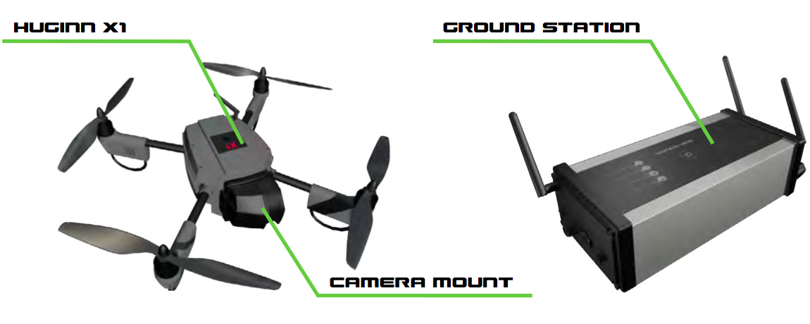
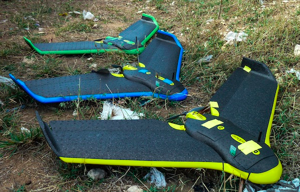
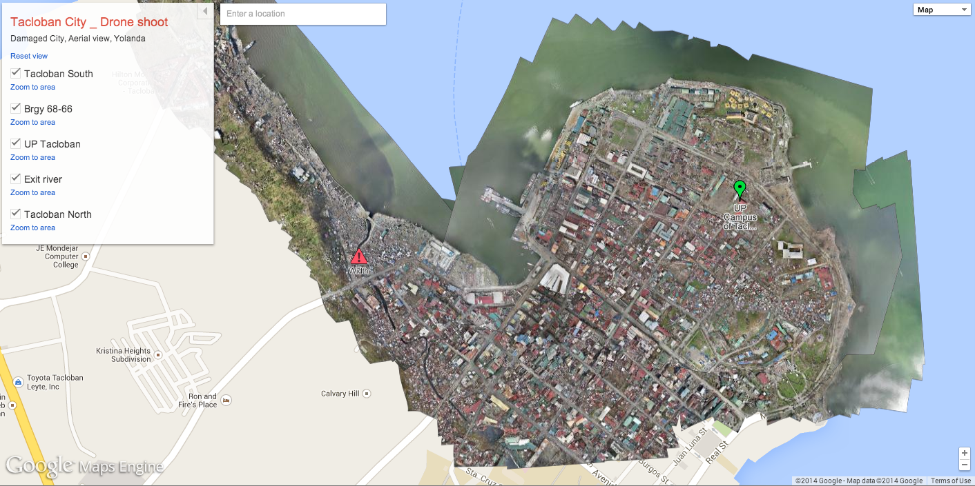
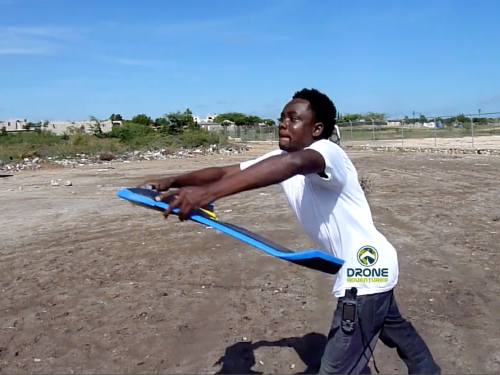
That being said, while defense contractors are promoting their large surveillance drones for use in humanitarian settings, “a different group of actors—who might be seen as a new breed of ‘techie humanitarians’—have entered the race. Their aim is to develop small drones to conduct SAR [search and rescue] or to provide data about emergencies, as part of the growing field of crisis mapping.” This “micro-UAV” space is the one promoted by the Humanitarian UAV Network (UAViators), not only for imaging but for multi-sensing and payload delivery. Indeed, as “the functions of UAV technologies evolve from relief-site monitoring to carrying cargo, enabling UAVs to participate more directly in field operations, ‘civil UAV technologies will be able to aid considerably in human relief […].”

Screen Shot 2014-06-24 at 2.30.27 PM

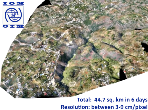
As UAVs continue collecting more information on disasters and the impact of humanitarian assistance, they will “part of the ongoing humanitarian challenge of securing, making sense of and maintaining Big Data, as well as developing processes for leveraging credible and actionable information in a reasonable amount of time. At the same time, the humanitarian enterprise is gradually becoming concerned about the privacy implications of surveillance, and the possible costs of witnessing.” This an area that the Humanitarian UAV Network is very much concerned about, so I hope that Kristen will continue to push for this given that she is also on the Advisory Board of UAViators.

In conclusion, the authors believe that the “focus on weaponized drones fails to capture the transformative potential of humanitarian drones and their possible impact on humanitarian action, and the associated pitfalls.” They also emphasize that “the notion of the humanitarian drone is still an immature concept, forming around an immature technology. It is unclear whether the integration of drones into humanitarian action will be cost-effective, ethical or feasible.” I agree with this but only in part since Kristin and Kjersti do not include small or micro-UAVs in their study. The latter are already being integrated in a cost-effective & ethical manner, which is in line with the Humanitarian UAV Network’s mission.

Screen Shot 2014-06-24 at 2.29.46 PM

More research is needed on the role of small-UAVs in the humanitarian space and in particular on the new actors deploying them: from citizen journalists and local, grassroots communities to international humanitarian organizations & national NGOs. Another area ripe for research is the resulting “Big Data” that is likely to be generated by these new data collection technologies.

bio

See Also:

  •  Humanitarians in the Sky: Using UAVs for Disaster Response [link]
  • How UAVs are Making a Difference in Disaster Response [link]
  • Humanitarians Using UAVs for Post Disaster Recovery [link]
  • Grassroots UAVs for Disaster Response [link]
  • Using UAVs for Search & Rescue [link]
  • Debrief: UAV/Drone Search & Rescue Challenge [link]
  • Crowdsourcing Analysis of UAV Imagery for Search/Rescue [link]
  • Check-List for Flying UAVs in Humanitarian Settings [link]

How UAVs Are Making a Difference in Disaster Response

I visited the University of Torino in 2007 to speak with the team developing UAVs for the World Food Program. Since then, I’ve bought and tested two small UAVs of my own so I can use this new technology to capture aerial imagery during disasters; like the footage below from the Philippines.

UAVs, or drones, have a very strong military connotation for many of us. But so did space satellites before Google Earth brought satellite imagery into our homes and changed our perceptions of said technology. So it stands to reason that UAVs and aerial imagery will follow suit. This explains why I’m a proponent of the Drone Social Innovation Award, which seeks to promote the use of civilian drone technology for the benefit of humanity. I’m on the panel of judges for this award, which is why I reached out to DanOffice IT, a Swiss-based company that deployed two drones in response to Typhoon Yolanda in the Philippines. The drones in question are Huginn X1’s, which have a flight time of 25 minutes with a range of 2 kilometers and maximum altitude of 150 meters.

HUGINN X1

I recently spoke with one of the Huginn pilots who was in Tacloban. He flew the drone to survey shelter damage, identify blocked roads and search for bodies in the debris (using thermal imaging cameras mounted on the drone for the latter). The imagery captured also helped to identify appropriate locations to set up camp. When I asked the pilot whether he was surprised by anything during the operation, he noted that road-clearance support was not a use-case he had expected. I’ll be meeting with him in Switzerland in the next few weeks to test-fly a Huginn and explore possible partnerships.

I’d like to see closer collaboration between the Digital Humanitarian Network (DHN) and groups like DanOffice, for example. Providing DHN-member Humanitarian OpenStreetMap (HOTosm) with up-to-date aerial imagery during disasters would be a major win. This was the concept behind OpenAerialMap, which was first discussed back in 2007. While the initiative has yet to formally launch, PIX4D is a platform that “converts thousands of aerial images, taken by lightweight UAV or aircraft into geo-referenced 2D mosaics and 3D surface models and point clouds.”

Drone Adventures

This platform was used in Haiti with the above drones. The International Organization for Migration (IOM) partnered with Drone Adventures to map over 40 square kilometers of dense urban territory including several shantytowns in Port-au-Prince, which was “used to count the number of tents and organize a ‘door-to-door’ census of the population, the first step in identifying aid requirements and organizing more permanent infrastructure.” This approach could also be applied to IDP and refugee camps in the immediate aftermath of a sudden-onset disaster. All the data generated by Drone Adventures was made freely available through OpenStreetMap.

If you’re interested in giving “drones for social good” a try, I recommend looking at the DJI Phantom and the AR.Drone Parrot. These are priced between $300- $600, which beats the $50,000 price tag of the Huginn X1.

 bio

The Use of Drones for Nonviolent Civil Resistance

In my previous blog post on the use of drones for human rights, I also advocated for the use of drones to support nonviolent civil resistance efforts. Obviously, like the use of any technology in such contexts, doing so presents both new opportunities and obvious dangers. In this blog post, I consider the use of DIY drones in the context of civil resistance, both vis-a-vis theory and practice. While I’ve read the civil resistance literature rather widely for my dissertation, I decided to get input from two of the world’s leading experts on the topic.

The first expert opined as follows: “Whether a given technology delivers strategic or tactical avantage is typically dependent on context. So to the extent that a drone can be useful in getting evidence that delegitimizes a movement’s opponent (i.e. exposing atrocities), and/or legitimizes a movement (i.e. docu-menting strictly nonviolent activities), and/or provides useful intelligence to a movement about an opponent’s current capabilities (i.e. the amount of supplies an adversary has), strengths, and weaknesses, then one could indeed argue that drones could provide strategic or tactical advantages.  But contextually speaking, if the amount of human and financial resources necessary to acquire and deploy a drone are a drain on beneficial activities that a movement may otherwise be undertaking, then it’s a cost/benefit analysis.”

As this New York Times article notes, the cost of drones is dropping dramatically and their applications multiplying. Even Professor Francis Fukuyama is getting in on the action. While drones were once exclusively the purview of the military, they are quickly becoming mainstream and being used by civilians. Indeed, the line dividing remote control toy planes and drones is starting to blur. Keep in mind that satellite imagery had a strong military connotation before Google Earth entered the scene a few  years ago. Indeed, greater civilian access to satellite imagery has demystified this erstwhile exclusively military technology.

A few weeks ago, a civilian used a simple Hexa Arducopter to film protests in Estonia. Around the same time, protestors in Warsaw used a small Polish RoboKopter equipped with a videocamera to get this drone’s eye view of police movement. Last year, a Hexacopter was used to film Russian protests, as repor-ted by CNN below.

As Wired editor-in-chief and drone-builder Chris Anderson notes, “no more do citizens need to wait for news choppers to get aerial footage of a major event. With drones, they can shoot their own overhead video.” Wired‘s Spencer Ackerman writes that “getting an aerial view is the next step in compelling DIY citizen video. […] An aerial view gives an entirely different perspective what constitutes a legitimate—and illegitimate—threat.”

The second civil resistance expert I consulted argued that “nonviolent move-ments definitely need good and timely information in order to engage in effective strategic planning, to be able to anticipate regime responses, etc., so we can draw on the strategic nonviolent conflict literature. And we can cite Brian Martin and Wendy Varney on how exposing regime violence (via images) targeting non-violent opposition can produce an important backfire effect, leading to loss of domestic and international support for the regime. Gene Sharp referred to it as political jiu-jitsu.”

Indeed, an arial view could capture a different perspective than state-television cameras might, and thus reveal an illegitimate act on behalf of the regime that is also not captured by cell phone cameras. To this end, an illegitimate act carried out by a repressive regime could backfire if caught on drone cameras and subsequently shared via Twitter, Flickr and/or YouTube. As Sharp writes, too much brutality may result in political jiu-jitsu where the opposition group is able to increase their unity and support while politically throwing the ruler off balance and weakening his/her regime.

I’ve blogged about Gene Sharp’s work several times on iRevolution, so I won’t expand on his bio here. In 1973, he published a book on nonviolent action in which he describes 198 tactics that civil resistance can employ in their campaign. I briefly reviewed these again within the context of DIY drones and have added some relevant ones below together with an explanation.

12. Skywriting and earthwriting: while drones are typically used for sur-veillance, they could be used for skywriting (or sky-graffiti). They could also be used to take pictures or videos of earthwriting.

18. Displays of flags and symbolic colors: just like the above, drones could also be used to fly small flags and banners, which could further spread the message of the movement. This could be safer than other methods.

31. “Haunting” officials: drones could be used to try and follow specific officials or groups of officials, especially as they are moving through the city center. They could also be used to follow military vehicles. These drones could also take pictures of said officials and military equipment, which could be used to further haunt said officials.

32. Taunting officials: in this case, drones could be used to buzz officials up close and personal. Of course, this would make it easier for the drone to get shot down. Perhaps if protestors used a fleet of DIY drones, there would be strength in numbers, creating an annoying wasp effect. For those drones that can carry some payload, leaflet could be dropped from said drones. If the pilots are particularly adept, they could also drop paint or even, well, urine.

161. Nonviolent harassment: basically same as points 31 & 32. Perhaps drones could be used to harass officials trying to give speeches. If some DIY drones are capable of carrying small but particularly loud speakers, they could be used to play music, or play back political speeches in which officials were clearly lying.

169. Nonviolent air raids: the tactics described above qualify as nonviolent air raids. Perhaps a drone could carry some firecrackers and buzz an airbase. Of course, this would likely provoke return fire with live ammunition.

184. Defiance of blockades: buzzing of blockades would demonstrate that while they can block people and cars, they care not impermeable. Those drones capable of carrying payloads could also be used to transport small packages across blockades.

194. Disclosing identities of secret agents: this is certainly more challenging and would require additional reconnaissance and intelligence information. But suspected secret agents could potentially be followed via small, DIY drones, particularly the hexacopter variety.

“At the end of the day,” according to the first expert I consulted, “a drone is a tool, and the strategic advantage it may provide will also depend on the funda-mental unity, planning, and discipline that a movement has or does not have.  For example, if a movement is lacking a fundamentally good and unifying message, no amount of technology will substitute for that, and thus the strategic value of that technology is diminished in the context of that movement.  On the other hand if a movement has a good and unifying message and levers technology to reinforce that message, then the technology can act as a multiplier and provide substantially more strategic value.

Drones for Human Rights: Brilliant or Foolish? (Updated)

My colleague Mark Hanis recently co-authored this Op-Ed in the New York Times advocating for the use of drones in human rights monitoring, particularly in Syria. The Op-Ed has provoked quite the debate on a number of list-serves like CrisisMappers, and several blog posts have been published on the question. I’ve long been interested this topic, which is why I included a section on drones in this official UN Foundation Report on “New Technologies in Emergen-cies and Conflicts: The Role of Information and Social Networks.” I also blogged about the World Food Program’s (WFP) use of drones some four years ago.

Some critics have made some good points vis-a-vis the limitation of drones for human rights surveillance. But some have also twisted the Op-Ed’s language and arguments. The types of drones or UAVs that an NGO might be able to purchase would not have the advanced technology required to capture the identify of perpetrators, according this critic. But at no point do Mark and his co-author, Andrew Sniderman, actually argue that drones should be used to document the identity of those committing human rights violations. Rather, “A drone would let us count demonstrators, gun barrels and pools of blood.” And what if a consortium of NGOs do receive substantial funding to acquire a high-end drone for human rights surveillance purposes? Moreover, as drones become cheaper and smaller, using them to capture the identity of perpetrators will become increasingly possible.

This same critic notes quite rightly that humanitarian drones would “not have been able to monitor any mistreatment of Mandela in his cell on Robben Island. Nor will they be able to monitor torture in Syrian detention facilities.” Indeed, but again, nowhere in the Op-Ed do the authors claim that drones could serve this purpose. So this is again a counter-argument to an argument that was never made in the first place. (This critic seems to enjoy this kind of debating tactic).

As the authors fully acknowledge, the use of humanitarian drones would “violate Syrian airspace, and perhaps a number of Syrian and international laws.” Some are concerned that this would “cause the Syrian government to even further escalate its military response.” If this is really the argument made against the use of drones, then this would beg the following question: should existing interventions in Syria also be vetoed since they too risk provoking the regime? This argument almost seeks to make a case for non-interference and non-intervention. The argument also supposes that the Syrian regime actually needs an excuse to escalate the slaughter of civilians.

This is a clear case where the regime has clearly and repeatedly violated the Responsibility to Protect (R2P) principle and has thus given up any legitimate claim to territorial sovereignty. “In any event, violations of Syrian sovereignty would be the direct consequence of the Syrian state’s brutality, not the imperialism of outsiders” (NYT Op-Ed). And yet, one critic still argues that using drones in Syria would “set an unfortunate precedent […] that human rights organizations are willing to violate international law […].” According to R2P, Syria’s claim to sovereignty expired almost a year ago.

Granted, R2P is an international norm, not (yet) international law, but as the authors of the Op-Ed acknowledge, this type of intervention “isn’t the kind of thing nongovernmental organizations usually do. But it is very different from what governments and armies do. Yes, we (like them) have an agenda, but ours is transparent: human rights. We have a duty, recognized internationally, to monitor governments that massacre their own people in large numbers. Human rights organizations have always done this. Why not get drones to assist the good work?” Besides, to assume that human rights organizations have never violated laws in the past would be naive at best. Human rights organizations often smuggle information and/or people across borders, I know this for a fact.

As for the argument that using drones “could make even traditional human rights monitoring in repressive countries more difficult,” this is certainly true, as is any other type of intervention and use of technology, like digital cameras, Twitter, blogging, satellite imagery, etc. This same critic quotes another who points to surface-to-air misslies as being a regime’s obvious antidote to human rights drones. Indeed, such cases have been reported in Sri Lanka, as I learned back in 2005 from a colleague based in Colombo. Providing a regime with non-human targets is preferable to them using live ammunition on children. Regimes can also destroy mobile phones, digital cameras, etc. So does that mean human rights activists should refrain from using these technologies as well?

More from the critic: “cell phones can go more places than drones. Most people own one, and two year olds can use iPads. Cell phones can take photos that identify who is wearing what uniform and beating which protesters.” Indeed, the Op-Ed does not make any claims to the contrary. Cell phones may be able to go to more places than drones, but can they do so “unmanned“?  Can cell phones take pictures of uniforms up close and personal with zero risk to the cell phone owner? The observers of the recent Arab League Mission were not free to move around as they pleased, which is one reason why the Op-Ed makes the case for humanitarian drones. Still, the critic points out that she could attach a cell phone to a weather balloon and thus create a mini-drone. For sure, DIY drones are becoming more and more popular given the new technologies available and the lower costs; as is balloon mapping. Nothing in the Op-Ed suggests that the authors would rule out these solutions.

So what impact might the use of drones for human rights have? This is another entirely separate but equally important question. What kinds of documented human rights violations (and on from what types of media) might have the greatest chance prompting individuals and policy makers to act? As this critic asks, “What is the point of diminishing marginal returns on ‘bearing witness'”? And as the previous critic argues, “plenty of graphic images and videos from Syria have been captured and made public. Most are taken by digital cameras and cell phones in close quarters or indoors. None have caused the outrage and response Hanis and Sniderman seek.”

I beg to differ on this last point. Many of us have been outraged by the images captured and shared by activists on Twitter, Facebook , etc; so have human rights organizations and policy makers, including members of the UN Security Council and the Arab League. How to translate this outrage into actual response, how-ever, is an entirely different and separate challenge; one that is no less important. Mark and Andrew do not argue or pretend that surveillance imagery captured by  drones would be a silver bullet to resolving the political inertia on Syria. Indeed: “as with any intelligence-gathering process, surveillance missions necessarily operate in a political, rather than neutral space.”

In my mind, a combination of efforts is required—call it a networked, ecosystem approach. Naturally, whether such a combination (with drones in the mix) makes sense will depend on the context and the situation. Using drones will not always make sense, the cost-benefit analysis may differ considerably depending on the use-case and also over time. From the perspective of civil resistance and non-violent action, the use of drones makes sense. It gives the regime another issue to deal with and requires them to allocate time and resources accordingly. In fact, even if human rights activists had access to the cheapest drones that do not have the ability to take pictures, flying these over Syrian airspace would likely get the attention of the regime.

The result? This would “force” the regime to deal with something new and hopefully draw their fire away from civilians, even if momentarily. At the very least, it would use up some of their military ammunitions. More importantly, there’s also a plausible psychological effect here: no one likes mosquitos buzzing around their heads. It’s annoying and frustrating. Harassing repressive regimes can certainly have negative consequences. But they are part and parcel of civil resistance tactics. In certain circumstances, these risks may be worth taking, especially if those who decide to use drones for these purposes are Syrian activists themselves or operating under the direction of these activists. Either way, the duty to bear witness remains and is recognized internationally.

From a financial cost-benefit perspective, there’s no doubt that “the comparative advantage on technological platforms lies with foreign governments, rather than the NGO community,” as this critic points out. But foreign governments do not readily make their imagery public for the purposes of advocacy. This would likely place unwanted pressure on them to react if they publicly shared the extent of the evidence they had on the atrocities being committed in Syria and elsewhere.

Update 1: An iRevolution reader commenting on another blog post just shared this news that the US Ambassador to Syria, Robert Ford, used his Facebook page to post “declassified US imagery of Syrian military attacks against civilians in the besieged city of Homs.” The US State Department explained that “Our intent here is to obviously expose the ruthlessness of the brutality of this regime and its overwhelming predominant advantage and the horrible kind of weaponry that it is deploying against its people.”

The news article adds that “Moscow and Beijing are also part of the intended audience for these images following their veto of a U.N. Security Council resolution backing Arab League action against President Assad.” In the context of my blog post above, one could argue that the USG could have made this type of information public 6 months ago in order to expose the brutality of the regime? And that a humanitarian drone might have exposed this earlier? In any case, this is a very interesting development. And as one colleague noted, “this proves point that images of atrocities are leveraged to build political pressure.”

Update 2: I wrote this follow-up post on the use of drones for civil resistance.

Links: Obama, Picture Passwords, Mini-UAVs

  • Obama, Internet and Elections: Obama’s victories in the Democratic primaries and the presidential election would not have been possible without Internet-empowered fundraising and social networking.
  • Mini-UAVs used to Collect Health Samples: The National Health Laboratory Services of South Africa is using mini-UAV’s to collect HIV/AIDS and TB samples from remote health posts in the region. Could this be applied to conflict early warning and early response?

UN World Food Program to use UAVs

I met with the World Food Program’s (WFP) Emergency Information Management team in Rome late last year and was pleasantly surprised when the term UAVs came up; Unmanned Areal Vehicles, otherwise known as drones and predators in different contexts. The fact that a leading field-based UN agency is actively engaged in a pilot program to use UAVs as early as this summer is particularly surprising and exciting at the same time.

Why surprising? UN Member States have been consistently touchy vis-a-vis issues of sovereignty. Indeed, much time has passed since President Dwight Eisenhower’s 1960 proposal for a “UN aerial reconnaissance capability […] to detect preparations for attack” to operate “in the territories of all nations prepared to accept such inspection.” Eisenhower had pledged that “the United States is prepared not only to accept United Nations aerial surveillance, but to do everything in its power to contribute to the rapid organization and successful operation of such international surveillance.” My, my how times have changed.

Why exciting? There is a notable albeit delayed “spill-over” effect between the use of ICTs by the disaster management and subsequently by the conflict prevention and human rights community. Furthermore, the occurrence of natural disasters amid complex political emergencies is an increasingly widespread phenomenon: over 140 natural disasters have occurred in complex political emergencies in the past five years alone.

The team at WFP is collaborating with ITHACA to build the UAV prototype Pelican. ITHACA is the Information Technology for Humanitarian Assistance, Cooperation and Action, a center of Excellence created by Politecnico di Torino (DITAG) and the Istituto Superiore sui Sistemi Territoriali per l’Innovazione (Si.T.I)

The main goal of the UAV project is to support disaster management through an innovative and effective tool for rapid mapping purposes in the early impact stage. The UAV is easily transportable on normal aircrafts and usable on the field, autonomously, by a couple of operators. The platform is equipped with the autopilot MP2128g, which allows an autonomous flight except for take-off and landing, and with digital sensors characterized by geometric and radiometric resolutions suitable for digital photogrammetry. […]

If satellite data are not available or not suitable to supply radiometric and geometric information, in situ missions must be foresaw. To this end the Pelican is equipped with a GPS/IMU navigation system and different photographic sensors suitable for digital photogrammetric shootings with satisfying geometric and radiometric quality. It can be easily transportable on normal aircrafts and usable on the field by a couple of operators.

The aircraft is equipped with the MP2128g autopilot that allows autonomous flights and provides a real-time attitude of flight. The software HORIZONmp provides flight path and current sensor values in real-time. The operator can also insert a flight plan (up to 1000 waypoints) on a preloaded map and upload them during the flight. Besides the system can be connected with the payload cameras, so it is possible to schedule an automatic shooting time. The operations of take-off and landing must be accomplished manually due to the insufficient GPS’s in-flight accuracy.

The Pelican uses the Ricoh GR commercial digital camera. The use of two Ricohs (stereo pairs) allows the Pelican to rapidly update existing maps and to perform 3D feature extraction devoted to the identification of areas that require further investigations.

When I spoke to the team at WFP, they quoted a price range of $12-$10K, which is definitely the cheapest price tag I’ve come across for a UAV with the Pelican’s specs. The folks in Torino are also working to push the range of the Pelican to 200km with longer endurance limits. One could then operate the Pelican from Thailand/Burmese border and fly the UAV into Burma to identify movement of soldiers.

Of course, the military junta could try and take the bird down, but even if the small Pelican took a hit, all the data would have been captured before impact thanks to the real-time video downlink made possible by the Ricoh. The potential for an iRevolution would be met if video footage could be beamed to individual mobile phones, perhaps using the video encryption technology I recently blogged about.

Patrick Philippe Meier