Tag Archives: UAViators

Aerial Robotics in the Land of Buddha

Buddhist Temples adorn Nepal’s blessed land. Their stupas, like Everest, stretch to the heavens, yearning to democratize the sky. We felt the same yearning after landing in Kathmandu with our UAVs. While some prefer the word “drone” over “UAVs”, the reason our Nepali partners use the latter dates back some 3,000 years to the spiritual epic Mahabharata (Great Story of Bharatas). The ancient story features Drona, a master of advanced military arts who slayed hundreds of thousands with his bow & arrows. This strong military connotation explains why our Nepali partners use “UAV” instead, which is the term we also used for our Humanitarian UAV Mission in the land of Buddha. Our purpose: to democratize the sky.

Screen Shot 2015-09-28 at 12.05.09 AM

Unmanned Aerial Vehicles (UAVs) are aerial robots. They are the first wave of robotics to impact the humanitarian space. The mission of the Humanitarian UAV Network (UAViators) is to enable the safe, responsible and effective use of UAVs in a wide range of humanitarian and development settings. We thus spearheaded a unique and weeklong UAV Mission in Nepal in close collaboration with Kathmandu University (KU), Kathmandu Living Labs (KLL), DJI and Pix4D. This mission represents the first major milestone for Kathmandu Flying Labs (please see end of this post for background on KFL).

WP1

Our joint UAV mission combined both hands-on training and operational deployments. The full program is available here. The first day comprised a series of presentations on Humanitarian UAV Applications, Missions, Best Practices, Guidelines, Technologies, Software and Regulations. These talks were given by myself, KU, DJI, KLL and the Civil Aviation Authority (CAA) of Nepal. The second day  focused on direct hands-on training. DJI took the lead by training 30+ participants on how to use the Phantom 3 UAVs safely, responsibly. Pix4D, also on site, followed up by introducing their imagery-analysis software.

WP2

WP3

WP4

The second-half of the day was dedicated to operations. We had already received written permission from the CAA to carry out all UAV flights thanks to KU’s outstanding leadership. KU also selected the deployment sites and enabled us to team up with the very pro-active Community Disaster Management Committee (CDMC-9) of Kirtipur to survey the town of Panga, which had been severely affected by the earthquake just months earlier. The CDMC was particularly keen to gain access to very high-resolution aerial imagery of the area to build back faster and better, so we spent half-a-day flying half-a-dozen Phantom 3’s over parts of Panga as requested by our local partners.

WP5

WP6

WP7

WP8

The best part of this operation came at the end of the day when we had finished the mission and were packing up: Our Nepali partners politely noted that we had not in fact finished the job; we still had a lot more area to cover. They wanted us back in Panga the following day to complete our mapping mission. We thus changed our plans and returned the next day during which—thanks to DJI & Pix4D—we flew several dozen additional UAV flights from four different locations across Panga (without taking a single break; no lunch was had). Our local partners were of course absolutely invaluable throughout since they were the ones informing the flight plans. They also made it possible for us to launch and land all our flights from the highest rooftops across town. (Click images to enlarge).

WP8b

WP8bb

WP8c

WP8cc

WP8d

Meanwhile, back at KU, our Pix4D partners provided hands-on training on how to use their software to analyze the aerial imagery we had collected the day before. KLL also provided training on how to use the Humanitarian Open Street Map Tasking Manager to trace this aerial imagery. Incidentally, we flew well over 60 UAV flights all in all over the course of our UAV mission, which includes all our training flights on campus as well as our aerial survey of a teaching hospital. Not a single incident or accident occurred; everyone followed safety guidelines and the technology worked flawlessly.

WP8e

WP8f

WP8g

With more than 800 aerial photographs in hand, the Pix4D team worked through the night to produce a very high-resolution orthorectified mosaic of Panga. Here are some of the results.

WP9

WP10

WP11

WP12

Compare these results with the resolution and colors of the satellite imagery for the same area (maximum zoom).

Screen Shot 2015-09-28 at 12.32.36 AM

WP10

We can now use MicroMappers to crowdsource the analysis & digital annotation of oblique aerial pictures and videos collected throughout the mission. This is an important step in the development of automated feature-detection algorithms using techniques from computer vision and machine learning. The reason we want automated solutions is because aerial imagery already presents a Big Data challenge for humanitarian and development organizations. Indeed, a single 20- minute UAV flight can generate some 800 images. A trained analyst needs at least one minute to analyze a single image, which means that more than 13 hours of human time is needed to analyze imagery captured from just one 20-minute UAV flight. More on this Big Data challenge here.

Incidentally, since Pix4D also used their software to produce a number of stunning 3D models, I’m keen to explore ways to crowdsource 3D models via MicroMappers and to explore possible Virtual Reality solutions to the Big Data challenge. In any event, we generated all the aerial data requested by our local partners by the end of the day.

While this technically meant that we had successfully completed our mission, it didn’t feel finished to me. I really wanted to “liberate” the data completely and place it directly into the hands of the CDCM and local community in Panga. What’s the point of “open data” if most of Panga’s residents are not able to view or interact with the resulting maps? So I canceled my return flight and stayed an extra day to print out our aerial maps on very large roll-able and waterproof banners (which are more durable than paper-based maps).

WP13

WP14

WP15

We thus used these banner-maps and participatory mapping methods to engage the local community directly. We invited community members to annotate the very-high resolution aerial maps themselves by using tape and color-coded paper we had brought along. In other words, we used the aerial imagery as a base map to catalyze a community-wide discussion; to crowdsource and to visualize the community’s local knowledge. Participatory mapping and GIS (PPGIS) can play an impactful role in humanitarian and development projects, hence the initiative with our local partners (more here on community mapping).

In short, our humanitarian mission combined aerial robotics, computer vision, waterproof banners, tape, paper and crowdsourcing to inform the rebuilding process at the community level.

WP16

WP20

WP19

WP18

WP17

WP16b

WP24

WP23

WP22

WP21

WP25

The engagement from the community was absolutely phenomenal and definitely for me the highlight of the mission. Our CDMC partners were equally thrilled and excited with the community engagement that the maps elicited. There were smiles all around. When we left Panga some four hours later, dozens of community members were still discussing the map, which our partners had hung up near a popular local teashop.

There’s so much more to share from this UAV mission; so many angles, side-stories and insights. The above is really just a brief and incomplete teaser. So stay tuned, there’s a lot more coming up from DJI and Pix4D. Also, the outstanding film crew that DJI invited along is already reviewing the vast volume of footage captured during the week. We’re excited to see the professionally edited video in coming weeks, not to mention the professional photographs that both DJI and Pix4D took throughout the mission. We’re especially keen to see what our trainees at KU and KLL do next with the technology and software that are now in their hands. Indeed, the entire point of our mission was to help build local capacity for UAV missions in Nepal by transferring knowledge, skills and technology. It is now their turn to democratize the skies of Nepal.

WP26

WP27

Acknowledgements: Some serious acknowledgements are in order. First, huge thanks to Lecturer Uma Shankar Panday from KU for co-sponsoring this mission, for hosting us and for making our joint efforts a resounding success. The warm welcome and kind hospitality we received from him, KU’s faculty and executive leadership was truly very touching. Second, special thanks to the CAA of Nepal for participating in our training and for giving us permission to fly. Third, big, big thanks to the entire DJI and Pix4D Teams for joining this UAViators mission and for all their very, very hard work throughout the week. Many thanks also to DJI for kindly donating 10 Smartisan phones and 10 Phantom 3’s to KU and KLL; and kind thanks to Pix4D for generously donating licenses of their software to both KU and KLL. Fourth, many thanks to KLL for contributing to the training and for sharing our vision behind Kathmandu Flying Labs. Fifth, I’d like to express my sincere gratitude to Smartisan for co-sponsoring this mission. Sixth, deepest thanks to CDMC and Dhulikhel Hospital for partnering with us on the ops side of the mission. Their commitment and life-saving work are truly inspiring. Seventh, special thanks to the film and photography crew for being so engaged throughout the mission; they were absolutely part of the team. In closing, I want to specifically thank my colleagues Andrew Schroeder from UAViators and Paul & William from DJI for all the heavy lifting they did to make this entire mission possible. On a final and personal note, I’ve made new friends for life as a result of this UAV mission, and for that I am infinitely grateful.


Kathmandu Flying Labs: My colleague Dr. Nama Budhathoki and I began discussing the potential role that small UAVs could play in his country in early 2014, well over a year-and-half before Nepal’s tragic earthquakes. Nama is the Director of Kathmandu Living Labs, a crack team of Digital Humanitarians whose hard work has been featured in The New York Times and the BBC. Nama and team create open-data maps for disaster risk reduction and response. They use Humanitarian OpenStreetMap’s Tasking Server to trace buildings and roads visible from orbiting satellites in order to produce these invaluable maps. Their primary source of satellite imagery for this is Bing. Alas, said imagery is both low-resolution and out-of-date. And they’re not sure they’ll have free access to said imagery indefinitely either.

KFL logo draft

So Nama and I decided to launch a UAV Innovation Lab in Nepal, which I’ve been referring to as Kathmandu Flying Labs. A year-and-a-half later, the tragic earthquake struck. So I reached out to DJI in my capacity as founder of the Humanitarian UAV Network (UAViators). The mission of UAViators is to enable the safe, responsible and effective use of UAVs in a wide range of humanitarian and development settings. DJI, who are on the Advisory Board of UAViators, had deployed a UAV team in response to the 6.1 earthquake in China the year before. Alas, they weren’t able to deploy to Nepal. But they very kindly donated two Phantom 2’s to KLL.

A few months later, my colleague Andrew Schroeder from UAViators and Direct Relief reconnected with DJI to explore the possibility of a post-disaster UAV Mission focused on recovery and rebuilding. Both DJI and Pix4D were game to make this mission happen, so I reached out to KLL and KU to discuss logistics. Professor Uma at KU worked tirelessly to set everything up. The rest, as they say, is history. There is of course a lot more to be done, which is why Nama, Uma and I are already planning the next important milestones for Kathmandu Flying Labs. Do please get in touch if you’d like to be involved and contribute to this truly unique initiative. We’re also exploring payload delivery options via UAVs and gearing up for new humanitarian UAV missions in other parts of the planet.

Developing Guidelines for Humanitarian UAV Missions

New: The revised Code of Conduct and Guidelines are now publicly available as part of an open consultative process that will conclude on October 10th. We thus invite comments on the draft guidelines here (Google Doc). Please note that only feedback provided via this Google Form will be reviewed. We’ll be running an open Webinar on September 16th to discuss the guidelines in more detail.


The Humanitarian UAV Network (UAViators) recently organized a 3-day Policy Forum on Humanitarian UAVs. The mission of UAViators is to promote the safe, coordinated and effective use of UAVs in a wide range of humanitarian settings. The Forum, the first of it’s kind, was generously sponsored and hosted by the Rockefeller Foundation at their conference center in Bellagio, Italy. The aerial panoramic photograph below was captured by UAV during the Forum.

EricChengBellagio

UAViators brought together a cross-section of experts from the UN Office for the Coordination of Humanitarian Affairs (OCHA), UN Refugee Agency (UNHCR), UN Department for Peacekeeping Operations (DPKO), World Food Program (WFP), International Committee of the Red Cross (ICRC), American Red Cross, European Commission’s Humanitarian Aid Organization (ECHO), Medair, Humanitarian OpenStreetMap, ICT for Peace Foundation (ICT4Peace), DJI, BuildPeace, Peace Research Institute, Oslo (PRIO), Trilateral Research, Harvard University, Texas A&M, University of Central Lancashire, École Polytechnique Fédérale de Lausanne (EPFL), Pepperdine University School of Law and other independent experts. The purpose of the Forum, which I had the distinct pleasure of running: to draft guidelines for the safe, coordinated and effective use of UAVs in humanitarian settings.

Five key sets of guidelines were drafted, each focusing on priority areas where policy has been notably absent: 1) Code of Conduct; 2) Data Ethics; 3) Community Engagement; 4) Principled Partnerships; and 5) Conflict Sensitivity. These five policy areas were identified as priorities during the full-day Humanitarian UAV Experts Meeting co-organized at the UN Secretariat in New York by UAViators and OCHA (see summary here). After 3 very long days of deliberation in Bellagio, we converged towards an initial draft set of guidelines for each of the key areas. There was certainly no guarantee that this convergence would happen, so I’m particularly pleased and very grateful to all participants for their hard work. Indeed, I’m reminded of Alexander Aleinikoff (Deputy High Commissioner in the Office of UNHCR) who defines innovation as “dynamic problem solving among friends.” The camaraderie throughout the long hours had a lot to do with the positive outcome. Conferences typically take a group photo of participants; we chose to take an aerial video instead:

Of course, this doesn’t mean we’re done. The most immediate next step is to harmonize each of the guideline documents so that they “speak” to each other. We’ll then solicit internal institutional feedback from the organizations that were represented in Bellagio. Once this feedback has been considered and integrated where appropriate, we will organize a soft public launch of the guidelines in August 2015. The purpose of this soft launch is to actively solicit feedback from the broader humanitarian community. We plan to hold Webinars in August and September to invite this additional feedback. The draft guidelines will be further reviewed in October at the 2015 Humanitarian UAV Experts Meeting, which is being hosted at MIT and co-organized by UAViators, OCHA and the World Humanitarian Summit (WHS).

We’ll then review all the feedback received since Bellagio to produce the “final” version of the guidelines, which will be presented to donors and humanitarian organizations for public endorsement. The guidelines will be officially launched at the World Humanitarian Summit in 2016. In the meantime, these documents will serve as best practices to inform both humanitarian UAV trainings and missions. In other words, they will already serve to guide the safe, coordinated and effective use of UAVs in humanitarian settings. We will also use these draft guidelines to hold ourselves accountable. To be sure, humanitarian innovation is not simply about the technology; humanitarian innovation is also about the processes that enable the innovative use of emerging technologies.

While the first text message (SMS) was sent in 1992, it took 20 years (!) until a set of guidelines were developed to inform the use of SMS in disaster response. I’m relieved that we won’t have to wait until 2035 to produce UAV guidelines. Yes, the evidence base for the added value of UAVs in humanitarian missions is still thin, which is why it is all the more remarkable that forward-thinking guidelines are already being drafted. As several participants noted during the Forum, “The humanitarian community completely missed the boat on the mobile phone revolution. It is vital that we not make this same mistake again with newer, emerging technologies.” As such, the question for everyone at the Forum was not whether UAVs will have a significant impact, but rather what guidelines are needed now to guide the impact that this new technology will inevitably have on future humanitarian efforts.

The evidence base is necessarily thin since UAVs are only now emerging as a potential humanitarian technology. There is still a lot of learning and documenting to be done. The Humanitarian UAV Network has already taken on this task and will continue to enable learning and catalyze information sharing by convening expert meetings and documenting lessons learned in collaboration with key partners. The Network will also seek to partner with select groups on strategic projects with the aim of expanding the evidence base. In sum, I think we’re on the right track, and staying on the right track will require a joint and sustained effort with a cross-section of partners and stakeholders. To be sure, UAViators cannot accomplish the above alone. It took 22 dedicated experts and 3 long days to produce the draft guidelines. So consider this post an open invitation to join these efforts as we press on to make the use of UAVs in humanitarian crises safer, more coordinated and more effective.

In the meantime, a big thanks once again to all the experts who joined us for the Forum, and equally big thanks to the team at the Rockefeller Foundation for graciously hosting us in Bellagio.

UN Experts Meeting on Humanitarian UAVs

Updated: The Experts Meeting Summary Report is now available here (PDF) and also here as an open, editable Google Doc for comments/questions.

The Humanitarian UAV Network (UAViators) and the United Nations Office for the Coordination of Humanitarian Affairs (OCHA) are co-organizing the first ever “Experts Meeting on Humanitarian UAVs” on November 6th at UN Head-quarters in New York. This full-day strategy meeting, which is co-sponsored by the ICT for Peace Foundation (ICT4Peace) and QCRI, will bring together leading UAV experts (including several members of the UAV Network’s Advisory Board, such as DJI) with seasoned humanitarian professionals from OCHA, WFP, UNICEF, UNHCR, UNDAC, IOM, American Red Cross, European Commission and several other groups that are also starting to use civilian UAVs or have a strong interest in leveraging this technology.

The strategy session, which I’ll be running with my colleague Dan Gilman from OCHA (who authored this Policy Brief on Humanitarian UAVs), will provide an important opportunity for information sharing between UAV experts and humanitarian professionals with the explicit goal of catalyzing direct collabo-ration on the operational use of UAVs in humanitarian settings. UAV experts seek to better understand humanitarian information needs (e.g. UNDAC needs) while humanitarians seek to better understand the challenges and opportunities regarding the rapid deployment of UAVs. In sum, this workshop will bring together 30 experts from different disciplines to pave the way forward for the safe and effective use of humanitarian UAVs.

Screen Shot 2014-06-24 at 2.22.05 PM

The Experts Meeting will include presentations from select participants such as Gene Robinson (leading expert in the use of UAVs for Search & Rescue), Kate Chapman (director of Humanitarian OpenStreetMap), Peter Spruyt (European Commission’s Joint Research Center), Jacob Petersen (Anthea Technologies), Charles Devaney (University of Hawaii), Adam Klaptocz (Drone Adventures & senseFly) and several others. Both Matternet and Google’s Project Wing have been formally invited to present on the latest in UAV payload transportation. (Representatives from the Small UAV Coalition have also been invited to attend).

In addition to the above, the strategy meeting will include dedicated sessions on Ethics, Legislation and Regulation facilitated by Brendan Schulman (leading UAV lawyer) and Kristin Sandvik (Norwegian Center for Humanitarian Studies). Other sessions are expected to focus on Community Engagement, Imagery Analysis as well as Training and Certification. The final session of the day will be dedicated to identifying potential joint pilot projects between UAV pro’s and humanitarian organizations as well as the Humanitarian UAV Network.

UAViators Logo

We will be writing up a summary of the Experts Meeting and making this report publicly available via the Humanitarian UAV Network website. In addition, we plan to post videos of select talks given during the strategy meeting along with accompanying slides. This first meeting at UN Headquarters serves as a spring board for 2 future strategy meetings scheduled for 2015. One of these will be a 3-day high-level & policy-focused international workshop on Humanitarian UAVs, which will be held at the Rockefeller Foundation’s Center in Bellagio, Italy (pictured below in an UAV/aerial image I took earlier this year). This workshop will be run by myself, Dan Gilman and Kristin Sandvik (both of whom are on the Advisory Board of the Humanitarian UAV Network).

ProPic35

Kristin and I are also looking to co-organize another workshop in 2015 to focus specifically on the use of non-lethal UAVs in conflict zones. We are currently talking to prospective donors to make this happen. So stay tuned for more information on all three Humanitarian UAV meetings as one of our key goals at the Humanitarian UAV Network is to raise awareness about humanitarian UAVs by publicly disseminating results & findings from key policy discussions and UAV missions. In the meantime, big thanks to UN/OCHA, ICT4Peace and the Rockefeller Foundation for their crucial and most timely support.

Bio

See also:

  • Humanitarians in the Sky: Using UAVs for Disaster Response [link]
  • Low-Cost UAV Applications for Post-Disaster Damage Assessments: A Streamlined Workflow [Link]
  • Humanitarian UAVs Fly in China After Earthquake [link]
  • Humanitarian UAV Missions During Balkan Floods [link]
  • Humanitarian UAVs in the Solomon Islands [link]
  • UAVs, Community Mapping & Disaster Risk Reduction in Haiti [link]

Humanitarians in the Sky: Using UAVs for Disaster Response

The following is a presentation that I recently gave at the 2014 Remotely Piloted Aircraft Systems Conference (RPAS 2014) held in Brussels, Belgium. The case studies on the Philippines and Haiti are also featured in my upcoming book on “Digital Humanitarians: How Big Data is Changing the Face of Humanitarian Response.” The book is slated to be published in January/February 2015.

Screen Shot 2014-06-24 at 2.20.54 PM

Good afternoon and many thanks to Peter van Blyenburgh for the kind invitation to speak on the role of UAVs in humanitarian contexts beyond the European region. I’m speaking today on behalf of the Humanitarian UAV Network, which brings together seasoned humanitarian professionals with UAV experts to facilitate the use of UAVs in humanitarian settings. I’ll be saying more about the Humanitarian UAV Network (UAViators, pronounced “way-viators”) at the end of my talk.

Screen Shot 2014-06-24 at 2.21.19 PM

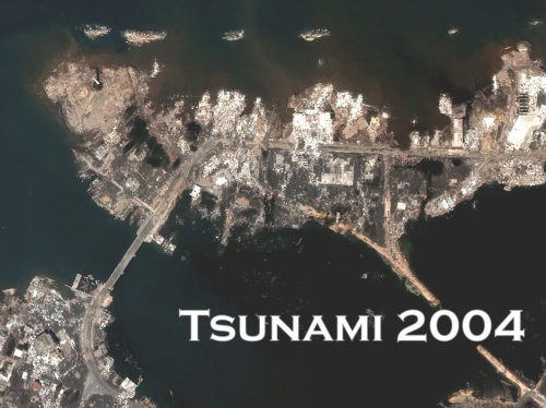
The view from above is key for humanitarian response. Indeed, satellite imagery has played an important role in relief operations since Hurricane Mitch in 1998. And the Indian Ocean Tsunami was the first to be captured from space as the way was still propagating. Some 650 images were produced using data from 15 different sensors. During the immediate aftermath of the Tsunami, satellite images were used at headquarters to assess the extent of the emergency. Later, satellite images were used in the field directly, distributed by the Humanitarian Information Center (HIC) and others to support and coordinate relief efforts. 

Screen Shot 2014-06-24 at 2.21.30 PM

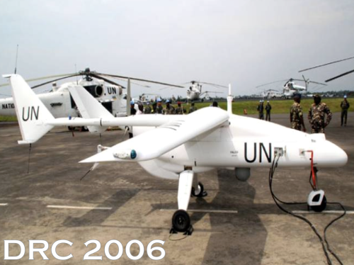
Satellites do present certain limitations, of course. These include cost, the time needed to acquire images, cloud cover, licensing issues and so on. In any event, two years after the Tsunami, an earlier iteration of the UN’s DRC Mission (MONUC) was supported by a European force (EUFOR), which used 4 Belgian UAVs. But I won’t be speaking about this type of UAV. For a variety of reasons, particularly affordability, ease of transport, regulatory concerns, and community engagement, UAVs used in humanitarian response are smaller systems or micro-UAVs that weigh just a few kilograms, such as one fixed-wing displayed below.

Screen Shot 2014-06-24 at 2.21.47 PM

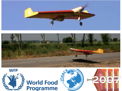
The World Food Program’s UAVs were designed and built at the University of Torino “way back” in 2007. But they’ve been grounded until this year due to lack of legislation in Italy.

Screen Shot 2014-06-24 at 2.22.05 PM

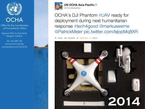
In June 2014, the UN’s Office for the Coordination of Humanitarian Affairs (OCHA) purchased a small quadcopter for use in humanitarian response and advocacy. Incidentally, OCHA is on the Advisory Board of the Humanitarian UAV Network, or UAViators. 

Screen Shot 2014-06-24 at 2.22.41 PM

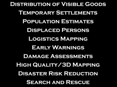
Now, there are many uses cases for the operation of UAVs in humanitarian settings (those listed above are only a subset). All of you here at RPAS 2014 are already very familiar with these applications. So let me jump directly to real world case studies from the Philippines and Haiti.

Screen Shot 2014-06-24 at 2.23.08 PM

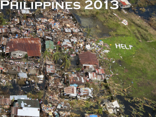
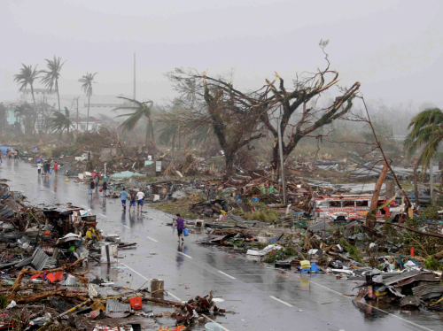
Typhoon Haiyan, or Yolanda as it was known locally, was the most powerful Typhoon in recorded human history to make landfall. The impact was absolutely devastated. I joined UN/OCHA in the Philippines following the Typhoon and was struck by how many UAV projects were being launched. What follows is just a few of said projects.

Screen Shot 2014-06-24 at 2.26.45 PM

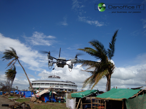
Danoffice IT, a company based in Lausanne, Switzerland, used the Sky-Watch Huginn X1 Quadcopter to support the humanitarian response in Tacloban. The rotary-wing UAV was used to identify where NGOs could set up camp. Later on, the UAV was used to support a range of additional tasks such as identifying which roads were passable for transportation/logistics. The quadcopter was also flown up the coast to assess the damage from the storm surge and flooding and to determine which villages had been most affected. This served to speed up the relief efforts and made the response more targeted vis-a-vis the provision of resources and assistance. Danoffice IT is also on the Board of the Humanitarian UAV Network (UAViators).

Screen Shot 2014-06-24 at 2.27.06 PM

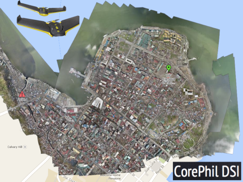
A second UAV project was carried out by local UAV start-up called CorePhil DSI. The team used an eBee to capture aerial imagery of downtown Tacloban, one of the areas hardest-hit by Typhoon Yolanda. They captured 22 Gigabytes of imagery and shared this with the Humanitarian OpenStreetMap Team (HOT) who are also on the Board of UAViators. HOT subsequently crowdsourced the tracing of this imagery (and satellite imagery) to create the most detailed and up-to-date maps of the area. These maps were shared with and used by multiple humanitarian organizations as well as the Filipino Government.

Screen Shot 2014-06-24 at 2.27.28 PM

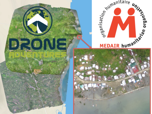
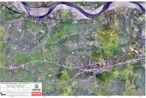
In a third project, the Swiss humanitarian organization Medair partnered with Drone Adventures to create a detailed set of 2D maps and 3D terrain models of the disaster-affected areas in which Medair works. These images were used to inform the humanitarian organization’s recovery and reconstruction programs. To be sure, Medair used the maps and models of Tacloban and Leyte to assist in assessing where the greatest need was and what level of assistance should be given to affected families as they continued to recover. Having these accurate aerial images of the affected areas allowed the Swiss organization to address the needs of individual households and—equally importantly—to advocate on their behalf when necessary.

Screen Shot 2014-06-24 at 3.20.08 PM

Drone Adventures also flew their fixed-wing UAVs (eBee’s) over Dulag, just north of Leyte, where more than 80% of homes and croplands were destroyed during the Typhoon. Medair is providing both materials and expertise to help build new shelters in Dulag. So the aerial imagery is proving invaluable to identify just how much material is needed and where. The captured imagery is also enabling community members themselves to better understand both where the greatest needs are an also what the potential solutions might be.

Screen Shot 2014-06-24 at 2.27.55 PM

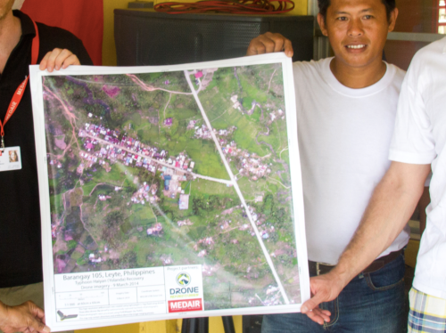
The partners are also committed to Open Data. The imagery captured was made available online and for free, enabling community leaders and humanitarian organizations to use the information to coordinate other reconstruction efforts. In addition, Drone Adventures and Medair presented locally-printed maps to community leaders within 24 hours of flying the UAVs. Some of these maps were printed on rollable, water proof banners, which make them more durable when used in the field.

Screen Shot 2014-06-24 at 2.28.11 PM

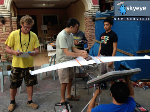
In yet another UAV project, the local Filipino start-up SkyEye Inc partnered with the University of the Philippines in Manila to develop expendable UAVs or xUAVs. The purpose of this initiative is to empower grassroots communities to deploy their own low-cost xUAVs and thus support locally-deployed response efforts. The team has trained 4 out of 5 teams across the Philippines to locally deploy UAVs in preparation for the next Typhoon season. In so doing, they are also transferring math, science and engineering skills to local communities. It is worth noting that community perceptions of UAVs in the Philippines and elsewhere has always been very positive. Indeed, local communities perceive small UAVs as toys more than anything else.

Screen Shot 2014-06-24 at 2.28.37 PM

SkyEye worked with this group from the University of Hawaii to create disaster risk reduction models of flood-prone areas.

Screen Shot 2014-06-24 at 2.29.22 PM

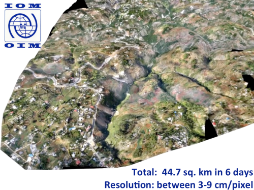
Moving to Haiti, the International Organization for Migration (IOM) has partnered with Drone Adventures and other to produce accurate topographical and 3D maps of disaster prone areas in the Philippines. These aerial images have been used to inform disaster risk reduction and community resilience programs. The UAVs have also enabled IOM to assess destroyed houses and other types of damage caused by floods and droughts. In addition, UAVs have been used to monitor IDP camps, helping aid workers identify when shelters are empty and thus ready to be closed. Furthermore, the high resolution aerial imagery has been used to support a census survey of public building, shelters, hospitals as well as schools.

Screen Shot 2014-06-24 at 2.29.46 PM

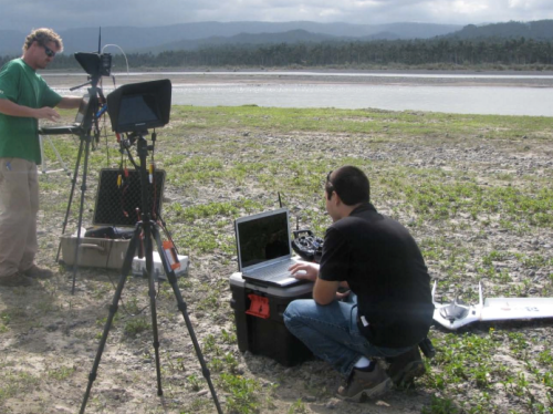
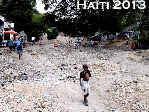
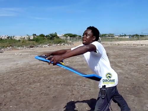
After Hurricane Sandy, for example, aerial imagery enabled IOM to very rapidly assess how many houses had collapsed near Rivière Grise and how many people were affected by the flooding. The aerial imagery was also used to identify areas of standing water where mosquitos and epidemics could easily thrive. Throughout their work with UAVs, IOM has stressed that regular community engagement has been critical for the successful use of UAVs. Indeed, informing local communities of the aerial mapping projects and explaining how the collected information is to be used is imperative. Local capacity building is also paramount, which is why Drone Adventures has trained a local team of Haitians to locally deploy and maintain their own eBee UAV.

Screen Shot 2014-06-24 at 2.30.27 PM

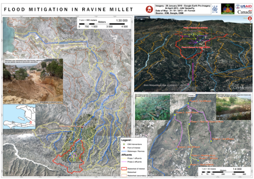
The pictures above and below are some of the information products produced by IOM and Drone Adventures. The 3D model above was used to model flood risk in the area and to inform subsequent disaster risk reduction projects.

Screen Shot 2014-06-24 at 2.30.47 PM

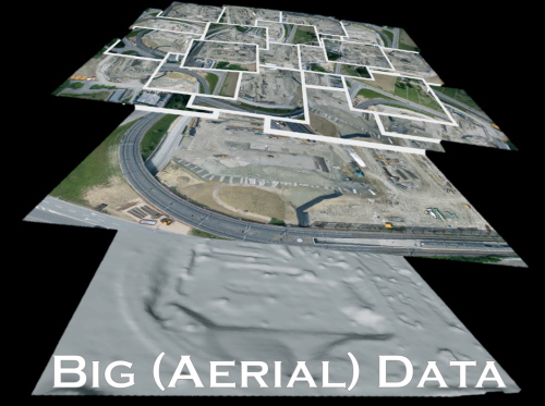
Several colleagues of mine have already noted that aerial imagery presents a Big Data challenge. This means that humanitarian organizations and others will need to use advanced computing (human computing and machine computing) to make sense of Big (Aerial) Data.

Screen Shot 2014-06-24 at 2.31.54 PM

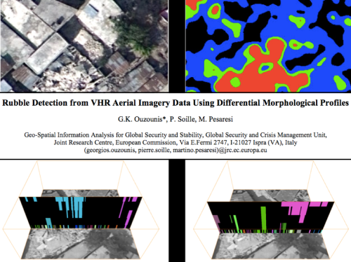
My colleagues at the European Commission’s Joint Research Center (JRC) are already beginning to apply advanced computing to automatically analyze aerial imagery. In the example from Haiti below, the JRC deployed a machine learning classifier to automatically identify rubble left over from the massive earthquake that struck Port-au-Prince in 2010. Their classifier had an impressive accuracy of 92%, “suggesting that the method in its simplest form is sufficiently reliable for rapid damage assessment.”

Screen Shot 2014-06-24 at 2.32.06 PM

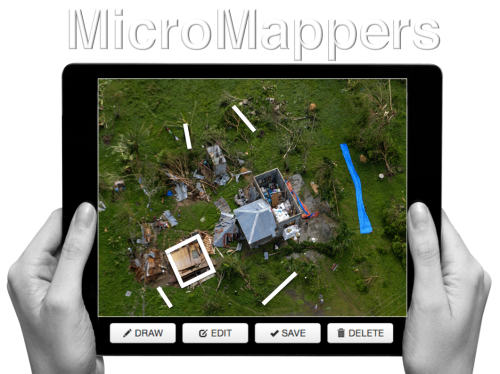
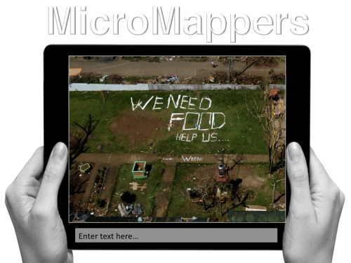
Human computing (or crowdsourcing) can also be used to make sense of Big Data. My team and I at QCRI have partnered with the UN (OCHA) to create the MicroMappers platform, which is a free and open-source tool to make sense of large datasets created during disasters, like aerial data. We have access to thousands of digital volunteers who can rapidly tag and trace aerial imagery; the resulting analysis of this tagging/tracing can be used to increase the situational awareness  of humanitarian organizations in the field.

Screen Shot 2014-06-24 at 2.32.43 PM


Digital volunteers can trace features of interest such as shelters without roofs. Our plan is to subsequently use these traced features as training data to develop machine learning classifiers that can automatically identify these features in future aerial images. We’re also exploring the second use-case depicted below, ie, the rapid transcription of imagery, which can then be automatically geo-tagged and added to a crisis map.

Screen Shot 2014-06-24 at 2.32.55 PM


The increasing use of UAVs during humanitarian disasters is why UAViators, the Humanitarian UAV Network, was launched. Recall the relief operations in response to Typhoon Yolanda; an unprecedented number of UAV projects were in operation. But most operators didn’t know about each other, so they were not coordinating flights let alone sharing imagery with local communities. Since the launch of UAViators, we’ve developed the first ever Code of Conduct for the use of UAVs in humanitarian settings, which includes guidelines on data protection and privacy. We have also drafted an Operational Check-List to educate those who are new to humanitarian UAVs. We are now in the process of carrying out a comprehensive evaluation of UAV models along with cameras, sensors, payload mechanism and image processing software. The purpose of this evaluation is to identify which are the best fit for use by humanitarians in the field. Since the UN and others are looking for training and certification programs, we are actively seeking partners to provide these services.

Screen Shot 2014-06-24 at 2.34.04 PM

The above goals are all for the medium to long term. More immediately, UAViators is working to educate humanitarian organizations on both the opportunities and challenges of using UAVs in humanitarian settings. UAViators is also working to facilitate the coordinate UAV flights during major disasters, enabling operators to share their flight plans and contact details with each other via the UAViators website. We are also planning to set up an SMS service to enable direct communication between operators and others in the field during UAV flights. Lastly, we are developing an online map for operators to easily share the imagery/videos they are collecting during relief efforts.

Screen Shot 2014-06-24 at 2.34.36 PM

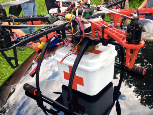
Data collection (imagery capture) is certainly not the only use case for UAVs in humanitarian contexts. The transportation of payloads may play an increasingly important role in the future. To be sure, my colleagues at UNICEF are actively exploring this with a number of partners in Africa.

Screen Shot 2014-06-24 at 2.34.47 PM

Other sensors also present additional opportunities for the use of UAVs in relief efforts. Sensors can be used to assess the impact of disasters on communication infrastructure, such as cell phone towers, for example. Groups are also looking into the use of UAVs to provide temporary communication infrastructure (“aerial cell phone towers”) following major disasters.

Screen Shot 2014-06-24 at 2.34.59 PM

The need for Sense and Avoid systems (a.k.a. Detection & Avoid solutions) has been highlighted in almost every other presentation given at RPAS 2014. We really need this new technology earlier rather than later (and that’s a major  understatement). At the same time, it is important to emphasize that the main added value of UAVs in humanitarian settings is to capture imagery of areas that are overlooked or ignored by mainstream humanitarian relief operations; that is, of areas that are partially or completely disconnected logistically. By definition, disaster-affected communities in these areas are likely to be more vulnerable than others in urban areas. In addition, the airspaces in these disconnected regions are not complex airspaces and thus present fewer challenges around safety and coordination, for example.

Screen Shot 2014-06-24 at 2.35.19 PM

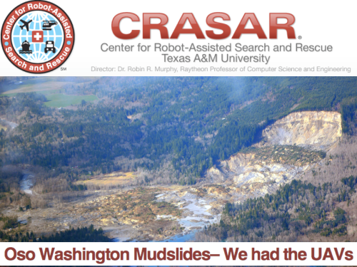
UAVs were ready to go following the mudslides in Oso, Washington back in March of this year. The UAVs were going to be used to look for survivors but the birds were not allowed to fly. The decision to ground UAVs and bar them from supporting relief and rescue efforts will become increasingly untenable when lives are at stake. I genuinely applaud the principle of proportionality applied by the EU and respective RPAS Associations vis-a-vis risks and regulations, but there is one very important variable missing in the proportionality equation: social benefit. Indeed, the cost benefit calculus of UAV risk & regulation in the context of humanitarian use must include the expected benefit of lives saved and suffering alleviated. Let me repeat this to make sure I’m crystal clear: risks must be weighed against potential lives saved.

Screen Shot 2014-06-24 at 2.35.39 PM

At the end of the day, the humanitarian context is different from precision agriculture or other commercial applications of UAVs such as film making. The latter have no relation to the Humanitarian Imperative. Having over-regulation stand in the way of humanitarian principles will simply become untenable. At the same time, the principle of Do No Harm must absolutely be upheld, which is why it features prominently in the Humanitarian UAV Network’s Code of Conduct. In sum, like the Do No Harm principle, the cost benefit analysis of proportionality must include potential or expected benefits as part of the calculus.

Screen Shot 2014-06-24 at 2.35.56 PM

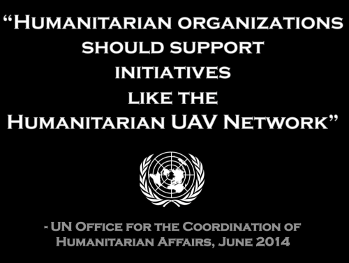
To conclude, a new (forthcoming) policy brief by the UN (OCHA) publicly calls on humanitarian organizations to support initiatives like the Humanitarian UAV Network. This is an important, public endorsement of our work thus far. But we also need support from non-humanitarian organizations like those you represent in this room. For example, we need clarity on existing legislation. Our partners like the UN need to have access to the latest laws by country to inform their use of UAVs following major disasters. We really need your help on this; and we also need your help in identifying which UAVs and related technologies are likely to be a good fit for humanitarians in the field. So if you have some ideas, then please find me during the break, I’d really like to speak with you, thank you!

bio

See Also:

  • Crisis Map of UAV/Aerial Videos for Disaster Response [link]
  • How UAVs are Making a Difference in Disaster Response [link]
  • Humanitarians Using UAVs for Post Disaster Recovery [link]
  • Grassroots UAVs for Disaster Response [link]
  • Using UAVs for Search & Rescue [link]
  • Debrief: UAV/Drone Search & Rescue Challenge [link]
  • Crowdsourcing Analysis of UAV Imagery for Search/Rescue [link]
  • Check-List for Flying UAVs in Humanitarian Settings [link]

Picture Credits:

  • Danoffice IT; Drone Adventures, SkyEye, JRC


Humanitarian UAV Network: Strategy for 2014-2015

The purpose of the Humanitarian UAV Network (UAViators) is to guide the responsible and safe use of small UAVs in humanitarian settings while promoting information sharing and enlightened policymaking. As I’ve noted in the past, UAVs are already being used to support a range of humanitarian efforts. So the question is not if, but rather how to facilitate the inevitable expanded use of UAVs in a responsible and safe manner. This is just one of many challenging questions that UAViators was created to manage.

UAViators Logo

UAViators has already drafted a number of documents, including a Code of Conduct and an Operational Check-List for the use of UAVs in humanitarian settings. These documents will continue to be improved throughout the year, so don’t expect a final and perfect version tomorrow. This space is still too new to have all the answers in a first draft. So our community will aim to improve these documents over time. By the end of 2014, we hope to have a solid version of the of Code of Conduct for organizations and companies to publicly endorse.

OCHA UAV

In the meantime, my three Research Assistants (RA’s) and I are working on (the first ever?) comprehensive evaluation of 1) Small UAVs; 2) Cameras; 3) Payload Units; and 4) Imagery Software specifically for humanitarian field-workers. The purpose of this evaluation is to rate which technologies are best suited to the needs of humanitarians in the field. We will carry out this research through interviews with seasoned UAV experts coupled with secondary, online research. Our aim is to recommend 2-3 small UAVs, cameras, payload units and software solutions for imagery processing and analysis that make the most sense for humanitarians as end users. These suggestions will then be “peer reviewed” by members of the Humanitarian UAV Network.

Following this evaluation, my three RA’s and I will create a detailed end-to-end operational model for the use of UAVs in humanitarian settings. The model will include pre-flight guidance on several key issues including legislation, insurance, safety and coordination. The pre-flight section will also include guidance on how to program the flight-path of the UAVs recommended in the evaluation. But the model does not end with the safe landing of a UAV. The operational model will include post-flight guidance on imagery processing and analysis for decision support as well as guidelines on information sharing with local communities. Once completed, this operational model will also be “peer reviewed” by members of the UAViators.

Credit Drone Adventures

Both deliverables—the evaluation and model—will be further reviewed by the Advisory Board of UAViators and by field-based humanitarians. We hope to have this review completed during the Humanitarian UAV Experts Meeting, which I am co-organizing with OCHA in New York this November. Feedback from this session will be integrated into both deliverables.

Our plan is to subsequently convert these documents into training materials for both online and onsite training. We have thus far identified two sites for this training, one in Southeast Asia and the other in southern Africa. We’re considering a potential third site in South America depending on the availability of funding. These trainings will enable us to further improve our materials and to provide minimum level certification to humanitarians participating in said trainings. To this end, our long-term strategy for the Humanitarian UAV Network is not only to facilitate the coordination of small UAVs in humanitarian settings but also to provide both training and certification in collaboration with multiple humanitarian organizations.

I recognize that the above is highly ambitious. But all the signals I’m getting from humanitarian organizations clearly demonstrate that the above is needed. So if you have some expertise in this space and wish to join my Research Assistants and I in this applied and policy-focused research, then please do get in touch. In addition, if your organization or company is interested in funding any of the above, then do get in touch as well. We have the initial funding for the first phase of the 2014-2015 strategy and are in the process of applying for funding to complete the second phase.

One final but important point: while the use of many small and large UAVs in complex airspaces in which piloted (manned) aircraft are also flying poses a major challenge in terms of safety, collision avoidance and coordination, this obviously doesn’t mean that small UAVs should be grounded in humanitarian contexts with far simpler airspaces. Indeed, to argue that small UAVs cannot be responsibly and safely operated in simpler airspaces ignores the obvious fact that they already have—and continue to be responsibly & safely used. Moreover, I for one don’t see the point of flying small UAVs in areas already covered by larger UAVs and piloted aircraft. I’m far more interested in the rapid and local deployment of small UAVs to cover areas that are overlooked or have not yet been reached by mainstream response efforts. In sum, while it will take years to develop effective solutions for large UAV-use in dense and complex airspaces, small UAVs are already being used responsibly and safely by a number of humanitarian organizations and their partners.

Bio

See Also:

  • Welcome to the Humanitarian UAV Network [link]
  • How UAVs are Making a Difference in Disaster Response [link]
  • Humanitarians Using UAVs for Post Disaster Recovery [link]
  • Grassroots UAVs for Disaster Response [link]
  • Using UAVs for Search & Rescue [link]
  • Debrief: UAV/Drone Search & Rescue Challenge [link]
  • Crowdsourcing Analysis of UAV Imagery for Search/Rescue [link]
  • Check-List for Flying UAVs in Humanitarian Settings [link]

An Operational Check-List for Flying UAVs in Humanitarian Settings

The Humanitarian UAV Network (UAViators) has taken off much faster than I expected. More than 240 members in 32 countries have joined the network since it’s launch just a few weeks ago.

UAViators Logo

I was also pleasantly surprised by the number of humanitarian organizations that got in touch with me right after the launch. Many of them are just starting to explore this space. And I found it refreshing that every single one of them considers the case for humanitarian UAVs to be perfectly obvious. Almost all of the groups also mentioned how they would have made use of UAVs in recent disasters. Some are even taking steps now to set up rapid-response UAV teams.

Credit: MicroDrones

My number one priority after launching the network was to start working on a Code of Conduct to guide the use of UAVs in humanitarian settings—the only one of it’s kind as far as I know. While I had initially sought to turn this Code of Conduct into a check-list, it became clear from the excellent feedback provided by members and the Advisory Board that we needed two separate documents. So my RA’s and I have created a more general Code of Conduct along with a more detailed operational check-list for flying UAVs in humanitarian settings. You’ll find the check-list here. Big thanks to Advisory Board member Gene Robinson for letting me draw on his excellent book for this check-list. Both the Code of Conduct and Check-List will continue to be updated on a monthly basis, so please do chime in and help us improve them.

One of my main goals for 2014 is to have the Code of Conduct officially and publicly endorsed by both UAV companies and humanitarian organizations alike. This may end up being a time-consuming process, but this endorsement is a must if the Code of Conduct is to become an established policy document. Another one of my goals is to organize a Humanitarian UAV Strategy Meeting in November that will bring together a select number of experts in Humanitarian UAVs with seasoned humanitarian professionals from the UN and Red Cross. The purpose of this meeting is to establish closer relationships between the humanitarian and UAV communities in order to facilitate coordination and information sharing during major disasters.

Also in the works for this year is a disaster response simulation with partners in the Philippines (including local government). The purpose of this simulation will be to rapidly deploy UAVs over a made-believe disaster area; then to upload the thousands of aerial images to MicroMappers to rapidly crowdsource the tagging of features-of-interest. Our (ambitious) hope is that the entire process can be done within a matter of hours. The simulation will help us identify the weak-links in our workflows. Our Filipino partners will also be using the resulting tagged images to create more accurate machine learning classifiers for automated feature detection. This will help them accelerate the analysis of aerial imagery during real disasters.

So stay tuned for updates, which will be posted on iRevolution and UAViators.

bio

See also:

  • How UAVs are Making a Difference in Disaster Response [link]
  • Humanitarians Using UAVs for Post Disaster Recovery [link]
  • Grassroots UAVs for Disaster Response [link]
  • Using UAVs for Search & Rescue [link]
  • Crowdsourcing Analysis of UAV Imagery for Search/Rescue [link]

Welcome to the Humanitarian UAV Network

UAViators Logo

The Humanitarian UAV Network (UAViators) is now live. Click here to access and join the network. Advisors include representatives from 3D Robotics, AirDroids, senseFly & DroneAdventures, OpenRelief, ShadowView Foundation, ICT4Peace Foundation, the United Nations and more. The website provides a unique set of resources, including the most comprehensive case study of humanitarian UAV deployments, a directory of organizations engaged in the humanitarian UAV space and a detailed list of references to keep track of ongoing research in this rapidly evolving area. All of these documents along with the network’s Code of Conduct—the only one of it’s kind—are easily accessible here.

UAViators 4 Teams

The UAViators website also includes 8 action-oriented Teams, four of which are displayed above. The Flight Team, for example, includes both new and highly experienced UAV pilots while the Imagery Team comprises members interested in imagery analysis. Other teams include the Camera, Legal and Policy Teams. In addition to this Team page, the site also has a dedicated Operations page to facilitate & coordinate safe and responsible UAV deployments in support of humanitarian efforts. In between deployments, the website’s Global Forum is a place where members share information about relevant news, events and more. One such event, for example, is the upcoming Drone/UAV Search & Rescue Challenge that UAViators is sponsoring.

When first announcing this initiative,  I duly noted that launching such a network will at first raise more questions than answers, but I welcome the challenge and believe that members of UAViators are well placed to facilitate the safe and responsible use of UAVs in a variety of humanitarian contexts.

Acknowledgements: Many thanks to colleagues and members of the Advisory Board who provided invaluable feedback and guidance in the lead-up to this launch. The Humanitarian UAV Network is result of collective vision and effort.

bio

See also:

  • How UAVs are Making a Difference in Disaster Response [link]
  • Humanitarians Using UAVs for Post Disaster Recovery [link]
  • Grassroots UAVs for Disaster Response [link]
  • Using UAVs for Search & Rescue [link]
  • Crowdsourcing Analysis of UAV Imagery for Search and Rescue [link]

Calling all UAV Pilots: Want to Support Humanitarian Efforts?

I’m launching a volunteer network to connect responsible civilian UAV pilots who are interested in safely and legally supporting humanitarian efforts when the need arises. I’ve been thinking through the concept for months now and have benefited from great feedback. The result is this draft strategy document; the keyword being draft. The concept is still being developed and there’s still room for improvement. So I very much welcome more constructive feedback.

Click here to join the list-serve for this initiative, which I’m referring to as the Humanitarian UAViators Network. Thank you for sharing this project far and wide—it will only work if we get a critical mass of UAV pilots from all around the world. Of course, launching such a network raises more questions than answers, but I welcome the challenge and believe members of UAViators will be well placed to address and manage these challenges.

bio