Category Archives: Humanitarian Technologies

Video: Humanitarian Response in 2025

I gave a talk on “The future of Humanitarian Response” at UN OCHA’s Global Humanitarian Policy Forum (#aid2025) in New York yesterday. More here for context. A similar version of the talk is available in the video presentation below.

Some of the discussions that ensued during the Forum were frustrating albeit an important reality check. Some policy makers still think that disaster response is about them and their international humanitarian organizations. They are still under the impression that aid does not arrive until they arrive. And yet, empirical research in the disaster literature points to the fact that the vast majority of survivals during disasters is the result of local agency, not external intervention.

In my talk (and video above), I note that local communities will increasingly become tech-enabled first responders, thus taking pressure off the international humanitarian system. These tech savvy local communities already exit. And they already respond to both “natural” (and manmade) disasters as noted in my talk vis-a-vis the information products produced by tech-savvy local Filipino groups. So my point about the rise of tech-enabled self-help was a more diplomatic way of conveying to traditional humanitarian groups that humanitarian response in 2025 will continue to happen with or without them; and perhaps increasingly without them.

This explains why I see OCHA’s Information Management (IM) Team increasingly taking on the role of “Information DJ”, mixing both formal and informal data sources for the purposes of both formal and informal humanitarian response. But OCHA will certainly not be the only DJ in town nor will they be invited to play at all “info events”. So the earlier they learn how to create relevant info mixes, the more likely they’ll still be DJ’ing in 2025.

Bio

How UAVs Are Making a Difference in Disaster Response

I visited the University of Torino in 2007 to speak with the team developing UAVs for the World Food Program. Since then, I’ve bought and tested two small UAVs of my own so I can use this new technology to capture aerial imagery during disasters; like the footage below from the Philippines.

UAVs, or drones, have a very strong military connotation for many of us. But so did space satellites before Google Earth brought satellite imagery into our homes and changed our perceptions of said technology. So it stands to reason that UAVs and aerial imagery will follow suit. This explains why I’m a proponent of the Drone Social Innovation Award, which seeks to promote the use of civilian drone technology for the benefit of humanity. I’m on the panel of judges for this award, which is why I reached out to DanOffice IT, a Swiss-based company that deployed two drones in response to Typhoon Yolanda in the Philippines. The drones in question are Huginn X1’s, which have a flight time of 25 minutes with a range of 2 kilometers and maximum altitude of 150 meters.

HUGINN X1

I recently spoke with one of the Huginn pilots who was in Tacloban. He flew the drone to survey shelter damage, identify blocked roads and search for bodies in the debris (using thermal imaging cameras mounted on the drone for the latter). The imagery captured also helped to identify appropriate locations to set up camp. When I asked the pilot whether he was surprised by anything during the operation, he noted that road-clearance support was not a use-case he had expected. I’ll be meeting with him in Switzerland in the next few weeks to test-fly a Huginn and explore possible partnerships.

I’d like to see closer collaboration between the Digital Humanitarian Network (DHN) and groups like DanOffice, for example. Providing DHN-member Humanitarian OpenStreetMap (HOTosm) with up-to-date aerial imagery during disasters would be a major win. This was the concept behind OpenAerialMap, which was first discussed back in 2007. While the initiative has yet to formally launch, PIX4D is a platform that “converts thousands of aerial images, taken by lightweight UAV or aircraft into geo-referenced 2D mosaics and 3D surface models and point clouds.”

Drone Adventures

This platform was used in Haiti with the above drones. The International Organization for Migration (IOM) partnered with Drone Adventures to map over 40 square kilometers of dense urban territory including several shantytowns in Port-au-Prince, which was “used to count the number of tents and organize a ‘door-to-door’ census of the population, the first step in identifying aid requirements and organizing more permanent infrastructure.” This approach could also be applied to IDP and refugee camps in the immediate aftermath of a sudden-onset disaster. All the data generated by Drone Adventures was made freely available through OpenStreetMap.

If you’re interested in giving “drones for social good” a try, I recommend looking at the DJI Phantom and the AR.Drone Parrot. These are priced between $300- $600, which beats the $50,000 price tag of the Huginn X1.

 bio

Humanitarian Response in 2025

I’ve been invited to give a “very provocative talk” on what humanitarian response will look like in 2025 for the annual Global Policy Forum organized by the UN Office for the Coordination of Humanitarian Affairs (OCHA) in New York. I first explored this question in early 2012 and my colleague Andrej Verity recently wrote up this intriguing piece on the topic, which I highly recommend; intriguing because he focuses a lot on the future of the pre-deployment process, which is often overlooked.

2025

I only have 7 minutes to give my talk so am thinking of leading with one or two of the following ideas−but I’m very interested in getting feedback from iRevolution readers and welcome additional ideas about what 2025 might look like for OCHA.

•  Situational Awareness: damage & needs assessments are instantaneous and 3D Crisis Maps are updated in real-time along with 3W’s information. Global communication networks are now hyper resilient, thus enabling uninterrupted communications after major disasters. More than 90% of the world’s population generates a readable, geo-referenced and multimedia digital footprint, which is used to augment 3D situational awareness; Fully 100% of all news media and citizen journalism content is now on the web and automatically translated & analyzed every second; high-resolution satellite and aerial imagery for 90% of the planet is updated and automatically analyzed every minute; Billions of physical sensors provide feedback loops on transportation, infrastructure, public health, weather-related and environmental dynamics in real-time. Big Data Analytics & advances in predictive modeling enables situational awareness to be predicted, allowing for IDP/refugee flows and disease outbreaks to be anticipated well ahead of any displacement.

•  Operational Response: disaster response is predominately driven by local communities. The real first responders, after all, have always been the disaster-affected communities. In 2025, this grassroots response is highly networked and hyper-tech enabled, thus significantly accelerating and improving the efficiency of self-help and mutual-aid. The Digital Humanitarian Network (DHN) is no longer a purely virtual network and has local chapters (with flocks of UAVs) in over 100 countries that each contribute to local response efforts. Meanwhile, close to 90% of the world’s population has an augmented-reality Personal Context Assistant (PCA), a wearable device that provides hyper-customized information (drawn in part from Quantified Self data) on urgent needs, available resources and logistics. National humanitarian response organizations have largely replaced the need for external assistance and coordination save for extreme events. International humanitarian organizations increasingly play a financial, certification and accountability role.

•  Early Recovery: There are more 3D printers than 2D printers in 2025. The former are extensively used for rapid reconstruction and post-disaster resilient development using local resources and materials. Mobile-money is automatically disbursed to enable this recovery based on personal insurance & real-time needs assessments. In addition, the Share Economy is truly global, which means that communication, transportation, accommodation and related local services are all readily available in the vast majority of urban areas. During disasters, Share Economy companies play an active role by offering free use of their platforms.

•  Data Access & Privacy: Telecommunications companies, satellite imagery firms and large technology & social media companies have all signed up to the International Data Philanthropy Charter, enabling them to share anonymized emergency data (albeit temporarily) that is directly relevant for humanitarian response. User-generated content is owned by the user who can limit the use of this data along the lines of the Open Paths model.

If you feel like this future is a little too rosy, that’s because I’m thinking of presenting two versions of the future, one that is optimistic and the other less so. The latter would be a world riddled with ad hoc decision-making based on very subjective damage & needs-assessments, highly restrictive data-sharing licenses and even the continued use of PDFs for data dissemination. This less-than pleasant world would also be plagued by data privacy, protection and security challenges. A new digital volunteer group called “Black Hat Humanitarians” rises to prominence and has little patience for humanitarian principles or codes of conduct. In this future world, digital data is collected and shared with no concern for informed consent. In addition, the vast majority of data relevant for saving lives in humanitarian crises remains highly proprietary. Meanwhile, open data that is publicly shared during disasters is used by tech-savvy criminals to further their own ends.

These two future worlds may be extremes but whether we lean towards one or the other will depend in part on enlightened leadership and policymaking. What do you think humanitarian response will look like in 2025? Where am I off and/or making unfounded assumptions? What aspects of the pictures I’m painting are more likely to become reality? What am I completely missing?

Update: Video of presentation available here.

bio

Combining Radio, SMS and Advanced Computing for Disaster Response

I’m headed to the Philippines this week to collaborate with the UN Office for the Coordination of Humanitarian Affairs (OCHA) on humanitarian crowdsourcing and technology projects. I’ll be based in the OCHA Offices in Manila, working directly with colleagues Andrej Verity and Luis Hernando to support their efforts in response to Typhoon Yolanda. One project I’m exploring in this respect is a novel radio-SMS-computing initiative that my colleague Anahi Ayala (Internews) and I began drafting during ICCM 2013 in Nairobi last week. I’m sharing the approach here to solicit feedback before I land in Manila.

Screen Shot 2013-11-25 at 6.21.33 AM

The “Radio + SMS + Computing” project is firmly grounded in GSMA’s official Code of Conduct for the use of SMS in Disaster Response. I have also drawn on the Bellagio Big Data Principles when writing up the in’s and out’s of this initiative with Anahi. The project is first and foremost a radio-based initiative that seeks to answer the information needs of disaster-affected communities.

The project: Local radio stations in the Philippines would create and broadcast radio programs inviting local communities to serve as “community journalists” to describe how the Typhoon has impacted their communities. The radio stations would provide a free SMS short-code and invite said communities to text in their observations. Each radio station would include in their broadcast a unique 2-letter identifier and would ask those texting in to start their SMS with that identifier. They would also emphasize that text messages should not include any Personal Identifying Information (PII) and no location information either. Those messages that do include PII would be deleted.

Text messages sent to the SMS short code would be automatically triaged by radio station (using the 2-letter identifier) and forwarded to the respective radio stations via SMS. (At this point, few local radio stations have web access in the disaster-affected areas). These radio stations would be funded to create radio programs based on the SMS’s received. These programs would conclude by asking local communities to text in their information needs—again using the unique radio identifier as a prefix in the text messages. Radio stations would create follow-up programs to address the information needs texted in by local communities (“news you can use”). This could be replicated on a weekly basis and extended to the post-disaster reconstruction phase.

Yolanda destruction

In parallel, the text messages documenting the impact of the Typhoon at the community level would be categorized by Cluster—such as shelter, health, education, etc. Each classified SMS would then be forwarded to the appropriate Cluster Leads. This is where advanced computing comes in: the application of microtasking and machine learning. Trusted Filipino volunteers would be invited to tag each SMS by Cluster-category (and also translate relevant text messages into English). Once enough text messages have been tagged per category, the use of machine learning classifiers would enable the automatic classification of incoming SMS’s. As explained above, these classified SMS’s would then be automatically forwarded to a designated point of contact at each Cluster Agency.

This process would be repeated for SMS’s documenting the information needs of local communities. In other words, information needs would be classified by Cluster category and forwarded to Cluster Leads. The latter would share their responses to stated information needs with the radio stations who in turn would complement their broadcasts with the information provided by the humanitarian community, thus closing the feedback loop.

The radio-SMS project would be strictly opt-in. Radio programs would clearly state that the data sent in via SMS would be fully owned by local communities who could call in or text in at any time to have their SMS deleted. Phone numbers would only be shared with humanitarian organization if the individuals texting to radio stations consented (via SMS) to their numbers being shared. Inviting communities to act as “citizen journalists” rather than asking them to report their needs may help manage expectations. Radio stations can further manage these expectations during their programs by taking questions from listeners calling in. In addition, the project seeks to limit the number of SMS’s that communities have to send. The greater the amount of information solicited from disaster-affected communities, the more challenging managing expectations may be. The project also makes a point of focusing on local information needs as the primary entry point. Finally, the data collection limits the geographical resolution to the village level for the purposes of data privacy and protection.

AIDR logo

It remains to be seen whether this project gets funded, but I’d welcome any feedback iRevolution readers may have in any event since this approach could also be used in future disasters. In the meantime, my QCRI colleagues and I are looking to modify AIDR to automatically classify SMS’s (in addition to tweets). My UNICEF colleagues already expressed to me their need to automatically classify millions of text messages for their U-Report project, so I believe that many other humanitarian and development organizations will benefit from a free and open source platform for automatic SMS classification. At the technical level, this means adding “batch-processing” to AIDR’s current “streaming” feature. We hope to have an update on this in coming weeks. Note that a batch-processing feature will also allow users to upload their own datasets of tweets for automatic classification. 

Bio

Opening Keynote Address at CrisisMappers 2013

Screen Shot 2013-11-18 at 1.58.07 AM

Welcome to Kenya, or as we say here, Karibu! This is a special ICCM for me. I grew up in Nairobi; in fact our school bus would pass right by the UN every day. So karibu, welcome to this beautiful country (and continent) that has taught me so much about life. Take “Crowdsourcing,” for example. Crowdsourcing is just a new term for the old African saying “It takes a village.” And it took some hard-working villagers to bring us all here. First, my outstanding organizing committee went way, way above and beyond to organize this village gathering. Second, our village of sponsors made it possible for us to invite you all to Nairobi for this Fifth Annual, International Conference of CrisisMappers (ICCM).

I see many new faces, which is really super, so by way of introduction, my name is Patrick and I develop free and open source next generation humanitarian technologies with an outstanding team of scientists at the Qatar Computing Research Institute (QCRI), one of this year’s co-sponsors.

We’ve already had an exciting two-days of pre-conference site visits with our friends from Sisi ni Amani and our co-host Spatial Collective. ICCM participants observed first-hand how GIS, mobile technology and communication projects operate in informal settlements, covering a wide range of topics that include governance, civic education and peacebuilding. In addition, our friend Heather Leson from the Open Knowledge Foundation (OKF) coordinated an excellent set of trainings at the iHub yesterday. So a big thank you to Heather, Sisi ni Amani and Spatial Collective for these outstanding pre-conference events.

Screen Shot 2013-11-19 at 10.48.30 AM

This is my 5th year giving opening remarks at ICCM, so some of you will know from previous years that I often take this moment to reflect on the past 12 months. But just reflecting on the past 12 days alone requires it’s own separate ICCM. I’m referring, of course, to the humanitarian and digital humanitarian response to the devastating Typhoon in the Philippines. This response, which is still ongoing, is unparalleled in terms of the level of collaboration between members of the Digital Humanitarian Network (DHN) and formal humanitarian organizations like UN OCHA and WFP. All of these organizations, both formal and digital, are also members of the CrisisMapper Network.

Screen Shot 2013-11-18 at 2.07.59 AM

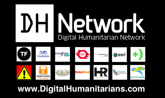
The Digital Humanitarian Network, or DHN, serves as the official interface between formal humanitarian organizations and global networks of tech-savvy digital volunteers. These digital volunteers provide humanitarian organizations with the skill and surge capacity they often need to make timely sense of “Big (Crisis) Data” during major disasters. By Big Crisis Data, I mean social media content and satellite imagery, for example. This overflow of such information generated during disasters can be as paralyzing to humanitarian response as the absence of information. And making sense of this overflow in response to Yolanda has required all hands on deck—i.e., an unprecedented level of collaboration between many members of the DHN.

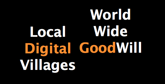
So I’d like to share with you 2 initial observations from this digital humanitarian response to Yolanda; just 2 points that may be signs of things to come. Local Digital Villages and World Wide (good) Will.

Screen Shot 2013-11-18 at 2.09.42 AM

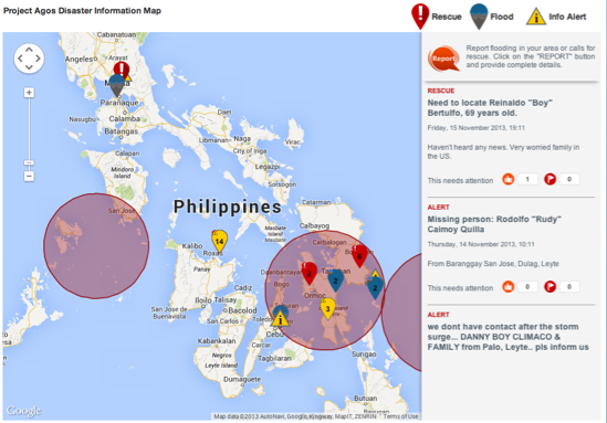
First, there were numerous local digital humanitarians on the ground in the Philippines. These digitally-savvy Filipinos were rapidly self-organizing and launching crisis maps well before any of us outside the Philippines had time to blink. One such group is Rappler, for example.

Screen Shot 2013-11-18 at 2.10.37 AM

We (the DHN) reached out to them early on, sharing both our data and volunteers. Remember that “Crowdsourcing” is just a new word for the old African saying that “it takes a village…” and sometimes, it takes a digital village to support humanitarian efforts on the ground. And Rappler is hardly the only local digital community that mobilizing in response to Yolanda, there are dozens of digital villages spearheading similar initiatives across the country.

The rise of local digital villages means that the distant future (or maybe not too distant future) of humanitarian operations may become less about the formal “brick-and-mortar” humanitarian organizations and, yes, also less about the Digital Humanitarian Network. Disaster response is and has always have been about local communities self-organizing and now local digital communities self-organizing. The majority of lives saved during disasters is attributed to this local agency, not international, external relief. Furthermore, these local digital villages are increasingly the source of humanitarian innovation, so we should pay close attention; we have a lot to learn from these digital villages. Naturally, they too are learning a lot from us.

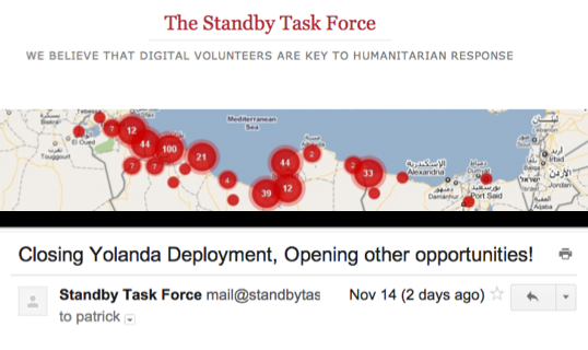
The second point that struck me occurred when the Standby Volunteer Task Force (SBTF) completed its deployment of MicroMappers on behalf of OCHA. The response from several SBTF volunteers was rather pointed—some were disappointed that the deployment had closed; others were downright upset. What happened next was very interesting; you see, these volunteers simply kept going, they used (hacked) the SBTF Skype Chat for Yolanda (which already had over 160 members) to self-organize and support other digital humanitarian efforts that were still ongoing. So the SBTF Team sent an email to it’s 1,000+ volunteers with the following subject header: “Closing Yolanda Deployment, Opening Other Opportunities!”

Screen Shot 2013-11-18 at 2.11.28 AM

The email provided a list of the most promising ongoing digital volunteer opportunities for the Typhoon response and encouraged volunteers to support whatever efforts they were most drawn to. This second reveals that a “World Wide (good) Will” exists. People care. This is good! Until recently, when disasters struck in faraway lands, we would watch the news on television wishing we could somehow help. That private wish—that innate human emotion—would perhaps translate into a donation. Today, not only can you donate cash to support those affected by disasters, you can also donate a few minutes of your time to support the relief efforts on the ground thanks to new humanitarian technologies and platforms. In other words, you, me, all of us can now translate our private wishes into direct, online public action, which can support those working in disaster-affected areas including local digital villages.

Screen Shot 2013-11-18 at 2.12.21 AM

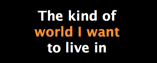
This surge of World Wide (good) Will explains why SBTF volunteers wanted to continue volunteering for as long as they wished even if our formal digital humanitarian network had phased out operations. And this is beautiful. We should not seek to limit or control this global goodwill or play the professional versus amateur card too quickly. Besides, who are we kidding? We couldn’t control this flood of goodwill even if we wanted to. But, we can embrace this goodwill and channel it. People care, they want to offer their time to help others thousands of miles away. This is beautiful and the kind of world I want to live in. To paraphrase the philosopher Hannah Arendt, the greatest harm in the world is caused not by evil but apathy. So we should cherish the digital goodwill that springs during disasters. This spring is the digital equivalent of mutual aid, of self-help. The global village of digital Good Samaritans is growing.

At the same time, this goodwill, this precious human emotion and the precious time it freely offers can cause more harm than good if it is not channeled responsibly. When international volunteers poor into disaster areas wanting to help, their goodwill can have the opposite effect, especially when they are inexperienced. This is also true of digital volunteers flooding in to help online.

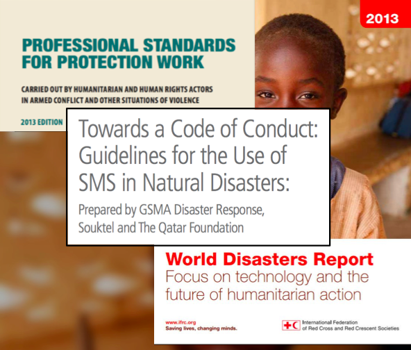
We in the CrisisMappers community have the luxury of having learned a lot about digital humanitarian response since the Haiti Earthquake; we have learned important lessons about data privacy and protection, codes of conduct, the critical information needs of humanitarian organizations and disaster-affected populations, standardizing operating procedures, and so on. Indeed we now (for the first time) have data protection protocols that address crowdsourcing, social media and digital volunteers thanks to our colleagues at the ICRC. We also have an official code of conduct on the use of SMS for disaster response thanks to our colleagues at GSMA. This year’s World Disaster Report (WDR 2013) also emphasizes the responsible use of next generation humanitarian technologies and the crisis data they manage.

Screen Shot 2013-11-18 at 2.13.03 AM

Now, this doesn’t mean that we the formal (digital) humanitarian sector have figured it all out—far from it. This simply means that we’ve learned a few important and difficult lessons along the way. Unlike newcomers to the digital humanitarian space, we have the benefit of several years of hard experience to draw on when deploying for disasters like Typhoon Yolanda. While sharing these lessons and disseminating them as widely as possible is obviously a must, it is simply not good enough. Guidebooks and guidelines just won’t cut it. We also need to channel the global spring of digital goodwill and distribute it to avoid  “flash floods” of goodwill. So what might these goodwill channels look like? Well they already exist in the form of the Digital Humanitarian Network—more specifically the members of the DHN.

These are the channels that focus digital goodwill in support of the humanitarian organizations that physically deploy to disasters. These channels operate using best practices, codes of conduct, protocols, etc., and can be held accountable. At the same time, however, these channels also block the upsurge of goodwill from new digital volunteers—those outside our digital villages. How? Our channels block this World Wide (good) Will by requiring technical expertise to engage with us and/or  by requiring an inordinate amount of time commitment. So we should not be surprised if the “World Wide (Good) Will” circumvents our channels altogether, and in so doing causes more harm than good during disasters. Our channels are blocking their engagement and preventing them from joining our digital villages. Clearly we need different channels to focus the World Wide (Good) Will.

Screen Shot 2013-11-18 at 2.14.21 AM

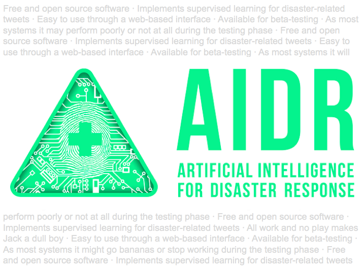
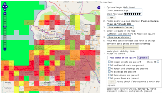
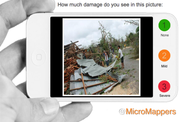
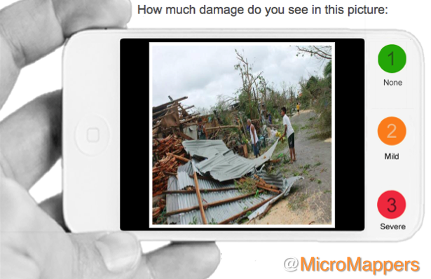
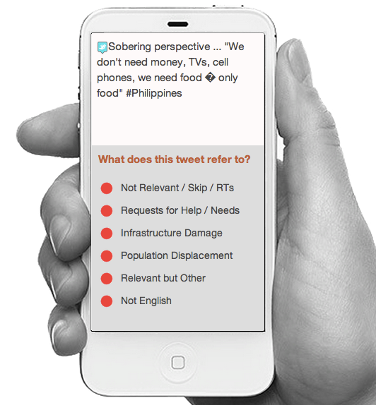
Our friends at Humanitarian OpenStreetMap already figured this out two years ago when they set up their microtasking server, making it easier for less tech-savvy volunteers to engage. We need to democratize our humanitarian technologies to responsibly channel the huge surplus global goodwill that exists online. This explains why my team and I at QCRI are developing MicroMappers and why we deployed the platform in response to OCHA’s request within hours of Typhoon Yolanda making landfall in the Philippines.

Screen Shot 2013-11-18 at 2.15.21 AM

This digital humanitarian operation was definitely far from perfect, but it was super simple to use and channeled 208 hours of global goodwill in just a matter days. Those are 208 hours that did not cause harm. We had volunteers from dozens of countries around the world and from all ages and walks of life offering their time on MicroMappers. OCHA, which had requested this support, channeled the resulting data to their teams on the ground in the Philippines.

These digital volunteers all cared and took the time to try and help others thousands of miles away. The same is true of the remarkable digital volunteers supporting the Humanitarian OpenStreetMap efforts. This is the kind of world I want to live in; the world in which humanitarian technologies harvest the global goodwill and channels it to make a difference to those affected by disasters.

Screen Shot 2013-11-18 at 2.09.42 AM

So these are two important trends I see moving forward, the rise of well-organized, local digital humanitarian groups, like Rappler, and the rise of World Wide (Good) Will. We must learn from the former, from the local digital villages, and when asked, we should support them as best we can. We should also channel, even amplify the World Wide (Good) Will by democratizing humanitarian technologies and embracing new ways to engage those who want to make a difference. Again, Crowdsourcing is simply a new term for the old African proverb, that it takes a village. Let us not close the doors to that village.

So on this note, I thank *you* for participating in ICCM and for being a global village that cares, both on and offline. Big thanks as well to our current team of sponsors for caring about this community and making sure that our village does continue to meet in person every year. And now for the next 3 days, we have an amazing line-up of speakers, panelists & technologies for you. So please use these days to plot, partner and disrupt. And always remember: be tough on ideas, but gentle on people.

Thanks again, and keep caring.

Early Results of MicroMappers Response to Typhoon Yolanda (Updated)

We have completed our digital humanitarian operation in the Philippines after five continuous days with MicroMappers. Many, many thanks to all volunteers from all around the world who donated their time by clicking on tweets and images coming from the Philippines. Our UN OCHA colleagues have confirmed that the results are being shared widely with their teams in the field and with other humanitarian organizations on the ground. More here.

ImageClicker

In terms of preliminary figures (to be confirmed):

  • Tweets collected during first 48 hours of landfall = ~230,000
  • Tweets automatically filtered for relevancy/uniqueness = ~55,000
  • Tweets clicked using the TweetClicker = ~ 30,000
  • Relevant tweets triangulated using TweetClicker = ~3,800
  • Triangulated tweets published on live Crisis Map = ~600
  • Total clicks on TweetClicker = ~ 90,000
  • Images clicked using the ImageClicker = ~ 5,000
  • Relevant images triangulated using TweetClicker = ~1,200
  • Triangulated images published on live Crisis Map = ~180
  • Total clicks on ImageClicker = ~15,000
  • Total clicks on MicroMappers (Image + Tweet Clickers) = ~105,000

Since each single tweet and image uploaded to the Clickers was clicked on by (at least) three individual volunteers for quality control purposes, the number of clicks is three times the total number of tweets and images uploaded to the respective clickers. In sum, digital humanitarian volunteers have clocked a grand total of ~105,000 clicks to support humanitarian operations in the Philippines.

While the media has largely focused on the technology angle of our digital humanitarian operation, the human story is for me the more powerful message. This operation succeeded because people cared. Those ~105,000 clicks did not magically happen. Each and every single one of them was clocked by humans, not machines. At one point, we had over 300 digital volunteers from the world over clicking away at the same time on the TweetClicker and more than 200 on the ImageClicker. This kind of active engagement by total strangers—good “digital Samaritans”—explains why I find the human angle of this story to be the most inspiring outcome of MicroMappers. “Crowdsourcing” is just a new term for the old saying “it takes a village,” and sometimes it takes a digital village to support humanitarian efforts on the ground.

Until recently, when disasters struck in faraway lands, we would watch the news on television wishing we could somehow help. That private wish—that innate human emotion—would perhaps translate into a donation. Today, not only can you donate cash to support those affected by disasters, you can also donate a few minutes of your time to support the operational humanitarian response on the ground by simply clicking on MicroMappers. In other words, you can translate your private wish into direct, online public action, which in turn translates into supporting offline collective action in the disaster-affected areas.

Clicking is so simple that anyone with Internet access can help. We had high schoolers in Qatar clicking away, fire officers in Belgium, graduate students in Boston, a retired couple in Kenya and young Filipinos clicking away. They all cared and took the time to try and help others, often from thousands of miles away. That is the kind of world I want to live in. So if you share this vision, then feel free to join the MicroMapper list-serve.

Yolanda TweetClicker4

Considering that MicroMappers is still very much under development, we are all pleased with the results. There were of course many challenges; the most serious was the CrowdCrafting server which hosts our Clickers. Unfortunately, that server was not able to handle the load and traffic generated by digital volunteers. So their server crashed twice and also slowed our Clickers to a complete stop at least a dozen times during the past five days. At times, it would take 10-15 seconds for a new tweet or image to load, which was frustrating. We were also limited by the number of tweets and images we could upload at any given time, usually ~1,500 at most. Any larger load would seriously slow down the Clickers. So it is rather remarkable that digital volunteers managed to clock more than 100,000 clicks given the repeated interruptions. 

Besides the server issue, the other main bottleneck was the geo-location of the ~30,000 tweets and ~5,000 images tagged using the Clickers. We do have a Tweet and Image GeoClicker but these were not slated to launch until next week at CrisisMappers 2013, which meant they weren’t ready for prime time. We’ll be sure to launch them soon. Once they are operational, we’ll be able to automatically push triangulated tweets and images from the Tweet and Image Clickers directly to the corresponding GeoClickers so volunteers can also aid humanitarian organizations by mapping important tweets and images directly.

There’s a lot more that we’ve learned throughout the past 5 days and much room for improvement. We have a long list of excellent suggestions and feedback from volunteers and partners that we’ll be going through starting tomorrow. The most important next step is to get a more powerful server that can handle a lot more load and traffic. We’re already taking action on that. I have no doubt that our clicks would have doubled without the server constraints.

For now, though, BIG thanks to the SBTF Team and in particular Jus McKinnon, the QCRI et al team, in particular Ji Lucas, Hemant Purohit and Andrew Ilyas for putting in very, very long hours, day in and day out on top of their full-time jobs and studies. And finally, BIG thanks to the World Wide Crowd, to all you who cared enough to click and support the relief operations in the Philippines. You are the heroes of this story.

bio

Live Crisis Map of Disaster Damage Reported on Social Media

Update: See early results of MicroMappers deployment here

Digital humanitarian volunteers have been busing tagging images posted to social media in the aftermath of Typhoon Yolanda. More specifically, they’ve been using the new MicroMappers ImageClicker to rate the level of damage they see in each image. Thus far, they have clicked over 7,000 images. Those that are tagged as “Mild” and “Severe” damage are then geolocated by members of the Standby Volunteer Task Force (SBTF) who have partnered with GISCorps and ESRI to create this live Crisis Map of the disaster damage tagged using the ImageClicker. The map takes a few second to load, so please be patient.

YolandaPH Crisis Map 1

The more pictures are clicked using the ImageClicker, the more populated this crisis map will become. So please help out if you have a few seconds to spare—that’s really all it takes to click an image. If there are no picture left to click or the system is temporarily offline, then please come back a while later as we’re uploading images around the clock. And feel free to join our list-serve in the meantime if you wish to be notified when humanitarian organizations need your help in the future. No prior experience or training necessary. Anyone who knows how to use a computer mouse can become a digital humanitarian.

The SBTF, GISCorps and ESRI are members of the Digital Humanitarian Network (DHN), which my colleague Andrej Verity and I co-founded last year. The DHN serves as the official interface for direct collaboration between traditional “brick-and-mortar” humanitarian organizations and highly skilled digital volunteer networks. The SBTF Yolanda Team, spearheaded by my colleague Justine Mackinnon, for example, has also produced this map based on the triangulated results of the TweetClicker:

YolandaPH Crisis Map 2
There’s a lot of hype around the use of new technologies and social media for disaster response. So I want to be clear that our digital humanitarian operations in the Philippines have not been perfect. This means  that we’re learning (a lot) by doing (a lot). Such is the nature of innovation. We don’t have the luxury of locking ourselves up in a lab for a year to build the ultimate humanitarian technology platform. This means we have to work extra, extra hard when deploying new platforms during major disasters—because not only do we do our very best to carry out Plan A, but we often have to carry out  Plans B and C in parallel just in case Plan A doesn’t pan out. Perhaps Samuel Beckett summed it up best: “Ever tried. Ever failed. No matter. Try Again. Fail again. Fail better.”

bio

Digital Humanitarians: From Haiti Earthquake to Typhoon Yolanda

We’ve been able to process and make sense of a quarter of a million tweets in the aftermath of Typhoon Yolanda. Using both AIDR (still under development) and Twitris, we were able to collect these tweets in real-time and use automated algorithms to filter for both relevancy and uniqueness. The resulting ~55,000 tweets were then uploaded to MicroMappers (still under development). Digital volunteers from the world over used this humanitarian technology platform to tag tweets and now images from the disaster (click image below to enlarge). At one point, volunteers tagged some 1,500 tweets in just 10 minutes. In parallel, we used machine learning classifiers to automatically identify tweets referring to both urgent needs and offers of help. In sum, the response to Typhoon Yolanda is the first to make full use of advanced computing, i.e., both human computing and machine computing to make sense of Big (Crisis) Data.

ImageClicker YolandaPH

We’ve come a long way since the tragic Haiti Earthquake. There was no way we would’ve been able to pull off the above with the Ushahidi platform. We weren’t able to keep up with even a few thousand tweets a day back then, not to mention images. (Incidentally, MicroMappers can also be used to tag SMS). Furthermore, we had no trained volunteers on standby back when the quake struck. Today, not only do we have a highly experienced network of volunteers from the Standby Volunteer Task Force (SBTF) who serve as first (digital) responders, we also have an ecosystem of volunteers from the Digital Humanitarian Network (DHN). In the case of Typhoon Yolanda, we also had a formal partner, the UN Office for the Coordination of Humanitarian Affairs (OCHA), that officially requested digital humanitarian support. In other words, our efforts are directly in response to clearly articulated information needs. In contrast, the response to Haiti was “supply based” in that we simply pushed out all information that we figured might be of use to humanitarian responders. We did not have a formal partner from the humanitarian sector going into the Haiti operation.

Yolanda Prezi

What this new digital humanitarian operation makes clear is that preparedness, partnerships & appropriate humanitarian technology go a long way to ensuring that our efforts as digital humanitarians add value to the field-based operations in disaster zones. The above Prezi by SBTF co-founder Anahi (click on the image to launch the presentation) gives an excellent overview of how these digital humanitarian efforts are being coordinated in response to Yolanda. SBTF Core Team member Justine Mackinnon is spearheading the bulk of these efforts.

While there are many differences between the digital response to Haiti and Yolanda, several key similarities have also emerged. First, neither was perfect, meaning that we learned a lot in both deployments; taking a few steps forward, then a few steps back. Such is the path of innovation, learning by doing. Second, like our use of Skype in Haiti, there’s no way we could do this digital response work without Skype. Third, our operations were affected by telecommunications going offline in the hardest hit areas. We saw an 18.7% drop in relevant tweets on Saturday compared to the day before, for example. Fourth, while the (very) new technologies we are deploying are promising, they are still under development and have a long way to go. Fifth, the biggest heroes in response to Haiti were the volunteers—both from the Haitian Diaspora and beyond. The same is true of Yolanda, with hundreds of volunteers from the world over (including the Philippines and the Diaspora) mobilizing online to offer assistance.

A Filipino humanitarian worker in Quezon City, Philippines, for example, is volunteering her time on MicroMappers. As is customer care advisor from Eurostar in the UK and a fire officer from Belgium who recruited his uniformed colleagues to join the clicking. We have other volunteer Clickers from Makati (Philippines), Cape Town (South Africa), Canberra & Gold Coast (Australia), Berkeley, Brooklyn, Citrus Heights & Hinesburg (US), Kamloops (Canada), Paris & Marcoussis (France), Geneva (Switzerland), Sevilla (Spain), Den Haag (Holland), Munich (Germany) and Stokkermarke (Denmark) to name just a few! So this is as much a human story is it is one about technology. This is why online communities like MicroMappers are important. So please join our list-serve if you want to be notified when humanitarian organizations need your help.

Bio

Typhoon Yolanda: UN Needs Your Help Tagging Crisis Tweets for Disaster Response (Updated)

Final Update 14 [Nov 13th @ 4pm London]: Thank you for clicking to support the UN’s relief operations in the Philippines! We have now completed our mission as digital humanitarian volunteers. The early results of our collective online efforts are described here. Thank you for caring and clicking. Feel free to join our list-serve if you want to be notified when humanitarian organizations need your help again during the next disaster—which we really hope won’t be for a long, long time. In the meantime, our hearts and prayers go out to those affected by this devastating Typhoon.

The United Nations Office for the Coordination of Humanitarian Affairs (OCHA) just activated the Digital Humanitarian Network (DHN) in response to Typhoon Yolanda, which has already been described as possibly one of the strongest Category 5 storms in history. The Standby Volunteer Task Force (SBTF) was thus activated by the DHN to carry out a rapid needs & damage assessment by tagging reports posted to social media. So Ji Lucas and I at QCRI (+ Hemant & Andrew) and Justine Mackinnon from SBTF have launched MicroMappers to microtask the tagging of tweets & images. We need all the help we can get given the volume we’ve collected (and are continuing to collect). This is where you come in!

TweetClicker_PH2

You don’t need any prior experience or training, nor do you need to create an account or even login to use the MicroMappers TweetClicker. If you can read and use a computer mouse, then you’re all set to be a Digital Humanitarian! Just click here to get started. Every tweet will get tagged by 3 different volunteers (to ensure quality control) and those tweets that get identical tags will be shared with our UN colleagues in the Philippines. All this and more is explained in the link above, which will give you a quick intro so you can get started right away. Our UN colleagues need these tags to better understand who needs help and what areas have been affected.

ImageClicker YolandaPH

It only takes 3 seconds to tag a tweet or image, so if that’s all the time you have then that’s plenty! And better yet, if you also share this link with family, friends, colleagues etc., and invite them to tag along. We’ll soon be launching We have also launched the ImageClicker to tag images by level of damage. So please stay tuned. What we need is the World Wide Crowd to mobilize in support of those affected by this devastating disaster. So please spread the word. And keep in mind that this is only the second time we’re using MicroMappers, so we know it is not (yet) perfect : ) Thank you!

bio

p.s. If you wish to receive an alert next time MicroMappers is activated for disaster response, then please join the MicroMappers list-serve here. Thanks!

Previous updates:

Update 1: If you notice that all the tweets (tasks) have been completed, then please check back in 1/2 hour as we’re uploading more tweets on the fly. Thanks!

Update 2: Thanks for all your help! We are getting lots of traffic, so the Clicker is responding very slowly right now. We’re working on improving speed, thanks for your patience!

Update 3: We collected 182,000+ tweets on Friday from 5am-7pm (local time) and have automatically filtered this down to 35,175 tweets based on relevancy and uniqueness. These 35K tweets are being uploaded to the TweetClicker a few thousand tweets at a time. We’ll be repeating all this for just one more day tomorrow (Saturday). Thanks for your continued support!

Update 4: We/you have clicked through all of Friday’s 35K tweets and currently clicking through today’s 28,202 tweets, which we are about 75% of the way through. Many thanks for tagging along with us, please keep up the top class clicking, we’re almost there! (Sunday, 1pm NY time)

Update 5: Thanks for all your help! We’ll be uploading more tweets tomorrow (Monday, November 11th). To be notified, simply join this list-serve. Thanks again! [updated post on Sunday, November 10th at 5.30pm New York]

Update 6: We’ve uploaded more tweets! This is the final stretch, thanks for helping us on this last sprint of clicks!  Feel free to join our list-serve if you want to be notified when new tweets are available, many thanks! If the system says all tweets have been completed, please check again in 1/2hr as we are uploading new tweets around the clock. [updated Monday, November 11th at 9am London]

Update 7 [Nov 11th @ 1pm London]We’ve just launched the ImageClicker to support the UN’s relief efforts. So please join us in tagging images to provide rapid damage assessments to our humanitarian partners. Our TweetClicker is still in need of your clicks too. If the Clickers are slow, then kindly be patient. If all the tasks are done, please come back in 1/2hr as we’re uploading content to both clickers around the clock. Thanks for caring and helping the relief efforts. An update on the overall digital humanitarian effort is available here.

Update 8 [Nov 11th @ 6.30pm NY]We’ll be uploading more tweets and images to the TweetClicker & ImageClicker by 7am London on Nov 12th. Thank you very much for supporting these digital humanitarian efforts, the results of which are displayed here. Feel free to join our list-serve if you want to be notified when the Clickers have been fed!

Update 9 [Nov 12th @ 6.30am London]: We’ve fed both our TweetClicker and ImageClicker with new tweets and images. So please join us in clicking away to provide our UN partners with the situational awareness they need to coordinate their important relief efforts on the ground. The results of all our clicks are displayed here. Thank you for helping and for caring. If the Clickers or empty or offline temporarily, please check back again soon for more clicks.

Update 10 [Nov 12th @ 10am New York]: Were continuing to feed both our TweetClicker and ImageClicker with new tweets and images. So please join us in clicking away to provide our UN partners with the situational awareness they need to coordinate their important relief efforts on the ground. The results of all our clicks are displayed here. Thank you for helping and for caring. If the Clickers or empty or offline temporarily, please check back again soon for more clicks. Try different browsers if the tweets/images are not showing up.

Update 11 [Nov 12th @ 5pm New York]: Only one more day to go! We’ll be feeding our TweetClicker and ImageClicker with new tweets and images by 7am London on the 13th. We will phase out operations by 2pm London, so this is the final sprint. The results of all our clicks are displayed here. Thank you for helping and for caring. If the Clickers are empty or offline temporarily, please check back again soon for more clicks. Try different browsers if the tweets/images are not showing up.

Update 12 [Nov 13th @ 9am London]: This is the last stretch, Clickers! We’ve fed our TweetClicker and ImageClicker with new tweets and images. We’ll be refilling them until 2pm London (10pm Manila) and phasing out shortly thereafter. Given that MicroMappers is still under development, we are pleased that this deployment went so well considering. The results of all our clicks are displayed here. Thank you for helping and for caring. If the Clickers are empty or offline temporarily, please check back again soon for more clicks. Try different browsers if the tweets/images are not showing up.

Update 13 [Nov 13th @ 11am London]: Just 3 hours left! Our UN OCHA colleagues have just asked us to prioritize the ImageClicker, so please focus on that Clicker. We’ll be refilling the ImageClicker until 2pm London (10pm Manila) and phasing out shortly thereafter. Given that MicroMappers is still under development, we are pleased that this deployment went so well considering. The results of all our clicks are displayed here. Thank you for helping and for caring. If the ImageClicker is empty or offline temporarily, please check back again soon for more clicks. Try different browsers if images are not showing up.

Big Data & Disaster Response: Even More Wrong Assumptions

“Arguing that Big Data isn’t all it’s cracked up to be is a straw man, pure and simple—because no one should think it’s magic to begin with.” Since citing this point in my previous post on Big Data for Disaster Response: A List of Wrong Assumptions, I’ve come across more mischaracterizations of Big (Crisis) Data. Most of these fallacies originate from the Ivory Towers; from [a small number of] social scientists who have carried out one or two studies on the use of social media during disasters and repeat their findings ad nauseam as if their conclusions are the final word on a very new area of research.

Screen Shot 2013-11-05 at 12.38.31 PM

The mischaracterization of “Big Data and Sample Bias”, for example, typically arises when academics point out that marginalized communities do not have access to social media. First things first: I highly recommend reading “Big Data and Its Exclusions,” published by Stanford Law Review. While the piece does not address Big Crisis Data, it is nevertheless instructive when thinking about social media for emergency management. Secondly, identifying who “speaks” (and who does not speak) on social media during humanitarian crises is of course imperative, but that’s exactly why the argument about sample bias is such a straw man—all of my humanitarian colleagues know full well that social media reports are not representative. They live in the real world where the vast majority of data they have access to is unrepresentative and imperfect—hence the importance of drawing on as many sources as possible, including social media. Random sampling during disasters is a Quixotic luxury, which explains why humanitarian colleagues seek “good enough” data and methods.

Some academics also seem to believe that disaster responders ignore all other traditional sources of crisis information in favor of social media. This means, to follow their argument, that marginalized communities have no access to other communication life lines if they are not active on social media. One popular observation is the “revelation” that some marginalized neighborhoods in New York posted very few tweets during Hurricane Sandy. Why some academics want us to be surprised by this, I know not. And why they seem to imply that emergency management centers will thus ignore these communities (since they apparently only respond to Twitter) is also a mystery. What I do know is that social capital and the use of traditional emergency communication channels do not disappear just because academics chose to study tweets. Social media is simply another node in the pre-existing ecosystem of crisis information. 

negative space

Furthermore, the fact that very few tweets came out of the Rockaways during Hurricane Sandy can be valuable information for disaster responders, a point that academics often overlook. To be sure, monitoring  social media footprints during disasters can help humanitarians get a better picture of the “negative space” and thus infer what they might be missing, especially when comparing these “negative footprints” with data from traditional sources. Indeed, knowing what you don’t know is a key component of situational awareness. No one wants blind spots, and knowing who is not speaking on social media during disasters can help correct said blind spots. Moreover, the contours of a community’s social media footprint during a disaster can shed light on how neighboring areas (that are not documented on social media) may have been affected. When I spoke about this with humanitarian colleagues in Geneva this week, they fully agreed with my line of reasoning and even added that they already apply “good enough” methods of inference with traditional crisis data.

My PopTech colleague Andrew Zolli is fond of saying that we shape the world by the questions we ask. My UN colleague Andrej Verity recently reminded me that one of the most valuable aspects of social media for humanitarian response is that it helps us to ask important questions (that would not otherwise be posed) when coordinating disaster relief. So the next time you hear an academic go on about [a presentation on] issues of bias and exclusion, feel free to share the above along with this list of wrong assumptions.

Most importantly, tell them [say] this: “Arguing that Big Data isn’t all it’s cracked up to be is a straw man, pure and simple—because no one should think it’s magic to begin with.” It is high time we stop mischaracterizing Big Crisis Data. What we need instead is a can-do, problem-solving attitude. Otherwise we’ll all fall prey to the Smart-Talk trap.

Bio