We’ve had the pleasure of working closely with Pfizer on an exciting project over the past 12 months. The project focused on using affordable, locally repairable, and locally owned cargo drones for the delivery of essential medicines to remote health facilities in the Dominican Republic. Local communities in the remote mountains of the Dominican Republic do not have regular access to healthcare services. This is not due to the lack of paved roads connecting their villages and local clinics to regional hospitals. Instead, it is the cost of local transportation that serves as the most significant impediment. This is particularly problematic when local clinics run out of medicines, or when they cannot test patient samples locally. When this happens, patients have to travel to the hospital in person. If the patient can afford the cost of local transportation, then getting to the hospital often requires a full day of travel due to the limited number of local transportation options. Taking a full day away from paid work and/or from supporting family is often not an option.

What’s more, some patients are too frail to travel on the back of motorbikes on bumpy and windy roads. This explains why some nurses at remote clinics have had to make the journey to the local hospital themselves when patient samples need to be dropped off and/or medicines picked up.
The final report on this project, which is available here (PDF), runs some 70+ pages long and represents the most detailed and most transparent publicly available report on cargo drones to date.
Pfizer partnered with WeRobotics and Dominican Republic Flying Labs to carry out autonomous cargo drone deliveries over six weeks in 2019. Dominican Republic Flying Labs is one of 25+ Flying Labs in Latin America, Africa, Asia, and Oceania. Flying Labs are local knowledge hubs run entirely by local experts who are trained, equipped, and supported by WeRobotics as needed. Since 2016, WeRobotics and Flying Labs have set up multiple cargo drone projects in Peru, Fiji, Papua New Guinea, Brazil, and Nepal with reliable public health partners. WeRobotics also worked with VillageReach to set up a cargo drone project in the DRC and partnered with DR Flying Labs on earlier cargo drone projects in the Caribbean.
To learn from this direct, hands-on experience in cargo drones along with lessons learned from the broader cargo drone community, please see this peer-reviewed online training on medical cargo drones.

The purpose of the joint Pfizer-WeRobotics cargo drone project with DR Flying Labs was to test the following hypothesis: can affordable and locally-repairable cargo drones be operated locally and ideally by health care professionals to reliably and autonomously deliver medicines on demand—much like any other medical instrument that is easy enough to use? As noted by the Ministry of Health Director for the El Valle Region, “This project is important in rural areas. With this project, people would have access to pharmaceuticals, lab tests, and other data in an expedited way because of the drone. This is an opportunity to extend to our people service at the right time at the right quality, warmth, and quickly as well.”

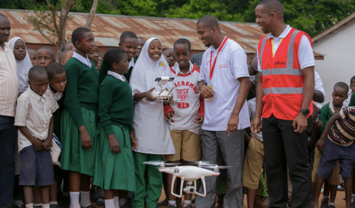
DR Flying Labs drone pilots, who were all trained on this affordable cargo drone solution by WeRobotics, carried out six weeks of consecutive deliveries in the province of San Juan de la Maguana between June and July 2019. A total of 101 autonomous flights were carried out to two separate health facilities, traveling a total of 994 kilometers. Of the 51 outbound flights, 40 carried medicines totaling 21.25 kilos. The drone had to gain an altitude of 784 meters above ground level. None of the risks identified at the outset of the project materialized thanks to active risk management and mitigation strategy developed by WeRobotics and DR Flying Labs. While there were several aborted deliveries due to weather, none of the 101 flights carried out over six weeks resulted in a crash or any material damage. Nepal Flying Labs has since carried out several hundred deliveries with the same cargo drone model for almost six months now. Philippines Flying Labs plans to use the same cargo drone model in early 2020.

The final report, which is available here (PDF), runs some 70+ pages long and represents the most detailed and most transparent publicly available report on cargo drones to date. The comprehensive report documents the full operations, technical solutions, and numerous lessons learned. It also presents concrete policy recommendations and presents a conceptual framework for complementary drone delivery models: the state model and the community model. We are becoming increasingly concerned that drone companies have to follow the “state model” to make a profit, i.e., they need to focus on high-frequency deliveries to areas with relatively large populations. In other words, their business models are not viable for the “community model” since smaller and more dispersed communities don’t require high-frequency deliveries. As such, we’re concerned that these smaller communities like those in the Dominican Republic are being overlooked even though they typically face the greatest health risks.

The state and community models are necessarily complementary, however, and should be combined into one holistic approach. This can be compared to “highways” versus “country roads,” for example. Leading drone companies are busy building “national highways” with their state-based delivery model, while others like WeRobotics are more interested in developing the “back roads” to serve the community model. Combining both models can provide the speed and geographical coverage necessary to ensure equal access, a duty of care, patient impact, cost-savings, resource optimization, and to improve healthcare outcomes at a truly national scale without discriminating against smaller and more dispersed populations. The business models for the state and community models have to be different. This project with Pfizer in the DR represents one step forward in developing and testing the business model for the community delivery model.

In sum, WeRobotics recommends that more operational data be generated to validate the community model and the corresponding business model fully. WeRobotics also recommends testing the use of both the state and community models in one country to evaluate overall impact since the implications of drone delivery should not be focused narrowly on specific technical models but broadly on the transformation of health care logistics. This requires a commitment of time, attention, and resources to see through.
As such, the economic data alone while a requisite is only one piece of the larger puzzle. The analysis must be more comprehensive and extended to include performance improvements, access, equity, patient outcomes, and of course, the transformation of health care logistics. The best way to get to that larger puzzle is by unpacking what is contained within the cost-benefit discussion. Are we sure we are accounting properly for costs? What are the associated costs of locally sustaining such systems? How will we determine those costs if markets are only minimally functional in this space? And more importantly, the benefits have to be understood broadly, systematically, and comparatively. What is the value of improved speed in critical logistics? How do we make sure that improved health outcomes are both understood in these projects and adequately accounted for in our understanding of financial benefit?
The goal isn’t to test these models for their own sake, but as a way to build a market. And for this, more data and learning is required.
Acknowledgments:
We sincerely thank Pfizer, Dominican Republic Flying Labs, Centro de Innovación de Drones, Cyberpark of Santo Domingo, Ministry of Health, Aviation Authority (IDAC) as well as regional and local doctors and local communities in San Juan, El Coco and Montacitos for their partnership, leadership, and invaluable support. Sincerest thanks in particular to Jose Antonio Martinez, Jim Mangione, Orlando Perez, and Leonor Cocco for their partnership and support for the field tests. We would also like to thank Susie Truog from VillageReach for sharing her independent cost-benefit analysis for cargo deliveries in San Juan Province. Big thanks as well to all the participants, students, and volunteers who participated in the training and field tests.


 Countries in the region experience severe flooding during Cyclone season
 An aerially-released mosquito finds their way to the arm of a WMP colleague