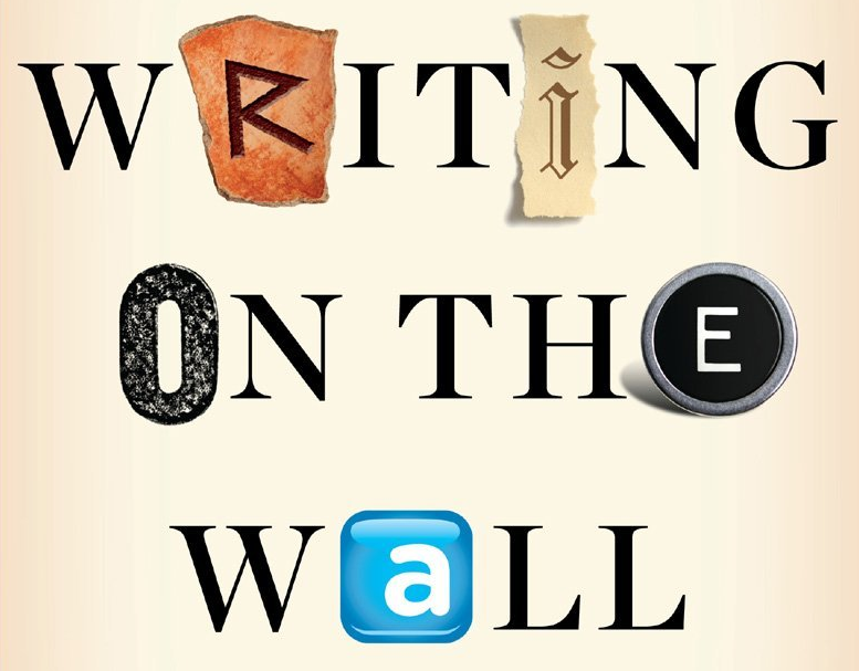
Yes, I’m Writing a Book (on Digital Humanitarians)

I recently signed a book deal with Taylor & Francis Press. The book, which is tentatively titled “Digital Humanitarians: How Big Data is Changing the Face of Disaster Response,” is slated to be published next year. The book will chart the rise of digital humanitarian response from the Haiti Earthquake to 2015, highlighting critical lessons learned and best practices. To this end, the book will draw on real-world examples of digital humanitarians in action to explain how they use new technologies and crowdsourcing to make sense of “Big (Crisis) Data”. In sum, the book will describe how digital humanitarians & humanitarian technologies are together reshaping the humanitarian space and what this means for the future of disaster response. The purpose of this book is to inspire and inform the next generation of (digital) humanitarians while serving as a guide for established humanitarian organizations & emergency management professionals who wish to take advantage of this transformation in humanitarian response.

2025

The book will thus consolidate critical lessons learned in digital humanitarian response (such as the verification of social media during crises) so that members of the public along with professionals in both international humanitarian response and domestic emergency management can improve their own relief efforts in the face of “Big Data” and rapidly evolving technologies. The book will also be of interest to academics and students who wish to better understand methodological issues around the use of social media and user-generated content for disaster response; or how technology is transforming collective action and how “Big Data” is disrupting humanitarian institutions, for example. Finally, this book will also speak to those who want to make a difference; to those who of you who may have little to no experience in humanitarian response but who still wish to help others affected during disasters—even if you happen to be thousands of miles away. You are the next wave of digital humanitarians and this book will explain how you can indeed make a difference.

The book will not be written in a technical or academic writing style. Instead, I’ll be using a more “storytelling” form of writing combined with a conversational tone. This approach is perfectly compatible with the clear documentation of critical lessons emerging from the rapidly evolving digital humanitarian space. This conversational writing style is not at odds with the need to explain the more technical insights being applied to develop next generation humanitarian technologies. Quite on the contrary, I’ll be using intuitive examples & metaphors to make the most technical details not only understandable but entertaining.

While this journey is just beginning, I’d like to express my sincere thanks to my mentors for their invaluable feedback on my book proposal. I’d also like to express my deep gratitude to my point of contact at Taylor & Francis Press for championing this book from the get-go. Last but certainly not least, I’d like to sincerely thank the Rockefeller Foundation for providing me with a residency fellowship this Spring in order to accelerate my writing.

I’ll be sure to provide an update when the publication date has been set. In the meantime, many thanks for being an iRevolution reader!

bio

The Best of iRevolution in 2013

iRevolution crossed the 1 million hits mark in 2013, so big thanks to iRevolution readers for spending time here during the past 12 months. This year also saw close to 150 new blog posts published on iRevolution. Here is a short selection of the Top 15 iRevolution posts of 2013:

How to Create Resilience Through Big Data
[Link]

Humanitarianism in the Network Age: Groundbreaking Study
[Link]

Opening Keynote Address at CrisisMappers 2013
[Link]

The Women of Crisis Mapping
[Link]

Data Protection Protocols for Crisis Mapping
[Link]

Launching: SMS Code of Conduct for Disaster Response
[Link]

MicroMappers: Microtasking for Disaster Response
[Link]

AIDR: Artificial Intelligence for Disaster Response
[Link]

Social Media, Disaster Response and the Streetlight Effect
[Link]

Why the Share Economy is Important for Disaster Response
[Link]

Automatically Identifying Fake Images on Twitter During Disasters
[Link]

Why Anonymity is Important for Truth & Trustworthiness Online
[Link]

How Crowdsourced Disaster Response Threatens Chinese Gov
[Link]

Seven Principles for Big Data and Resilience Projects
[Link]

#NoShare: A Personal Twist on Data Privacy
[Link]

I’ll be mostly offline until February 1st, 2014 to spend time with family & friends, and to get started on a new exciting & ambitious project. I’ll be making this project public in January via iRevolution, so stay tuned. In the meantime, wishing iRevolution readers a very Merry Happy Everything!

santahat

Video: Humanitarian Response in 2025

I gave a talk on “The future of Humanitarian Response” at UN OCHA’s Global Humanitarian Policy Forum (#aid2025) in New York yesterday. More here for context. A similar version of the talk is available in the video presentation below.

Some of the discussions that ensued during the Forum were frustrating albeit an important reality check. Some policy makers still think that disaster response is about them and their international humanitarian organizations. They are still under the impression that aid does not arrive until they arrive. And yet, empirical research in the disaster literature points to the fact that the vast majority of survivals during disasters is the result of local agency, not external intervention.

In my talk (and video above), I note that local communities will increasingly become tech-enabled first responders, thus taking pressure off the international humanitarian system. These tech savvy local communities already exit. And they already respond to both “natural” (and manmade) disasters as noted in my talk vis-a-vis the information products produced by tech-savvy local Filipino groups. So my point about the rise of tech-enabled self-help was a more diplomatic way of conveying to traditional humanitarian groups that humanitarian response in 2025 will continue to happen with or without them; and perhaps increasingly without them.

This explains why I see OCHA’s Information Management (IM) Team increasingly taking on the role of “Information DJ”, mixing both formal and informal data sources for the purposes of both formal and informal humanitarian response. But OCHA will certainly not be the only DJ in town nor will they be invited to play at all “info events”. So the earlier they learn how to create relevant info mixes, the more likely they’ll still be DJ’ing in 2025.

Bio

How UAVs Are Making a Difference in Disaster Response

I visited the University of Torino in 2007 to speak with the team developing UAVs for the World Food Program. Since then, I’ve bought and tested two small UAVs of my own so I can use this new technology to capture aerial imagery during disasters; like the footage below from the Philippines.

http://www.youtube.com/watch?v=vh19naTXFuo

UAVs, or drones, have a very strong military connotation for many of us. But so did space satellites before Google Earth brought satellite imagery into our homes and changed our perceptions of said technology. So it stands to reason that UAVs and aerial imagery will follow suit. This explains why I’m a proponent of the Drone Social Innovation Award, which seeks to promote the use of civilian drone technology for the benefit of humanity. I’m on the panel of judges for this award, which is why I reached out to DanOffice IT, a Swiss-based company that deployed two drones in response to Typhoon Yolanda in the Philippines. The drones in question are Huginn X1’s, which have a flight time of 25 minutes with a range of 2 kilometers and maximum altitude of 150 meters.

HUGINN X1

I recently spoke with one of the Huginn pilots who was in Tacloban. He flew the drone to survey shelter damage, identify blocked roads and search for bodies in the debris (using thermal imaging cameras mounted on the drone for the latter). The imagery captured also helped to identify appropriate locations to set up camp. When I asked the pilot whether he was surprised by anything during the operation, he noted that road-clearance support was not a use-case he had expected. I’ll be meeting with him in Switzerland in the next few weeks to test-fly a Huginn and explore possible partnerships.

I’d like to see closer collaboration between the Digital Humanitarian Network (DHN) and groups like DanOffice, for example. Providing DHN-member Humanitarian OpenStreetMap (HOTosm) with up-to-date aerial imagery during disasters would be a major win. This was the concept behind OpenAerialMap, which was first discussed back in 2007. While the initiative has yet to formally launch, PIX4D is a platform that “converts thousands of aerial images, taken by lightweight UAV or aircraft into geo-referenced 2D mosaics and 3D surface models and point clouds.”

Drone Adventures

This platform was used in Haiti with the above drones. The International Organization for Migration (IOM) partnered with Drone Adventures to map over 40 square kilometers of dense urban territory including several shantytowns in Port-au-Prince, which was “used to count the number of tents and organize a ‘door-to-door’ census of the population, the first step in identifying aid requirements and organizing more permanent infrastructure.” This approach could also be applied to IDP and refugee camps in the immediate aftermath of a sudden-onset disaster. All the data generated by Drone Adventures was made freely available through OpenStreetMap.

If you’re interested in giving “drones for social good” a try, I recommend looking at the DJI Phantom and the AR.Drone Parrot. These are priced between $300- $600, which beats the $50,000 price tag of the Huginn X1.

 bio

Humanitarian Response in 2025

I’ve been invited to give a “very provocative talk” on what humanitarian response will look like in 2025 for the annual Global Policy Forum organized by the UN Office for the Coordination of Humanitarian Affairs (OCHA) in New York. I first explored this question in early 2012 and my colleague Andrej Verity recently wrote up this intriguing piece on the topic, which I highly recommend; intriguing because he focuses a lot on the future of the pre-deployment process, which is often overlooked.

2025

I only have 7 minutes to give my talk so am thinking of leading with one or two of the following ideas−but I’m very interested in getting feedback from iRevolution readers and welcome additional ideas about what 2025 might look like for OCHA.

•  Situational Awareness: damage & needs assessments are instantaneous and 3D Crisis Maps are updated in real-time along with 3W’s information. Global communication networks are now hyper resilient, thus enabling uninterrupted communications after major disasters. More than 90% of the world’s population generates a readable, geo-referenced and multimedia digital footprint, which is used to augment 3D situational awareness; Fully 100% of all news media and citizen journalism content is now on the web and automatically translated & analyzed every second; high-resolution satellite and aerial imagery for 90% of the planet is updated and automatically analyzed every minute; Billions of physical sensors provide feedback loops on transportation, infrastructure, public health, weather-related and environmental dynamics in real-time. Big Data Analytics & advances in predictive modeling enables situational awareness to be predicted, allowing for IDP/refugee flows and disease outbreaks to be anticipated well ahead of any displacement.

•  Operational Response: disaster response is predominately driven by local communities. The real first responders, after all, have always been the disaster-affected communities. In 2025, this grassroots response is highly networked and hyper-tech enabled, thus significantly accelerating and improving the efficiency of self-help and mutual-aid. The Digital Humanitarian Network (DHN) is no longer a purely virtual network and has local chapters (with flocks of UAVs) in over 100 countries that each contribute to local response efforts. Meanwhile, close to 90% of the world’s population has an augmented-reality Personal Context Assistant (PCA), a wearable device that provides hyper-customized information (drawn in part from Quantified Self data) on urgent needs, available resources and logistics. National humanitarian response organizations have largely replaced the need for external assistance and coordination save for extreme events. International humanitarian organizations increasingly play a financial, certification and accountability role.

•  Early Recovery: There are more 3D printers than 2D printers in 2025. The former are extensively used for rapid reconstruction and post-disaster resilient development using local resources and materials. Mobile-money is automatically disbursed to enable this recovery based on personal insurance & real-time needs assessments. In addition, the Share Economy is truly global, which means that communication, transportation, accommodation and related local services are all readily available in the vast majority of urban areas. During disasters, Share Economy companies play an active role by offering free use of their platforms.

•  Data Access & Privacy: Telecommunications companies, satellite imagery firms and large technology & social media companies have all signed up to the International Data Philanthropy Charter, enabling them to share anonymized emergency data (albeit temporarily) that is directly relevant for humanitarian response. User-generated content is owned by the user who can limit the use of this data along the lines of the Open Paths model.

If you feel like this future is a little too rosy, that’s because I’m thinking of presenting two versions of the future, one that is optimistic and the other less so. The latter would be a world riddled with ad hoc decision-making based on very subjective damage & needs-assessments, highly restrictive data-sharing licenses and even the continued use of PDFs for data dissemination. This less-than pleasant world would also be plagued by data privacy, protection and security challenges. A new digital volunteer group called “Black Hat Humanitarians” rises to prominence and has little patience for humanitarian principles or codes of conduct. In this future world, digital data is collected and shared with no concern for informed consent. In addition, the vast majority of data relevant for saving lives in humanitarian crises remains highly proprietary. Meanwhile, open data that is publicly shared during disasters is used by tech-savvy criminals to further their own ends.

These two future worlds may be extremes but whether we lean towards one or the other will depend in part on enlightened leadership and policymaking. What do you think humanitarian response will look like in 2025? Where am I off and/or making unfounded assumptions? What aspects of the pictures I’m painting are more likely to become reality? What am I completely missing?

Update: Video of presentation available here.

bio

Combining Radio, SMS and Advanced Computing for Disaster Response

I’m headed to the Philippines this week to collaborate with the UN Office for the Coordination of Humanitarian Affairs (OCHA) on humanitarian crowdsourcing and technology projects. I’ll be based in the OCHA Offices in Manila, working directly with colleagues Andrej Verity and Luis Hernando to support their efforts in response to Typhoon Yolanda. One project I’m exploring in this respect is a novel radio-SMS-computing initiative that my colleague Anahi Ayala (Internews) and I began drafting during ICCM 2013 in Nairobi last week. I’m sharing the approach here to solicit feedback before I land in Manila.

Screen Shot 2013-11-25 at 6.21.33 AM

The “Radio + SMS + Computing” project is firmly grounded in GSMA’s official Code of Conduct for the use of SMS in Disaster Response. I have also drawn on the Bellagio Big Data Principles when writing up the in’s and out’s of this initiative with Anahi. The project is first and foremost a radio-based initiative that seeks to answer the information needs of disaster-affected communities.

The project: Local radio stations in the Philippines would create and broadcast radio programs inviting local communities to serve as “community journalists” to describe how the Typhoon has impacted their communities. The radio stations would provide a free SMS short-code and invite said communities to text in their observations. Each radio station would include in their broadcast a unique 2-letter identifier and would ask those texting in to start their SMS with that identifier. They would also emphasize that text messages should not include any Personal Identifying Information (PII) and no location information either. Those messages that do include PII would be deleted.

Text messages sent to the SMS short code would be automatically triaged by radio station (using the 2-letter identifier) and forwarded to the respective radio stations via SMS. (At this point, few local radio stations have web access in the disaster-affected areas). These radio stations would be funded to create radio programs based on the SMS’s received. These programs would conclude by asking local communities to text in their information needs—again using the unique radio identifier as a prefix in the text messages. Radio stations would create follow-up programs to address the information needs texted in by local communities (“news you can use”). This could be replicated on a weekly basis and extended to the post-disaster reconstruction phase.

Yolanda destruction

In parallel, the text messages documenting the impact of the Typhoon at the community level would be categorized by Cluster—such as shelter, health, education, etc. Each classified SMS would then be forwarded to the appropriate Cluster Leads. This is where advanced computing comes in: the application of microtasking and machine learning. Trusted Filipino volunteers would be invited to tag each SMS by Cluster-category (and also translate relevant text messages into English). Once enough text messages have been tagged per category, the use of machine learning classifiers would enable the automatic classification of incoming SMS’s. As explained above, these classified SMS’s would then be automatically forwarded to a designated point of contact at each Cluster Agency.

This process would be repeated for SMS’s documenting the information needs of local communities. In other words, information needs would be classified by Cluster category and forwarded to Cluster Leads. The latter would share their responses to stated information needs with the radio stations who in turn would complement their broadcasts with the information provided by the humanitarian community, thus closing the feedback loop.

The radio-SMS project would be strictly opt-in. Radio programs would clearly state that the data sent in via SMS would be fully owned by local communities who could call in or text in at any time to have their SMS deleted. Phone numbers would only be shared with humanitarian organization if the individuals texting to radio stations consented (via SMS) to their numbers being shared. Inviting communities to act as “citizen journalists” rather than asking them to report their needs may help manage expectations. Radio stations can further manage these expectations during their programs by taking questions from listeners calling in. In addition, the project seeks to limit the number of SMS’s that communities have to send. The greater the amount of information solicited from disaster-affected communities, the more challenging managing expectations may be. The project also makes a point of focusing on local information needs as the primary entry point. Finally, the data collection limits the geographical resolution to the village level for the purposes of data privacy and protection.

AIDR logo

It remains to be seen whether this project gets funded, but I’d welcome any feedback iRevolution readers may have in any event since this approach could also be used in future disasters. In the meantime, my QCRI colleagues and I are looking to modify AIDR to automatically classify SMS’s (in addition to tweets). My UNICEF colleagues already expressed to me their need to automatically classify millions of text messages for their U-Report project, so I believe that many other humanitarian and development organizations will benefit from a free and open source platform for automatic SMS classification. At the technical level, this means adding “batch-processing” to AIDR’s current “streaming” feature. We hope to have an update on this in coming weeks. Note that a batch-processing feature will also allow users to upload their own datasets of tweets for automatic classification. 

Bio

Opening Keynote Address at CrisisMappers 2013

Screen Shot 2013-11-18 at 1.58.07 AM

Welcome to Kenya, or as we say here, Karibu! This is a special ICCM for me. I grew up in Nairobi; in fact our school bus would pass right by the UN every day. So karibu, welcome to this beautiful country (and continent) that has taught me so much about life. Take “Crowdsourcing,” for example. Crowdsourcing is just a new term for the old African saying “It takes a village.” And it took some hard-working villagers to bring us all here. First, my outstanding organizing committee went way, way above and beyond to organize this village gathering. Second, our village of sponsors made it possible for us to invite you all to Nairobi for this Fifth Annual, International Conference of CrisisMappers (ICCM).

I see many new faces, which is really super, so by way of introduction, my name is Patrick and I develop free and open source next generation humanitarian technologies with an outstanding team of scientists at the Qatar Computing Research Institute (QCRI), one of this year’s co-sponsors.

We’ve already had an exciting two-days of pre-conference site visits with our friends from Sisi ni Amani and our co-host Spatial Collective. ICCM participants observed first-hand how GIS, mobile technology and communication projects operate in informal settlements, covering a wide range of topics that include governance, civic education and peacebuilding. In addition, our friend Heather Leson from the Open Knowledge Foundation (OKF) coordinated an excellent set of trainings at the iHub yesterday. So a big thank you to Heather, Sisi ni Amani and Spatial Collective for these outstanding pre-conference events.

Screen Shot 2013-11-19 at 10.48.30 AM

This is my 5th year giving opening remarks at ICCM, so some of you will know from previous years that I often take this moment to reflect on the past 12 months. But just reflecting on the past 12 days alone requires it’s own separate ICCM. I’m referring, of course, to the humanitarian and digital humanitarian response to the devastating Typhoon in the Philippines. This response, which is still ongoing, is unparalleled in terms of the level of collaboration between members of the Digital Humanitarian Network (DHN) and formal humanitarian organizations like UN OCHA and WFP. All of these organizations, both formal and digital, are also members of the CrisisMapper Network.

Screen Shot 2013-11-18 at 2.07.59 AM

The Digital Humanitarian Network, or DHN, serves as the official interface between formal humanitarian organizations and global networks of tech-savvy digital volunteers. These digital volunteers provide humanitarian organizations with the skill and surge capacity they often need to make timely sense of “Big (Crisis) Data” during major disasters. By Big Crisis Data, I mean social media content and satellite imagery, for example. This overflow of such information generated during disasters can be as paralyzing to humanitarian response as the absence of information. And making sense of this overflow in response to Yolanda has required all hands on deck—i.e., an unprecedented level of collaboration between many members of the DHN.

So I’d like to share with you 2 initial observations from this digital humanitarian response to Yolanda; just 2 points that may be signs of things to come. Local Digital Villages and World Wide (good) Will.

Screen Shot 2013-11-18 at 2.09.42 AM

First, there were numerous local digital humanitarians on the ground in the Philippines. These digitally-savvy Filipinos were rapidly self-organizing and launching crisis maps well before any of us outside the Philippines had time to blink. One such group is Rappler, for example.

Screen Shot 2013-11-18 at 2.10.37 AM

We (the DHN) reached out to them early on, sharing both our data and volunteers. Remember that “Crowdsourcing” is just a new word for the old African saying that “it takes a village…” and sometimes, it takes a digital village to support humanitarian efforts on the ground. And Rappler is hardly the only local digital community that mobilizing in response to Yolanda, there are dozens of digital villages spearheading similar initiatives across the country.

The rise of local digital villages means that the distant future (or maybe not too distant future) of humanitarian operations may become less about the formal “brick-and-mortar” humanitarian organizations and, yes, also less about the Digital Humanitarian Network. Disaster response is and has always have been about local communities self-organizing and now local digital communities self-organizing. The majority of lives saved during disasters is attributed to this local agency, not international, external relief. Furthermore, these local digital villages are increasingly the source of humanitarian innovation, so we should pay close attention; we have a lot to learn from these digital villages. Naturally, they too are learning a lot from us.

The second point that struck me occurred when the Standby Volunteer Task Force (SBTF) completed its deployment of MicroMappers on behalf of OCHA. The response from several SBTF volunteers was rather pointed—some were disappointed that the deployment had closed; others were downright upset. What happened next was very interesting; you see, these volunteers simply kept going, they used (hacked) the SBTF Skype Chat for Yolanda (which already had over 160 members) to self-organize and support other digital humanitarian efforts that were still ongoing. So the SBTF Team sent an email to it’s 1,000+ volunteers with the following subject header: “Closing Yolanda Deployment, Opening Other Opportunities!”

Screen Shot 2013-11-18 at 2.11.28 AM

The email provided a list of the most promising ongoing digital volunteer opportunities for the Typhoon response and encouraged volunteers to support whatever efforts they were most drawn to. This second reveals that a “World Wide (good) Will” exists. People care. This is good! Until recently, when disasters struck in faraway lands, we would watch the news on television wishing we could somehow help. That private wish—that innate human emotion—would perhaps translate into a donation. Today, not only can you donate cash to support those affected by disasters, you can also donate a few minutes of your time to support the relief efforts on the ground thanks to new humanitarian technologies and platforms. In other words, you, me, all of us can now translate our private wishes into direct, online public action, which can support those working in disaster-affected areas including local digital villages.

Screen Shot 2013-11-18 at 2.12.21 AM

This surge of World Wide (good) Will explains why SBTF volunteers wanted to continue volunteering for as long as they wished even if our formal digital humanitarian network had phased out operations. And this is beautiful. We should not seek to limit or control this global goodwill or play the professional versus amateur card too quickly. Besides, who are we kidding? We couldn’t control this flood of goodwill even if we wanted to. But, we can embrace this goodwill and channel it. People care, they want to offer their time to help others thousands of miles away. This is beautiful and the kind of world I want to live in. To paraphrase the philosopher Hannah Arendt, the greatest harm in the world is caused not by evil but apathy. So we should cherish the digital goodwill that springs during disasters. This spring is the digital equivalent of mutual aid, of self-help. The global village of digital Good Samaritans is growing.

At the same time, this goodwill, this precious human emotion and the precious time it freely offers can cause more harm than good if it is not channeled responsibly. When international volunteers poor into disaster areas wanting to help, their goodwill can have the opposite effect, especially when they are inexperienced. This is also true of digital volunteers flooding in to help online.

We in the CrisisMappers community have the luxury of having learned a lot about digital humanitarian response since the Haiti Earthquake; we have learned important lessons about data privacy and protection, codes of conduct, the critical information needs of humanitarian organizations and disaster-affected populations, standardizing operating procedures, and so on. Indeed we now (for the first time) have data protection protocols that address crowdsourcing, social media and digital volunteers thanks to our colleagues at the ICRC. We also have an official code of conduct on the use of SMS for disaster response thanks to our colleagues at GSMA. This year’s World Disaster Report (WDR 2013) also emphasizes the responsible use of next generation humanitarian technologies and the crisis data they manage.

Screen Shot 2013-11-18 at 2.13.03 AM

Now, this doesn’t mean that we the formal (digital) humanitarian sector have figured it all out—far from it. This simply means that we’ve learned a few important and difficult lessons along the way. Unlike newcomers to the digital humanitarian space, we have the benefit of several years of hard experience to draw on when deploying for disasters like Typhoon Yolanda. While sharing these lessons and disseminating them as widely as possible is obviously a must, it is simply not good enough. Guidebooks and guidelines just won’t cut it. We also need to channel the global spring of digital goodwill and distribute it to avoid  “flash floods” of goodwill. So what might these goodwill channels look like? Well they already exist in the form of the Digital Humanitarian Network—more specifically the members of the DHN.

These are the channels that focus digital goodwill in support of the humanitarian organizations that physically deploy to disasters. These channels operate using best practices, codes of conduct, protocols, etc., and can be held accountable. At the same time, however, these channels also block the upsurge of goodwill from new digital volunteers—those outside our digital villages. How? Our channels block this World Wide (good) Will by requiring technical expertise to engage with us and/or  by requiring an inordinate amount of time commitment. So we should not be surprised if the “World Wide (Good) Will” circumvents our channels altogether, and in so doing causes more harm than good during disasters. Our channels are blocking their engagement and preventing them from joining our digital villages. Clearly we need different channels to focus the World Wide (Good) Will.

Screen Shot 2013-11-18 at 2.14.21 AM

Our friends at Humanitarian OpenStreetMap already figured this out two years ago when they set up their microtasking server, making it easier for less tech-savvy volunteers to engage. We need to democratize our humanitarian technologies to responsibly channel the huge surplus global goodwill that exists online. This explains why my team and I at QCRI are developing MicroMappers and why we deployed the platform in response to OCHA’s request within hours of Typhoon Yolanda making landfall in the Philippines.

Screen Shot 2013-11-18 at 2.15.21 AM

This digital humanitarian operation was definitely far from perfect, but it was super simple to use and channeled 208 hours of global goodwill in just a matter days. Those are 208 hours that did not cause harm. We had volunteers from dozens of countries around the world and from all ages and walks of life offering their time on MicroMappers. OCHA, which had requested this support, channeled the resulting data to their teams on the ground in the Philippines.

These digital volunteers all cared and took the time to try and help others thousands of miles away. The same is true of the remarkable digital volunteers supporting the Humanitarian OpenStreetMap efforts. This is the kind of world I want to live in; the world in which humanitarian technologies harvest the global goodwill and channels it to make a difference to those affected by disasters.

Screen Shot 2013-11-18 at 2.09.42 AM

So these are two important trends I see moving forward, the rise of well-organized, local digital humanitarian groups, like Rappler, and the rise of World Wide (Good) Will. We must learn from the former, from the local digital villages, and when asked, we should support them as best we can. We should also channel, even amplify the World Wide (Good) Will by democratizing humanitarian technologies and embracing new ways to engage those who want to make a difference. Again, Crowdsourcing is simply a new term for the old African proverb, that it takes a village. Let us not close the doors to that village.

So on this note, I thank *you* for participating in ICCM and for being a global village that cares, both on and offline. Big thanks as well to our current team of sponsors for caring about this community and making sure that our village does continue to meet in person every year. And now for the next 3 days, we have an amazing line-up of speakers, panelists & technologies for you. So please use these days to plot, partner and disrupt. And always remember: be tough on ideas, but gentle on people.

Thanks again, and keep caring.

#Westgate Tweets: A Detailed Study in Information Forensics

My team and I at QCRI have just completed a detailed analysis of the 13,200+ tweets posted from one hour before the attacks began until two hours into the attack. The purpose of this study, which will be launched at CrisisMappers 2013 in Nairobi tomorrow, is to make sense of the Big (Crisis) Data generated during the first hours of the siege. A summary of our results are displayed below. The full results of our analysis and discussion of findings are available as a GoogleDoc and also PDF. The purpose of this public GoogleDoc is to solicit comments on our methodology so as to inform the next phase of our research. Indeed, our aim is to categorize and study the entire Westgate dataset in the coming months (730,000+ tweets). In the meantime, sincere appreciation go to my outstanding QCRI Research Assistants, Ms. Brittany Card and Ms. Justine MacKinnon for their hard work on the coding and analysis of the 13,200+ tweets. Our study builds on this preliminary review.

The following 7 figures summarize the main findings of our study. These are discussed in more detail in the GoogleDoc/PDF.

Figure 1: Who Authored the Most Tweets?

Figure 2: Frequency of Tweets by Eyewitnesses Over Time?

Figure 3: Who Were the Tweets Directed At?

Figure 4: What Content Did Tweets Contain?

Figure 5: What Terms Were Used to Reference the Attackers?

Figure 6: What Terms Were Used to Reference Attackers Over Time?

Figure 7: What Kind of Multimedia Content Was Shared?

Early Results of MicroMappers Response to Typhoon Yolanda (Updated)

We have completed our digital humanitarian operation in the Philippines after five continuous days with MicroMappers. Many, many thanks to all volunteers from all around the world who donated their time by clicking on tweets and images coming from the Philippines. Our UN OCHA colleagues have confirmed that the results are being shared widely with their teams in the field and with other humanitarian organizations on the ground. More here.

ImageClicker

In terms of preliminary figures (to be confirmed):

  • Tweets collected during first 48 hours of landfall = ~230,000
  • Tweets automatically filtered for relevancy/uniqueness = ~55,000
  • Tweets clicked using the TweetClicker = ~ 30,000
  • Relevant tweets triangulated using TweetClicker = ~3,800
  • Triangulated tweets published on live Crisis Map = ~600
  • Total clicks on TweetClicker = ~ 90,000
  • Images clicked using the ImageClicker = ~ 5,000
  • Relevant images triangulated using TweetClicker = ~1,200
  • Triangulated images published on live Crisis Map = ~180
  • Total clicks on ImageClicker = ~15,000
  • Total clicks on MicroMappers (Image + Tweet Clickers) = ~105,000

Since each single tweet and image uploaded to the Clickers was clicked on by (at least) three individual volunteers for quality control purposes, the number of clicks is three times the total number of tweets and images uploaded to the respective clickers. In sum, digital humanitarian volunteers have clocked a grand total of ~105,000 clicks to support humanitarian operations in the Philippines.

While the media has largely focused on the technology angle of our digital humanitarian operation, the human story is for me the more powerful message. This operation succeeded because people cared. Those ~105,000 clicks did not magically happen. Each and every single one of them was clocked by humans, not machines. At one point, we had over 300 digital volunteers from the world over clicking away at the same time on the TweetClicker and more than 200 on the ImageClicker. This kind of active engagement by total strangers—good “digital Samaritans”—explains why I find the human angle of this story to be the most inspiring outcome of MicroMappers. “Crowdsourcing” is just a new term for the old saying “it takes a village,” and sometimes it takes a digital village to support humanitarian efforts on the ground.

Until recently, when disasters struck in faraway lands, we would watch the news on television wishing we could somehow help. That private wish—that innate human emotion—would perhaps translate into a donation. Today, not only can you donate cash to support those affected by disasters, you can also donate a few minutes of your time to support the operational humanitarian response on the ground by simply clicking on MicroMappers. In other words, you can translate your private wish into direct, online public action, which in turn translates into supporting offline collective action in the disaster-affected areas.

Clicking is so simple that anyone with Internet access can help. We had high schoolers in Qatar clicking away, fire officers in Belgium, graduate students in Boston, a retired couple in Kenya and young Filipinos clicking away. They all cared and took the time to try and help others, often from thousands of miles away. That is the kind of world I want to live in. So if you share this vision, then feel free to join the MicroMapper list-serve.

Yolanda TweetClicker4

Considering that MicroMappers is still very much under development, we are all pleased with the results. There were of course many challenges; the most serious was the CrowdCrafting server which hosts our Clickers. Unfortunately, that server was not able to handle the load and traffic generated by digital volunteers. So their server crashed twice and also slowed our Clickers to a complete stop at least a dozen times during the past five days. At times, it would take 10-15 seconds for a new tweet or image to load, which was frustrating. We were also limited by the number of tweets and images we could upload at any given time, usually ~1,500 at most. Any larger load would seriously slow down the Clickers. So it is rather remarkable that digital volunteers managed to clock more than 100,000 clicks given the repeated interruptions. 

Besides the server issue, the other main bottleneck was the geo-location of the ~30,000 tweets and ~5,000 images tagged using the Clickers. We do have a Tweet and Image GeoClicker but these were not slated to launch until next week at CrisisMappers 2013, which meant they weren’t ready for prime time. We’ll be sure to launch them soon. Once they are operational, we’ll be able to automatically push triangulated tweets and images from the Tweet and Image Clickers directly to the corresponding GeoClickers so volunteers can also aid humanitarian organizations by mapping important tweets and images directly.

There’s a lot more that we’ve learned throughout the past 5 days and much room for improvement. We have a long list of excellent suggestions and feedback from volunteers and partners that we’ll be going through starting tomorrow. The most important next step is to get a more powerful server that can handle a lot more load and traffic. We’re already taking action on that. I have no doubt that our clicks would have doubled without the server constraints.

For now, though, BIG thanks to the SBTF Team and in particular Jus McKinnon, the QCRI et al team, in particular Ji Lucas, Hemant Purohit and Andrew Ilyas for putting in very, very long hours, day in and day out on top of their full-time jobs and studies. And finally, BIG thanks to the World Wide Crowd, to all you who cared enough to click and support the relief operations in the Philippines. You are the heroes of this story.

bio

Live Crisis Map of Disaster Damage Reported on Social Media

Update: See early results of MicroMappers deployment here

Digital humanitarian volunteers have been busing tagging images posted to social media in the aftermath of Typhoon Yolanda. More specifically, they’ve been using the new MicroMappers ImageClicker to rate the level of damage they see in each image. Thus far, they have clicked over 7,000 images. Those that are tagged as “Mild” and “Severe” damage are then geolocated by members of the Standby Volunteer Task Force (SBTF) who have partnered with GISCorps and ESRI to create this live Crisis Map of the disaster damage tagged using the ImageClicker. The map takes a few second to load, so please be patient.

YolandaPH Crisis Map 1

The more pictures are clicked using the ImageClicker, the more populated this crisis map will become. So please help out if you have a few seconds to spare—that’s really all it takes to click an image. If there are no picture left to click or the system is temporarily offline, then please come back a while later as we’re uploading images around the clock. And feel free to join our list-serve in the meantime if you wish to be notified when humanitarian organizations need your help in the future. No prior experience or training necessary. Anyone who knows how to use a computer mouse can become a digital humanitarian.

The SBTF, GISCorps and ESRI are members of the Digital Humanitarian Network (DHN), which my colleague Andrej Verity and I co-founded last year. The DHN serves as the official interface for direct collaboration between traditional “brick-and-mortar” humanitarian organizations and highly skilled digital volunteer networks. The SBTF Yolanda Team, spearheaded by my colleague Justine Mackinnon, for example, has also produced this map based on the triangulated results of the TweetClicker:

YolandaPH Crisis Map 2
There’s a lot of hype around the use of new technologies and social media for disaster response. So I want to be clear that our digital humanitarian operations in the Philippines have not been perfect. This means  that we’re learning (a lot) by doing (a lot). Such is the nature of innovation. We don’t have the luxury of locking ourselves up in a lab for a year to build the ultimate humanitarian technology platform. This means we have to work extra, extra hard when deploying new platforms during major disasters—because not only do we do our very best to carry out Plan A, but we often have to carry out  Plans B and C in parallel just in case Plan A doesn’t pan out. Perhaps Samuel Beckett summed it up best: “Ever tried. Ever failed. No matter. Try Again. Fail again. Fail better.”

bio