Category Archives: Humanitarian Technologies

Humanitarian UAV Missions in Nepal: Early Observations (Updated)

Public request from the United Nations (UN) Office for the Coordination of Humanitarian Affairs (OCHA) posted on April 28, 2015:

“OCHA would prefer that all the UAV operators coordinate their efforts. With UAViators (Humanitarian UAV Network) in place, OCHA suggest that they all connect to UAViators and share their activities so everyone knows what is being worked on. Please make sure all UAV teams register at the RDC (Reception and Departure Center) at the airport.” 

Note: UAViators does not self-deploy but rather responds to requests from established humanitarian organizations.


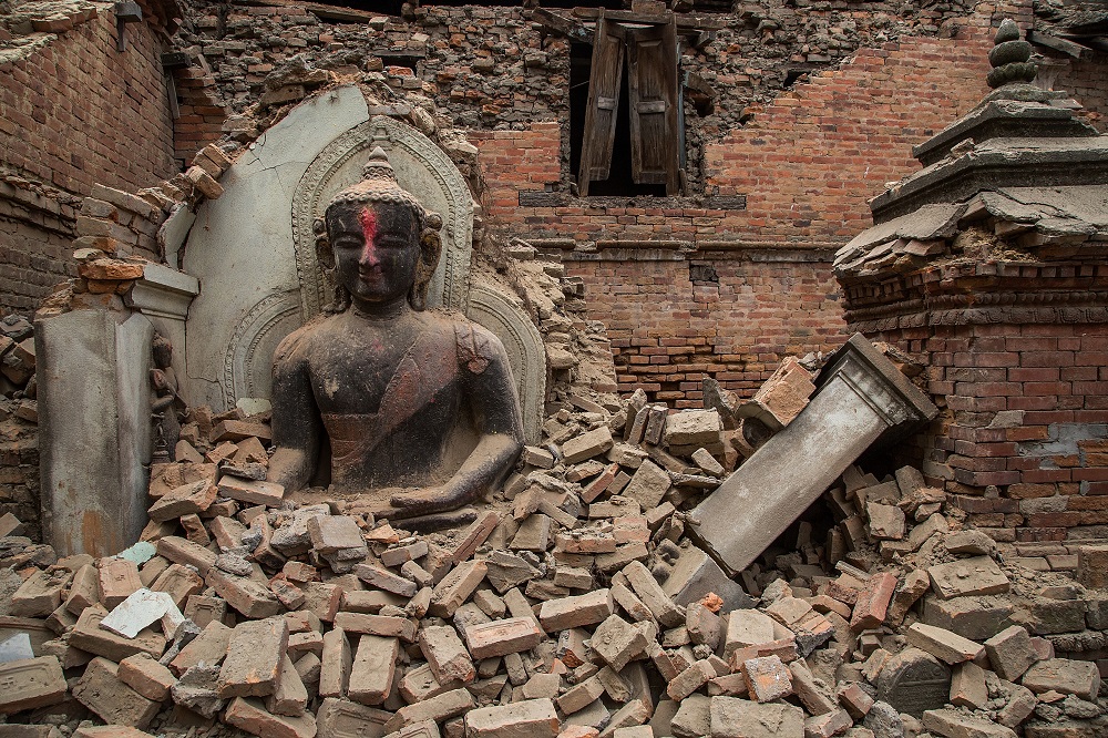
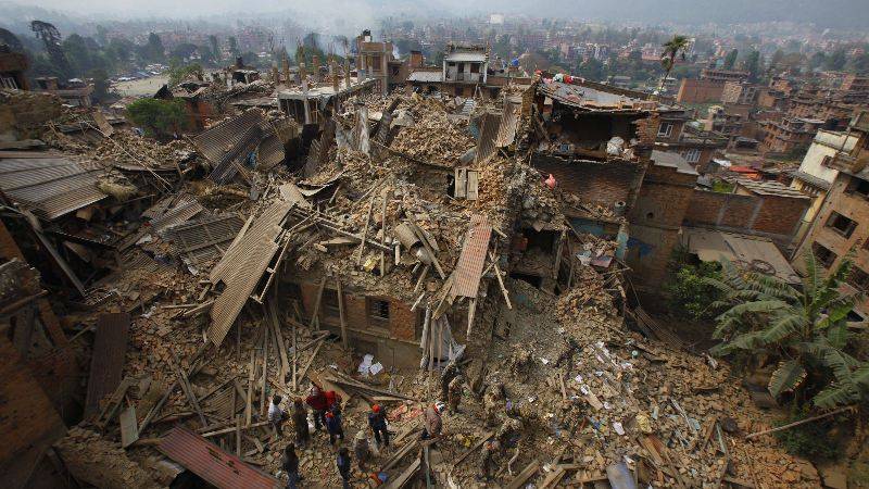
There are at the very least 15 humanitarian UAV teams operating in Nepal. We know this since these teams voluntarily chose to liaise with the Humanitarian UAV Network (UAViators). In this respect, the current humanitarian UAV response is far better coordinated than the one I witnessed in the Philippines right after Typhoon Haiyan in 2013. In fact, there was little to no coordination at the time amongst the multiple civilian UAV teams; let alone between these teams and humanitarian organizations, or the Filipino government for that matter. This lack of coordination coupled with the fact that I could not find any existing “Code of Conduct” for the use of UAVs in humanitarian settings is actually what prompted me to launch UAViators just months after leaving the Philippines.

DCIM100MEDIA

The past few days have made it clear that we still have a long way to go in the humanitarian UAV space. Below are some early observations (not to be taken as criticisms but early reflections only). UAV technology is highly disruptive and is only now starting to have visible impact (both good and bad) in humanitarian contexts. We don’t have all the answers; the institutions are not keeping up with the rapid pace of innovation, nor are the regulators. The challenges below cut across technical, organizational, regulatory challenges that are only growing more complex. So I welcome your constructive input on how to improve these efforts moving forward.

  • Yes, we now have a Code of Conduct which was drafted by several humanitarian professionals, UAV pilots & experts and academics. However, this doesn’t mean that every civilian UAV pilot in Nepal has taken the time to read this document let alone knows that this document exists. As such, most UAV pilots may not even realize that they require legal permission from the government in order to operate or that they should carry some form of insurance. Even professional pilots may not think to inform the local police that they have formal authorization to operate; or know how to communicate with Air Traffic Control or with the military for flight permissions. UAViators can’t force anyone in Nepal to comply with national regulations or the Code. The Network can only encourage UAV pilots to follow best practices. The majority of the problems vis-a-vis the use of UAVs in Nepal would have been avoided had the majority of UAV users followed the Humanitarian UAV Code of Conduct.
  • Yes, more countries have instituted UAV regulations. Some of these tend to be highly restrictive, equating 700-gram micro-UAVs with 50-kilo UAVs. Some apply the same sets of laws for the use of UAVs for amateur movie productions as for the professional use of UAVs for Search & Rescue. In any event, there are no (clear) regulations in Nepal as per research and phone calls made by the Humanitarian UAV Network (see also the UAViators Laws/Travel Wiki). To this end, UAViators has provided contact info to Nepal’s Civil Aviation Authority and Chief of Police. Update: All humanitarian UAV Teams are now required to obtain permission from the Ministry of Home Affairs to operate UAVs in Nepal. Once permission is granted, individual flight plants must be approved by the Nepal Army (via UNDAC). More info here (see May 8 Update). It has taken almost two weeks to get the above process in place. Clearly, without a strong backing or leadership from an established humanitarian group that is able and willing to mediate with appropriate Ministries and Civil Aviation authorities, there is only so much that UAViators can do to support the above process.
  • Yes, we now have all 15 UAV teams on one single dedicated email thread. And yes, UAViators has been able to vet many teams while keeping amateur UAV pilots on standby if the latter have less than 50 hours of flight experience. Incidentally, requests for imagery can be made here. That said, what about all the other civilian UAV pilots operating independently? These other pilots, some of them reporters and disaster junkies, have already undermined the use of UAVs for humanitarian efforts. Indeed, it was reported that “The Nepali Government became very irritated with reporters collecting disaster adventure footage using drones.” This has prompted the government to ban UAV flights with the exception of flights carried out for humanitarian purposes. The latter still require permission from the Ministry of Home Affairs. The problem with so-called “drone journalists” is not simply a safety issue, which is obviously the number one priority of a humanitarian UAV mission. Fact is, there are far more requests for aerial imagery than can be met with just 10 UAV teams on site. So coordination and data sharing is key—even with drone journalists if the latter are prepared to be a part of the solution by liaising with UAViators and following the Code of Conduct. Furthermore, local communities have already expressed anger at the fact that drone & humanitarian journalists have “have visited the same sites with no plans to share data, make the imagery publicly available, or to make an effort to communicate to villages why the flights are important and how the information will be used to assist in relief efforts.”
  • Yes, we have workflows in place for the UAV teams to share their imagery, and some already have. Alas, limited Internet bandwidth is significantly slowing down the pace of data sharing. Some UAV teams have not (yet) expressed an interest in sharing their imagery. Some have not provided information about where they’re flying. Of course, they are incredibly busy. And besides, they are not required to share any data or information. The best UAViators can do is simply to outline the added value of sharing this imagery & their flight plans. And without strong public backing from established humanitarian groups, there is little else the Network can do. Update: several UAV teams are now only sharing imagery with local and national authorities. If the UN and others want this imagery, they need to go through Nepali authorities.
  • Yes, UAViators is indeed in touch with a number of humanitarian organizations who would like aerial imagery for specific areas, however these groups are unable (or not yet willing) to make these requests public or formal until they better understand the risks (legal, political and operational), the extent of the value-added (they want to see the imagery first), the experience and reliability of the UAV teams, etc. They are also weary of having UAV teams take requests for imagery as carte blanche to say they are operating on their behalf. At the same time, these humanitarian organizations do not have the resources (or time) to provide any coordination support between the Humanitarian UAV Network, appropriate government ministries and Nepal’s Civil Aviation Authority.
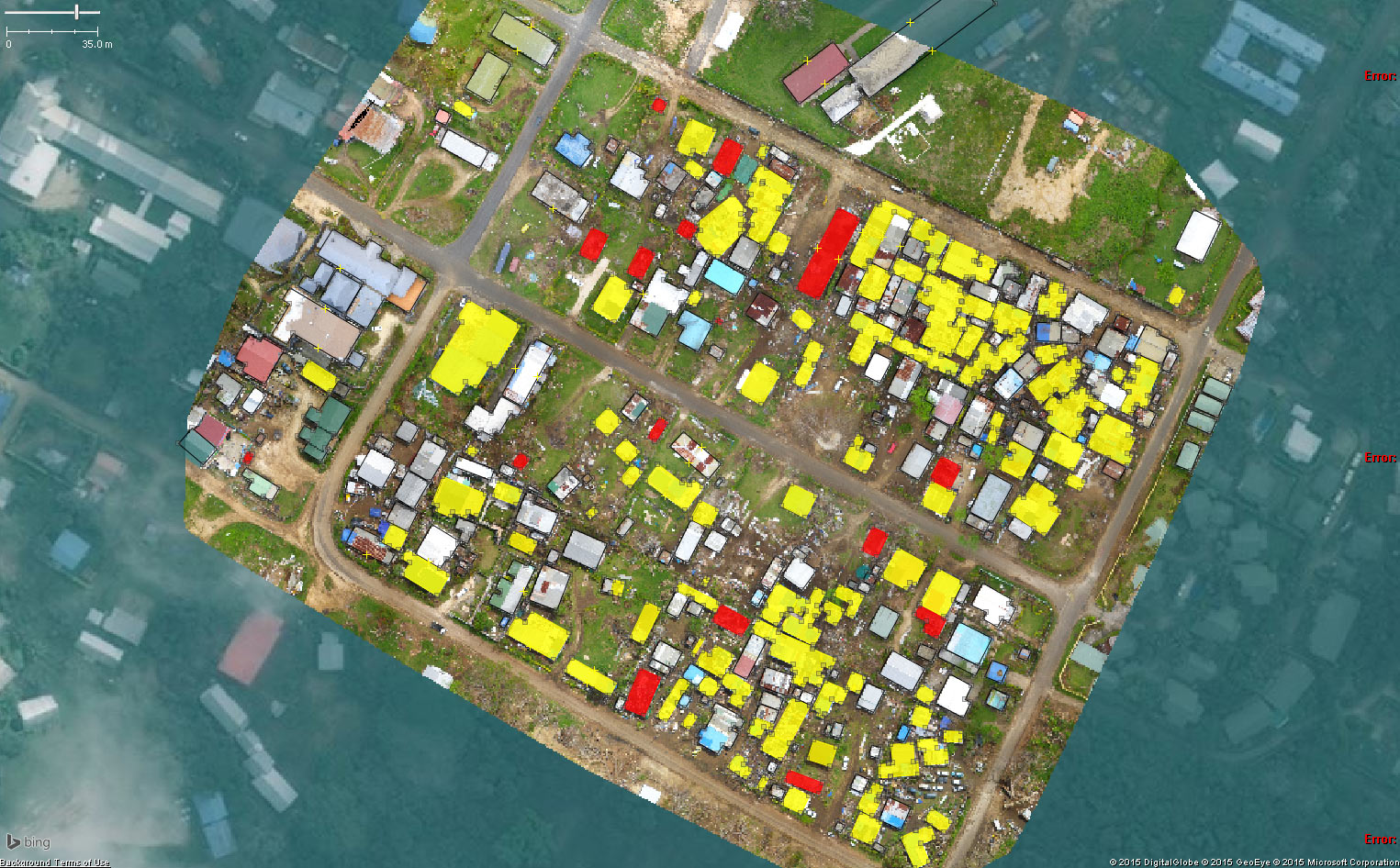
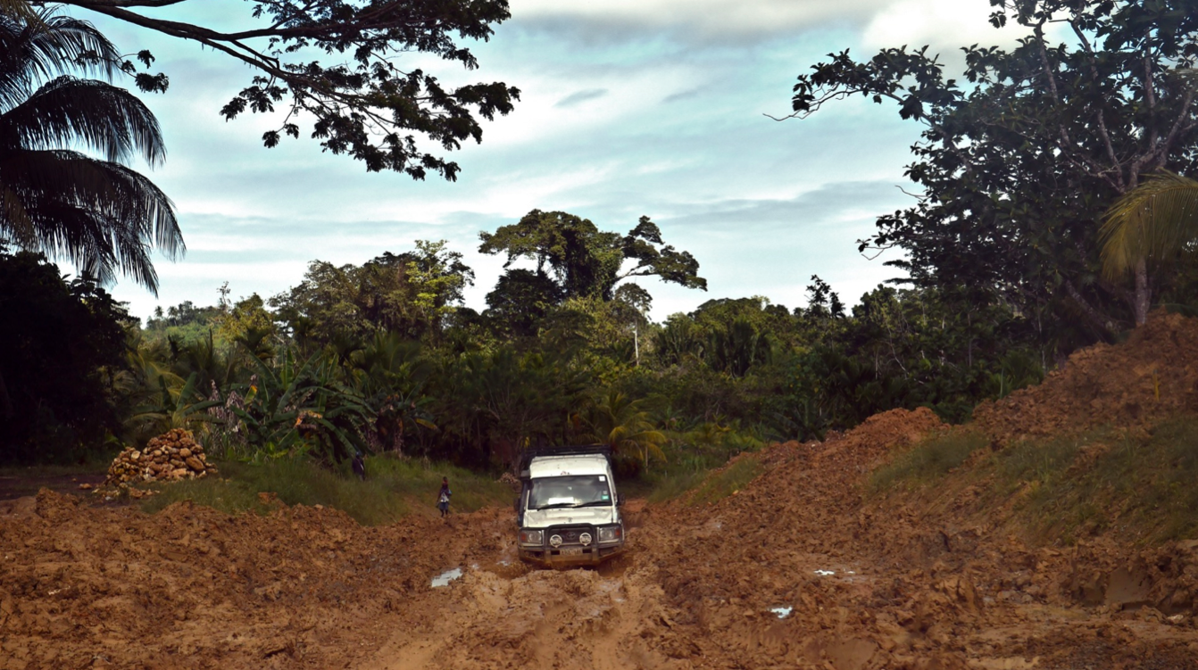
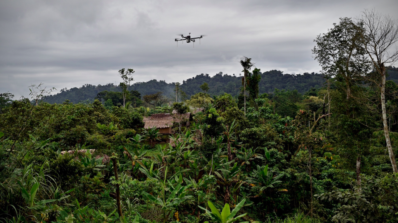
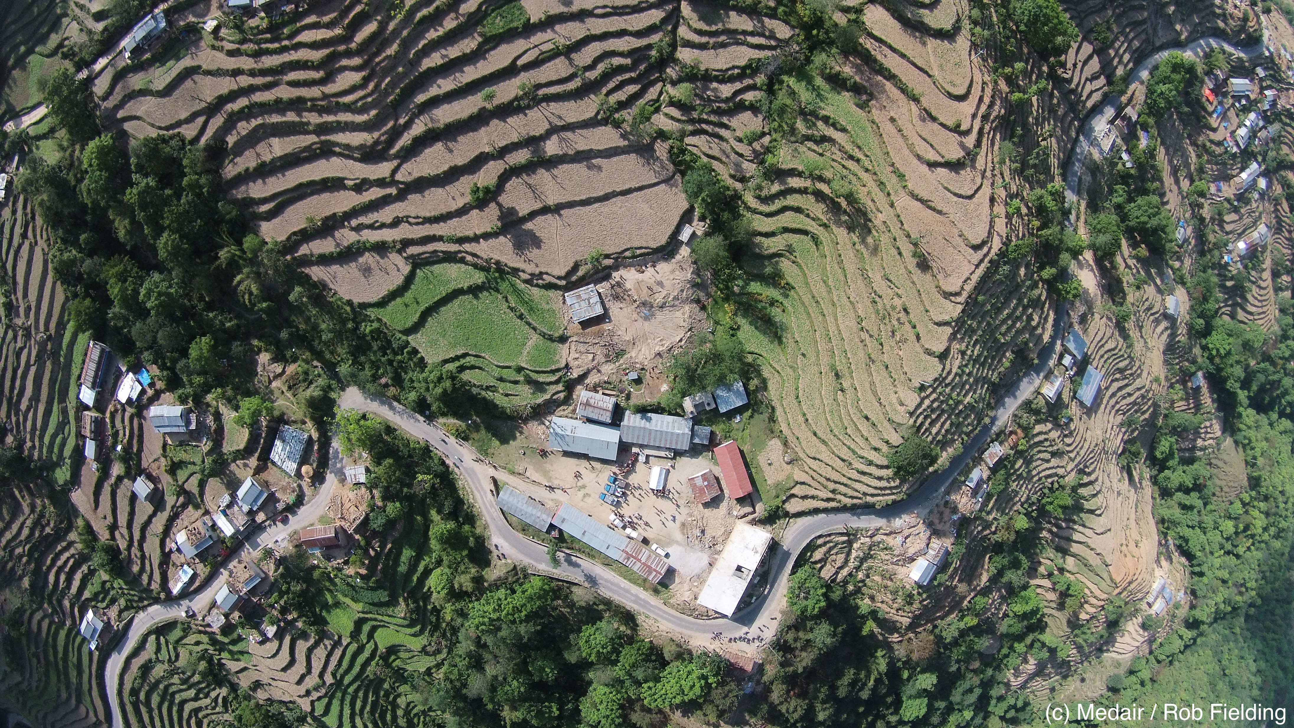
  • Yes, we have a dedicated UAViators site for Nepal updated multiple times a day. Unfortunately, most UAV Teams are having difficulty accessing this site from Nepal due to continuing Internet connectivity issues. This is also true of the dedicated UAViators Google Spreadsheet being used to facilitate the coordination of UAV operations. This online resource includes each team’s contact info, UAV assets, requests for aerial imagery, data needs, etc. We’re now sharing this information via basic text within the body of emails; but this also contributes to email overload. Incidentally, the UAVs being used by the 7 Teams in Nepal are small UAVs such as DJI’s Phantom and Inspire and Aeryon SkyRangers and eBees for example.
  • Yes, we have set up a UAV-Flights-Twitter map for Nepal (big thanks to colleagues at LinkedIn) to increase the transparency of where and when UAVs are being flown across the country. Alas, none of the UAV teams have made use of this solution yet even though most are tweeting from the field. This service allows UAV teams to send a simple tweet about their next UAV flight which then gets mapped automatically. If not used in Nepal, perhaps this service will be used in the future & combined with SMS/WhatsApp.
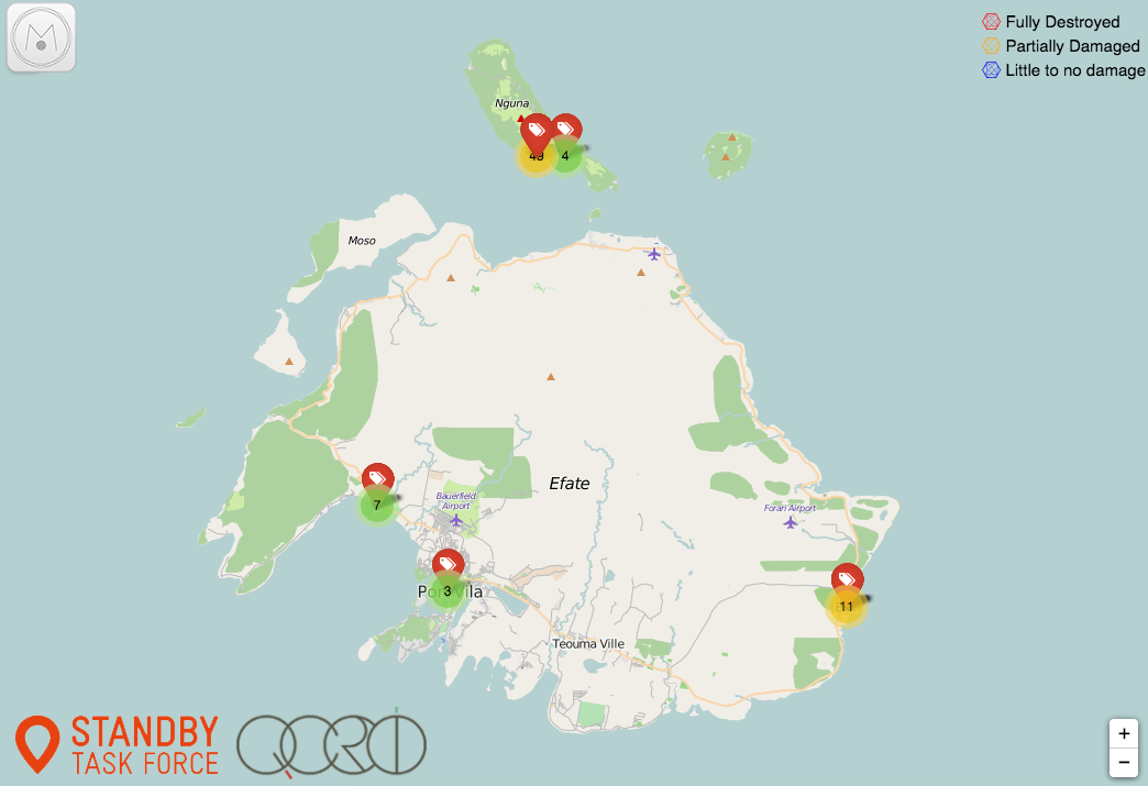
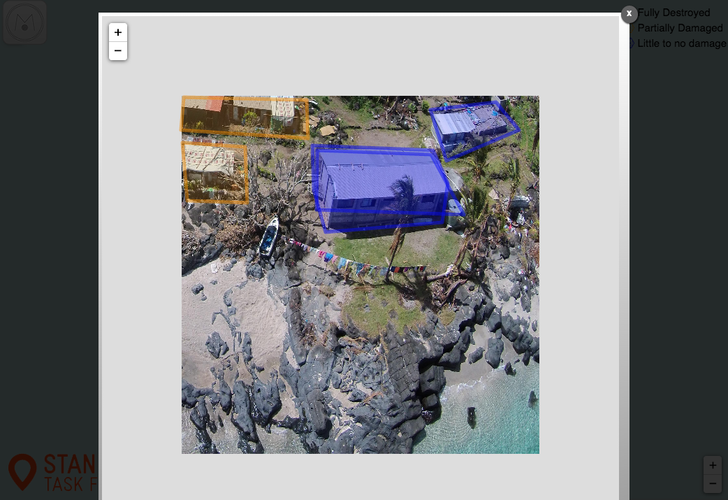
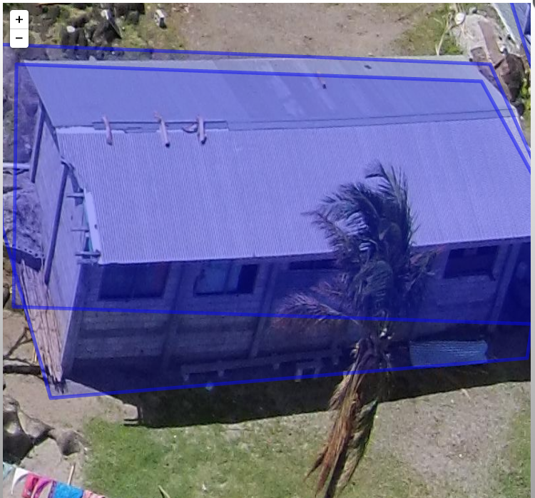
  • Yes, UAViators is connected with the Digital Humanitarian Network (DHN); specifically Humanitarian OpenStreetMap (HOT) and the Standby Task Force (SBTF), with the latter ready to deploy QCRI’s MicroMappers platform for the analysis of oblique imagery. Yet we’re still not sure how best to combine the results of nadir imagery and oblique imagery analysis to add value. Every point on a nadir (vertical) image has a GPS coordinate; but this is not true of obliques (photos taken at an angle). The GPS data for oblique photographs is simply the GPS coordinates for the position of the camera at the time the oblique image was taken. (Specialist gimbal mounted cameras can provide GPS info for objects in oblique photographs, but these are not in use in Nepal).
  • Yes, UAViators has access to a local physical office in Kathmandu. Thanks to the kind offer from Kathmandu Living Labs (KLL), UAV pilots can meet and co-work at KLL. However, even finding a time for all the UAV teams to meet at this office has proven impossible. And yet this is so crucial; there are good reasons why humanitarians have Cluster meetings.
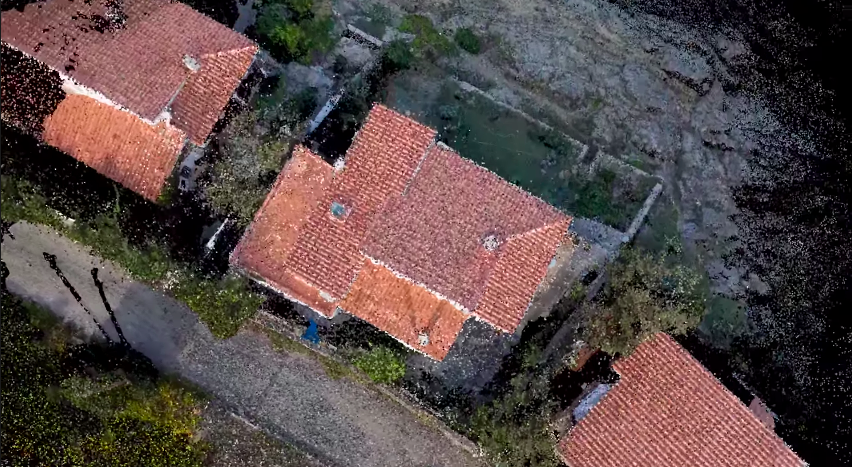
  • Yes, 3D models (Point Clouds) of disaster areas can add insights to disaster damage assessments. That said, these are often huge files and thus particularly challenging to upload. And when these do get posted on-line, what is the best way to have them analyzed? GIS experts and other professionals tend to be completely swamped during disasters. But even if a team were available, what methods & software should they be using to assess and indeed quantify the level of damage in each 3D model? Can this assessment be crowdsourced? And how can the results of 3D analysis be added to other datasets and official humanitarian information products?
  • Yes, the majority of UAV teams that have chosen to liaise with the Humanitarian UAV Network are now in Nepal, yet it took a while for some teams to get on site and there were delays with their UAV assets getting into the country. This points to the need for building local capacity within Nepal and other disaster-prone countries so that local organizations can rapidly deploy UAVs and analyze the resulting imagery themselves after major disasters. This explains why my colleague Nama Budhathoki (at KLL) and I have been looking to set up Kathmandu Flying Labs (basically a Humanitarian UAV Innovation Lab) for literally a year now. In any event, thanks to LinkedIn for Good, we were able to identify some local UAV pilots and students right after the earthquake; some of whom have since been paired with the international UAV teams. Building the capacity of local teams is also important because of the local knowledge and local contacts (and potentially the legal permissions) that these teams will already have.

https://vimeo.com/126676918

So where do we go from here? Despite the above challenges, there is a lot more coordination and structure to the UAV response in Nepal than there was following Typhoon Haiyan in 2013. Then again, the challenges that come with UAV operations in disaster situations are only going to increase as more UAV teams deploy in future crises alongside members of the public, drone journalists, military UAVs, etc. At some point, hopefully sooner (before accidents and major mistakes happen) rather than later, an established humanitarian organization will take on the responsibility of mediating between UAV teams, UAViators, the government, civil aviation officials, military and other aid groups.

What we may need is something along the lines of what GSMA’s Disaster Response Program has done for Mobile Network Operators (MNOs) and the humanitarian community. GSMA has done a lot since the 2010 Haiti Earthquake to bridge MNOs and humanitarians, acting as convener, developing standard operating procedures, ethical guidelines, a global model agreement, etc. Another suggestion floated by a humanitarian colleague is the INSARAG Secretariat, which classifies and also categorizes Search and Rescue teams. Each teams has to “sign onto agreed guidelines (behavior, coordination, markings, etc). So, when the first one arrives, they know to setup a reception space; they all know that there will be coordination meetings, etc.” Perhaps INSARAG could serve as a model for UAViators 2.0. Update: UNDAC is now serving as liaison for UAV flights, which will likely set a precedence for future humanitarian UAV missions.

Coordination is never easy. And leveraging a new, disruptive technology for disaster response is also a major challenge. I, for one, am ready and want to take on these new challenges, but do I need a willing and able partner in the humanitarian community to take on these challenges with me and others. The added value of timely, very high-resolution aerial data during disaster is significant for disaster response, not to mention the use of UAVs for payload transportation and the provision of communication services via UAV. The World Humanitarian Summit (WHS) is coming up next year. Will we unveil a solution to the above challenges at this pivotal Summit or will we continue dragging our feet and forgo the humanitarian innovation opportunities that are right on front of our eyes in Nepal?

In the meantime, I want to thank and acknowledge the following UAV Teams for liaising with the Humanitarian UAV Network: Team RubiconSkyCatch, Halo Drop, GlobalMedic, Medair, Deploy Media and Paul Borrud. Almost all teams have already been able to share aerial imagery. If other responders on the ground are able to support these efforts in any way, e.g., CISCO providing better Internet connectivity, or if you know of other UAV groups that are moving faster and able to provide guidance, for example, then please do get in touch.

A Force for Good: How Digital Jedis are Responding to the Nepal Earthquake (Updated)

Digital Humanitarians are responding in full force to the devastating earthquake that struck Nepal. Information sharing and coordination is taking place online via CrisisMappers and on multiple dedicated Skype chats. The Standby Task Force (SBTF), Humanitarian OpenStreetMap (HOT) and others from the Digital Humanitarian Network (DHN) have also deployed in response to the tragedy. This blog post provides a quick summary of some of these digital humanitarian efforts along with what’s coming in terms of new deployments.

Update: A list of Crisis Maps for Nepal is available below.

Credit: http://www.thestar.com/content/dam/thestar/uploads/2015/4/26/nepal2.jpg

At the request of the UN Office for the Coordination of Humanitarian Affairs (OCHA), the SBTF is using QCRI’s MicroMappers platform to crowdsource the analysis of tweets and mainstream media (the latter via GDELT) to rapidly 1) assess disaster damage & needs; and 2) Identify where humanitarian groups are deploying (3W’s). The MicroMappers CrisisMaps are already live and publicly available below (simply click on the maps to open live version). Both Crisis Maps are being updated hourly (at times every 15 minutes). Note that MicroMappers also uses both crowdsourcing and Artificial Intelligence (AIDR).

Update: More than 1,200 Digital Jedis have used MicroMappers to sift through a staggering 35,000 images and 7,000 tweets! This has so far resulted in 300+ relevant pictures of disaster damage displayed on the Image Crisis Map and over 100 relevant disaster tweets on the Tweet Crisis Map.

Live CrisisMap of pictures from both Twitter and Mainstream Media showing disaster damage:

MM Nepal Earthquake ImageMap

Live CrisisMap of Urgent Needs, Damage and Response Efforts posted on Twitter:

MM Nepal Earthquake TweetMap

Note: the outstanding Kathmandu Living Labs (KLL) team have also launched an Ushahidi Crisis Map in collaboration with the Nepal Red Cross. We’ve already invited invited KLL to take all of the MicroMappers data and add it to their crisis map. Supporting local efforts is absolutely key.

WP_aerial_image_nepal

The Humanitarian UAV Network (UAViators) has also been activated to identify, mobilize and coordinate UAV assets & teams. Several professional UAV teams are already on their way to Kathmandu. The UAV pilots will be producing high resolution nadir imagery, oblique imagery and 3D point clouds. UAViators will be pushing this imagery to both HOT and MicroMappers for rapid crowdsourced analysis (just like was done with the aerial imagery from Vanuatu post Cyclone Pam, more on that here). A leading UAV manufacturer is also donating several UAVs to UAViators for use in Nepal. These UAVs will be sent to KLL to support their efforts. In the meantime, DigitalGlobePlanet Labs and SkyBox are each sharing their satellite imagery with CrisisMappers, HOT and others in the Digital Humanitarian Network.

There are several other efforts going on, so the above is certainly not a complete list but simply reflect those digital humanitarian efforts that I am involved in or most familiar with. If you know of other major efforts, then please feel free to post them in the comments section. Thank you. More on the state of the art in digital humanitarian action in my new book, Digital Humanitarians.


List of Nepal Crisis Maps

Please add to the list below by posting new links in this Google Spreadsheet. Also, someone should really create 1 map that pulls from each of the listed maps.

Code for Nepal Casualty Crisis Map:
http://bit.ly/1IpUi1f 

DigitalGlobe Crowdsourced Damage Assessment Map:
http://goo.gl/bGyHTC

Disaster OpenRouteService Map for Nepal:
http://www.openrouteservice.org/disaster-nepal

ESRI Damage Assessment Map:
http://arcg.is/1HVNNEm

Harvard WorldMap Tweets of Nepal:
http://worldmap.harvard.edu/maps/nepalquake 

Humanitarian OpenStreetMap Nepal:
http://www.openstreetmap.org/relation/184633

Kathmandu Living Labs Crowdsourced Crisis Map: http://www.kathmandulivinglabs.org/earthquake

MicroMappers Disaster Image Map of Damage:
http://maps.micromappers.org/2015/nepal/images/#close

MicroMappers Disaster Damage Tweet Map of Needs:
http://maps.micromappers.org/2015/nepal/tweets

NepalQuake Status Map:
http://www.nepalquake.org/status-map

UAViators Crisis Map of Damage from Aerial Pics/Vids:
http://uaviators.org/map (takes a while to load)

Visions SDSU Tweet Crisis Map of Nepal:
http://vision.sdsu.edu/ec2/geoviewer/nepal-kathmandu#

Can Massively Multiplayer Online Games also be Next Generation Humanitarian Technologies?

IRL

My colleague Peter Mosur and I launched the Internet Response League (IRL) at QCRI a while back to actively explore the intersection of massively multiplayer online games & humanitarian response. IRL is also featured in my new book, Digital Humanitarians, along with many other innovative ideas & technologies. Shortly after the book came out, Peter and I had the pleasure of exploring a collaboration with the team at Massive Multiplayer Online Science (MMOS) and CCP Games—makers of the popular game EVE Online.

MMOS is an awesome group that aims to enable online gamers to contribute to scientific research while playing video games. Our colleagues at MMOS kindly reached out to us earlier this year as they’re really interested in supporting humanitarian efforts as well. They are thus kindly bringing IRL on board to help them explore the use of online games for humanitarian projects.

CCP Games has already been mentioned on the IRL blog here. Their gamers managed to raise an impressive $190,890 for the Icelandic Red Cross in response to Typhoon Haiyan/Yolanda with their PLEX for Good initiative. This is on top of the $100,000 that the company has raised with the program for various disasters in Japan, Haiti, Pakistan, and the United States.

CCP Game’s flagship title EVE Online passed 500,000 subscribers in 2013. The game is extremely unique when it comes to MMORPGs. Rather than having a player base spanning across many different servers, EVE Online keeps keeps all players on one large server. Entitled “Tranquility”, this one server currently averages 25,000 players at any given time, with peaks of over 38,000 [1]. This equates to an average of 600,000 hours of human time spent playing EVE Online every day! The potential good to come out of a humanitarian partnership would be immensely valuable to the world!

So we’re currently exploring with the team at MMOS possible ways to process humanitarian data within EVE’s gaming environment. We’ll write another post soon detailing the unique challenges we’re facing in terms of seamlessly process-ing digital humanitarian tasks within EVE Online. This will require a lot of creativity to pull off and success is by no means guaranteed (just like life and online games). In sum, our humanitarian tasks must in no way disrupt the EVE Online experience; they basically need to be “invisible” to the gamer (besides an initial opt-in).

See the video below for an in-depth overview of the type of work that MMOS and CCP Games envision incorporated into EVE Online. The video was screened at the recent EVE Online Fanfest last month and also features a message from the Internet Response League at the 40:36 minute mark!

This blog post was co-authored with Peter Mosur.

Crowdsourcing Point Clouds for Disaster Response

Point Clouds, or 3D models derived from high resolution aerial imagery, are in fact nothing new. Several software platforms already exist to reconstruct a series of 2D aerial images into fully fledged 3D-fly-through models. Check out these very neat examples from my colleagues at Pix4D and SenseFly:

What does a castle, Jesus and a mountain have to do with humanitarian action? As noted in my previous blog post, there’s only so much disaster damage one can glean from nadir (that is, vertical) imagery and oblique imagery. Lets suppose that the nadir image below was taken by an orbiting satellite or flying UAV right after an earthquake, for example. How can you possibly assess disaster damage from this one picture alone? Even if you had nadir imagery for these houses before the earthquake, your ability to assess structural damage would be limited.

Screen Shot 2015-04-09 at 5.48.23 AM

This explains why we also captured oblique imagery for the World Bank’s UAV response to Cyclone Pam in Vanuatu (more here on that humanitarian mission). But even with oblique photographs, you’re stuck with one fixed perspective. Who knows what these houses below look like from the other side; your UAV may have simply captured this side only. And even if you had pictures for all possible angles, you’d literally have 100’s of pictures to leaf through and make sense of.

Screen Shot 2015-04-09 at 5.54.34 AM

What’s that famous quote by Henry Ford again? “If I had asked people what they wanted, they would have said faster horses.” We don’t need faster UAVs, we simply need to turn what we already have into Point Clouds, which I’m indeed hoping to do with the aerial imagery from Vanuatu, by the way. The Point Cloud below was made only from single 2D aerial images.

It isn’t perfect, but we don’t need perfection in disaster response, we need good enough. So when we as humanitarian UAV teams go into the next post-disaster deployment and ask what humanitarians they need, they may say “faster horses” because they’re not (yet) familiar with what’s really possible with the imagery processing solutions available today. That obviously doesn’t mean that we should ignore their information needs. It simply means we should seek to expand their imaginations vis-a-vis the art of the possible with UAVs and aerial imagery. Here is a 3D model of a village in Vanuatu constructed using 2D aerial imagery:

Now, the title of my blog post does lead with the word crowdsourcing. Why? For several reasons. First, it takes some decent computing power (and time) to create these Point Clouds. But if the underlying 2D imagery is made available to hundreds of Digital Humanitarians, we could use this distributed computing power to rapidly crowdsource the creation of 3D models. Second, each model can then be pushed to MicroMappers for crowdsourced analysis. Why? Because having a dozen eyes scrutinizing one Point Cloud is better than 2. Note that for quality control purposes, each Point Cloud would be shown to 5 different Digital Humanitarian volunteers; we already do this with MicroMappers for tweets, pictures, videos, satellite images and of course aerial images as well. Each digital volunteer would then trace areas in the Point Cloud where they spot damage. If the traces from the different volunteers match, then bingo, there’s likely damage at those x, y and z coordinate. Here’s the idea:

We could easily use iPads to turn the process into a Virtual Reality experience for digital volunteers. In other words, you’d be able to move around and above the actual Point Cloud by simply changing the position of your iPad accordingly. This technology already exists and has for several years now. Tracing features in the 3D models that appear to be damaged would be as simple as using your finger to outline the damage on your iPad.

What about the inevitable challenge of Big Data? What if thousands of Point Clouds are generated during a disaster? Sure, we could try to scale our crowd-sourcing efforts by recruiting more Digital Humanitarian volunteers, but wouldn’t that just be asking for a “faster horse”? Just like we’ve already done with MicroMappers for tweets and text messages, we would seek to combine crowdsourcing and Artificial Intelligence to automatically detect features of interest in 3D models. This sounds to me like an excellent research project for a research institute engaged in advanced computing R&D.

I would love to see the results of this applied research integrated directly within MicroMappers. This would allow us to integrate the results of social media analysis via MicroMappers (e.g, tweets, Instagram pictures, YouTube videos) directly with the results of satellite imagery analysis as well as 2D and 3D aerial imagery analysis generated via MicroMappers.

Anyone interested in working on this?

How Digital Jedis Are Springing to Action In Response To Cyclone Pam

Digital Humanitarians sprung to action just hours after the Category 5 Cyclone collided with Vanuatu’s many islands. This first deployment focused on rapidly assessing the damage by analyzing multimedia content posted on social media and in the mainstream news. This request came directly from the United Nations (OCHA), which activated the Digital Humanitarian Network (DHN) to carry out the rapid damage assessment. So the Standby Task Force (SBTF), a founding member of the DHN, used QCRI′s MicroMappers platform to produce a digital, interactive Crisis Map of some 1,000+ geo-tagged pictures of disaster damage (screenshot below).

MM_ImageMap_Vanuatu

Within days of Cyclone Pam making landfall, the World Bank (WB) activated the Humanitarian UAV Network (UAViators) to quickly deploy UAV pilots to the affected islands. UAViators has access to a global network of 700+ professional UAV pilots is some 70+ countries worldwide. The WB identified two UAV teams from the Humanitarian UAV Network and deployed them to capture very high-resolution aerial photographs of the damage to support the Government’s post-disaster damage assessment efforts. Pictures from these early UAV missions are available here. Aerial images & videos of the disaster damage were also posted to the UAViators Crowdsourced Crisis Map.

Last week, the World Bank activated the DHN (for the first time ever) to help analyze the many, many GigaBytes of aerial imagery from Vanuatu. So Digital Jedis from the DHN are now using Humanitarian OpenStreetMap (HOT) and MicroMappers (MM) to crowdsource the search for partially damaged and fully destroyed houses in the aerial imagery. The OSM team is specifically looking at the “nadir imagery” captured by the UAVs while MM is exclusively reviewing the “oblique imagery“. More specifically, digital volunteers are using MM to trace destroyed houses red, partially damaged houses orange, and using blue to denote houses that appear to have little to no damage. Below is an early screenshot of the Aerial Crisis Map for the island of Efate. The live Crisis Map is available here.

Screen Shot 2015-04-06 at 10.56.09 AM

Clicking on one of these markers will open up the high resolution aerial pictures taken at that location. Here, two houses are traced in blue (little to no damage) and two on the upper left are traced in orange (partial damage expected).

Screen Shot 2015-04-06 at 10.57.17 AM

The cameras on the UAVs captured the aerial imagery in very high resolution, as you can see from the close up below. You’ll note two traces for the house. These two traces were done by two independent volunteers (for the purposes of quality control). In fact, each aerial image is shown to at least 3 different Digital Jedis.

Screen Shot 2015-04-06 at 10.58.31 AM

Once this MicroMappers deployment is over, we’ll be using the resulting traces to create automated featured detection algorithms; just like we did here for the MicroMappers Namibia deployment. This approach, combining crowdsourcing with Artificial Intelligence (AI), is explored in more detail here vis-a-vis disaster response. The purpose of taking this hybrid human-machine computing solution is to accelerate (semi-automate) future damage assessment efforts.

Meanwhile, back in Vanuatu, the HOT team has already carried out some tentative, preliminary analysis of the damage based on the aerial imagery provided. They are also up-dating their OSM maps of the affected islands thanks this imagery. Below is an initial damage assessment carried out by HOT for demonstration purposes only. Please visit their deployment page on the Vanuatu response for more information.

2015-04-04_18h04_00

So what’s next? Combining both the nadir and oblique imagery to interpret disaster damage is ultimately what is needed, so we’re actually hoping to make this happen (today) by displaying the nadir imagery directly within the Aerial Crisis Map produced by MicroMappers. (Many thanks to the MapBox team for their assistance on this). We hope this integration will help HOT and our World Bank partners better assess the disaster damage. This is the first time that we as a group are doing anything like this, so obviously lots of learning going on, which should improve future deployments. Ultimately, we’ll need to create 3D models (point clouds) of disaster affected areas (already easy to do with high-resolution aerial imagery) and then simply use MicroMappers to crowdsource the analysis of these 3D models.

And here’s a 3D model of a village in Vanuatu constructed using 2D aerial photos taken by UAV:

For now, though, Digital Jedis will continue working very closely with the World Bank to ensure that the latter have the results they need in the right format to deliver a comprehensive damage assessment to the Government of Vanuatu by the end of the week. In the meantime, if you’re interested in learning more about digital humanitarian action, then please check out my new book, which features UAViators, HOT, MM and lots more.

Pictures: Humanitarian UAV Mission to Vanuatu in Response to Cyclone Pam

Aéroport de Port Vila – Bauerfield International Airport. As we land, thousands of uprooted trees could be seen in almost every direction.

WP1

Massive roots were not enough to save these trees from Cyclone Pam. The devastation reminds us how powerful nature is.

WP2

WP3

WP4

After getting clearance from the Australian Defense Force (ADF), we pack up our UAVs and head over to La Lagune for initial tests. Close collaboration with the military is an absolute must for humanitarian UAV missions. UAVs cannot operate in Restricted Operations Zones without appropriate clearance.

WP5

We’re in Vanuatu by invitation of the Government’s National Disaster Risk Management Office (NDMO). So we’re working very closely with our hosts to assess disaster damage and resulting needs. The government and donors need the damage quantified to assess how much funding is necessary for the recovery efforts; and where geographically that funding should be targeted.

WP6

Ceci n’est pas un drone; what we found at La Lagune, where the ADF has set up camp. At 2200 every night we send the ADF our flight plan clearance requests for the following day. For obvious safety reasons, we never deviate from these plans after they’ve been approved.

WP6b

Unpacking and putting together the hexacopters can take a long time. The professional and certified UAV team from New Zealand (X-Craft) follows strict operational check lists to ensure safety and security. We also have a professional and certified team from Australia, Heliwest, which will be flying quadcopters. The UAV team from SPC is also joining our efforts. I’m proud to report that both the Australian & New Zealand teams were recruited directly from the pilot roster of the Humanitarian UAV Network.

WP7

WP8

WP11

WP9

WP10

The payload (camera) attached to our hexacopters; not exactly a GoPro. We also have other sensors for thermal imaging, etc.

WP12

Programming the test flights. Here’s a quick video intro on how to program UAVs for autonomous flights.

WP13

Night falls fast in Vanuatu…

WP14

WP14b

… So our helpful drivers kindly light up our work area.

WP15

After flawless test flights; we’re back at “HQ” to program the flight paths for tomorrow morning’s humanitarian UAV missions. The priority survey areas tend to change on a daily basis as the government gets more information on which outlying islands have been hardest hit. Our first mission will focus on an area comprised of informal settlements.

WP16

WP16b

Dawn starts to break at 0500. We haven’t gotten much sleep.

WP17

At 0600, we arrive at the designated meeting point, the Beach Bar. This will be our base of operations for this morning’s mission.

WP18

WP19

The flight plans for the hexacopters are ready to go. We have clearance from Air Traffic Control (ATC) to fly until 0830 as manned aircraft start operating extensively after 0900. So in complex airspaces like this one in Vanuatu’s Port Vila, we only fly very early in the morning and after 1700 in the evening. We have ATC’s direct phone number and are in touch with the tower at all times.

WP20

Could this be the one and only SXSW 2015 bag in Vanuatu?

WP20b

All our multirotor UAVs have been tested once again and are now ready to go. The government has already communicated to nearby villages that UAVs will be operating between 0630-0830. We aim to collect aerial imagery at a resolution of 4cm-6cm throughout our missions.

WP22

WP21

An old basketball court; perfect for take-off & landing.

WP23

And of course, when we’re finally ready to fly, it starts to pour. Other challenges include an ash cloud from a nearby volcano. We’ve also been told that kids here are pro’s with slingshots (which is one reason why the government informed local villagers of the mission; i.e., to request that kids not use the UAVs for target practice).

WP24

After some delays, we are airborne at last.

WP26

Operating the UAViators DJI Phantom…

WP26b

… Which I’m using purely for documentary purposes. In coming days, we’ll be providing our government partners with a hands-on introduction on how to operate Phantom II’s. Building local capacity is key; which is why this action item is core to the Humanitarian UAV Network’s Code of Conduct.

WP27

WP27b

WP27c

Can you spot the hexacopter? While there’s only one in the picture below, we actually have two in the air at different altitudes which we are operating by Extended Line of Site and First Person View as a backup.

WP27a

More aerial shots I took using the Phantom (not for damage assessment; simply for documentary purposes).

Screen Shot 2015-03-28 at 9.55.11 PM

Can you spot the basketball court?

WP28

Large clouds bring back the rain; visibility is reduced. We have to suspend our flights; will try again after 1700.

WP30

WP31

WP29

Meanwhile, my Phantom’s GoPro snaps this close up picture on landing.

WP32

Stay tuned for updates and in particular the very high resolution aerial imagery that we’ll be posting to MapBox in coming days; along with initial analysis carried out by multiple partners including Humanitarian OpenStreetMap (HOT) and QCRI‘s MicroMappers. Many thanks to MapBox for supporting our efforts. We will also be overlaying the aerial imagery analysis over this MicroMappers crisis map of ground-based pictures of disaster damage in order to triangulate the damage assessment results. Check out the latest update here.

In the meantime, more information on this Humanitarian UAV Mission to Vanuatu–spearheaded by the World Bank in very close collaboration with the Government and SPC–can be found on the Humanitarian UAV Network (UAViators) Ops page here. UAViators is an initiative I launched at QCRI following Typhoon Haiyan in the Philippines in 2013. More on UAViators and the use of humanitarian UAVs in my new book Digital Humanitarians.

Important: this blog post is a personal update written in my personal capacity; none of the above is in any way shape or form a formal communique or press release by any of the partners. Official updates will be provided by the Government of Vanuatu and World Bank directly. Please contact me here for official media requests; kindly note that my responses will need to be cleared by the Government & Bank first.

Artificial Intelligence Powered by Crowdsourcing: The Future of Big Data and Humanitarian Action

There’s no point spewing stunning statistics like this recent one from The Economist, which states that 80% of adults will have access to smartphones before 2020. The volume, velocity and variety of digital data will continue to skyrocket. To paraphrase Douglas Adams, “Big Data is big. You just won’t believe how vastly, hugely, mind-bogglingly big it is.”

WP1

And so, traditional humanitarian organizations have a choice when it comes to battling Big Data. They can either continue business as usual (and lose) or get with the program and adopt Big Data solutions like everyone else. The same goes for Digital Humanitarians. As noted in my new book of the same title, those Digital Humanitarians who cling to crowdsourcing alone as their pièce de résistance will inevitably become the ivy-laden battlefield monuments of 2020.

bookcover

Big Data comprises a variety of data types such as text, imagery and video. Examples of text-based data includes mainstream news articles, tweets and WhatsApp messages. Imagery includes Instagram, professional photographs that accompany news articles, satellite imagery and increasingly aerial imagery as well (captured by UAVs). Television channels, Meerkat and YouTube broadcast videos. Finding relevant, credible and actionable pieces of text, imagery and video in the Big Data generated during major disasters is like looking for a needle in a meadow (haystacks are ridiculously small datasets by comparison).

Humanitarian organizations, like many others in different sectors, often find comfort in the notion that their problems are unique. Thankfully, this is rarely true. Not only is the Big Data challenge not unique to the humanitarian space, real solutions to the data deluge have already been developed by groups that humanitarian professionals at worst don’t know exist and at best rarely speak with. These groups are already using Artificial Intelligence (AI) and some form of human input to make sense of Big Data.

Data digital flow

How does it work? And why do you still need some human input if AI is already in play? The human input, which can be via crowdsourcing or a few individuals is needed to train the AI engine, which uses a technique from AI called machine learning to learn from the human(s). Take AIDR, for example. This experimental solution, which stands for Artificial Intelligence for Disaster Response, uses AI powered by crowdsourcing to automatically identify relevant tweets and text messages in an exploding meadow of digital data. The crowd tags tweets and messages they find relevant and the AI engine learns to recognize the relevance patterns in real-time, allowing AIDR to automatically identify future tweets and messages.

As far as we know, AIDR is the only Big Data solution out there that combines crowdsourcing with real-time machine learning for disaster response. Why do we use crowdsourcing to train the AI engine? Because speed is of the essence in disasters. You need a crowd of Digital Humanitarians to quickly tag as many tweets/messages as possible so that AIDR can learn as fast as possible. Incidentally, once you’ve created an algorithm that accurately detects tweets relaying urgent needs after a Typhoon in the Philippines, you can use that same algorithm again when the next Typhoon hits (no crowd needed).

What about pictures? After all, pictures are worth a thousand words. Is it possible to combine artificial intelligence with human input to automatically identify pictures that show infrastructure damage? Thanks to recent break-throughs in computer vision, this is indeed possible. Take Metamind, for example, a new startup I just met with in Silicon Valley. Metamind is barely 6 months old but the team has already demonstrated that one can indeed automatically identify a whole host of features in pictures by using artificial intelligence and some initial human input. The key is human input since this is what trains the algorithms. The more human-generated training data you have, the better your algorithms.

My team and I at QCRI are collaborating with Metamind to create algorithms that can automatically detect infrastructure damage in pictures. The Silicon Valley start-up is convinced that we’ll be able to create a highly accurate algorithms if we have enough training data. This is where MicroMappers comes in. We’re already using MicroMappers to create training data for tweets and text messages (which is what AIDR uses to create algorithms). In addition, we’re already using MicroMappers to tag and map pictures of disaster damage. The missing link—in order to turn this tagged data into algorithms—is Metamind. I’m excited about the prospects, so stay tuned for updates as we plan to start teaching Metamind’s AI engine this month.

Screen Shot 2015-03-16 at 11.45.31 AM

How about videos as a source of Big Data during disasters? I was just in Austin for SXSW 2015 and met up with the CEO of WireWax, a British company that uses—you guessed it—artificial intelligence and human input to automatically detect countless features in videos. Their platform has already been used to automatically find guns and Justin Bieber across millions of videos. Several other groups are also working on feature detection in videos. Colleagues at Carnegie Melon University (CMU), for example, are working on developing algorithms that can detect evidence of gross human rights violations in YouTube videos coming from Syria. They’re currently applying their algorithms on videos of disaster footage, which we recently shared with them, to determine whether infrastructure damage can be automatically detected.

What about satellite & aerial imagery? Well the team driving DigitalGlobe’s Tomnod platform have already been using AI powered by crowdsourcing to automatically identify features of interest in satellite (and now aerial) imagery. My team and I are working on similar solutions with MicroMappers, with the hope of creating real-time machine learning solutions for both satellite and aerial imagery. Unlike Tomnod, the MicroMappers platform is free and open source (and also filters social media, photographs, videos & mainstream news).

Screen Shot 2015-03-16 at 11.43.23 AM

Screen Shot 2015-03-16 at 11.41.21 AM

So there you have it. The future of humanitarian information systems will not be an App Store but an “Alg Store”, i.e, an Algorithm Store providing a growing menu of algorithms that have already been trained to automatically detect certain features in texts, imagery and videos that gets generated during disasters. These algorithms will also “talk to each other” and integrate other feeds (from real-time sensors, Internet of Things) thanks to data-fusion solutions that already exist and others that are in the works.

Now, the astute reader may have noted that I omitted audio/speech in my post. I’ll be writing about this in a future post since this one is already long enough.

What to Know When Using Humanitarian UAVs for Transportation

UAVs can support humanitarian action in a variety of ways. Perhaps the most common and well-documented use-case is data collection. There are several other use-cases, however, such as payload transportation, which I have blogged about herehere and here. I had the opportunity to learn more about the logistics and operations of payload UAVs while advising a well-known public health NGO in Liberia as well as an international organization in Tanzania. This advising led to conversations with some of the leading experts in the UAV-for-transportation space like Google Project WingMatternet and Vayu for example.

UAV payload unit

Below are just some of the questions you’ll want to ask when you’re considering the use of UAVs for the transportation of small payloads. Of course, the UAV may not be the most appropriate technology for the problem you’re looking to solve. So naturally, the very first step is to carry out a comparative cost-benefit analysis with multiple technologies. The map below, kindly shared by Matternet, is from a project they’re working on with Médecins Sans Frontières (MSF) in Papua New Guinea.

Credit: Matternet

Why does it take some 4 hours to drive 60km (40 miles) compared to 55 minutes by UAV? The pictures below (also shared by Matternet) speak for themselves.

Credit: Matternet

Credit: Matternet

Credit: Matternet

Any use of UAVs in humanitarian contexts should follow the Code of Conduct proposed by the Humanitarian UAV Network (UAViators), which was recently endorsed by the UN. Some of the (somewhat obvious) questions you’ll want to bear in mind as you carry out your cost-benefit analysis thus include:

  • What is maximum, minimum and the average distance that the UAV needs to fly?
  • How frequently do the UAVs need to make the deliveries?
  • How much mass needs to be moved per given amount of time?
  • What is the mass of individual packages (and can these be split into smaller parcels if need be)?
  • Do the packages contain a mechanism for cold transport or would the UAV need to provide refrigeration (assuming this is needed)?
  • What do the take-off and landing spaces look like? How much area, type of ground, size of trees or other obstacles nearby?
  • What does the typology between the take-off and landing sites look like? Tall trees, mountains, or other obstructions?
  • Regarding batteries, is there easy access to electricity in the areas where the UAVs will be landing?
  • Is there any form of cell phone coverage in the landing areas?
  • What is the overall fixed and variable cost of operating the payload UAVs compared to other solutions?
  • What impact (both positive and negative) will the introduction of the payload UAV have on the local economy?

While the payload weight is relatively small (1kg-2kg) for low-cost UAVs, keep in mind that UAV flights can continue around the clock. As one of my colleagues at the Syria Airlift Project recently noted, “If  one crew could launch a plane every 5 minutes, that would add up to almost 200kg in an eight-hour time period.”

IMG_1893

Naturally, Google and Matternet are not the only group out there developing UAVs for payload transportation. Amazon, DHL and others are prototyping the same technology. In addition, many of the teams I met at the recent Drones for Good Challenge in Dubai demo’ed payload solutions. One of the competition’s top 5 finalists was Drone Life from Spain. They flew their quadcopter (pictured above) fully autonomously. What’s special about this particular prototype is not just it’s range (40-50km with 2-3kg payload) but the fact that it also includes a fridge (for vaccines, organs, etc.,) that can be remotely monitored in real-time to ensure the temperature remains within required parameters.

At some point in your planning process, you’ll want to map the landing and take-off sites. The map below (click to enlarge) is the one we recently produced for the Tanzania UAV project (which is still being explored). Naturally, all these payload UAV flights would be pre-programmed and autonomous. If you’d like to learn more about how one programs such flights, check out my short video here.

Screen Shot 2015-02-11 at 2.06.45 PM

One other point worth keeping in mind is that UAVs need not be independent from existing transportation infrastructure. One team at the recent Drones for Good Challenge in Dubai suggested using public buses as take-off and landing points for UAVs. A university in the US is actually exploring this same use case, extending the reach of delivery trucks by using UAVs.

Of course, there are a host of issues that one needs to consider when operating any kind of UAV for humanitarian purposes. These include regulations, permits, risk assessments and mitigation strategies, fail safe mechanisms, community engagement, data privacy/security, etc. The above is simply meant to highlight some of the basic questions that need to be posed at the outset of the project. Needless to say, the very first question should always be whether the UAV is indeed the most appropriate tool (cost/benefit analysis) for the task at hand. In any case, the above is obviously not an exhaustive list. So I’d very much welcome feedback on what’s missing. Thank you!

How to Become a Digital Sherlock Holmes and Support Relief Efforts

Humanitarian organizations need both timely and accurate information when responding to disasters. Where is the most damage located? Who needs the most help? What other threats exist? Respectable news organizations also need timely and accurate information during crisis events to responsibly inform the public. Alas, both humanitarian & mainstream news organizations are often confronted with countless rumors and unconfirmed reports. Investigative journalists and others have thus developed a number of clever strategies to rapidly verify such reports—as detailed in the excellent Verification Handbook. There’s just one glitch: Journalists and humanitarians alike are increasingly overwhelmed by the “Big Data” generated during crises, particularly information posted on social media. They rarely have enough time or enough staff to verify the majority of unconfirmed reports. This is where Verily comes in, a new type of Detective Agency for a new type of detective: The Virtual Digital Detective.

Screen Shot 2015-02-26 at 5.47.35 AM

The purpose of Verily is to rapidly crowdsource the verification of unconfirmed reports during major disasters. The way it works is simple. If a humanitarian or news organization has a verification request, they simply submit this request online at Verily. This request must be phrased in the form of a Yes-or-No question, such as: “Has the Brooklyn Bridge been destroyed by the Hurricane?”; “Is this Instagram picture really showing current flooding in Indonesia”?; “Is this new YouTube video of the Chile earthquake fake?”; “Is it true that the bush fires in South Australia are getting worse?” and so on.

Verily helps humanitarian & news organizations find answers to these questions by rapidly crowdsourcing the collection of clues that can help answer said questions. Verification questions are communicated widely across the world via Verily’s own email-list of Digital Detectives and also via social media. This new bread of Digital Detectives then scour the web for clues that can help answer the verification questions. Anyone can become a Digital Detective at Verily. Indeed, Verily provides a menu of mini-verification guides for new detectives. These guides were written by some of the best Digital Detectives on the planet, the authors of the Verification Handbook. Verily Detectives post the clues they find directly to Verily and briefly explain why these clues help answer the verification question. That’s all there is to it.

xlarge

If you’re familiar with Reddit, you may be thinking “Hold on, doesn’t Reddit do this already?” In part yes, but Reddit is not necessarily designed to crowdsource critical thinking or to create skilled Digital Detectives. Recall this fiasco during the Boston Marathon Bombings which fueled disastrous “witch hunts”. Said disaster would not have happened on Verily because Verily is deliberately designed to focus on the process of careful detective work while providing new detectives with the skills they need to precisely avoid the kind of disaster that happened on Reddit. This is no way a criticism of Reddit! One single platform alone cannot be designed to solve every problem under the sun. Deliberate, intentional design is absolutely key.

In sum, our goal at Verily is to crowdsource Sherlock Holmes. Why do we think this will work? For several reasons. First, authors of the Verification Handbook have already demonstrated that individuals working alone can, and do, verify unconfirmed reports during crises. We believe that creating a community that can work together to verify rumors will be even more powerful given the Big Data challenge. Second, each one of us with a mobile phone is a human sensor, a potential digital witness. We believe that Verily can help crowdsource the search for eyewitnesses, or rather the search for digital content that these eyewitnesses post on the Web. Third, the Red Balloon Challenge was completed in a matter of hours. This Challenge focused on crowdsourcing the search for clues across an entire continent (3 million square miles). Disasters, in contrast, are far more narrow in terms of geographic coverage. In other words, the proverbial haystack is smaller and thus the needles easier to find. More on Verily here & here.

So there’s reason to be optimistic that Verily can succeed given the above and recent real-world deployments. Of course, Verily is is still very much in early phase and still experimental. But both humanitarian organizations and high-profile news organizations have expressed a strong interest in field-testing this new Digital Detective Agency. To find out more about Verily and to engage with experts in verification, please join us on Tuesday, March 3rd at 10:00am (New York time) for this Google Hangout with the Verily Team and our colleague Craig Silverman, the Co-Editor of the Verification Handbook. Click here for the Event Page and here to follow on YouTube. You can also join the conversations on Twitter and pose questions or comments using the hashtag #VerilyLive.

This is How Social Media Can Inform UN Needs Assessments During Disasters

My team at QCRI just published their latest findings on our ongoing crisis computing and humanitarian technology research. They focused on UN/OCHA, the international aid agency responsible for coordinating humanitarian efforts across the UN system. “When disasters occur, OCHA must quickly make decisions based on the most complete picture of the situation they can obtain,” but “given that complete knowledge of any disaster event is not possible, they gather information from myriad available sources, including social media.” QCRI’s latest research, which also drew on multiple interviews, shows how “state-of-the-art social media processing methods can be used to produce information in a format that takes into account what large international humanitarian organizations require to meet their constantly evolving needs.”

ClusterPic

QCRI’s new study (PDF) focuses specifically on the relief efforts in response to Typhoon Yolanda (known locally as Haiyan). “When Typhoon Yolanda struck the Philippines, the combination of widespread network access, high Twitter use, and English proficiency led to many located in the Philippines to tweet about the typhoon in English. In addition, outsiders located elsewhere tweeted about the situation, leading to millions of English-language tweets that were broadcast about the typhoon and its aftermath.”

When disasters like Yolanda occur, the UN uses the Multi Cluster/Sector Initial Rapid Assessment (MIRA) survey to assess the needs of affected populations. “The first step in the MIRA process is to produce a ‘Situation Analysis’ report,” which is produced within the first 48 hours of a disaster. Since the Situation Analysis needs to be carried out very quickly, “OCHA is open to using new sources—including social media communications—to augment the information that they and partner organizations so desperately need in the first days of the immediate post-impact period. As these organizations work to assess needs and distribute aid, social media data can potentially provide evidence in greater numbers than what individuals and small teams are able to collect on their own.”

My QCRI colleagues therefore analyzed the 2 million+ Yolanda-related tweets published between November 7-13, 2013 to assess whether any of these could have augmented OCHA’s situational awareness at the time. (OCHA interviewees stated that this “six-day period would be of most interest to them”). QCRI subsequently divided the tweets into two periods:

Screen Shot 2015-02-14 at 8.31.58 AM

Next, colleagues geo-located the tweets by administrative region and compared the frequency of tweets in each region with the number of people who were later found to have been affected in the respective region. The result of this analysis is displayed below (click to enlarge).

Screen Shot 2015-02-14 at 8.33.21 AM

While the “activity on Twitter was in general more significant in regions heavily affected by the typhoon, the correlation is not perfect.” This should not come as a surprise. This analysis is nevertheless a “worthwhile exercise, as it can prove useful in some circumstances.” In addition, knowing exactly what kinds of biases exist on Twitter, and which are “likely to continue is critical for OCHA to take into account as they work to incorporate social media data into future response efforts.”

QCRI researchers also analyzed the 2 million+ tweets to determine which  contained useful information. An informative tweet is defined as containing “information that helps you understand the situation.” They found that 42%-48% of the 2 million tweets fit this category, which is particularly high. Next, they classified those one million informative tweets using the Humanitarian Cluster System. The Up/Down arrows below indicate a 50%+ increase/decrease of tweets in that category during period 2.

Screen Shot 2015-02-14 at 8.35.53 AM

“In the first time period (roughly the first 48 hours), we observe concerns focused on early recovery and education and child welfare. In the second time period, these concerns extend to topics related to shelter, food, nutrition, and water, sanitation and hygiene (WASH). At the same time, there are proportionally fewer tweets regarding telecommunications, and safety and security issues.” The table above shows a “significant increase of useful messages for many clusters between period 1 and period 2. It is also clear that the number of potentially useful tweets in each cluster is likely on the order of a few thousand, which are swimming in the midst of millions of tweets. This point is illustrated by the majority of tweets falling into the ‘None of the above’ category, which is expected and has been shown in previous research.”

My colleagues also examined how “information relevant to each cluster can be further categorized into useful themes.” They used topic modeling to “quickly group thousands of tweets [and] understand the information they contain. In the future, this method can help OCHA staff gain a high- level picture of what type of information to expect from Twitter, and to decide which clusters or topics merit further examination and/or inclusion in the Situation Analysis.” The results of this topic modeling is displayed in the table below (click to enlarge).

Screen Shot 2015-02-14 at 8.34.37 AM

When UN/OCHA interviewees were presented with these results, their “feedback was positive and favorable.” One OCHA interviewee noted that this information “could potentially give us an indicator as to what people are talking most about— and, by proxy, apply that to the most urgent needs.” Another interviewee stated that “There are two places in the early hours that I would want this: 1) To add to our internal “one-pager” that will be released in 24-36 hours of an emergency, and 2) the Situation Analysis: [it] would be used as a proxy for need.” Another UN staffer remarked that “Generally yes this [information] is very useful, particularly for building situational awareness in the first 48 hours.” While some of the analysis may at times be too general, an OCHA interviewee “went on to say the table [above] gives a general picture of severity, which is an advantage during those first hours of response.”

As my QCRI team rightly notes, “This validation from UN staff supports our continued work on collecting, labeling, organizing, and presenting Twitter data to aid humanitarian agencies with a focus on their specific needs as they perform quick response procedures.” We are thus on the right track with both our AIDR and MicroMappers platforms. Our task moving forward is to use these platforms to produce the analysis discussed above, and to do so in near real-time. We also need to (radically) diversify our data sources and thus include information from text messages (SMS), mainstream media, Facebook, satellite imagery and aerial imagery (as noted here).

But as I’ve noted before, we also need enlightened policy making to make the most of these next generation humanitarian technologies. This OCHA proposal  on establishing specific social media standards for disaster response, and the official social media strategy implemented by the government of the Philippines during disasters serve as excellent examples in this respect.

bookcover

Lots more on humanitarian technology, innovation, computing as well as policy making in my new book Digital Humanitarians: How Big Data is Changing the Face of Humanitarian Action.